
เบเกอร์, โอคลาโฮมา
เบเกอร์, โอคลาโฮมา | |
|---|---|
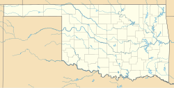  เบเกอร์, โอคลาโฮมา ตั้งอยู่ในรัฐโอคลาโฮมา แสดงแผนที่ของรัฐโอคลาโฮมา เบเกอร์, โอคลาโฮมา เบเกอร์, โอคลาโฮมา (สหรัฐอเมริกา) แสดงแผนที่ประเทศสหรัฐอเมริกา | |
| พิกัด: 36°52′10″N 101°01′05″W / 36.86944°N 101.01806°W / 36.86944; -101.01806 [ 1 ] | |
| ประเทศ | สหรัฐอเมริกา |
| สถานะ | โอคลาโฮมา |
| เขต | เท็กซัส |
| พื้นที่ | |
• ทั้งหมด | 1.00 ตาราง ไมล์ (2.58 ตาราง กิโลเมตร) |
| • ที่ดิน | 1.00 ตาราง ไมล์ (2.58 ตาราง กิโลเมตร) |
| • น้ำ | 0 ตาราง ไมล์ (0.00 ตาราง กิโลเมตร) |
| ระดับความสูง | 2,848 ฟุต (868 เมตร) |
| ประชากร ( 2020 ) | |
• ทั้งหมด | 37 |
| • ความหนาแน่น | 37.2/ตร. ไมล์ (14.37/ ตร.กม. ) |
| เขตเวลา | เวลา 6.00 น. ตามเวลา ภาคกลาง ( CST ) |
| • ฤดูร้อน ( เวลาออมแสง ) | 5 โมงเช้า (CDT) |
| รหัสไปรษณีย์ | 73950 |
| รหัส FIPS | 40-03900 |
เบเกอร์เป็นชุมชนที่ไม่ได้จดทะเบียนในเขตเท็กซัสเคาน์ตี้ทาง ตะวันออกเฉียงเหนือ รัฐ โอคลาโฮมาสหรัฐอเมริกา ห่างจากทางหลวงสหรัฐหมายเลข 64 ไปทางเหนือ ¼ ไมล์ ไทโรนอยู่ห่างไปทางเหนือ-ตะวันตกเฉียงเหนือ 6 ไมล์ บนทางหลวงสหรัฐหมายเลข 54และเทอร์ปินอยู่ห่างไปทางตะวันออก 8 ไมล์ ที่จุดตัดของทางหลวงหมายเลข 64 และทางหลวงสหรัฐหมายเลข 83ในเขตบีเวอร์เคาน์ตี้ที่ อยู่ติดกัน [ 3 ]
จากข้อมูลสำมะโนประชากรปี 2020เบเกอร์มีประชากร 37 คน[ 4 ]
ประวัติศาสตร์
Founded between Hooker and Turpin Oklahoma, a child of the BM&E (Beaver. Meade and Englewood, Later MKT) railroad. Baker become a double railroad town in its infancy when the CRI&P (Chicago Rock Island and Pacific) crossed through just three years after being platted. Named after a Hooker, Oklahoma man, Reuben F. Baker whom sold the acreage for the town from his quarter section where baker lies, the town sprung to existence in the summer and fall of 1926. The town thrived in its early years and persevered through the dust bowl and Great Depression. Home to the remnants of the Eureka school (Eureka Polar Bears), Baker has but few residents left. However, two grain elevators still operate today, centered in wheat and corn country. One elevator, the Riffe-Gilmore elevator is one of few Riffe-Gilmore elevators still in operation, having been operated by the same family since its inception on the railroad in 1926. GW Riffe, an early settler of the area was one of the first to plant wheat in the new Oklahoma territory near Baker as what was once known as “no man’s land” became the Oklahoma Panhandle. The town briefly held the name of Bakerburg after opening a post office in 1931, as another Baker, Oklahoma held a post office in that name, after that town's post office closed, Bakerburg was once again Baker, officially renaming in 1953. The last Katy train left eastbound from Baker around January 4, 1973. Following bankruptcy of the Chicago Rock Island line in 1974, the last trains of the thriving Baker town left the transportation of the surrounding wheat fields to trucks on US Highway 64.[5][6]
NRHP Sites
Both the Baker Woodframe Elevator and the separate Baker Woodframe Grain Elevator are NRHP-listed.
Demographics
2020 census
As of the 2020 census, Baker had a population of 37. The median age was 35.5 years. 13.5% of residents were under the age of 18 and 27.0% of residents were 65 years of age or older. For every 100 females there were 85.0 males, and for every 100 females age 18 and over there were 77.8 males age 18 and over.[4][7]
0.0% of residents lived in urban areas, while 100.0% lived in rural areas.[8]
There were 14 households in Baker, of which 21.4% had children under the age of 18 living in them. Of all households, 28.6% were married-couple households, 21.4% were households with a male householder and no spouse or partner present, and 50.0% were households with a female householder and no spouse or partner present. About 57.1% of all households were made up of individuals and 7.1% had someone living alone who was 65 years of age or older.[4]
มีหน่วยที่อยู่อาศัย 21 หน่วย ซึ่ง 33.3% ว่าง อัตราว่างของเจ้าของบ้านคือ 0.0% และอัตราว่างของการเช่าคือ 0.0% [ 4 ]
| แข่ง | ตัวเลข | เปอร์เซ็นต์ |
|---|---|---|
| สีขาว | 16 | 43.2% |
| คนผิวดำหรือชาวอเมริกันเชื้อสายแอฟริกัน | 0 | 0.0% |
| ชาวอเมริกันอินเดียนและชาวอะแลสกาพื้นเมือง | 2 | 5.4% |
| เอเชีย | 0 | 0.0% |
| ชาวฮาวายพื้นเมืองและชาวเกาะแปซิฟิกอื่นๆ | 0 | 0.0% |
| เชื้อชาติอื่น ๆ | 10 | 27.0% |
| เชื้อชาติสองเชื้อชาติขึ้นไป | 9 | 24.3% |
| ชาวฮิสแปนิกหรือลาติน (ไม่ว่าจะเป็นเชื้อชาติใด) | 17 | 45.9% |
การศึกษา
อยู่ในเขตโรงเรียนTurpin Public Schools [ 9 ]