
Choman District
Coordinates: 36°38′N44°52′E / 36.633°N 44.867°E / 36.633; 44.867
Choman District قەزای چۆمان Arabic: قضاء جومان | |
|---|---|
 | |
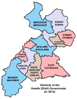 Districts of Erbil Governorate (in 2012) | |
 Interactive map of Choman District | |
| Coordinates: 36°38′N44°52′E / 36.633°N 44.867°E / 36.633; 44.867 | |
| Country |  Iraq Iraq |
| Autonomous region |  Kurdistan Region[1] Kurdistan Region[1] |
| Governorate | Erbil Governorate |
| Seat | Choman |
| Time zone | UTC+3 (AST) |
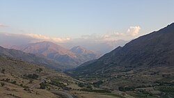
Choman District (Kurdish: قەزای چۆمان, romanized: Qezay Çoman; Arabic: قضاء جومان) is a district in Erbil Province, Iraq. Its administrative centre is also called Choman. The District of Choman lies at the Iraqi-Iranian border, and is composed of four Sub-Districts Galala, Haji Omeran, Samilan and Qasre and about 166 villages.[2]
External links
- District Of Choman