
Colorado State Highway 12
 State Highway 12 | ||||
|---|---|---|---|---|
| Highway of Legends National Scenic Byway | ||||
 Map of southern Colorado with SH 12 highlighted in red | ||||
| Route information | ||||
| Maintained by CDOT | ||||
| Length | 70.39 mi[1] (113.28 km) | |||
| Major junctions | ||||
| CW end |  US 160 in La Veta US 160 in La Veta | |||
| CCW end |    I-25 / US 85 / US 87 in Trinidad I-25 / US 85 / US 87 in Trinidad | |||
| Location | ||||
| Country | United States | |||
| State | Colorado | |||
| Counties | Huerfano, Las Animas | |||
| Highway system | ||||
| ||||
| ||||


State Highway 12 (SH 12), also known as the Highway of Legends National Scenic Byway, in the U.S. state of Colorado is a mountainous state highway through the Rocky Mountains in southern Colorado. The route travels from La Veta through the mountains to Trinidad. It is included in the Colorado Scenic and Historic Byways system and runs through the San Isabel National Forest. In 2021, the highway was designated a National Scenic Byway.[2]
Route description

SH 12 begins at the junction with U.S. Route 160 (US 160) north of La Veta. It heads southward through that town before entering the San Isabel National Forest and passing through Cuchara, near the Spanish Peaks Wilderness. It then crosses Cucharas Pass into Las Animas County.
SH 12 heads through Monument Park and turns eastward near Stonewall Gap. It then passes eastward along the Purgatoire River through Weston, Segundo, Valdez, Cokedale, and Jansen. It then ends in Trinidad at an intersection with Interstate 25, US 85, and US 87.
History
เส้นทางนี้ก่อตั้งขึ้นในช่วงทศวรรษ 1920 โดยเริ่มต้นที่สโตนวอลล์บน ทางหลวง หมายเลข 111ไปทางตะวันออกสู่ทรินิแดดและลาจุนตาส่วนของทรินิแดด-ลาจุนตาถูกแทนที่ด้วยทางหลวงหมายเลข 350 ของสหรัฐอเมริกาในปี 1957 และเส้นทางนี้ได้รับการปูผิวจราจรจากเวสตันไปยังทรินิแดดในปี 1939 เส้นทางทั้งหมดได้รับการปูผิวจราจรเสร็จสมบูรณ์ในปี 1946 ในปี 1954 ทางหลวงหมายเลข 111 ของรัฐโคโลราโดได้ถูกเปลี่ยนแปลง ทำให้จุดสิ้นสุดของทางหลวงหมายเลข 12 ของรัฐโคโลราโดไม่มีทางหลวงของรัฐอื่น[ 3 ]ในปี 1970 ทางหลวงหมายเลข 12 ของรัฐโคโลราโดได้ขยายไปถึงทางหลวงหมายเลข 160 ของสหรัฐอเมริกาและส่วนนี้ได้รับการปูผิวจราจรในอีกหนึ่งปีต่อมา เส้นทางนี้ได้รับการกำหนดให้เป็นเส้นทางชมทิวทัศน์และประวัติศาสตร์ของโคโลราโดในปี 1989 [ 4 ]
สี่แยกสำคัญ
| เขต | ที่ตั้ง | mi [ 1 ] | กม. | จุดหมายปลายทาง | หมายเหตุ |
|---|---|---|---|---|---|
| ฮูเออร์ฟาโน่ | ลา เวตา | 0.000 | 0.000 |  ทางหลวง หมายเลข 160 ของสหรัฐฯ – อลาโมซา , วอลเซนเบิร์ก ทางหลวง หมายเลข 160 ของสหรัฐฯ – อลาโมซา , วอลเซนเบิร์ก | จุดสิ้นสุดตามเข็มนาฬิกา; ทางเข้าสู่ศูนย์สุขภาพภูมิภาคสแปนิชพีคส์ |
| ช่องเขาคูชารัส | 22.266 | 35.834 | ยอดเขา (ความสูง 9,941 ฟุต (3,030 เมตร)) | ||
| ลาส อานิมัส | ตรินิแดด | 70.485 | 113.435 | ทางหลวงหมายเลข I-25 ( US 85 / US 87 ) – ราตัน , พิวโบล | จุดสิ้นสุดแบบทวนเข็มนาฬิกา; ทางออกหมายเลข 13 ของทางหลวงหมายเลข I-25 |
| 1.000 ไมล์ = 1.609 กม.; 1.000 กม. = 0.621 ไมล์ | |||||
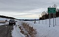 ช่องเขาคูชาราบนทางหลวงหมายเลข 12
 ทางหลวงที่ตัดผ่านเมืองเซกุนโด รัฐโคโลราโด
 ทางหลวงที่ตัดผ่านเมืองคูชารา รัฐโคโลราโด
ลิงก์ภายนอก

- Ryan's Digital Roadgeekdom - The Southern Figure-8 Tour, หน้า 6
- Ryan's Digital Roadgeekdom - The Southern Figure-8 Tour, หน้า 7