
ดาฮิจูรี
ดาฮิจูรี | |
|---|---|
หมู่บ้าน | |
  ดาฮิจูรี ตั้งอยู่ในรัฐเวสต์เบงกอล ประเทศอินเดีย แสดงแผนที่ของรัฐเวสต์เบงกอล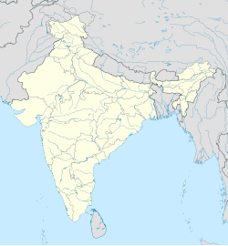 ดาฮิจูรี ดาฮิจูรี (อินเดีย) แสดงแผนที่ประเทศอินเดีย | |
| พิกัด: 22°30′20.5″N 86°59′32.03″E / 22.505694°N 86.9922306°E / 22.505694; 86.9922306 | |
| ประเทศ |  อินเดีย อินเดีย |
| สถานะ | รัฐเวสต์เบงกอล |
| เขต | จาร์แกรม |
| ประชากร (2011) | |
• ทั้งหมด | 3,237 |
| ภาษา | |
| • เป็นทางการ | ภาษาเบงกาลี ภาษาสันตาลีภาษาอังกฤษ |
| เขตเวลา | 5:30 น. ( เวลาอินเดีย ) (UTC+1 ) |
| เข็มหมุด | 721504 (ดาฮิจูรี) |
| หมายเลขโทรศัพท์/ รหัสพื้นที่ | 03221 |
| เขตเลือกตั้งโลคสภา | จาร์แกรม |
| เขตเลือกตั้งสภาวิธานสภา | จาร์แกรม |
| เว็บไซต์ | jhargram.gov.in |
ดาฮิจูรีเป็นหมู่บ้านและองค์การบริหารส่วนตำบลในเขตการปกครองบินปูร์ 1 ในอำเภอจาร์แกรมจังหวัดจาร์แกรมรัฐ เวส ต์เบงกอลประเทศอินเดีย
ความวุ่นวายทางสังคมและการเมือง
Dahijuri เคยเป็นศูนย์กลางของกิจกรรมรุนแรงของกลุ่มเหมาอิสต์ในช่วงการเคลื่อนไหวของ Lalgarhในช่วงปี 2009–2011 [ 1 ] [ 2 ] [ 3 ] ปัจจุบัน Dahijuri มีความมั่นคงและปลอดจากกิจกรรมรุนแรงและกลุ่มเหมาอิสต์แล้ว Dahijuri Gram Panchayat เป็นหนึ่งในสิบ Gram Panchayat ของBinpur -I Block
ภูมิศาสตร์


[[Gopiballavpur]] (R)
\", \"description\": \" ([https://geohack.toolforge.org/geohack.php?params=22.20833;86.9_dim:2000 22.20833,86.9])\", \"marker-symbol\": \"-number-F1093\", \"marker-size\": \"medium\", \"marker-color\": \"#c40000\" }, \"geometry\": {\"type\": \"Point\", \"coordinates\": [86.9,22.20833] } }, { \"type\": \"Feature\", \"properties\": { \"title\": \"R
[[Belpahari]] (R)
\", \"description\": \" ([https://geohack.toolforge.org/geohack.php?params=22.63306;86.76444_dim:2000 22.63306,86.76444])\", \"marker-symbol\": \"-number-F1093\", \"marker-size\": \"medium\", \"marker-color\": \"#c40000\" }, \"geometry\": {\"type\": \"Point\", \"coordinates\": [86.76444,22.63306] } }, { \"type\": \"Feature\", \"properties\": { \"title\": \"R
[[Baligeria]] (R)
\", \"description\": \" ([https://geohack.toolforge.org/geohack.php?params=21.9875;87.11111_dim:2000 21.9875,87.11111])\", \"marker-symbol\": \"-number-F1093\", \"marker-size\": \"medium\", \"marker-color\": \"#c40000\" }, \"geometry\": {\"type\": \"Point\", \"coordinates\": [87.11111,21.9875] } }, { \"type\": \"Feature\", \"properties\": { \"title\": \"R
[[Beliaberah]] (R)
\", \"description\": \" ([https://geohack.toolforge.org/geohack.php?params=22.27167;86.95222_dim:2000 22.27167,86.95222])\", \"marker-symbol\": \"-number-F1093\", \"marker-size\": \"medium\", \"marker-color\": \"#c40000\" }, \"geometry\": {\"type\": \"Point\", \"coordinates\": [86.95222,22.27167] } }, { \"type\": \"Feature\", \"properties\": { \"title\": \"R
[[Bhanga Gar]] (R)
\", \"description\": \" ([https://geohack.toolforge.org/geohack.php?params=22.19917;87.13861_dim:2000 22.19917,87.13861])\", \"marker-symbol\": \"-number-F1093\", \"marker-size\": \"medium\", \"marker-color\": \"#c40000\" }, \"geometry\": {\"type\": \"Point\", \"coordinates\": [87.13861,22.19917] } }, { \"type\": \"Feature\", \"properties\": { \"title\": \"R
[[Binpur]] (R)
\", \"description\": \" ([https://geohack.toolforge.org/geohack.php?params=22.58583;86.91806_dim:2000 22.58583,86.91806])\", \"marker-symbol\": \"-number-F1093\", \"marker-size\": \"medium\", \"marker-color\": \"#c40000\" }, \"geometry\": {\"type\": \"Point\", \"coordinates\": [86.91806,22.58583] } }, { \"type\": \"Feature\", \"properties\": { \"title\": \"R
[[Chhatinasol]] (R)
\", \"description\": \" ([https://geohack.toolforge.org/geohack.php?params=22.18861;86.92611_dim:2000 22.18861,86.92611])\", \"marker-symbol\": \"-number-F1093\", \"marker-size\": \"medium\", \"marker-color\": \"#c40000\" }, \"geometry\": {\"type\": \"Point\", \"coordinates\": [86.92611,22.18861] } }, { \"type\": \"Feature\", \"properties\": { \"title\": \"R
[[Chilkigarh]] (R)
\", \"description\": \" ([https://geohack.toolforge.org/geohack.php?params=22.45083;86.88167_dim:2000 22.45083,86.88167])\", \"marker-symbol\": \"-number-F1093\", \"marker-size\": \"medium\", \"marker-color\": \"#c40000\" }, \"geometry\": {\"type\": \"Point\", \"coordinates\": [86.88167,22.45083] } }, { \"type\": \"Feature\", \"properties\": { \"title\": \"R
Dahijuri (R)
\", \"description\": \" ([https://geohack.toolforge.org/geohack.php?params=22.50556;86.99222_dim:2000 22.50556,86.99222])\", \"marker-symbol\": \"-number-F1093\", \"marker-size\": \"medium\", \"marker-color\": \"#000000\" }, \"geometry\": {\"type\": \"Point\", \"coordinates\": [86.99222,22.50556] } }, { \"type\": \"Feature\", \"properties\": { \"title\": \"R
[[Gidhni]] (R)
\", \"description\": \" ([https://geohack.toolforge.org/geohack.php?params=22.48083;86.85278_dim:2000 22.48083,86.85278])\", \"marker-symbol\": \"-number-F1093\", \"marker-size\": \"medium\", \"marker-color\": \"#c40000\" }, \"geometry\": {\"type\": \"Point\", \"coordinates\": [86.85278,22.48083] } }, { \"type\": \"Feature\", \"properties\": { \"title\": \"R
[[Ergoda]] (R)
\", \"description\": \" ([https://geohack.toolforge.org/geohack.php?params=22.54194;86.8425_dim:2000 22.54194,86.8425])\", \"marker-symbol\": \"-number-F1093\", \"marker-size\": \"medium\", \"marker-color\": \"#c40000\" }, \"geometry\": {\"type\": \"Point\", \"coordinates\": [86.8425,22.54194] } }, { \"type\": \"Feature\", \"properties\": { \"title\": \"R
[[Jamboni]] (R)
\", \"description\": \" ([https://geohack.toolforge.org/geohack.php?params=22.45083;86.89778_dim:2000 22.45083,86.89778])\", \"marker-symbol\": \"-number-F1093\", \"marker-size\": \"medium\", \"marker-color\": \"#c40000\" }, \"geometry\": {\"type\": \"Point\", \"coordinates\": [86.89778,22.45083] } }, { \"type\": \"Feature\", \"properties\": { \"title\": \"R
[[Kapgari]] (R)
\", \"description\": \" ([https://geohack.toolforge.org/geohack.php?params=22.525;86.87278_dim:2000 22.525,86.87278])\", \"marker-symbol\": \"-number-F1093\", \"marker-size\": \"medium\", \"marker-color\": \"#c40000\" }, \"geometry\": {\"type\": \"Point\", \"coordinates\": [86.87278,22.525] } }, { \"type\": \"Feature\", \"properties\": { \"title\": \"R
[[Kharikamathani]] (R)
\", \"description\": \" ([https://geohack.toolforge.org/geohack.php?params=22.01083;87.14389_dim:2000 22.01083,87.14389])\", \"marker-symbol\": \"-number-F1093\", \"marker-size\": \"medium\", \"marker-color\": \"#c40000\" }, \"geometry\": {\"type\": \"Point\", \"coordinates\": [87.14389,22.01083] } }, { \"type\": \"Feature\", \"properties\": { \"title\": \"R
[[Kultikri]] (R)
\", \"description\": \" ([https://geohack.toolforge.org/geohack.php?params=22.18222;87.15944_dim:2000 22.18222,87.15944])\", \"marker-symbol\": \"-number-F1093\", \"marker-size\": \"medium\", \"marker-color\": \"#c40000\" }, \"geometry\": {\"type\": \"Point\", \"coordinates\": [87.15944,22.18222] } }, { \"type\": \"Feature\", \"properties\": { \"title\": \"R
[[Lalgarh, Jhargram]] (R)
\", \"description\": \" ([https://geohack.toolforge.org/geohack.php?params=22.575;87.05556_dim:2000 22.575,87.05556])\", \"marker-symbol\": \"-number-F1093\", \"marker-size\": \"medium\", \"marker-color\": \"#c40000\" }, \"geometry\": {\"type\": \"Point\", \"coordinates\": [87.05556,22.575] } }, { \"type\": \"Feature\", \"properties\": { \"title\": \"R
[[Lodhasuli]] (R)
\", \"description\": \" ([https://geohack.toolforge.org/geohack.php?params=22.33778;87.04806_dim:2000 22.33778,87.04806])\", \"marker-symbol\": \"-number-F1093\", \"marker-size\": \"medium\", \"marker-color\": \"#c40000\" }, \"geometry\": {\"type\": \"Point\", \"coordinates\": [87.04806,22.33778] } }, { \"type\": \"Feature\", \"properties\": { \"title\": \"R
[[Mohanpur, Jhargram]] (R)
\", \"description\": \" ([https://geohack.toolforge.org/geohack.php?params=22.32361;87.01222_dim:2000 22.32361,87.01222])\", \"marker-symbol\": \"-number-F1093\", \"marker-size\": \"medium\", \"marker-color\": \"#c40000\" }, \"geometry\": {\"type\": \"Point\", \"coordinates\": [87.01222,22.32361] } }, { \"type\": \"Feature\", \"properties\": { \"title\": \"R
[[Nayagram]] (R)
\", \"description\": \" ([https://geohack.toolforge.org/geohack.php?params=22.03167;87.17806_dim:2000 22.03167,87.17806])\", \"marker-symbol\": \"-number-F1093\", \"marker-size\": \"medium\", \"marker-color\": \"#c40000\" }, \"geometry\": {\"type\": \"Point\", \"coordinates\": [87.17806,22.03167] } }, { \"type\": \"Feature\", \"properties\": { \"title\": \"R
[[Netai]] (R)
\", \"description\": \" ([https://geohack.toolforge.org/geohack.php?params=22.59167;87.03333_dim:2000 22.59167,87.03333])\", \"marker-symbol\": \"-number-F1093\", \"marker-size\": \"medium\", \"marker-color\": \"#c40000\" }, \"geometry\": {\"type\": \"Point\", \"coordinates\": [87.03333,22.59167] } }, { \"type\": \"Feature\", \"properties\": { \"title\": \"R
[[Rohini, West Bengal]] (R)
\", \"description\": \" ([https://geohack.toolforge.org/geohack.php?params=22.16944;87.09944_dim:2000 22.16944,87.09944])\", \"marker-symbol\": \"-number-F1093\", \"marker-size\": \"medium\", \"marker-color\": \"#c40000\" }, \"geometry\": {\"type\": \"Point\", \"coordinates\": [87.09944,22.16944] } }, { \"type\": \"Feature\", \"properties\": { \"title\": \"R
[[Sankrail, Jhargram]] (R)
\", \"description\": \" ([https://geohack.toolforge.org/geohack.php?params=22.20222;87.12778_dim:2000 22.20222,87.12778])\", \"marker-symbol\": \"-number-F1093\", \"marker-size\": \"medium\", \"marker-color\": \"#c40000\" }, \"geometry\": {\"type\": \"Point\", \"coordinates\": [87.12778,22.20222] } }, { \"type\": \"Feature\", \"properties\": { \"title\": \"R
[[Sijua, Jhargram]] (R)
\", \"description\": \" ([https://geohack.toolforge.org/geohack.php?params=22.63833;87.015_dim:2000 22.63833,87.015])\", \"marker-symbol\": \"-number-F1093\", \"marker-size\": \"medium\", \"marker-color\": \"#c40000\" }, \"geometry\": {\"type\": \"Point\", \"coordinates\": [87.015,22.63833] } }, { \"type\": \"Feature\", \"properties\": { \"title\": \"R
[[Tapsia]] (R)
\", \"description\": \" ([https://geohack.toolforge.org/geohack.php?params=22.25694;86.91472_dim:2000 22.25694,86.91472])\", \"marker-symbol\": \"-number-F1093\", \"marker-size\": \"medium\", \"marker-color\": \"#c40000\" }, \"geometry\": {\"type\": \"Point\", \"coordinates\": [86.91472,22.25694] } }, { \"type\": \"Feature\", \"properties\": { \"title\": \"M
[[Jhargram]] (M)
\", \"description\": \" ([https://geohack.toolforge.org/geohack.php?params=22.46111;86.98_dim:2000 22.46111,86.98])\", \"marker-symbol\": \"-number-F1093\", \"marker-size\": \"medium\", \"marker-color\": \"#800000\" }, \"geometry\": {\"type\": \"Point\", \"coordinates\": [86.98,22.46111] } }, { \"type\": \"Feature\", \"properties\": { \"title\": \"CT
[[Silda, West Bengal]] (CT)
\", \"description\": \" ([https://geohack.toolforge.org/geohack.php?params=22.61778;86.81806_dim:2000 22.61778,86.81806])\", \"marker-symbol\": \"-number-F1093\", \"marker-size\": \"medium\", \"marker-color\": \"#c40000\" }, \"geometry\": {\"type\": \"Point\", \"coordinates\": [86.81806,22.61778] } } ] } ]"}}">
ที่ตั้ง
Dahijuri ตั้งอยู่ที่22°30′20.5″N 86°59′32.03″E / 22.505694°N 86.9922306°E / 22.505694; 86.9922306
ภาพรวมของพื้นที่
เขตย่อยจาร์แกรม ซึ่งเป็นเขตเดียวในอำเภอจาร์แกรม ดังแสดงในแผนที่ด้านข้าง ประกอบด้วยเนินเขา เนินดิน และที่ราบลูกคลื่นรายงานการพัฒนาทรัพยากรมนุษย์ของอำเภอปี 2011 (ในขณะนั้นเป็นส่วนหนึ่งของอำเภอปาชิม เมดินิปูร์) ได้อธิบายไว้อย่างกระชับว่า "เขตแดนทางทิศตะวันตกมีลักษณะขรุขระและงดงามกว่า เนื่องจากมีเทือกเขาโชตานาปูร์ตอนล่างเรียงรายอยู่ตามขอบฟ้า ป่ามีลักษณะเป็นป่าทึบ และต้นไม้ขนาดใหญ่เริ่มมีจำนวนมาก อย่างไรก็ตาม ดินเป็นดินลูกรัง พื้นที่ส่วนใหญ่ไม่สามารถทำการเกษตรได้ แทบไม่มีผู้คนอาศัยอยู่ โดยเฉพาะอย่างยิ่งทางทิศตะวันตกเฉียงเหนือสุด ซึ่งมีเนินเขาหลายแห่งสูงกว่า 1,000 ฟุต ส่วนที่เหลือของประเทศเป็นที่ราบเกือบราบเรียบ มีเพียงเนินทรายเท่านั้นที่คั่นอยู่" [ 4 ] 3.48% ของประชากรอาศัยอยู่ในเขตเมือง และ 96.52% อาศัยอยู่ในเขตชนบท ร้อยละ 20.11 ของประชากรทั้งหมดเป็นวรรณะที่กำหนดไว้และร้อยละ 29.37 เป็นชนเผ่าที่กำหนดไว้[ 5 ]
หมายเหตุ: แผนที่ด้านข้างแสดงสถานที่สำคัญบางแห่งในหมู่บ้านจัดสรร สถานที่ทั้งหมดที่ทำเครื่องหมายไว้ในแผนที่นี้เชื่อมโยงไปยังแผนที่ขนาดใหญ่แบบเต็มหน้าจอ
ข้อมูลประชากร
ตามสำมะโนประชากรของอินเดียปี 2011ดาฮิจูรีมีประชากรทั้งหมด 3,237 คน โดยเป็นชาย 1,597 คน (49%) และหญิง 1,640 คน (51%) ประชากรในช่วงอายุ 0–6 ปี มีจำนวน 364 คน จำนวนผู้รู้หนังสือในดาฮิจูรีทั้งหมดคือ 2,066 คน (63.82% ของประชากรที่มีอายุมากกว่า 6 ปี) [ 6 ]
เศรษฐกิจ
ธนาคารแห่งรัฐอินเดียมีสาขาอยู่ที่ดาฮิจูรี[ 7 ]เศรษฐกิจส่วนใหญ่ขึ้นอยู่กับการเพาะปลูกที่นี่ ตอนนี้ SBI [ 8 ]ได้นำตู้เอทีเอ็มเครื่องแรกมาเพื่อกระตุ้นเศรษฐกิจใหม่
ขนส่ง
ทางหลวงหมายเลข 5 ของรัฐซึ่งวิ่งจาก Rupnarayanpur (ในเขต Bardhaman) ไปยัง Junput (ในเขต Purba Medinipur) ผ่าน Dahijuri [ 9 ]ถนน Dahijuri-Kanajpal-Lalgarh, Dahijuri-Dherua และ Dahijuri-Parihati มาบรรจบกัน ณ สถานที่แห่งนี้[ 10 ]
การศึกษา
โรงเรียน Dahijuri Mahatma Vidyapith ก่อตั้งขึ้นในปี 1948 เป็นโรงเรียนมัธยมศึกษาตอนปลายแบบสหศึกษาที่ใช้ภาษาเบงกาลีเป็นสื่อการสอน[ 11 ]