
ไดน์ฮัท
ไดน์ฮัท | |
|---|---|
เมือง | |
  ไดน์ฮัท ตั้งอยู่ในรัฐเวสต์เบงกอล ประเทศอินเดีย 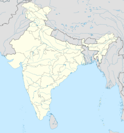 ไดน์ฮัท ไดน์ฮัต (อินเดีย) | |
| พิกัด: 23.6063°เหนือ 88.1715°ตะวันออก23°36′23″เหนือ88°10′17″ตะวันออก/ | |
| ประเทศ |  อินเดีย อินเดีย |
| สถานะ | รัฐเวสต์เบงกอล |
| เขต | ปุรบา บาร์ดามาน |
| รัฐบาล | |
| • พิมพ์ | เทศบาล |
| • ร่างกาย | เทศบาลเมืองไดน์ฮัท |
| พื้นที่ | |
• ทั้งหมด | 10.36 ตาราง กิโลเมตร(4.00 ตารางไมล์) |
| ประชากร (2001) [ 1 ] | |
• ทั้งหมด | 24,390 |
| • ความหนาแน่น | 2,354/ตร.กม. ( 6,097/ตร. ไมล์) |
| ภาษา | |
| • เป็นทางการ | ภาษาเบ งกาลีภาษาอังกฤษ |
| เขตเวลา | 5:30 น. ( เวลา UTC+ IST ) |
| เว็บไซต์ | purbabardhaman.gov.in |
Dainhatเป็นเมืองและเทศบาลภายใต้สถานีตำรวจKatwa ของ เขตย่อย Katwa [ 2 ]ในเขต Purba Bardhamanในรัฐเว ส ต์เบงกอลประเทศอินเดีย
ประวัติศาสตร์
กองทหารม้ามาราฐาหรือบาร์กีส์ภายใต้การนำของภัสการ ปัณฑิต ที่ส่งไปยังเบงกอลโดยราโฆจีที่ 1 โภณสเลในศตวรรษที่ 18 ได้เข้ามาทางปันเชตและเริ่มปล้นสะดมชนบท ภัสการ ปัณฑิต ได้ตัดสินใจสร้างไดนฮัตเป็นค่ายหลักเพื่อโจมตีศัตรู เขาได้ขุดคูน้ำหลายแห่งเพื่อป้องกันค่ายของเขา วัดที่สร้างโดยภัสการ ปัณฑิต ยังคงตั้งอยู่ใกล้กับสถานที่สวามัจ บาติ แห่งไดนฮัต ปัจจุบันวัดนั้นรู้จักกันในชื่อวัดกิโชร กิโชรี[ 3 ] [ 4 ]
ภูมิศาสตร์


[[Katwa]] (M)
\", \"description\": \" ([https://geohack.toolforge.org/geohack.php?params=23.65;88.13_dim:2000 23.65,88.13])\", \"marker-symbol\": \"-number-F11165\", \"marker-size\": \"medium\", \"marker-color\": \"#800000\" }, \"geometry\": {\"type\": \"Point\", \"coordinates\": [88.13,23.65] } }, { \"type\": \"Feature\", \"properties\": { \"title\": \"M
Dainhat (M)
\", \"description\": \" ([https://geohack.toolforge.org/geohack.php?params=23.60611;88.17972_dim:2000 23.60611,88.17972])\", \"marker-symbol\": \"-number-F11165\", \"marker-size\": \"medium\", \"marker-color\": \"#000000\" }, \"geometry\": {\"type\": \"Point\", \"coordinates\": [88.17972,23.60611] } }, { \"type\": \"Feature\", \"properties\": { \"title\": \"CT
[[Panuhat]] (CT)
\", \"description\": \" ([https://geohack.toolforge.org/geohack.php?params=23.61944;88.13222_dim:2000 23.61944,88.13222])\", \"marker-symbol\": \"-number-F11165\", \"marker-size\": \"medium\", \"marker-color\": \"#a40000\" }, \"geometry\": {\"type\": \"Point\", \"coordinates\": [88.13222,23.61944] } }, { \"type\": \"Feature\", \"properties\": { \"title\": \"R
[[Mongalkote]] (R)
\", \"description\": \" ([https://geohack.toolforge.org/geohack.php?params=23.525;87.90333_dim:2000 23.525,87.90333])\", \"marker-symbol\": \"-number-F11165\", \"marker-size\": \"medium\", \"marker-color\": \"#c42222\" }, \"geometry\": {\"type\": \"Point\", \"coordinates\": [87.90333,23.525] } }, { \"type\": \"Feature\", \"properties\": { \"title\": \"R
[[Ketugram]] (R)
\", \"description\": \" ([https://geohack.toolforge.org/geohack.php?params=23.70167;88.04389_dim:2000 23.70167,88.04389])\", \"marker-symbol\": \"-number-F11165\", \"marker-size\": \"medium\", \"marker-color\": \"#c42222\" }, \"geometry\": {\"type\": \"Point\", \"coordinates\": [88.04389,23.70167] } }, { \"type\": \"Feature\", \"properties\": { \"title\": \"R
[[Nutanhat]] (R)
\", \"description\": \" ([https://geohack.toolforge.org/geohack.php?params=23.54556;87.90222_dim:2000 23.54556,87.90222])\", \"marker-symbol\": \"-number-F11165\", \"marker-size\": \"medium\", \"marker-color\": \"#c42222\" }, \"geometry\": {\"type\": \"Point\", \"coordinates\": [87.90222,23.54556] } }, { \"type\": \"Feature\", \"properties\": { \"title\": \"R
[[Kandra, Bardhaman]] (R)
\", \"description\": \" ([https://geohack.toolforge.org/geohack.php?params=23.73139;87.96944_dim:2000 23.73139,87.96944])\", \"marker-symbol\": \"-number-F11165\", \"marker-size\": \"medium\", \"marker-color\": \"#c42222\" }, \"geometry\": {\"type\": \"Point\", \"coordinates\": [87.96944,23.73139] } }, { \"type\": \"Feature\", \"properties\": { \"title\": \"R
[[Gangatikuri]] (R)
\", \"description\": \" ([https://geohack.toolforge.org/geohack.php?params=23.72222;88.09778_dim:2000 23.72222,88.09778])\", \"marker-symbol\": \"-number-F11165\", \"marker-size\": \"medium\", \"marker-color\": \"#c42222\" }, \"geometry\": {\"type\": \"Point\", \"coordinates\": [88.09778,23.72222] } }, { \"type\": \"Feature\", \"properties\": { \"title\": \"R
[[Chandrapur, Bardhaman]] (R)
\", \"description\": \" ([https://geohack.toolforge.org/geohack.php?params=23.46389;88.07472_dim:2000 23.46389,88.07472])\", \"marker-symbol\": \"-number-F11165\", \"marker-size\": \"medium\", \"marker-color\": \"#c42222\" }, \"geometry\": {\"type\": \"Point\", \"coordinates\": [88.07472,23.46389] } }, { \"type\": \"Feature\", \"properties\": { \"title\": \"R
[[Singot]] (R)
\", \"description\": \" ([https://geohack.toolforge.org/geohack.php?params=23.57139;87.98139_dim:2000 23.57139,87.98139])\", \"marker-symbol\": \"-number-F11165\", \"marker-size\": \"medium\", \"marker-color\": \"#c42222\" }, \"geometry\": {\"type\": \"Point\", \"coordinates\": [87.98139,23.57139] } }, { \"type\": \"Feature\", \"properties\": { \"title\": \"R
[[Srikhanda]] (R)
\", \"description\": \" ([https://geohack.toolforge.org/geohack.php?params=23.57222;88.07972_dim:2000 23.57222,88.07972])\", \"marker-symbol\": \"-number-F11165\", \"marker-size\": \"medium\", \"marker-color\": \"#c42222\" }, \"geometry\": {\"type\": \"Point\", \"coordinates\": [88.07972,23.57222] } }, { \"type\": \"Feature\", \"properties\": { \"title\": \"H
[[Uddharanpur]] (H)
\", \"description\": \" ([https://geohack.toolforge.org/geohack.php?params=23.68556;88.13917_dim:2000 23.68556,88.13917])\", \"marker-symbol\": \"-number-F11165\", \"marker-size\": \"medium\", \"marker-color\": \"#aa6666\" }, \"geometry\": {\"type\": \"Point\", \"coordinates\": [88.13917,23.68556] } }, { \"type\": \"Feature\", \"properties\": { \"title\": \"H
[[Kogram]] (H)
\", \"description\": \" ([https://geohack.toolforge.org/geohack.php?params=23.54722;87.87833_dim:2000 23.54722,87.87833])\", \"marker-symbol\": \"-number-F11165\", \"marker-size\": \"medium\", \"marker-color\": \"#aa6666\" }, \"geometry\": {\"type\": \"Point\", \"coordinates\": [87.87833,23.54722] } }, { \"type\": \"Feature\", \"properties\": { \"title\": \"H
[[Sribati]] (H)
\", \"description\": \" ([https://geohack.toolforge.org/geohack.php?params=23.52111;88.17861_dim:2000 23.52111,88.17861])\", \"marker-symbol\": \"-number-F11165\", \"marker-size\": \"medium\", \"marker-color\": \"#aa6666\" }, \"geometry\": {\"type\": \"Point\", \"coordinates\": [88.17861,23.52111] } }, { \"type\": \"Feature\", \"properties\": { \"title\": \"H
[[Karui]] (H)
\", \"description\": \" ([https://geohack.toolforge.org/geohack.php?params=23.52111;88.09333_dim:2000 23.52111,88.09333])\", \"marker-symbol\": \"-number-F11165\", \"marker-size\": \"medium\", \"marker-color\": \"#aa6666\" }, \"geometry\": {\"type\": \"Point\", \"coordinates\": [88.09333,23.52111] } }, { \"type\": \"Feature\", \"properties\": { \"title\": \"C
[[Bankapasi]] (C)
\", \"description\": \" ([https://geohack.toolforge.org/geohack.php?params=23.58056;88.04722_dim:2000 23.58056,88.04722])\", \"marker-symbol\": \"-number-F11165\", \"marker-size\": \"medium\", \"marker-color\": \"#c42222\" }, \"geometry\": {\"type\": \"Point\", \"coordinates\": [88.04722,23.58056] } }, { \"type\": \"Feature\", \"properties\": { \"title\": \"H
[[Kshirgram]] (H)
\", \"description\": \" ([https://geohack.toolforge.org/geohack.php?params=23.51111;88.02722_dim:2000 23.51111,88.02722])\", \"marker-symbol\": \"-number-F11165\", \"marker-size\": \"medium\", \"marker-color\": \"#aa6666\" }, \"geometry\": {\"type\": \"Point\", \"coordinates\": [88.02722,23.51111] } }, { \"type\": \"Feature\", \"properties\": { \"title\": \"H
[[Jajigram]] (H)
\", \"description\": \" ([https://geohack.toolforge.org/geohack.php?params=23.63;88.10361_dim:2000 23.63,88.10361])\", \"marker-symbol\": \"-number-F11165\", \"marker-size\": \"medium\", \"marker-color\": \"#aa6666\" }, \"geometry\": {\"type\": \"Point\", \"coordinates\": [88.10361,23.63] } } ] } ]"}}">
ที่ตั้ง
Dainhat ตั้งอยู่ที่พิกัด23.6063°N 88.1715° E23°36′23″เหนือ88°10′17″ตะวันออก/
บล็อกซีดี HQ
สำนักงานใหญ่ของ กลุ่ม Katwa II CDตั้งอยู่ที่ Dainhat [ 5 ] [ 6 ]
การขยายตัวของเมือง
88.44% ของประชากรในเขตย่อย Katwa อาศัยอยู่ในพื้นที่ชนบท มีเพียง 11.56% ของประชากรเท่านั้นที่อาศัยอยู่ในพื้นที่เมือง[ 7 ]แผนที่ด้านข้างแสดงสถานที่สำคัญบางแห่งในเขตย่อย สถานที่ทั้งหมดที่ทำเครื่องหมายไว้ในแผนที่เชื่อมโยงกันในแผนที่แบบเต็มหน้าจอขนาดใหญ่
ข้อมูลประชากร
จากข้อมูลสำมะโนประชากรของอินเดียปี 2011ดาอินฮัตมีประชากรทั้งหมด 24,397 คน โดยเป็นชาย 12,487 คน (51%) และหญิง 11,910 คน (49%) ประชากรที่มีอายุต่ำกว่า 6 ปีมีจำนวน 2,306 คน จำนวนผู้รู้หนังสือในดาอินฮัตมีทั้งหมด 18,353 คน (75.23% ของประชากรที่มีอายุมากกว่า 6 ปี) [ 8 ]
ข้อมูล ณ ปี 2001จากการสำรวจสำมะโนประชากรของอินเดียDainhat มีประชากร 22,593 คน โดยเป็นชาย 51% และหญิง 49% Dainhat มีอัตราการรู้หนังสือเฉลี่ย 66% ซึ่งสูงกว่าค่าเฉลี่ยของประเทศที่ 59.5% โดยอัตราการรู้หนังสือของชายอยู่ที่ 72% และของหญิงอยู่ที่ 59% ใน Dainhat ประชากร 12% มีอายุต่ำกว่า 6 ปี[ 9 ]
เศรษฐกิจ
มีผู้คนประมาณ 3,200,000 คนเดินทางไปกลับจากทั่วเมืองไปยังเมืองโกลกาตาเป็นประจำทุกวัน มีรถไฟ 38 ขบวนให้บริการรับส่งผู้โดยสารจาก 45 สถานีในเส้นทาง Howrah-Katwa [ 10 ]
ขนส่ง
สถานีรถไฟ Dainhatอยู่ ห่างจาก Howrah 135 กม. บนเส้นทางสาย Bandel-Katwa [ 11 ]
ทางหลวงหมายเลข 15 (รัฐเวสต์เบงกอล)เริ่มต้นจาก Dainhat และวิ่งไปยัง Gadiara (ในเขต Howrah) [ 12 ]
จากเมือง Burdwan เดินทาง โดยรถบัสประมาณ 60 กิโลเมตร Dainhat มีบริการเรือข้ามฟากที่เชื่อมต่อกับ Matiyari (ในเขต Nadia) ข้ามแม่น้ำคงคา
การศึกษา
Dainhat มีโรงเรียนประถมศึกษา 20 แห่ง โรงเรียนประถมศึกษาตอนปลาย 1 แห่ง โรงเรียนมัธยมศึกษา 4 แห่ง และโรงเรียนมัธยมศึกษาตอนปลาย 3 แห่ง รวมถึงห้องสมุดประจำเมือง 1 แห่ง (Dainhat Sahar Jitendranath Mitra Smriti Pathagar) [ 13 ]
การดูแลสุขภาพ
ศูนย์สุขภาพปฐมภูมิประจำบล็อกโนอาปารา ที่โนอาปารา PO Dainhat (มี 15 เตียง) เป็นสถานพยาบาลหลักในบล็อก Katwa II CD นอกจากนี้ยังมีศูนย์สุขภาพปฐมภูมิที่ Agradwip (มี 10 เตียง) และ Singhi (มี 6 เตียง) [ 14 ]ในปี 2555 จำนวนผู้ป่วยเฉลี่ยต่อเดือนที่เข้ารับบริการที่ศูนย์สุขภาพปฐมภูมิโนอาปาราคือ 2,909 ราย และจำนวนผู้ป่วยที่เข้ารับการรักษาในโรงพยาบาลเฉลี่ยต่อเดือนคือ 163 ราย โดยมีผู้ป่วยฉุกเฉินเข้ารับการรักษาปีละ 1,772 ราย[ 15 ]
ดูเพิ่มเติม - ระบบการดูแลสุขภาพในรัฐเวสต์เบงกอล