
คาราโครัม
| คาราโครัม | |
|---|---|
 ธารน้ำแข็งบัลโตโรในเทือกเขาคาราโครัมตอนกลางกิลกิต-บัลติสถานแคชเมียร์ที่อยู่ภายใต้การปกครองของปากีสถาน | |
| จุดสูงสุด | |
| จุดสูงสุด | เค2 |
| ระดับความสูง | 8,611 เมตร (28,251 ฟุต) |
| พิกัด | 35°52′57″N 76°30′48″E / 35.88250°N 76.51333°E / 35.88250; 76.51333 |
| มิติ | |
| ความยาว | 500 กม. (310 ไมล์) |
| ภูมิศาสตร์ | |
 แผนที่แบบอินเทอร์แอ็กทีฟแสดงขอบเขตของเทือกเขาคาราโครัม | |
ประเทศ | |
ภูมิภาค/จังหวัด | |
พิกัดช่วง | 36°N 76°E / 36°N 76°E / 36; 76 |
| ชายแดนติดกับ | |
| คาราโครัม | |||||||
|---|---|---|---|---|---|---|---|
| ชื่อภาษาจีน | |||||||
| ชาวจีน | 喀喇昆仑yama脉 | ||||||
| ฮันยู พินอิน | Kālǎ Kūnlún shānmài | ||||||
| ความหมายตามตัวอักษร | "เทือกเขาคารา-คุนหลุน" | ||||||
| |||||||
| ชื่อทิเบต | |||||||
| ทิเบต | ཁར་ཁོ་རུམ་རི | ||||||
| |||||||
| ชื่ออุยกูร์ | |||||||
| อุยกูร์ | قاراقورام | ||||||
เทือกเขาคาราโครัม ( ภาษาอังกฤษ: /ˌkɑːrəˈkɔːrəm, ˌkær-/ , ภาษาอูร์ดู: [ kaːɾaːkoːɾəm ] ) [ 1 ]เป็นเทือกเขาในทวีปเอเชีย ตั้งอยู่ใน ภูมิภาค แคชเมียร์ เป็นหลัก เทือกเขานี้ทอดยาวข้ามพรมแดนของปากีสถานจีนและอินเดีย[ a ] โดยปลายด้านตะวันตกเฉียงเหนือของเทือกเขาขยายเข้าไปในอัฟกานิสถานและทาจิกิสถาน เทือกเขา คาราโครัมมียอด เขาสูงแปดพันเมตรอยู่สี่แห่งจากทั้งหมดสิบสี่แห่ง โดยยอดเขาที่สูงที่สุดคือK2 ซึ่ง เป็นภูเขาที่สูงเป็นอันดับสองของโลก
เทือกเขาคาราโครัมเริ่มต้นที่ระเบียงวาคานในอัฟกานิสถานตะวันออก และทอดยาวไปทางตะวันออกสู่ลาดักห์ที่ อยู่ภายใต้การปกครองของอินเดีย และอักไซชิน ที่อยู่ภายใต้การปกครองของจีน รวมถึงมณฑลซินเจียง ของจีน ส่วนใหญ่ของเทือกเขาคาราโครัมตั้งอยู่ใน ภูมิภาค กิลกิต-บัลติสถาน ซึ่งอยู่ภายใต้การปกครองของ ปากีสถาน เทือกเขา คาราโค รัมมีพรมแดนทางตะวันออกติดกับที่ราบสูงอักไซชิน ทางตะวันออกเฉียงเหนือติดกับขอบที่ราบสูงทิเบต และทางเหนือติดกับ หุบเขาแม่น้ำ ยาร์กันด์และคาราคัชซึ่งถัดไปเป็นเทือกเขาคุนหลุนทางมุมตะวันตกเฉียงเหนือเป็นเทือกเขาปามีร์ ในขณะที่ทางตะวันตกเป็น เทือกเขาฮินดูกุชพรมแดนทางใต้ของเทือกเขาคาราโครัมเกิดจากแม่น้ำกิลกิตแม่น้ำสินธุและ แม่น้ำ ชยอกซึ่งแบ่งเทือกเขาออกจากปลายด้านตะวันตกเฉียงเหนือของเทือกเขาหิมาลัยแม่น้ำเหล่านี้ไหลไปทางทิศตะวันตกเฉียงเหนือ ก่อนที่จะหักเลี้ยวอย่างฉับพลันไปทางทิศตะวันตกเฉียงใต้สู่ที่ราบของปากีสถาน บริเวณกึ่งกลางของเทือกเขาคาราโครัมคือช่องเขาคาราโครัมซึ่งเคยเป็นส่วนหนึ่งของเส้นทางการค้าที่ปัจจุบันเลิกใช้แล้วระหว่างลาดักห์และยาร์คันด์
เทือกเขานี้มีความยาวประมาณ500 กิโลเมตร (311 ไมล์)และเป็น สถานที่ ที่มีธารน้ำแข็ง มากที่สุด ในโลกนอกเขตขั้วโลกธารน้ำแข็งเซียเชน ( ยาว 76 กิโลเมตร (47 ไมล์) ) และธารน้ำแข็งเบียโฟ ( ยาว 63 กิโลเมตร (39 ไมล์) ) เป็นธารน้ำแข็งที่ยาวเป็นอันดับสองและสามนอกเขตขั้วโลก[ 2 ]เทือกเขาคาราโครัมเป็นเทือกเขาที่สูงเป็นอันดับสองของโลกและเป็นส่วนหนึ่งของกลุ่มเทือกเขาที่รวมถึงเทือกเขาปามีร์ เทือกเขาฮินดูกุช และเทือกเขาหิมาลัย[ 3 ] [ 4 ]เทือกเขานี้มียอดเขาสูงกว่า7,500 เมตร (24,600 ฟุต) จำนวน 18 ยอด โดยมี 4 ยอดที่สูงกว่า8,000 เมตร (26,000 ฟุต) [ 5 ] [ 6 ] [ 7 ]ซึ่งรวมถึงK2 , กาเชอร์บรัม 1 , บรอดพีคและ กาเชอ ร์บรัม 2
ชื่อ
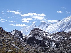
คาราโครัมเป็นคำภาษาเตอร์กิก ที่มีความหมายว่า กรวดสีดำพ่อค้าชาวเอเชียกลางใช้ชื่อนี้เรียกช่องเขาคาราโครัมแต่ เดิม [ 8 ]นักเดินทางชาวยุโรปในยุคแรกๆ รวมถึงวิลเลียม มัวร์ครอฟต์และจอร์ จ เฮย์เวิร์ด เริ่มใช้คำนี้เรียกเทือกเขาทางตะวันตกของช่องเขา แม้ว่าพวกเขาจะใช้คำว่ามุซทาก (หมายถึง "ภูเขาน้ำแข็ง") เรียกเทือกเขาที่ปัจจุบันรู้จักกันในชื่อคาราโครัมก็ตาม[ 8 ] [ 9 ]ต่อมาคำศัพท์ได้รับอิทธิพลจากโทมัส มอนต์โกเมอรีแห่งสำรวจอินเดียซึ่งกำหนดป้ายกำกับ K1 ถึง K6 (K สำหรับคาราโครัม) ให้กับภูเขาสูงหกลูกที่มองเห็นได้จากสถานีของเขาที่ภูเขาฮารามุคในช่วงทศวรรษ 1850 รหัสเหล่านี้ได้รับการขยายไปจนถึงมากกว่าสามสิบลูก
ในภูมิศาสตร์อินเดียแบบดั้งเดิม ภูเขาเหล่า นี้เรียกว่าKrishnagiri (ภูเขาสีดำ), KanhagiriและKanheri [ 10 ]
การสำรวจ
เนื่องจากระดับความสูงและภูมิประเทศที่ขรุขระ เทือกเขาคาราโครัมจึงมีประชากรอาศัยอยู่น้อยกว่าส่วนอื่นๆ ของเทือกเขาหิมาลัยทางตะวันออก นักสำรวจชาวยุโรปเดินทางมาเยือนเป็นครั้งแรกในช่วงต้นศตวรรษที่ 19 ตามมาด้วยนักสำรวจชาวอังกฤษที่เริ่มเข้ามาตั้งแต่ปี 1856
คณะสำรวจของพันเอก ฟราน ซิส ยังฮัสแบน ด์ ได้ข้าม ช่องเขามุซทาก ในปี พ.ศ. 2430 [ 11 ]และหุบเขาเหนือแม่น้ำฮุนซาได้รับการสำรวจโดยพลเอกเซอร์จอร์จ เค. ค็อกเกอริลในปี พ.ศ. 2435 การสำรวจในช่วงปี พ.ศ. 2453 และ พ.ศ. 2463 ได้กำหนดภูมิศาสตร์ส่วนใหญ่ของภูมิภาคนี้
ชื่อ Karakoram ถูกใช้ในช่วงต้นศตวรรษที่ 20 ตัวอย่างเช่นโดยKenneth Mason [ 8 ] สำหรับเทือกเขาที่ปัจจุบันรู้จักกันในชื่อBaltoro Muztaghคำนี้ปัจจุบันใช้เพื่ออ้างถึงเทือกเขาทั้งหมดตั้งแต่Batura MuztaghเหนือHunzaทางตะวันตกไปจนถึงSaser Muztaghในส่วนโค้งของแม่น้ำ Shyokทางตะวันออก

การสำรวจพืชพรรณดำเนินการในลุ่มน้ำ Shyok และจาก Panamik ไปยังหมู่บ้าน Turtuk โดยChandra Prakash Kalaในช่วงปี 1999 และ 2000 [ 12 ] [ 13 ]
ธรณีวิทยาและธารน้ำแข็ง
เทือกเขาคาราโครัมตั้งอยู่ในพื้นที่ที่มีกิจกรรมทางธรณีวิทยามากที่สุดแห่งหนึ่งของโลก ณขอบเขตแผ่นเปลือกโลกระหว่างแผ่นอินโด-ออสเตรเลียและแผ่นยูเรเซีย [ 14 ] ส่วนสำคัญของเทือกเขาคาราโครัม ซึ่งอยู่ระหว่าง 28 ถึง 50 เปอร์เซ็นต์ ปกคลุมด้วยธารน้ำแข็ง ครอบคลุมพื้นที่มากกว่า15,000 ตารางกิโลเมตร หรือ 5,800 ตารางไมล์ [ 15 ] เมื่อเทียบกับเทือกเขาหิมาลัยซึ่งอยู่ระหว่าง 8 ถึง 12 เปอร์เซ็นต์ และเทือกเขาแอลป์ซึ่ง อยู่ระหว่าง 2.2 เปอร์เซ็นต์ [ 16 ]ธารน้ำแข็งบนภูเขาอาจทำหน้าที่เป็นตัวบ่งชี้การเปลี่ยนแปลงสภาพภูมิอากาศ โดยมีการขยายตัวและหดตัวตามการเปลี่ยนแปลงระยะยาวของอุณหภูมิและปริมาณน้ำฝน ธารน้ำแข็งคาราโครัมกำลังถอยร่นเล็กน้อย[ 17 ] [ 18 ] [ 19 ]ซึ่งแตกต่างจากเทือกเขาหิมาลัยที่ธารน้ำแข็งสูญเสียมวลในอัตราที่สูงกว่ามาก ธารน้ำแข็งคาราโครัมหลายแห่งถูกปกคลุมด้วยชั้นของเศษหินซึ่งช่วยป้องกันน้ำแข็งจากความร้อนของดวงอาทิตย์[ 20 ]ในบริเวณที่ไม่มีฉนวนดังกล่าว อัตราการถอยร่นจะสูง[ 21 ]การศึกษาล่าสุดบางชิ้นเผยให้เห็นการเพิ่มขึ้นเล็กน้อยหรือความคงที่ของมวลธารน้ำแข็งในคาราโครัมตอนกลางและตะวันตก ซึ่งนักวิชาการบางคนเรียกว่า "ความผิดปกติของคาราโครัม" [ 22 ] [ 23 ] [ 24 ] [ 25 ]ซึ่งแตกต่างจากคาราโครัมตะวันออกที่พบว่าธารน้ำแข็งกำลังถอยร่น[ 26 ] [ 27 ] [ 28 ] [ 29 ]ธารน้ำแข็งที่โดดเด่นในคาราโครัม ได้แก่:
- ธารน้ำแข็งเซียเชน
- ธารน้ำแข็งบัลโตโร
- ธารน้ำแข็งฮิสปาร์
- ธารน้ำแข็งบาตูรา
- ธารน้ำแข็งเบียโฟ
- ธารน้ำแข็งโชโก ลุงมา
- ธารน้ำแข็งยินซูกาอิติ
ยุคน้ำแข็ง
ในยุคน้ำแข็ง ครั้งสุดท้าย ธารน้ำแข็งที่เชื่อมต่อกัน ทอดยาวจาก ทิเบตตะวันตกไปยังนังกาปาร์บัตและจากแอ่งทาริมไปยังเขตปกครองกิลกิต [ 30 ] [ 31 ] [ 32 ] ทางใต้ธารน้ำแข็งอินดัสเป็นธารน้ำแข็งหุบเขาหลัก ซึ่งไหลลงมาจากเทือกเขานังกาปาร์บัตเป็น ระยะทาง 120 กิโลเมตร (75 ไมล์) ไปจนถึง ระดับความสูง870 เมตร (2,850 ฟุต) [ 30 ] [ 33 ]ทางเหนือ ธารน้ำแข็งคาราโครัมรวมกับธารน้ำแข็งจากเทือกเขาคุนหลุนและไหลลงมาถึง ระดับความ สูง 2,000 เมตร (6,600 ฟุต)ในแอ่งทาริม[ 32 ] [ 34 ]
ในขณะที่ธารน้ำแข็งหุบเขาในปัจจุบันในคาราโครัมมีความยาวสูงสุด76 กิโลเมตร (47 ไมล์)แต่ธารน้ำแข็งหุบเขาสาขาและธารน้ำแข็งหุบเขาหลักในยุคน้ำแข็งหลายแห่งมีความยาวถึง700 กิโลเมตร (430 ไมล์)ในช่วงยุคน้ำแข็ง เส้นหิมะของธารน้ำแข็งอยู่ต่ำกว่าปัจจุบัน ประมาณ 1,300 เมตร (4,300 ฟุต) [ 32 ] [ 33 ]
ยอดเขาสูงที่สุด


\", \"description\": \"8,611 m (28,251 ft) ([https://geohack.toolforge.org/geohack.php?params=35.8825;76.51333_dim:2000 35.8825,76.51333])\", \"marker-symbol\": \"-number-F1118\", \"marker-size\": \"medium\", \"marker-color\": \"#269F46\" }, \"geometry\": {\"type\": \"Point\", \"coordinates\": [76.51333,35.8825] } }, { \"type\": \"Feature\", \"properties\": { \"title\": \"[[Gasherbrum I|Gasherbrum I, K5]]
\", \"description\": \"8,080 m (26,510 ft) ([https://geohack.toolforge.org/geohack.php?params=35.72444;76.69639_dim:2000 35.72444,76.69639])\", \"marker-symbol\": \"-number-F1118\", \"marker-size\": \"medium\", \"marker-color\": \"#269F46\" }, \"geometry\": {\"type\": \"Point\", \"coordinates\": [76.69639,35.72444] } }, { \"type\": \"Feature\", \"properties\": { \"title\": \"[[Broad Peak]]
\", \"description\": \"8,051 m (26,414 ft) ([https://geohack.toolforge.org/geohack.php?params=35.81167;76.565_dim:2000 35.81167,76.565])\", \"marker-symbol\": \"-number-F1118\", \"marker-size\": \"medium\", \"marker-color\": \"#269F46\" }, \"geometry\": {\"type\": \"Point\", \"coordinates\": [76.565,35.81167] } }, { \"type\": \"Feature\", \"properties\": { \"title\": \"[[Gasherbrum II|Gasherbrum II, K4]]
\", \"description\": \"8,035 m (26,362 ft) ([https://geohack.toolforge.org/geohack.php?params=35.7577;76.6533_dim:2000 35.7577,76.6533])\", \"marker-symbol\": \"-number-F1118\", \"marker-size\": \"medium\", \"marker-color\": \"#269F46\" }, \"geometry\": {\"type\": \"Point\", \"coordinates\": [76.6533,35.7577] } }, { \"type\": \"Feature\", \"properties\": { \"title\": \"[[Gasherbrum III|Gasherbrum III, K3a]]
\", \"description\": \"7,952 m (26,089 ft) ([https://geohack.toolforge.org/geohack.php?params=35.7597;76.642_dim:2000 35.7597,76.642])\", \"marker-symbol\": \"-number-F1118\", \"marker-size\": \"medium\", \"marker-color\": \"#269F46\" }, \"geometry\": {\"type\": \"Point\", \"coordinates\": [76.642,35.7597] } }, { \"type\": \"Feature\", \"properties\": { \"title\": \"[[Gasherbrum IV|Gasherbrum IV, K3]]
\", \"description\": \"7,925 m (26,001 ft) ([https://geohack.toolforge.org/geohack.php?params=35.75833;76.61667_dim:2000 35.75833,76.61667])\", \"marker-symbol\": \"-number-F1118\", \"marker-size\": \"medium\", \"marker-color\": \"#269F46\" }, \"geometry\": {\"type\": \"Point\", \"coordinates\": [76.61667,35.75833] } }, { \"type\": \"Feature\", \"properties\": { \"title\": \"[[Distaghil Sar]]
\", \"description\": \"7,885 m (25,869 ft) ([https://geohack.toolforge.org/geohack.php?params=36.32583;75.18833_dim:2000 36.32583,75.18833])\", \"marker-symbol\": \"-number-F1118\", \"marker-size\": \"medium\", \"marker-color\": \"#269F46\" }, \"geometry\": {\"type\": \"Point\", \"coordinates\": [75.18833,36.32583] } }, { \"type\": \"Feature\", \"properties\": { \"title\": \"[[Kunyang Chhish]] (Kunyang Kish, Khunyang Chhish, Khinyang Chhish)
\", \"description\": \"7,823 m (25,666 ft) ([https://geohack.toolforge.org/geohack.php?params=36.20528;75.20778_dim:2000 36.20528,75.20778])\", \"marker-symbol\": \"-number-F1118\", \"marker-size\": \"medium\", \"marker-color\": \"#269F46\" }, \"geometry\": {\"type\": \"Point\", \"coordinates\": [75.20778,36.20528] } }, { \"type\": \"Feature\", \"properties\": { \"title\": \"[[Masherbrum|Masherbrum, K1]]
\", \"description\": \"7,821 m (25,659 ft) ([https://geohack.toolforge.org/geohack.php?params=35.64;76.30583_dim:2000 35.64,76.30583])\", \"marker-symbol\": \"-number-F1118\", \"marker-size\": \"medium\", \"marker-color\": \"#269F46\" }, \"geometry\": {\"type\": \"Point\", \"coordinates\": [76.30583,35.64] } }, { \"type\": \"Feature\", \"properties\": { \"title\": \"[[Batura Sar|Batura Sar, Batura I]]
\", \"description\": \"7,795 m (25,574 ft) ([https://geohack.toolforge.org/geohack.php?params=36.51;74.52417_dim:2000 36.51,74.52417])\", \"marker-symbol\": \"-number-F1118\", \"marker-size\": \"medium\", \"marker-color\": \"#269F46\" }, \"geometry\": {\"type\": \"Point\", \"coordinates\": [74.52417,36.51] } }, { \"type\": \"Feature\", \"properties\": { \"title\": \"[[Rakaposhi]]
\", \"description\": \"7,788 m (25,551 ft) ([https://geohack.toolforge.org/geohack.php?params=36.1425;74.48917_dim:2000 36.1425,74.48917])\", \"marker-symbol\": \"-number-F1118\", \"marker-size\": \"medium\", \"marker-color\": \"#269F46\" }, \"geometry\": {\"type\": \"Point\", \"coordinates\": [74.48917,36.1425] } }, { \"type\": \"Feature\", \"properties\": { \"title\": \"[[Batura II]]
\", \"description\": \"7,762 m (25,466 ft) ([https://geohack.toolforge.org/geohack.php?params=36.51889;74.50806_dim:2000 36.51889,74.50806])\", \"marker-symbol\": \"-number-F1118\", \"marker-size\": \"medium\", \"marker-color\": \"#269F46\" }, \"geometry\": {\"type\": \"Point\", \"coordinates\": [74.50806,36.51889] } }, { \"type\": \"Feature\", \"properties\": { \"title\": \"[[Kanjut Sar]]
\", \"description\": \"7,760 m (25,460 ft) ([https://geohack.toolforge.org/geohack.php?params=36.205;75.41778_dim:2000 36.205,75.41778])\", \"marker-symbol\": \"-number-F1118\", \"marker-size\": \"medium\", \"marker-color\": \"#269F46\" }, \"geometry\": {\"type\": \"Point\", \"coordinates\": [75.41778,36.205] } }, { \"type\": \"Feature\", \"properties\": { \"title\": \"[[Saltoro Kangri|Saltoro Kangri, K10]]
\", \"description\": \"7,742 m (25,400 ft) ([https://geohack.toolforge.org/geohack.php?params=35.39917;76.8475_dim:2000 35.39917,76.8475])\", \"marker-symbol\": \"-number-F1118\", \"marker-size\": \"medium\", \"marker-color\": \"#269F46\" }, \"geometry\": {\"type\": \"Point\", \"coordinates\": [76.8475,35.39917] } }, { \"type\": \"Feature\", \"properties\": { \"title\": \"[[Batura III]]
\", \"description\": \"7,729 m (25,358 ft) ([https://geohack.toolforge.org/geohack.php?params=36.53083;74.50139_dim:2000 36.53083,74.50139])\", \"marker-symbol\": \"-number-F1118\", \"marker-size\": \"medium\", \"marker-color\": \"#269F46\" }, \"geometry\": {\"type\": \"Point\", \"coordinates\": [74.50139,36.53083] } }, { \"type\": \"Feature\", \"properties\": { \"title\": \"[[Saser Kangri|Saser Kangri I, K22]]
\", \"description\": \"7,672 m (25,171 ft) ([https://geohack.toolforge.org/geohack.php?params=34.86667;77.7525_dim:2000 34.86667,77.7525])\", \"marker-symbol\": \"-number-F1118\", \"marker-size\": \"medium\", \"marker-color\": \"#269F46\" }, \"geometry\": {\"type\": \"Point\", \"coordinates\": [77.7525,34.86667] } }, { \"type\": \"Feature\", \"properties\": { \"title\": \"[[Chogolisa]]
\", \"description\": \"7,665 m (25,148 ft) ([https://geohack.toolforge.org/geohack.php?params=35.61417;76.57917_dim:2000 35.61417,76.57917])\", \"marker-symbol\": \"-number-F1118\", \"marker-size\": \"medium\", \"marker-color\": \"#269F46\" }, \"geometry\": {\"type\": \"Point\", \"coordinates\": [76.57917,35.61417] } }, { \"type\": \"Feature\", \"properties\": { \"title\": \"[[Shispare]] or Shispare Sar
\", \"description\": \"7,611 m (24,970 ft) ([https://geohack.toolforge.org/geohack.php?params=36.44056;74.68083_dim:2000 36.44056,74.68083])\", \"marker-symbol\": \"-number-F1118\", \"marker-size\": \"medium\", \"marker-color\": \"#269F46\" }, \"geometry\": {\"type\": \"Point\", \"coordinates\": [74.68083,36.44056] } }, { \"type\": \"Feature\", \"properties\": { \"title\": \"[[Trivor|Trivor Sar]]
\", \"description\": \"7,577 m (24,859 ft) (The higher value from a Russian survey is inaccurate) ([https://geohack.toolforge.org/geohack.php?params=36.2875;75.08611_dim:2000 36.2875,75.08611])\", \"marker-symbol\": \"-number-F1118\", \"marker-size\": \"medium\", \"marker-color\": \"#269F46\" }, \"geometry\": {\"type\": \"Point\", \"coordinates\": [75.08611,36.2875] } }, { \"type\": \"Feature\", \"properties\": { \"title\": \"[[Skyang Kangri]]
\", \"description\": \"7,545 m (24,754 ft) ([https://geohack.toolforge.org/geohack.php?params=35.92639;76.5675_dim:2000 35.92639,76.5675])\", \"marker-symbol\": \"-number-F1118\", \"marker-size\": \"medium\", \"marker-color\": \"#269F46\" }, \"geometry\": {\"type\": \"Point\", \"coordinates\": [76.5675,35.92639] } }, { \"type\": \"Feature\", \"properties\": { \"title\": \"[[Mamostong Kangri|Mamostong Kangri K35]]
\", \"description\": \"7,516 m (24,659 ft) ([https://geohack.toolforge.org/geohack.php?params=35.14083;77.5775_dim:2000 35.14083,77.5775])\", \"marker-symbol\": \"-number-F1118\", \"marker-size\": \"medium\", \"marker-color\": \"#269F46\" }, \"geometry\": {\"type\": \"Point\", \"coordinates\": [77.5775,35.14083] } }, { \"type\": \"Feature\", \"properties\": { \"title\": \"[[Saser Kangri|Saser Kangri II]]
\", \"description\": \"7,518 m (24,665 ft) ([https://geohack.toolforge.org/geohack.php?params=34.8045;77.8054_dim:2000 34.8045,77.8054])\", \"marker-symbol\": \"-number-F1118\", \"marker-size\": \"medium\", \"marker-color\": \"#269F46\" }, \"geometry\": {\"type\": \"Point\", \"coordinates\": [77.8054,34.8045] } }, { \"type\": \"Feature\", \"properties\": { \"title\": \"[[Saser Kangri|Saser Kangri III]]
\", \"description\": \"7,495 m (24,590 ft) ([https://geohack.toolforge.org/geohack.php?params=34.8448;77.7846_dim:2000 34.8448,77.7846])\", \"marker-symbol\": \"-number-F1118\", \"marker-size\": \"medium\", \"marker-color\": \"#269F46\" }, \"geometry\": {\"type\": \"Point\", \"coordinates\": [77.7846,34.8448] } }, { \"type\": \"Feature\", \"properties\": { \"title\": \"[[Pumari Chhish]]
\", \"description\": \"7,492 m (24,580 ft) ([https://geohack.toolforge.org/geohack.php?params=36.21111;75.25278_dim:2000 36.21111,75.25278])\", \"marker-symbol\": \"-number-F1118\", \"marker-size\": \"medium\", \"marker-color\": \"#269F46\" }, \"geometry\": {\"type\": \"Point\", \"coordinates\": [75.25278,36.21111] } }, { \"type\": \"Feature\", \"properties\": { \"title\": \"[[Passu Sar]]
\", \"description\": \"7,478 m (24,534 ft) ([https://geohack.toolforge.org/geohack.php?params=36.48778;74.58778_dim:2000 36.48778,74.58778])\", \"marker-symbol\": \"-number-F1118\", \"marker-size\": \"medium\", \"marker-color\": \"#269F46\" }, \"geometry\": {\"type\": \"Point\", \"coordinates\": [74.58778,36.48778] } }, { \"type\": \"Feature\", \"properties\": { \"title\": \"[[Yukshin Gardan Sar]]
\", \"description\": \"7,530 m (24,700 ft) {other heights have been given) ([https://geohack.toolforge.org/geohack.php?params=36.25;75.375_dim:2000 36.25,75.375])\", \"marker-symbol\": \"-number-F1118\", \"marker-size\": \"medium\", \"marker-color\": \"#269F46\" }, \"geometry\": {\"type\": \"Point\", \"coordinates\": [75.375,36.25] } }, { \"type\": \"Feature\", \"properties\": { \"title\": \"[[Teram Kangri|Teram Kangri I]]
\", \"description\": \"7,462 m (24,482 ft) ([https://geohack.toolforge.org/geohack.php?params=35.5802;77.0797_dim:2000 35.5802,77.0797])\", \"marker-symbol\": \"-number-F1118\", \"marker-size\": \"medium\", \"marker-color\": \"#269F46\" }, \"geometry\": {\"type\": \"Point\", \"coordinates\": [77.0797,35.5802] } }, { \"type\": \"Feature\", \"properties\": { \"title\": \"[[Malubiting]]
\", \"description\": \"7,458 m (24,469 ft) ([https://geohack.toolforge.org/geohack.php?params=36.00167;74.87583_dim:2000 36.00167,74.87583])\", \"marker-symbol\": \"-number-F1118\", \"marker-size\": \"medium\", \"marker-color\": \"#269F46\" }, \"geometry\": {\"type\": \"Point\", \"coordinates\": [74.87583,36.00167] } }, { \"type\": \"Feature\", \"properties\": { \"title\": \"[[K12 (mountain)|K12]]
\", \"description\": \"7,428 m (24,370 ft) ([https://geohack.toolforge.org/geohack.php?params=35.295;77.02167_dim:2000 35.295,77.02167])\", \"marker-symbol\": \"-number-F1118\", \"marker-size\": \"medium\", \"marker-color\": \"#269F46\" }, \"geometry\": {\"type\": \"Point\", \"coordinates\": [77.02167,35.295] } }, { \"type\": \"Feature\", \"properties\": { \"title\": \"[[Sia Kangri]]
\", \"description\": \"7,422 m (24,350 ft) ([https://geohack.toolforge.org/geohack.php?params=35.66333;76.7625_dim:2000 35.66333,76.7625])\", \"marker-symbol\": \"-number-F1118\", \"marker-size\": \"medium\", \"marker-color\": \"#269F46\" }, \"geometry\": {\"type\": \"Point\", \"coordinates\": [76.7625,35.66333] } }, { \"type\": \"Feature\", \"properties\": { \"title\": \"[[Momhil Sar]]
\", \"description\": \"7,414 m (24,324 ft) ([https://geohack.toolforge.org/geohack.php?params=36.31778;75.03639_dim:2000 36.31778,75.03639])\", \"marker-symbol\": \"-number-F1118\", \"marker-size\": \"medium\", \"marker-color\": \"#269F46\" }, \"geometry\": {\"type\": \"Point\", \"coordinates\": [75.03639,36.31778] } }, { \"type\": \"Feature\", \"properties\": { \"title\": \"[[Skil Brum]]
\", \"description\": \"7,410 m (24,310 ft) ([https://geohack.toolforge.org/geohack.php?params=35.85083;76.42917_dim:2000 35.85083,76.42917])\", \"marker-symbol\": \"-number-F1118\", \"marker-size\": \"medium\", \"marker-color\": \"#269F46\" }, \"geometry\": {\"type\": \"Point\", \"coordinates\": [76.42917,35.85083] } }, { \"type\": \"Feature\", \"properties\": { \"title\": \"[[Haramosh Peak]]
\", \"description\": \"7,409 m (24,308 ft) ([https://geohack.toolforge.org/geohack.php?params=35.84;74.8975_dim:2000 35.84,74.8975])\", \"marker-symbol\": \"-number-F1118\", \"marker-size\": \"medium\", \"marker-color\": \"#269F46\" }, \"geometry\": {\"type\": \"Point\", \"coordinates\": [74.8975,35.84] } }, { \"type\": \"Feature\", \"properties\": { \"title\": \"[[Ghent Kangri]]
\", \"description\": \"7,401 m (24,281 ft) ([https://geohack.toolforge.org/geohack.php?params=35.5175;76.80028_dim:2000 35.5175,76.80028])\", \"marker-symbol\": \"-number-F1118\", \"marker-size\": \"medium\", \"marker-color\": \"#269F46\" }, \"geometry\": {\"type\": \"Point\", \"coordinates\": [76.80028,35.5175] } }, { \"type\": \"Feature\", \"properties\": { \"title\": \"[[Ultar|Ultar, Ultar Peak, Ultar Sar]]
\", \"description\": \"7,388 m (24,239 ft) ([https://geohack.toolforge.org/geohack.php?params=36.39833;74.70889_dim:2000 36.39833,74.70889])\", \"marker-symbol\": \"-number-F1118\", \"marker-size\": \"medium\", \"marker-color\": \"#269F46\" }, \"geometry\": {\"type\": \"Point\", \"coordinates\": [74.70889,36.39833] } }, { \"type\": \"Feature\", \"properties\": { \"title\": \"Rimo I, [[Rimo Massif]]
\", \"description\": \"7,385 m (24,229 ft) ([https://geohack.toolforge.org/geohack.php?params=35.35583;77.36806_dim:2000 35.35583,77.36806])\", \"marker-symbol\": \"-number-F1118\", \"marker-size\": \"medium\", \"marker-color\": \"#269F46\" }, \"geometry\": {\"type\": \"Point\", \"coordinates\": [77.36806,35.35583] } }, { \"type\": \"Feature\", \"properties\": { \"title\": \"[[Sherpi Kangri]]
\", \"description\": \"7,380 m (24,210 ft) ([https://geohack.toolforge.org/geohack.php?params=35.46611;76.78139_dim:2000 35.46611,76.78139])\", \"marker-symbol\": \"-number-F1118\", \"marker-size\": \"medium\", \"marker-color\": \"#269F46\" }, \"geometry\": {\"type\": \"Point\", \"coordinates\": [76.78139,35.46611] } }, { \"type\": \"Feature\", \"properties\": { \"title\": \"[[Yazghil Dome South]]
\", \"description\": \"7,365 m (24,163 ft) ([https://geohack.toolforge.org/geohack.php?params=36.308;75.2317_dim:2000 36.308,75.2317])\", \"marker-symbol\": \"-number-F1118\", \"marker-size\": \"medium\", \"marker-color\": \"#269F46\" }, \"geometry\": {\"type\": \"Point\", \"coordinates\": [75.2317,36.308] } }, { \"type\": \"Feature\", \"properties\": { \"title\": \"[[Baltoro Kangri]]
\", \"description\": \"7,312 m (23,990 ft) ([https://geohack.toolforge.org/geohack.php?params=35.63917;76.67333_dim:2000 35.63917,76.67333])\", \"marker-symbol\": \"-number-F1118\", \"marker-size\": \"medium\", \"marker-color\": \"#269F46\" }, \"geometry\": {\"type\": \"Point\", \"coordinates\": [76.67333,35.63917] } }, { \"type\": \"Feature\", \"properties\": { \"title\": \"[[The Crown (mountain)|Crown Peak]]
\", \"description\": \"7,295 m (23,934 ft) ([https://geohack.toolforge.org/geohack.php?params=36.10833;76.2125_dim:2000 36.10833,76.2125])\", \"marker-symbol\": \"-number-F1118\", \"marker-size\": \"medium\", \"marker-color\": \"#269F46\" }, \"geometry\": {\"type\": \"Point\", \"coordinates\": [76.2125,36.10833] } }, { \"type\": \"Feature\", \"properties\": { \"title\": \"[[Baintha Brakk]]
\", \"description\": \"7,285 m (23,901 ft) ([https://geohack.toolforge.org/geohack.php?params=35.9475;75.75333_dim:2000 35.9475,75.75333])\", \"marker-symbol\": \"-number-F1118\", \"marker-size\": \"medium\", \"marker-color\": \"#269F46\" }, \"geometry\": {\"type\": \"Point\", \"coordinates\": [75.75333,35.9475] } }, { \"type\": \"Feature\", \"properties\": { \"title\": \"[[Yutmaru Sar]]
\", \"description\": \"7,283 m (23,894 ft) ([https://geohack.toolforge.org/geohack.php?params=36.22778;75.36806_dim:2000 36.22778,75.36806])\", \"marker-symbol\": \"-number-F1118\", \"marker-size\": \"medium\", \"marker-color\": \"#269F46\" }, \"geometry\": {\"type\": \"Point\", \"coordinates\": [75.36806,36.22778] } }, { \"type\": \"Feature\", \"properties\": { \"title\": \"[[K6 (mountain)|K6]]
\", \"description\": \"7,282 m (23,891 ft) ([https://geohack.toolforge.org/geohack.php?params=35.41833;76.55166_dim:2000 35.41833,76.55166])\", \"marker-symbol\": \"-number-F1118\", \"marker-size\": \"medium\", \"marker-color\": \"#269F46\" }, \"geometry\": {\"type\": \"Point\", \"coordinates\": [76.55166,35.41833] } }, { \"type\": \"Feature\", \"properties\": { \"title\": \"[[Muztagh Tower]]
\", \"description\": \"7,276 m (23,871 ft) ([https://geohack.toolforge.org/geohack.php?params=35.82833;76.36083_dim:2000 35.82833,76.36083])\", \"marker-symbol\": \"-number-F1118\", \"marker-size\": \"medium\", \"marker-color\": \"#269F46\" }, \"geometry\": {\"type\": \"Point\", \"coordinates\": [76.36083,35.82833] } }, { \"type\": \"Feature\", \"properties\": { \"title\": \"[[Diran]]
\", \"description\": \"7,266 m (23,839 ft) ([https://geohack.toolforge.org/geohack.php?params=36.12194;74.66111_dim:2000 36.12194,74.66111])\", \"marker-symbol\": \"-number-F1118\", \"marker-size\": \"medium\", \"marker-color\": \"#269F46\" }, \"geometry\": {\"type\": \"Point\", \"coordinates\": [74.66111,36.12194] } }, { \"type\": \"Feature\", \"properties\": { \"title\": \"[[Apsarasas Kangri|Apsarasas Kangri I]]
\", \"description\": \"7,245 m (23,770 ft) ([https://geohack.toolforge.org/geohack.php?params=35.52083;77.19917_dim:2000 35.52083,77.19917])\", \"marker-symbol\": \"-number-F1118\", \"marker-size\": \"medium\", \"marker-color\": \"#269F46\" }, \"geometry\": {\"type\": \"Point\", \"coordinates\": [77.19917,35.52083] } }, { \"type\": \"Feature\", \"properties\": { \"title\": \"[[Rimo Massif|Rimo III]]
\", \"description\": \"7,385 m (24,229 ft) ([https://geohack.toolforge.org/geohack.php?params=35.37472;77.36167_dim:2000 35.37472,77.36167])\", \"marker-symbol\": \"-number-F1118\", \"marker-size\": \"medium\", \"marker-color\": \"#269F46\" }, \"geometry\": {\"type\": \"Point\", \"coordinates\": [77.36167,35.37472] } }, { \"type\": \"Feature\", \"properties\": { \"title\": \"[[Gasherbrum V]]
\", \"description\": \"7,147 m (23,448 ft) ([https://geohack.toolforge.org/geohack.php?params=35.72916;76.61333_dim:2000 35.72916,76.61333])\", \"marker-symbol\": \"-number-F1118\", \"marker-size\": \"medium\", \"marker-color\": \"#269F46\" }, \"geometry\": {\"type\": \"Point\", \"coordinates\": [76.61333,35.72916] } }, { \"type\": \"Feature\", \"properties\": { \"title\": \" China
\", \"description\": \" ([https://geohack.toolforge.org/geohack.php?params=36.98;76.5_dim:2000 36.98,76.5])\", \"marker-symbol\": \"-number-F1118\", \"marker-size\": \"medium\", \"marker-color\": \"#269F46\" }, \"geometry\": {\"type\": \"Point\", \"coordinates\": [76.5,36.98] } }, { \"type\": \"Feature\", \"properties\": { \"title\": \" India
\", \"description\": \" ([https://geohack.toolforge.org/geohack.php?params=34.54;76.5_dim:2000 34.54,76.5])\", \"marker-symbol\": \"-number-F1118\", \"marker-size\": \"medium\", \"marker-color\": \"#269F46\" }, \"geometry\": {\"type\": \"Point\", \"coordinates\": [76.5,34.54] } }, { \"type\": \"Feature\", \"properties\": { \"title\": \" Pakistan
\", \"description\": \" ([https://geohack.toolforge.org/geohack.php?params=35.6;74.02_dim:2000 35.6,74.02])\", \"marker-symbol\": \"-number-F1118\", \"marker-size\": \"medium\", \"marker-color\": \"#269F46\" }, \"geometry\": {\"type\": \"Point\", \"coordinates\": [74.02,35.6] } }, { \"type\": \"Feature\", \"properties\": { \"title\": \"\", \"description\": \" ([https://geohack.toolforge.org/geohack.php?params=37.07;74.02_dim:2000 37.07,74.02])\", \"marker-symbol\": \"-number-F1118\", \"marker-size\": \"medium\", \"marker-color\": \"#269F46\" }, \"geometry\": {\"type\": \"Point\", \"coordinates\": [74.02,37.07] } }, { \"type\": \"Feature\", \"properties\": { \"title\": \"\", \"description\": \" ([https://geohack.toolforge.org/geohack.php?params=37.48;74.02_dim:2000 37.48,74.02])\", \"marker-symbol\": \"-number-F1118\", \"marker-size\": \"medium\", \"marker-color\": \"#269F46\" }, \"geometry\": {\"type\": \"Point\", \"coordinates\": [74.02,37.48] } } ] } ]"}}">
- 1:K2
- 2:Gasherbrum I, K5
- 3: ยอดเขากว้าง
- 4:กาเชอร์บรัม II, K4
- 5:Gasherbrum III, K3a
- 6:กาเชอร์บรัม IV, K3
- 7:Distaghil Sar
- 8:คุนหยาง ชิช
- 9:มาเชอร์บรัม, K1
- 10:บาตูรา ซาร์, บาตูรา ไอ
- 11: รากาโปชิ
- 12: บาตูรา II
- 13:กันจุตสาร
- 14: ซัลโตโร คังกรี, K10
- 15: บาตูรา III
- 16:ซาเซอร์ กังกรี ไอ, K22
- 17: โชโกลิซ่า
- 18: ชิสปาเร
- 19: ทริวอร์ ซาร์
- 20:Skyang Kangri
- 21:Mamostong Kangri, K35
- 22: ซาเซอร์ คังรี II
- 23: ซาเซอร์ คังรี III
- 24: ปูมารี ชิช
- 25:Passu Sar
- 26:ยุกชิน การ์ดัน ซาร์
- 27:Teram Kangri I
- 28: การล่วงละเมิดทางเพศ
- 29: K12
- 30: เซีย คังรี
- 31:Momhil Sar
- 32: สกิล บรัม
- 33: ยอดเขาฮาราโมช
- 34: เกนต์ คังกรี
- 35:อุลตาร์ ซาร์
- 36: เทือกเขาริโม
- 37: เชอร์ปี คังกรี
- 38: โดมยาซกิลใต้
- 39: บัลโตโร่ คังกรี
- 40: คราวน์ พีค
- 41:เบนธา บรักก์
- 42:ยุตมารุ สาร
- 43: K6
- 44: หอคอยมุซทากห์
- 45: ดิรัน
- 46: อัปสราสะ คังรี 1
- 47: ริโม III
- 48:กาเชอร์บรัม วี
ยอดเขาสูงส่วนใหญ่อยู่ใน ภูมิภาค กิลกิต-บัลติสถานซึ่งอยู่ภายใต้การปกครองของปากีสถาน บัลติสถานมียอดเขาสูงกว่า 100 ยอด ที่สูงเกิน6,100 เมตร (20,000 ฟุต)จากระดับน้ำทะเลรายชื่อต่อไปนี้เป็นรายชื่อยอดเขาสูงที่สุดของเทือกเขาคาราโครัม ซึ่งรวมถึงยอดเขาบางแห่งที่มีรหัสขึ้นต้นด้วยตัว K โดยยอดเขาที่รู้จักกันดีที่สุดคือ K2
| ภูเขา | ความสูง[ 35 ] | จัดอันดับ | รหัส K | พื้นที่ที่อยู่ภายใต้การบริหารของ |
|---|---|---|---|---|
| เค2 | 8,611 เมตร (28,251 ฟุต) | 2 | เค2 | ปากีสถาน – จีนบริเวณต้นธารน้ำแข็งก็อดวิน-ออสติน |
| กาเชอร์บรัมที่ 1 | 8,080 เมตร (26,510 ฟุต) | 11 | เค5 | จีน – ปากีสถาน |
| ยอดเขากว้าง | 8,051 เมตร (26,414 ฟุต) | 12 | จีน – ปากีสถาน | |
| กาเชอร์บรัมที่ 2 | 8,034 เมตร (26,358 ฟุต) | 13 | เค4 | จีน – ปากีสถาน |
| กาเชอร์บรัมที่ 3 | 7,952 เมตร (26,089 ฟุต) | เค3เอ | ปากีสถาน | |
| กาเชอร์บรัมที่ 4 | 7,925 เมตร (26,001 ฟุต) | 17 | เค3 | ปากีสถาน |
| ดิสตากิล ซาร์ | 7,885 เมตร (25,869 ฟุต) | 19 | ปากีสถาน | |
| คุนหยาง ชิช | 7,852 เมตร (25,761 ฟุต) | 21 | ปากีสถาน | |
| มาเชอร์บรัมที่ 1 | 7,821 เมตร (25,659 ฟุต) | 22 | เค1 | ปากีสถาน |
| บาตูราที่ 1 | 7,795 เมตร (25,574 ฟุต) | 25 | ปากีสถาน | |
| รากาโปชิ | 7,788 เมตร (25,551 ฟุต) | 26 | ปากีสถาน | |
| บาตูรา II | 7,762 เมตร (25,466 ฟุต) | ปากีสถาน | ||
| กันจุต สาร | 7,760 เมตร (25,460 ฟุต) | 28 | ปากีสถาน | |
| ซัลโตโร คังกรี I | 7,742 เมตร (25,400 ฟุต) | 31 | เค10 | อินเดีย – ปากีสถาน |
| บาตูราที่ 3 | 7,729 เมตร (25,358 ฟุต) | ปากีสถาน | ||
| ซัลโตโร คังกรี II | 7,705 เมตร (25,279 ฟุต) | เค11 | อินเดีย – ปากีสถาน | |
| ซาเซอร์ คังกรีไอ | 7,672 เมตร (25,171 ฟุต) | 35 | เค22 | อินเดีย |
| โชโกลิซ่า | 7,665 เมตร (25,148 ฟุต) | 36 | ปากีสถาน | |
| ชิสปาเร ซาร์ | 7,611 เมตร (24,970 ฟุต) | 38 | ปากีสถาน | |
| ทริวอร์ซาร์ | 7,577 เมตร (24,859 ฟุต) | 39 | ปากีสถาน | |
| สกายัง คังรี | 7,545 เมตร (24,754 ฟุต) | 43 | จีน – ปากีสถาน | |
| มาโมสตอง คังกรี | 7,516 เมตร (24,659 ฟุต) | 47 | เค35 | อินเดีย |
| ซาเซอร์ คังรี II | 7,513 เมตร (24,649 ฟุต) | 48 | อินเดีย | |
| ซาเซอร์ คังรี ที่ 3 | 7,495 เมตร (24,590 ฟุต) | 51 | อินเดีย | |
| ปูมารี ชิช | 7,492 เมตร (24,580 ฟุต) | 53 | ปากีสถาน | |
| ปัสสุ ซาร์ | 7,478 เมตร (24,534 ฟุต) | 54 | ปากีสถาน | |
| ยุกชิน การ์ดัน ซาร์ | 7,469 เมตร (24,505 ฟุต) | 55 | ปากีสถาน | |
| เตรัม คังกรี I | 7,462 เมตร (24,482 ฟุต) | 56 | จีน – อินเดีย | |
| การกระทำที่ผิดศีลธรรม | 7,458 เมตร (24,469 ฟุต) | 58 | ปากีสถาน | |
| K12หรือยอดเขาไซตัง | 7,428 เมตร (24,370 ฟุต) | 61 | เค12 | อินเดีย – ปากีสถานบริษัทในเครือของSaltoro Kangri |
| เซีย คังรี | 7,422 เมตร (24,350 ฟุต) | 63 | จีน – ปากีสถาน | |
| สกิลมา กังกรี หรือ เกอร์เซย์ กังกรีที่ 2 | 7,422 เมตร (24,350 ฟุต) | เค8 | ปากีสถานตั้งอยู่ทางด้านตะวันตกของธารน้ำแข็งเซียเชน | |
| มอมฮิล ซาร์ | 7,414 เมตร (24,324 ฟุต) | 64 | ปากีสถาน | |
| สกิลบรัม | 7,410 เมตร (24,310 ฟุต) | 66 | จีน – ปากีสถาน | |
| ยอดเขาฮาราโมช | 7,409 เมตร (24,308 ฟุต) | 67 | ปากีสถาน | |
| เกนต์ คังกรี | 7,401 เมตร (24,281 ฟุต) | 69 | อินเดีย – ปากีสถาน | |
| อัลตร้าพีค | 7,388 เมตร (24,239 ฟุต) | 70 | ปากีสถาน | |
| ริโม ฉัน | 7,385 เมตร (24,229 ฟุต) | 71 | อินเดีย | |
| เชอร์ปิ คังกรี | 7,380 เมตร (24,210 ฟุต) | 74 | ปากีสถาน | |
| โบโจฮากูร์ ดูอานาซีร์ | 7,329 เมตร (24,045 ฟุต) | ปากีสถาน | ||
| โดมยาซกิลใต้ | 7,324 เมตร (24,029 ฟุต) | ปากีสถาน | ||
| บัลโตโร คังกรี | 7,312 เมตร (23,990 ฟุต) | 81 | ปากีสถาน | |
| คราวน์ พีค | 7,295 เมตร (23,934 ฟุต) | 83 | จีน | |
| เบนธา บรักก์ | 7,285 เมตร (23,901 ฟุต) | 86 | ปากีสถาน | |
| ยุตมารุ สาร | 7,283 เมตร (23,894 ฟุต) | 87 | ปากีสถาน | |
| ยอดเขาบัลติสถาน | 7,282 เมตร (23,891 ฟุต) | 88 | เค6 | ปากีสถาน |
| หอคอยมุซทากห์ | 7,273 เมตร (23,862 ฟุต) | 90 | จีน – ปากีสถาน | |
| ดิรัน | 7,266 เมตร (23,839 ฟุต) | 92 | ปากีสถาน | |
| อัปสราสะ คังรีที่ 1 | 7,243 เมตร (23,763 ฟุต) | 95 | จีน – อินเดีย | |
| ริโมที่ 1 และ 2 | 7,233 เมตร (23,730 ฟุต) | 97 | อินเดีย | |
| กาเชอร์บรัมที่ 5 | 7,147 เมตร (23,448 ฟุต) | ปากีสถาน | ||
| ลิงก์ซาร์ | 7,041 เมตร (23,100 ฟุต) | ปากีสถาน | ||
| กัมบา กังรี | 7,000 เมตร (23,000 ฟุต) (โดยประมาณ) | เค9 | ปากีสถานใกล้กับTrango Towers | |
| กอมกมา กังริ | 6,934 เมตร (22,749 ฟุต) | เค7 | ปากีสถานตั้งอยู่บริเวณต้นหุบเขาชารากุสะ | |
| ยอดเขาดันซัม | 6,666 เมตร (21,870 ฟุต) | เค13 | ปากีสถานทางตะวันตกเฉียงใต้ของSaltoro Kangri | |
| ยอดเขาไพจู | 6,610 เมตร (21,686 ฟุต) | ปากีสถาน | ||
| ปาสตันคังรี | 6,523 เมตร (21,401 ฟุต) | เค25 | อินเดียตอนใต้ของSaltoro Kangri |
ช่วงย่อย
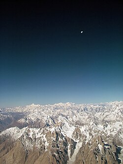
การตั้งชื่อและการแบ่งเทือกเขาย่อยต่างๆ ของคาราโครัมยังไม่เป็นที่ยอมรับโดยทั่วไป อย่างไรก็ตาม ต่อไปนี้เป็นรายชื่อเทือกเขาย่อยที่สำคัญที่สุด ตาม Jerzy Wala [ 36 ]เทือกเขาเหล่านี้เรียงลำดับจากตะวันตกไปตะวันออกโดยประมาณ
บัตรผ่าน


\", \"description\": \" ([https://geohack.toolforge.org/geohack.php?params=35.5812;76.7908_dim:2000 35.5812,76.7908])\", \"marker-symbol\": \"-number-F1118\", \"marker-size\": \"medium\", \"marker-color\": \"#269F46\" }, \"geometry\": {\"type\": \"Point\", \"coordinates\": [76.7908,35.5812] } }, { \"type\": \"Feature\", \"properties\": { \"title\": \"[[Bilafond La]]
\", \"description\": \" ([https://geohack.toolforge.org/geohack.php?params=35.3919;76.9487_dim:2000 35.3919,76.9487])\", \"marker-symbol\": \"-number-F1118\", \"marker-size\": \"medium\", \"marker-color\": \"#269F46\" }, \"geometry\": {\"type\": \"Point\", \"coordinates\": [76.9487,35.3919] } }, { \"type\": \"Feature\", \"properties\": { \"title\": \"[[Gyong La]]
\", \"description\": \" ([https://geohack.toolforge.org/geohack.php?params=35.1744;77.0702_dim:2000 35.1744,77.0702])\", \"marker-symbol\": \"-number-F1118\", \"marker-size\": \"medium\", \"marker-color\": \"#269F46\" }, \"geometry\": {\"type\": \"Point\", \"coordinates\": [77.0702,35.1744] } }, { \"type\": \"Feature\", \"properties\": { \"title\": \"[[Sasser Pass]]
\", \"description\": \" ([https://geohack.toolforge.org/geohack.php?params=35.03333;77.73333_dim:2000 35.03333,77.73333])\", \"marker-symbol\": \"-number-F1118\", \"marker-size\": \"medium\", \"marker-color\": \"#269F46\" }, \"geometry\": {\"type\": \"Point\", \"coordinates\": [77.73333,35.03333] } }, { \"type\": \"Feature\", \"properties\": { \"title\": \"[[Burji La]]
\", \"description\": \" ([https://geohack.toolforge.org/geohack.php?params=35.1823;75.5168_dim:2000 35.1823,75.5168])\", \"marker-symbol\": \"-number-F1118\", \"marker-size\": \"medium\", \"marker-color\": \"#269F46\" }, \"geometry\": {\"type\": \"Point\", \"coordinates\": [75.5168,35.1823] } }, { \"type\": \"Feature\", \"properties\": { \"title\": \"[[Machulo La]]
\", \"description\": \" ([https://geohack.toolforge.org/geohack.php?params=35.27368;76.31893_dim:2000 35.27368,76.31893])\", \"marker-symbol\": \"-number-F1118\", \"marker-size\": \"medium\", \"marker-color\": \"#269F46\" }, \"geometry\": {\"type\": \"Point\", \"coordinates\": [76.31893,35.27368] } }, { \"type\": \"Feature\", \"properties\": { \"title\": \"[[Naltar Pass]]
\", \"description\": \" ([https://geohack.toolforge.org/geohack.php?params=36.3366;74.044_dim:2000 36.3366,74.044])\", \"marker-symbol\": \"-number-F1118\", \"marker-size\": \"medium\", \"marker-color\": \"#269F46\" }, \"geometry\": {\"type\": \"Point\", \"coordinates\": [74.044,36.3366] } }, { \"type\": \"Feature\", \"properties\": { \"title\": \"[[Hispar Pass]]
\", \"description\": \" ([https://geohack.toolforge.org/geohack.php?params=36.0192;75.54571_dim:2000 36.0192,75.54571])\", \"marker-symbol\": \"-number-F1118\", \"marker-size\": \"medium\", \"marker-color\": \"#269F46\" }, \"geometry\": {\"type\": \"Point\", \"coordinates\": [75.54571,36.0192] } }, { \"type\": \"Feature\", \"properties\": { \"title\": \"[[Shimshal Pass]]
\", \"description\": \" ([https://geohack.toolforge.org/geohack.php?params=36.426;75.6851_dim:2000 36.426,75.6851])\", \"marker-symbol\": \"-number-F1118\", \"marker-size\": \"medium\", \"marker-color\": \"#269F46\" }, \"geometry\": {\"type\": \"Point\", \"coordinates\": [75.6851,36.426] } }, { \"type\": \"Feature\", \"properties\": { \"title\": \"[[Karakoram Pass]]
\", \"description\": \" ([https://geohack.toolforge.org/geohack.php?params=35.51333;77.82306_dim:2000 35.51333,77.82306])\", \"marker-symbol\": \"-number-F1118\", \"marker-size\": \"medium\", \"marker-color\": \"#269F46\" }, \"geometry\": {\"type\": \"Point\", \"coordinates\": [77.82306,35.51333] } }, { \"type\": \"Feature\", \"properties\": { \"title\": \"[[Indira Col|Turkistan La Pass]]
\", \"description\": \" ([https://geohack.toolforge.org/geohack.php?params=35.65667;76.86056_dim:2000 35.65667,76.86056])\", \"marker-symbol\": \"-number-F1118\", \"marker-size\": \"medium\", \"marker-color\": \"#269F46\" }, \"geometry\": {\"type\": \"Point\", \"coordinates\": [76.86056,35.65667] } }, { \"type\": \"Feature\", \"properties\": { \"title\": \"[[K2|Windy Gap]]
\", \"description\": \" ([https://geohack.toolforge.org/geohack.php?params=35.87318;76.57692_dim:2000 35.87318,76.57692])\", \"marker-symbol\": \"-number-F1118\", \"marker-size\": \"medium\", \"marker-color\": \"#269F46\" }, \"geometry\": {\"type\": \"Point\", \"coordinates\": [76.57692,35.87318] } }, { \"type\": \"Feature\", \"properties\": { \"title\": \"[[Mustagh Pass]]
\", \"description\": \" ([https://geohack.toolforge.org/geohack.php?params=35.84;76.25_dim:2000 35.84,76.25])\", \"marker-symbol\": \"-number-F1118\", \"marker-size\": \"medium\", \"marker-color\": \"#269F46\" }, \"geometry\": {\"type\": \"Point\", \"coordinates\": [76.25,35.84] } }, { \"type\": \"Feature\", \"properties\": { \"title\": \"[[Mustagh Pass|Sarpo Laggo Pass]]
\", \"description\": \" ([https://geohack.toolforge.org/geohack.php?params=35.8234;76.16249_dim:2000 35.8234,76.16249])\", \"marker-symbol\": \"-number-F1118\", \"marker-size\": \"medium\", \"marker-color\": \"#269F46\" }, \"geometry\": {\"type\": \"Point\", \"coordinates\": [76.16249,35.8234] } }, { \"type\": \"Feature\", \"properties\": { \"title\": \"[[Khunjerab Pass]]
\", \"description\": \" ([https://geohack.toolforge.org/geohack.php?params=36.85;75.42778_dim:2000 36.85,75.42778])\", \"marker-symbol\": \"-number-F1118\", \"marker-size\": \"medium\", \"marker-color\": \"#269F46\" }, \"geometry\": {\"type\": \"Point\", \"coordinates\": [75.42778,36.85] } }, { \"type\": \"Feature\", \"properties\": { \"title\": \"[[Khunjerab Pass|Mutsjliga Pass]]
\", \"description\": \" ([https://geohack.toolforge.org/geohack.php?params=36.97374;75.2973_dim:2000 36.97374,75.2973])\", \"marker-symbol\": \"-number-F1118\", \"marker-size\": \"medium\", \"marker-color\": \"#269F46\" }, \"geometry\": {\"type\": \"Point\", \"coordinates\": [75.2973,36.97374] } }, { \"type\": \"Feature\", \"properties\": { \"title\": \"[[Mintaka Pass]]
\", \"description\": \" ([https://geohack.toolforge.org/geohack.php?params=37.0039;74.8511_dim:2000 37.0039,74.8511])\", \"marker-symbol\": \"-number-F1118\", \"marker-size\": \"medium\", \"marker-color\": \"#269F46\" }, \"geometry\": {\"type\": \"Point\", \"coordinates\": [74.8511,37.0039] } }, { \"type\": \"Feature\", \"properties\": { \"title\": \"[[Kilik Pass]]
\", \"description\": \" ([https://geohack.toolforge.org/geohack.php?params=37.0792;74.6722_dim:2000 37.0792,74.6722])\", \"marker-symbol\": \"-number-F1118\", \"marker-size\": \"medium\", \"marker-color\": \"#269F46\" }, \"geometry\": {\"type\": \"Point\", \"coordinates\": [74.6722,37.0792] } }, { \"type\": \"Feature\", \"properties\": { \"title\": \"[[China|People's Republic of China]]
\", \"description\": \" ([https://geohack.toolforge.org/geohack.php?params=36.98;76.5_dim:2000 36.98,76.5])\", \"marker-symbol\": \"-number-F1118\", \"marker-size\": \"medium\", \"marker-color\": \"#269F46\" }, \"geometry\": {\"type\": \"Point\", \"coordinates\": [76.5,36.98] } }, { \"type\": \"Feature\", \"properties\": { \"title\": \"[[India|Republic of India]]
\", \"description\": \" ([https://geohack.toolforge.org/geohack.php?params=34.54;76.5_dim:2000 34.54,76.5])\", \"marker-symbol\": \"-number-F1118\", \"marker-size\": \"medium\", \"marker-color\": \"#269F46\" }, \"geometry\": {\"type\": \"Point\", \"coordinates\": [76.5,34.54] } }, { \"type\": \"Feature\", \"properties\": { \"title\": \"[[Pakistan|Islamic Republic of Pakistan]]
\", \"description\": \" ([https://geohack.toolforge.org/geohack.php?params=35.9;74.02_dim:2000 35.9,74.02])\", \"marker-symbol\": \"-number-F1118\", \"marker-size\": \"medium\", \"marker-color\": \"#269F46\" }, \"geometry\": {\"type\": \"Point\", \"coordinates\": [74.02,35.9] } }, { \"type\": \"Feature\", \"properties\": { \"title\": \"[[Afghanistan|Islamic Emirate of Afghanistan]]
\", \"description\": \" ([https://geohack.toolforge.org/geohack.php?params=37.07;74.02_dim:2000 37.07,74.02])\", \"marker-symbol\": \"-number-F1118\", \"marker-size\": \"medium\", \"marker-color\": \"#269F46\" }, \"geometry\": {\"type\": \"Point\", \"coordinates\": [74.02,37.07] } }, { \"type\": \"Feature\", \"properties\": { \"title\": \"[[Tajikistan|Republic of Tajikistan]]
\", \"description\": \" ([https://geohack.toolforge.org/geohack.php?params=37.48;74.02_dim:2000 37.48,74.02])\", \"marker-symbol\": \"-number-F1118\", \"marker-size\": \"medium\", \"marker-color\": \"#269F46\" }, \"geometry\": {\"type\": \"Point\", \"coordinates\": [74.02,37.48] } } ] } ]"}}">
1:เซียลา , 2:บิลาฟอนด์ลา , 3:กยองลา , 4:แซสเซอร์พาส , 5:บูร์จีลา , 6:มาชูโลลา , 7:นัลตาร์พาส , 8:ฮิสปาร์พาส , 9:ชิมชาลพาส , 10:คาราโครัมพาส , 11:ตูร์กิสถานลาพาส , 12:Windy Gap , 13:Mustagh Pass , 14:Sarpo Laggo Pass , 15:Khunjerab Pass , 16:Mutsjliga Pass , 17:Mintaka Pass , 18:Kilik Pass
เส้นทางผ่านภูเขาจากทิศตะวันตกไปทิศตะวันออก ได้แก่:
- ช่องเขาดานดาลาเป็นช่องเขาที่สำคัญที่สุดและเก่าแก่ที่สุด เริ่มต้นจากเมืองกูร์เซย์ไซตังไปจนถึงยาร์กันด์ในประเทศจีน เป็นเส้นทางการค้าหลักระหว่างคัปปู ลาดักห์ คาร์มัง และยาร์กันด์ ประเทศจีน
- ช่องเขาคิลิก
- ช่องเขามินทากะ
- ช่องเขาคุนเจราบเป็นด่านพรมแดนระหว่างประเทศที่ปูด้วยถนนสูงที่สุดที่ระดับความสูง4,693 เมตร (15,397 ฟุต) เป็นส่วนหนึ่ง ของทางหลวงมิตรภาพจีน-ปากีสถานซึ่งเป็น "สิ่งมหัศจรรย์อันดับ 8 ของโลก" [ 37 ]
- ช่องเขาชิมชัล
- ช่องเขามุสตาห์
- ช่องเขาคาราโครัม
- แซสเซอร์พาส
- นาลตาร์พาส
ช่องเขาคุนเจราบเป็นช่องเขาเดียวที่รถยนต์สามารถสัญจรผ่านเทือกเขานี้ได้ ส่วนช่องเขาชิมชัล (ซึ่งไม่ได้ตัดผ่านพรมแดนระหว่างประเทศ) เป็นช่องเขาอีกแห่งเดียวที่ยังคงใช้งานอยู่เป็นประจำ
การอ้างอิงทางวัฒนธรรม
เทือกเขาคาราโครัมได้รับการกล่าวถึงใน นวนิยายและภาพยนตร์หลายเรื่องรัดยาร์ด คิปลิงกล่าวถึงเทือกเขาคาราโครัมในนวนิยายเรื่องKimซึ่งตีพิมพ์ครั้งแรกในปี 1900 มาร์เซล อิชาคสร้างภาพยนตร์เรื่องKarakoramซึ่งบันทึกการเดินทางสำรวจเทือกเขาของชาวฝรั่งเศสในปี 1936 ภาพยนตร์เรื่องนี้ได้รับรางวัล Silver Lion ในเทศกาลภาพยนตร์เวนิสปี 1937 เกร็ก มอร์เทนสันบรรยายรายละเอียดเกี่ยวกับคาราโครัม โดยเฉพาะ K2 และBaltiอย่างละเอียดในหนังสือThree Cups of Tea ของเขา ซึ่งเกี่ยวกับภารกิจของเขาในการสร้างโรงเรียนสำหรับเด็กในภูมิภาคนี้K2 Kahani (เรื่องราวของ K2) โดยมุสทันซาร์ ฮุสเซน ทาราร์บรรยายถึงประสบการณ์ของเขาที่ค่ายฐาน K2 [ 38 ]
ดูเพิ่มเติม
- ทางหลวงคาราโครัม
- รายชื่อเทือกเขาของโลก
- รายชื่อภูเขาสูงที่สุด (รายชื่อภูเขาที่มีความสูงเกิน7,200 เมตร (23,600 ฟุต) )
- ภูเขาอิเมออน
อ่านเพิ่มเติม
- Dainelli, G. (1932). การเดินทางสู่ธารน้ำแข็งแห่งคาราโครัมตะวันออกวารสารภูมิศาสตร์ 79 ( 4), 257–268.
ลิงก์ภายนอก

- Blankonthemapเว็บไซต์แคชเมียร์ตอนเหนือ