
Kajjansi
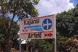

Kajjansi is a town in Central Uganda. It is one of the urban centers in Wakiso District.

Location
The township is situated on the tarmacked, all-weather Kampala - Entebbe Road. Kajjansi is located approximately 16 kilometres (9.9 mi), by road, south of Kampala, Uganda's capital and largest city.[2] This location is approximately 25 kilometres (16 mi), by road, north of Entebbe International Airport, Uganda's largest civilian and military airport.[3] The coordinates of Kajjansi are:0°12'54.0"N, 32°33'00.0"E (Latitude:0.2150; Longitude:32.5500).[4]
Population
In 2006, the population of Kajjansi was estimated at 7,530.[5]
Points of interest
The following points of interest lie within the town limits or close to the edges of town:
- Uganda Clays Limited - The headquarters and main factory are located in Kajjansi
- Kajjansi Airport - A private civilianairport belonging to Mission Aviation Fellowship
- A branch of Equity Bank
- Kajjansi Roses - A horticultural company; a member of the Madhvani Group of Companies
- Headquarters of the Rotary Club of Kajjansi, Uganda. Club Number:61815
- Aquaculture Research and Development Centre - A government fisheries research and training center
- Palliative Care Association of Uganda (PCAU)
- Sunfish Farms Limited - A private fish farm
- Kajjansi Central Market
See also
External links
- Overview of Aquaculture in Uganda
00°12′54″N32°33′00″E / 0.21500°N 32.55000°E / 0.21500; 32.55000