
Kole District
Kole District | |
|---|---|
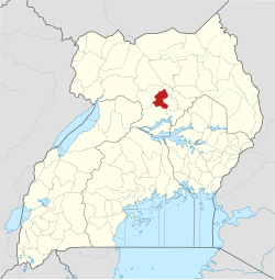 District location in Uganda | |
| Coordinates: 02°24′N32°48′E / 2.400°N 32.800°E / 2.400; 32.800 | |
| Country |  Uganda Uganda |
| Region | Northern Uganda |
| Sub-region | Lango sub-region |
| Established | 1 July 2010 |
| Capital | Kole |
| Area | |
• Total | 2,847 km2 (1,099 sq mi) |
| Population (2012 Estimate) | |
• Total | 231,969 |
| • Density | 81.48/km2 (211.0/sq mi) |
| Time zone | UTC+3 (EAT) |
| Website | kole |
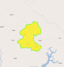
Kole District is a district in Northern Uganda. Like most other Ugandan districts, it is named after its 'chief town', Kole, where the district headquarters are located.
Location
Kole District is bordered by Lira District to the east, Apac District to the south and Oyam District to the west and north. Kole, the district capital, is located approximately 28 kilometres (17 mi), by road, northwest of Lira, the largest city in the sub-region.[1] This location is approximately 290 kilometres (180 mi), by road, north of Kampala, Uganda's capital and largest city.[2] The coordinates of the district are:02 24N, 32 48E.
Overview
Kole District was created by an Act of Parliament and became operational on 1 July 2010. Earlier, it was part of Apac District.[3] The district is part of Lango sub-region, home to an estimated 1.5 million people, in 2002, according to the national census. The sub-region comprises the following districts: (a) Alebtong District (b) Amolatar District (c) Apac District (d) Dokolo District (e) Kole District (f) Lira District (g) Otuke District and (h) Oyam District. Kole district is subdivided into the following sub-counties: 1. Aboke 2. Akalo 3. Alito 4. Ayer and 5. Bala[4]
Population
The 2002 national census estimated the population of the district at about 165,900. The population of the district was estimated at 231,900 as of July 2012.[5]
ตั้งแต่ปี 2014 ถึง 2024 ประชากรของ Kole เพิ่มขึ้น 2.1% ทำให้มีประชากรรวม294,301 คนเมื่อเทียบกับวันที่ 27 สิงหาคม 2014 ซึ่งมีประชากรประมาณ239,327 คนประชากรของ Kole มีการกระจายตัวอยู่ที่274.3 คนต่อตารางกิโลเมตรเนื่องจากเขต นี้มี พื้นที่ประมาณ1,073 ตารางกิโลเมตร[ 6 ]
กิจกรรมทางเศรษฐกิจ
- การทำฟาร์ม
- การก่อสร้าง
- บริการงานพิมพ์
- ธุรกิจร้านหนังสือ
ปศุสัตว์ที่เลี้ยง
- ไก่
- วัว
- แพะ
ดูเพิ่มเติม
ลิงก์ภายนอก
- พอร์ทัลอินเทอร์เน็ตของเขตโคเล