
ลาบห์ปูร์
ลาบห์ปูร์ | |
|---|---|
เมืองสำมะโนประชากร | |
  ลาบห์ปูร์ ตั้งอยู่ในรัฐเวสต์เบงกอล ประเทศอินเดีย แสดงแผนที่ของรัฐเวสต์เบงกอล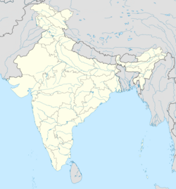 ลาบห์ปูร์ ลาภปุระ (อินเดีย) แสดงแผนที่ประเทศอินเดีย | |
| พิกัด: 23°50′N 87°49′E / 23.83°N 87.82°E / 23.83; 87.82 | |
| ประเทศ |  อินเดีย อินเดีย |
| สถานะ | รัฐเวสต์เบงกอล |
| เขต | บีร์บุม |
| ระดับความสูง | 35 เมตร (115 ฟุต) |
| ประชากร (2011) | |
• ทั้งหมด | 5,419 |
| ภาษา | |
| • เป็นทางการ | ภาษาเบงกาลีภาษาอังกฤษ |
| เขตเวลา | 5:30 น. ( เวลา UTC+ IST ) |
| เข็มหมุด | 731303 |
| รหัสโทรศัพท์ | 03463 |
| การลงทะเบียนยานพาหนะ | ดับเบิลยูบี |
| อัตราส่วนเพศ | 944 ชาย / หญิง |
| เขตเลือกตั้งโลคสภา | โบลปูร์ |
| เขตเลือกตั้งสภาวิธานสภา | แลบปูร์ |
| เว็บไซต์ | birbhum |
ลาภปุระเป็นเมืองตามสำมะโนประชากรใน เขต ลาภปุระซึ่งเป็นบล็อกพัฒนาชุมชนในตำบลโบลปุระอำเภอเบอร์บุม รัฐ เบงกอลตะวันตก ประเทศ อินเดียเป็นบ้านเกิดของนักเขียนนวนิยายชื่อดัง ทาราชันการ์ บันโดปาธยายและเป็นหนึ่งใน 51 ศักติปิฐะ
ภูมิศาสตร์


[[Ilambazar]] (CT)
\", \"description\": \" ([https://geohack.toolforge.org/geohack.php?params=23.62917;87.54167_dim:2000 23.62917,87.54167])\", \"marker-symbol\": \"-number-F1114\", \"marker-size\": \"medium\", \"marker-color\": \"#a40000\" }, \"geometry\": {\"type\": \"Point\", \"coordinates\": [87.54167,23.62917] } }, { \"type\": \"Feature\", \"properties\": { \"title\": \"CT
[[Surul]] (CT)
\", \"description\": \" ([https://geohack.toolforge.org/geohack.php?params=23.67028;87.65139_dim:2000 23.67028,87.65139])\", \"marker-symbol\": \"-number-F1114\", \"marker-size\": \"medium\", \"marker-color\": \"#a40000\" }, \"geometry\": {\"type\": \"Point\", \"coordinates\": [87.65139,23.67028] } }, { \"type\": \"Feature\", \"properties\": { \"title\": \"CT
[[Parota, Birbhum]] (CT)
\", \"description\": \" ([https://geohack.toolforge.org/geohack.php?params=23.77889;87.8725_dim:2000 23.77889,87.8725])\", \"marker-symbol\": \"-number-F1114\", \"marker-size\": \"medium\", \"marker-color\": \"#a40000\" }, \"geometry\": {\"type\": \"Point\", \"coordinates\": [87.8725,23.77889] } }, { \"type\": \"Feature\", \"properties\": { \"title\": \"CT
Labhpur (CT)
\", \"description\": \" ([https://geohack.toolforge.org/geohack.php?params=23.82972;87.79694_dim:2000 23.82972,87.79694])\", \"marker-symbol\": \"-number-F1114\", \"marker-size\": \"medium\", \"marker-color\": \"#000000\" }, \"geometry\": {\"type\": \"Point\", \"coordinates\": [87.79694,23.82972] } }, { \"type\": \"Feature\", \"properties\": { \"title\": \"M
[[Bolpur]] (M)
\", \"description\": \" ([https://geohack.toolforge.org/geohack.php?params=23.67111;87.68861_dim:2000 23.67111,87.68861])\", \"marker-symbol\": \"-number-F1114\", \"marker-size\": \"medium\", \"marker-color\": \"#a40000\" }, \"geometry\": {\"type\": \"Point\", \"coordinates\": [87.68861,23.67111] } }, { \"type\": \"Feature\", \"properties\": { \"title\": \"R
[[Shantiniketan]] (R)
\", \"description\": \" ([https://geohack.toolforge.org/geohack.php?params=23.68611;87.66111_dim:2000 23.68611,87.66111])\", \"marker-symbol\": \"-number-F1114\", \"marker-size\": \"medium\", \"marker-color\": \"#a40000\" }, \"geometry\": {\"type\": \"Point\", \"coordinates\": [87.66111,23.68611] } }, { \"type\": \"Feature\", \"properties\": { \"title\": \"R
[[Nanoor]] (R)
\", \"description\": \" ([https://geohack.toolforge.org/geohack.php?params=23.7;87.86_dim:2000 23.7,87.86])\", \"marker-symbol\": \"-number-F1114\", \"marker-size\": \"medium\", \"marker-color\": \"#a40000\" }, \"geometry\": {\"type\": \"Point\", \"coordinates\": [87.86,23.7] } }, { \"type\": \"Feature\", \"properties\": { \"title\": \"R
[[Sriniketan]] (R)
\", \"description\": \" ([https://geohack.toolforge.org/geohack.php?params=23.65833;87.66111_dim:2000 23.65833,87.66111])\", \"marker-symbol\": \"-number-F1114\", \"marker-size\": \"medium\", \"marker-color\": \"#a40000\" }, \"geometry\": {\"type\": \"Point\", \"coordinates\": [87.66111,23.65833] } }, { \"type\": \"Feature\", \"properties\": { \"title\": \"R
[[Kirnahar]] (R)
\", \"description\": \" ([https://geohack.toolforge.org/geohack.php?params=23.76306;87.87778_dim:2000 23.76306,87.87778])\", \"marker-symbol\": \"-number-F1114\", \"marker-size\": \"medium\", \"marker-color\": \"#a40000\" }, \"geometry\": {\"type\": \"Point\", \"coordinates\": [87.87778,23.76306] } }, { \"type\": \"Feature\", \"properties\": { \"title\": \"R
[[Raipur, Birbhum]] (R)
\", \"description\": \" ([https://geohack.toolforge.org/geohack.php?params=23.63667;87.64694_dim:2000 23.63667,87.64694])\", \"marker-symbol\": \"-number-F1114\", \"marker-size\": \"medium\", \"marker-color\": \"#a40000\" }, \"geometry\": {\"type\": \"Point\", \"coordinates\": [87.64694,23.63667] } }, { \"type\": \"Feature\", \"properties\": { \"title\": \"R
[[Khujutipara]] (R)
\", \"description\": \" ([https://geohack.toolforge.org/geohack.php?params=23.61083;87.89694_dim:2000 23.61083,87.89694])\", \"marker-symbol\": \"-number-F1114\", \"marker-size\": \"medium\", \"marker-color\": \"#a40000\" }, \"geometry\": {\"type\": \"Point\", \"coordinates\": [87.89694,23.61083] } }, { \"type\": \"Feature\", \"properties\": { \"title\": \"R
[[Khustigiri]] (R)
\", \"description\": \" ([https://geohack.toolforge.org/geohack.php?params=23.76056;87.53639_dim:2000 23.76056,87.53639])\", \"marker-symbol\": \"-number-F1114\", \"marker-size\": \"medium\", \"marker-color\": \"#a40000\" }, \"geometry\": {\"type\": \"Point\", \"coordinates\": [87.53639,23.76056] } }, { \"type\": \"Feature\", \"properties\": { \"title\": \"R
[[Jaydev Kenduli]] (R)
\", \"description\": \" ([https://geohack.toolforge.org/geohack.php?params=23.64444;87.43_dim:2000 23.64444,87.43])\", \"marker-symbol\": \"-number-F1114\", \"marker-size\": \"medium\", \"marker-color\": \"#a40000\" }, \"geometry\": {\"type\": \"Point\", \"coordinates\": [87.43,23.64444] } }, { \"type\": \"Feature\", \"properties\": { \"title\": \"R
[[Kankalitala]] (R)
\", \"description\": \" ([https://geohack.toolforge.org/geohack.php?params=23.71472;87.72278_dim:2000 23.71472,87.72278])\", \"marker-symbol\": \"-number-F1114\", \"marker-size\": \"medium\", \"marker-color\": \"#a40000\" }, \"geometry\": {\"type\": \"Point\", \"coordinates\": [87.72278,23.71472] } }, { \"type\": \"Feature\", \"properties\": { \"title\": \"U
[[Visva-Bharati University]] (U)
\", \"description\": \" ([https://geohack.toolforge.org/geohack.php?params=23.68333;87.67361_dim:2000 23.68333,87.67361])\", \"marker-symbol\": \"-number-F1114\", \"marker-size\": \"medium\", \"marker-color\": \"#967117\" }, \"geometry\": {\"type\": \"Point\", \"coordinates\": [87.67361,23.68333] } } ] } ]"}}">
ที่ตั้ง
Labpur ตั้งอยู่ที่23°50′N 87°49′E / 23.83°N 87.82°E / 23.83; 87.82 [ 1 ] มีระดับความสูงเฉลี่ย35 เมตร (115 ฟุต )
หมายเหตุ: แผนที่ด้านข้างแสดงสถานที่สำคัญบางแห่งในบริเวณนี้ สถานที่ทั้งหมดที่ทำเครื่องหมายไว้ในแผนที่นี้เชื่อมโยงไปยังแผนที่ขนาดใหญ่แบบเต็มหน้าจอ
ตั้งอยู่ในที่ราบน้ำท่วมถึงของแม่น้ำมายูรักชีและเมื่อมีการปล่อยน้ำจากเขื่อนมาสซันจอร์และเขื่อนทิลปาราในปริมาณมาก น้ำท่วมจะสร้างความเสียหายอย่างร้ายแรงในพื้นที่ ในปี 2549 มีผู้คนเกือบ 50,000 คนติดอยู่ที่ลาภปุระและบล็อกโดยรอบของอำเภอเบอร์บุม[ 2 ]
ข้อมูลประชากร
ตามสำมะโนประชากรของอินเดียปี 2011ลาบห์ปูร์มีประชากรทั้งหมด 5,419 คน โดยเป็นชาย 2,762 คน (51%) และหญิง 2,657 คน (49%) ประชากรที่มีอายุต่ำกว่า 6 ปีมีจำนวน 443 คน จำนวนผู้รู้หนังสือในลาบห์ปูร์ทั้งหมดคือ 4,193 คน (84.26% ของประชากรที่มีอายุมากกว่า 6 ปี) [ 3 ]
โครงสร้างพื้นฐาน
ตามข้อมูลจากหนังสือสำมะโนประชากรประจำอำเภอปี 2011 อำเภอลาภปุระมีพื้นที่ 2.1069 ตาราง กิโลเมตร
วิทยาลัย
- วิทยาลัยสัมภูนาถลาภปุระ. (พ.ศ. 2506) [ 4 ]
วัฒนธรรม
ประเทศทาราชันการ์
Tarashankar Bandopadhyay นักเขียน ชาวเบงกาลีเกิดที่ Labhpur เมื่อวันที่ 23 กรกฎาคม พ.ศ. 2441 [ 5 ]เขาสำเร็จการศึกษาระดับมัธยมปลายจาก Labhpur ในปี พ.ศ. 2459 [ 6 ]นวนิยายและเรื่องสั้นหลายเรื่องของเขามีการบรรยายถึงพื้นที่นั้นอย่างชัดเจน[ 7 ] [ 8 ]
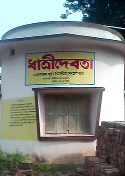
ในนวนิยายHansulibanker Upkathaเขาเขียนว่า "ชนบทของ Hansulibank เป็นพื้นที่ขรุขระ ที่นี่ การต่อสู้ของมนุษย์มีมากกว่าการต่อสู้กับแม่น้ำ เมื่อเกิดภัยแล้งในช่วงฤดูร้อนที่รุนแรง แม่น้ำจะกลายเป็นทะเลทราย เป็นดินแดนแห่งทราย มีเพียงน้ำลึกเท่านั้นที่สามารถไหลผ่านได้เป็นทางแคบๆ ดินแดนนั้นจะกลายเป็นหิน หญ้าจะแห้งเหี่ยว ดินแดนจะร้อนขึ้นราวกับเป็นเหล็กที่ถูกทำให้ร้อน" [ 9 ]
ในนวนิยายเรื่องGanadevata ของเขา เขาได้ยกบทกวีพื้นบ้านมาอ้างอิง
บุคคลสำคัญ
- ธาราสันกร บันโยปัทยานักประพันธ์
- ปรานับ มุเคอร์จีประธานาธิบดีแห่งอินเดีย
ดูเพิ่มเติม
 คู่มือการเดินทางลาภปุระ จาก Wikivoyage
- สถานีรถไฟลาบปูร์
- เส้นทางอาห์มัดปูร์–กัตวา