
โลยิว
โลยิว | |
|---|---|
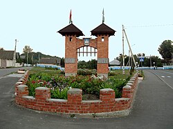 | |
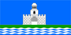 ธง  ตราแผ่นดิน | |
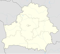  โลยิว | |
| พิกัด: 51°56′00″N 30°48′04″E / 51.93333°N 30.80111°E / 51.93333; 30.80111 | |
| ประเทศ | เบลารุส |
| ภูมิภาค | ภูมิภาคโกเมล |
| เขต | เขตโลยิว |
| กล่าวถึงครั้งแรก | 1505 |
| พื้นที่ | |
• ทั้งหมด | 6.768433 ตาราง กิโลเมตร(2.613307 ตารางไมล์) |
| ระดับความสูง | 132 เมตร (433 ฟุต) |
| ประชากร (2025) [ 2 ] | |
• ทั้งหมด | 6,028 |
| • ความหนาแน่น | 890.6/กม. ² (2,307/ตร. ไมล์) |
| เขตเวลา | UTC+3 ( MSK ) |
| รหัสไปรษณีย์ | 247095 |
| รหัสพื้นที่ | +375 2347 |
| ป้ายทะเบียนรถ | 3 |
| เว็บไซต์ | loev |
โลยิวหรือโลเยฟ ( ภาษาเบลารุส: Лоеў , โรมันไนซ์ : Lojeŭ , IPA: [ loyew ] ; ภาษารัสเซีย: Лоев , IPA: [ ˈloɪf ] ; ภาษาโปแลนด์: Łojów ) เป็นชุมชนเมืองในภูมิภาคโกเมลทางตะวันออกเฉียงใต้ของเบลารุส [ 2 ] ทำหน้าที่เป็นศูนย์กลางการบริหารของเขตโลยิว[ 2 ]ในปี 2018 มีประชากร 6,698 คน[ 3 ]ณ ปี 2025 มีประชากร 6,028 คน[ 2 ]
ชุมชนแห่งนี้ตั้งอยู่ริมชายฝั่งด้านขวาของแม่น้ำดนีเปอร์ณ จุดบรรจบกับแม่น้ำโซซ
ประวัติศาสตร์
Loyew arose on the site of an ancient settlement of the Dregoviches within the Principality of Chernigov. The settlement was situated on the route from the Varangians to the Greeks. The first mention of Loyew goes back to 1505 and it was known as Loyewa Hara (Loyew Hill). The name is probably derived from the Abkhaz-Adyghe surname Loo.
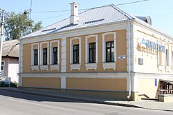
In 1569, it passed to the Kingdom of Poland within the Polish–Lithuanian Commonwealth. In 1646, it passed to Lithuania within the Commonwealth, as reward for the loss of Trubeck.[4] During the Khmelnytsky Uprising, it was the location of two battles, fought in 1649 and 1651, both won by Polish–Lithuanian forces. After the Second Partition of Poland in 1793, it became a part of the Russian Empire. According to the results of the census held in 1897 the town had 4,667 inhabitants, among them 2150 Jews. There were 251 farms, 9 mills, 24 shops, 1 school, 1 post-office, 2 orthodox churches, 1 catholic church and 1 synagogue.
In December 1926, Loyew was included in the Byelorussian SSR and became the center of Loyew District. In 1938, it was granted the status of a city. In 1941–1943, the city lost nearly 1,500 inhabitants. In 1962-1966 it was placed in Rechytsa District.
In the city there are building materials and dairy factories, a pedagogical school and musical school, a house of culture, and some libraries. There is the Church of the Holy Trinity in Loyew.
External links

- พอร์ทัลข้อมูล "Loeuski kraj"
- Loyew บน globustut.by
51°56′N 30°48′E / 51.933°N 30.800°E / 51.933; 30.800
 | บทความเกี่ยวกับสถานที่ในเบลารุสนี้ ยัง ไม่สมบูรณ์คุณสามารถช่วยวิกิพีเดียได้โดยการเพิ่มข้อมูลที่ขาดหายไป |