
Om Noi
Om Noi อ้อมน้อย | |
|---|---|
| City of Om Noiเทศบาลนครอ้อมน้อย | |
 | |
 Flag  Seal | |
| Motto: Thai: ศรัทธาหลวงพ่อเพ็ง หลวงพ่อพักตร์ อนุรักษ์วัฒนธรรมไทย ลือไกลอุตสาหกรรม งามล้ำเบญจรงค์ | |
| Coordinates: 13°42′00″N100°19′27″E / 13.7001°N 100.3241°E / 13.7001; 100.3241 | |
| Country |  Thailand Thailand |
| Region | Central Thailand |
| Province |  Samut Sakhon Samut Sakhon |
| District | Krathum Baen |
| Subdistrict municipality | 1 May 1994 |
| Town municipality | 21 September 2002 |
| City municipality | 27 December 2010 |
| Government | |
| • Type | City Municipality |
| Area | |
• Total | 30.40 km2 (11.74 sq mi) |
| Elevation | 7.0 m (23.0 ft) |
| Population (2024)[1] | |
• Total | 53,914 |
| • Density | 1,773/km2 (4,590/sq mi) |
| Time zone | UTC+7 (ICT) |
| Postcode | 74130 |
| Calling code | 034 |
| ISO 3166 code | TH-74020200 |
| Local Admin. Org. | code[2] |
| Om Noi city mun. | 03740201 |
| Website | omnoi |
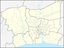

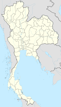
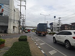
Om Noi (Thai: อ้อมน้อย, RTGS: Om Noi) officially the City of Om Noi (Thai: เทศบาลนครอ้อมน้อย, RTGS: Thetsaban Nakhon Om Noi) is a municipality in Samut Sakhon, Thailand. It is located 13 km west from Bangkok. The city was established in 2010.
History
Om Noi was upgraded to subdistrict municipality (thesaban tambon) on 1 May 1994. Later to town municipality (thesaban mueang) on 21 September 2002. Finally on 27 December 2010 to city municipality (thesaban nakhon).[3]
Geography
Neighbouring subdistricts are (from the west clockwise): Om Yai, Rai Khing and Krathum Lom of Sam Phran district, Nakhon Pathom province; Nong Khang Phlu of Nong Khaem district, Bangkok; Suan Luang and Tha Mai of Krathum Baen district, Samut Sakhon province. The main watercourse of Samut Sakhon province, Tha Chin River flows into the Gulf of Thailand at Bang Ya Phraek subdistrict.
Administration
Provincial government
The administration of Om Noi subdistrict (tambon) is responsible for an area that covers 30.4 square kilometres (11.7 sq mi) and consists of thirteen villages (muban), as of December 2024: 53,9148 people and 51,913 households.[1]
| No. | Villages | Thai | Pop. |
|---|---|---|---|
| 1. | Pak Khlong Om Noi | ปากคลองอ้อมน้อย | 627 |
| 2. | Khlong Talad | คลองตลาด | 7,922 |
| 3. | Rang Nam Sai | รางน้ำใส | 2,531 |
| 4. | Taew | แถว | 3,659 |
| 5. | Na Don | นาดอน | 8,445 |
| 6. | Huathanon | ห้วถนน | 2,602 |
| 7. | Tan Kloeway | ต้นกล้วย | 825 |
| 8. | Nong Bua | หนองบัว | 3,028 |
| 9. | Nong Nok Krasa | หนองนอกกระสา | 2,987 |
| 10. | Krathum Lom | กระทุ่มล้ม | 3,522 |
| 11. | Don Song | ดอนสอง | 3,933 |
| 12. | Sri Samran | ศรีสำราญ | 5,140 |
| 13. | Rong Mu | โรงหมู | 8,693 |
| Total | 53,914 |
Local government
As of December 2024 there is Om Noi city municipality (thesaban nakhon), which covers the whole subdistrict.[2] There are 28 communities (chumchon) in Om Noi, although not directly chosen by the local citizens, which provides advice and recommendations to the local administrative organization.
Healthcare
Hospitals
There are in the subdistrict: Mahachai 2 Hospital with 200 beds and Vichaivaj International Hospital Om Noi with 196 beds.
Health promoting hospitals
There is one health-promoting hospital in the subdistrict (Moo10).[4]
Education
There are four primary schools:
- Ban Klong Kae school - Moo2.
- Wat Om Noi school - Moo4.
- Om Noi municipal school - Moo13.
- Wat Sri Samranrat Bamrung school.
There is one secondary school:
- Om Noi Sobhon Chanupatham school - Moo4.
There is one vocational school:
- Om Noi municipal vocational college.
Religion
The following active temples, where Theravada Buddhism is practised by local residents:[5]
| Temple name | Thai | Location |
|---|---|---|
| Wat Om Noi | วัดอ้อมน้อย | Moo4 |
| Wat Si Samranrat Bamrung | วัดศรีสำราญราษฎร์บำรุง | Moo12 |
Transportation
Because it is situated in Bangkok Metropolitan Region, making Om Noi easily accessible by three mainroads: Highway 4, Phutthamonthon Sai 4 Road (Highway 3310) and Phutthamonthon Sai 5 Road (Highway 3414). The area is served by several bus lines of the Bangkok Mass Transit Authority (BMTA).
- 12"Official statistics registration systems". Department of Provincial Administration (DOPA). Retrieved 10 April 2025, year 2024 >village level >Excel File >no.74020200-74020213 >Excel line 79639-79652
{{cite web}}: CS1 maint: postscript (link) - 12"Local Government Organization Code". DLA. Retrieved 10 April 2025.
- ↑"ประกาศกระทรวงมหาดไทย เรือง เปลี่ยนแปลงฐานะเทศบาลเมืองอ้อมน้อย อำเภอกระทุ่มแบนจังหวัดสมุทรสาคร เป็นเทศบาลนครอ้อมน้อย"[Announcement of the Ministry of Interior on changing the status of Om Noi town municipality Krathum Baen district Samut Sakhon province to Om Noi city municipality](PDF). Royal Gazette (in Thai). 127 (Special 149 Ng): 45. 27 December 2010. Archived from the original(PDF) on 10 November 2011. Retrieved 16 April 2025.
- ↑"Name-of-the-hospital-service-unit". Ministry of Public Health. Retrieved 14 March 2025, >health zone 5 no.08478
{{cite web}}: CS1 maint: postscript (link) - ↑"list of temples". Retrieved 20 January 2025, Sect Maha Nikai no.274020201-274020202
{{cite web}}: CS1 maint: postscript (link)