
ปาการ์ตันร์
ปาการ์ตันร์ | |
|---|---|
หมู่บ้าน | |
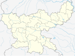  ปาการ์ตันร์ ตั้งอยู่ในรัฐฌาร์ขันด์ ประเทศอินเดีย แสดงแผนที่ของรัฐฌาร์ขันด์ ปาการ์ตันร์ ปาการ์ตันร์ (อินเดีย) แสดงแผนที่ประเทศอินเดีย | |
| พิกัด: 22°42′45″N 84°25′57″E / 22.71253°N 84.43248°E / 22.71253; 84.43248 | |
| ประเทศ |  อินเดีย อินเดีย |
| สถานะ | จาร์คันด์ |
| เขต | ซิมเดกา |
| รัฐบาล | |
| • พิมพ์ | ประชาธิปไตยแบบสหพันธรัฐ |
| ประชากร (2011) | |
• ทั้งหมด | 3,098 |
| ภาษา * | |
| • เป็นทางการ | ภาษาฮินดีภาษาอูร์ดู |
| เขตเวลา | 5:30 น. ( เวลา UTC+ IST ) |
| เข็มหมุด | 835228 |
| หมายเลขโทรศัพท์/ รหัสพื้นที่ | 06525 |
| การลงทะเบียนยานพาหนะ | เจเอช 20 |
| การรู้หนังสือ | 74.55% |
| เขตเลือกตั้งโลคสภา | ขุนติ |
| เขตเลือกตั้งสภาวิธานสภา | ซิมเดกา |
| เว็บไซต์ | simdega |
ปาการ์ตันร์ ( หรือเรียกอีกอย่างว่า ปาการ์ดันร์) เป็นหมู่บ้านในเขตการปกครองปาการ์ตัน ร์ ในตำบลซิมเดกา อำเภอซิมเดกา จังหวัดฌาร์ขันด์ประเทศอินเดีย
ภูมิศาสตร์


[[Bano, Simdega]] (R)
\", \"description\": \" ([https://geohack.toolforge.org/geohack.php?params=22.65278;84.92167_dim:2000 22.65278,84.92167])\", \"marker-symbol\": \"-number-F10705\", \"marker-size\": \"medium\", \"marker-color\": \"#c40000\" }, \"geometry\": {\"type\": \"Point\", \"coordinates\": [84.92167,22.65278] } }, { \"type\": \"Feature\", \"properties\": { \"title\": \"R
[[Bansjore]] (R)
\", \"description\": \" ([https://geohack.toolforge.org/geohack.php?params=22.43417;84.72333_dim:2000 22.43417,84.72333])\", \"marker-symbol\": \"-number-F10705\", \"marker-size\": \"medium\", \"marker-color\": \"#c40000\" }, \"geometry\": {\"type\": \"Point\", \"coordinates\": [84.72333,22.43417] } }, { \"type\": \"Feature\", \"properties\": { \"title\": \"R
[[Bolba]] (R)
\", \"description\": \" ([https://geohack.toolforge.org/geohack.php?params=22.43111;84.34472_dim:2000 22.43111,84.34472])\", \"marker-symbol\": \"-number-F10705\", \"marker-size\": \"medium\", \"marker-color\": \"#c40000\" }, \"geometry\": {\"type\": \"Point\", \"coordinates\": [84.34472,22.43111] } }, { \"type\": \"Feature\", \"properties\": { \"title\": \"R
[[Jaldega]] (R)
\", \"description\": \" ([https://geohack.toolforge.org/geohack.php?params=22.57667;84.81167_dim:2000 22.57667,84.81167])\", \"marker-symbol\": \"-number-F10705\", \"marker-size\": \"medium\", \"marker-color\": \"#c40000\" }, \"geometry\": {\"type\": \"Point\", \"coordinates\": [84.81167,22.57667] } }, { \"type\": \"Feature\", \"properties\": { \"title\": \"R
Pakartanr (R)
\", \"description\": \" ([https://geohack.toolforge.org/geohack.php?params=22.7125;84.43222_dim:2000 22.7125,84.43222])\", \"marker-symbol\": \"-number-F10705\", \"marker-size\": \"medium\", \"marker-color\": \"#000000\" }, \"geometry\": {\"type\": \"Point\", \"coordinates\": [84.43222,22.7125] } }, { \"type\": \"Feature\", \"properties\": { \"title\": \"R
[[Kersai]] (R)
\", \"description\": \" ([https://geohack.toolforge.org/geohack.php?params=22.52556;84.23139_dim:2000 22.52556,84.23139])\", \"marker-symbol\": \"-number-F10705\", \"marker-size\": \"medium\", \"marker-color\": \"#c40000\" }, \"geometry\": {\"type\": \"Point\", \"coordinates\": [84.23139,22.52556] } }, { \"type\": \"Feature\", \"properties\": { \"title\": \"R
[[Kolebira]] (R)
\", \"description\": \" ([https://geohack.toolforge.org/geohack.php?params=22.70417;84.69278_dim:2000 22.70417,84.69278])\", \"marker-symbol\": \"-number-F10705\", \"marker-size\": \"medium\", \"marker-color\": \"#c40000\" }, \"geometry\": {\"type\": \"Point\", \"coordinates\": [84.69278,22.70417] } }, { \"type\": \"Feature\", \"properties\": { \"title\": \"R
[[Kurdeg]] (R)
\", \"description\": \" ([https://geohack.toolforge.org/geohack.php?params=22.55861;84.11944_dim:2000 22.55861,84.11944])\", \"marker-symbol\": \"-number-F10705\", \"marker-size\": \"medium\", \"marker-color\": \"#c40000\" }, \"geometry\": {\"type\": \"Point\", \"coordinates\": [84.11944,22.55861] } }, { \"type\": \"Feature\", \"properties\": { \"title\": \"R
[[Thethaitangar]] (R)
\", \"description\": \" ([https://geohack.toolforge.org/geohack.php?params=22.50417;84.51278_dim:2000 22.50417,84.51278])\", \"marker-symbol\": \"-number-F10705\", \"marker-size\": \"medium\", \"marker-color\": \"#c40000\" }, \"geometry\": {\"type\": \"Point\", \"coordinates\": [84.51278,22.50417] } }, { \"type\": \"Feature\", \"properties\": { \"title\": \"M
[[Simdega]] (M)
\", \"description\": \" ([https://geohack.toolforge.org/geohack.php?params=22.62;84.49667_dim:2000 22.62,84.49667])\", \"marker-symbol\": \"-number-F10705\", \"marker-size\": \"medium\", \"marker-color\": \"#c40000\" }, \"geometry\": {\"type\": \"Point\", \"coordinates\": [84.49667,22.62] } }, { \"type\": \"Feature\", \"properties\": { \"title\": \"T
[[Palkot Wildlife Sanctuary]] (T)
\", \"description\": \" ([https://geohack.toolforge.org/geohack.php?params=22.74444;84.58611_dim:2000 22.74444,84.58611])\", \"marker-symbol\": \"-number-F10705\", \"marker-size\": \"medium\", \"marker-color\": \"#74c365\" }, \"geometry\": {\"type\": \"Point\", \"coordinates\": [84.58611,22.74444] } } ] } ]"}}">
ที่ตั้ง
ปากาดันร์ตั้งอยู่ที่22°42′45″N 84°25′57″E / 22.71253°N 84.43248°E / 22.71253; 84.43248
ภาพรวมของพื้นที่
ในพื้นที่ที่แสดงในแผนที่ด้านข้าง "ภูมิประเทศประกอบด้วยเนินเขาและที่ราบสูงลูกคลื่น" ในส่วนตะวันตกเฉียงใต้ของที่ราบสูงโชตานาคปุระประมาณ 32% ของอำเภอปกคลุมด้วยป่าไม้ (ทำเครื่องหมายส่วนที่แรเงาในแผนที่) เป็นพื้นที่ชนบทเป็นส่วนใหญ่ โดย 92.83% ของประชากรอาศัยอยู่ในพื้นที่ชนบท ประชากรในชนบทส่วนใหญ่พึ่งพาการเกษตรแบบอาศัยน้ำฝน (ปริมาณน้ำฝนเฉลี่ยต่อปี: 1,100-1,200 มม.) ในการดำรงชีวิต[ 1 ]
หมายเหตุ: แผนที่ด้านข้างแสดงสถานที่สำคัญบางแห่งในเขตนี้ สถานที่ทั้งหมดที่ทำเครื่องหมายไว้ในแผนที่นี้เชื่อมโยงไปยังแผนที่ขนาดใหญ่แบบเต็มหน้าจอ
การบริหารราชการส่วนท้องถิ่น
มีสถานีตำรวจอยู่ที่ปาการ์ตันร์[ 2 ]
สำนักงานใหญ่ของ เขตการปกครอง Pakartanr CD ตั้งอยู่ที่หมู่บ้าน Pakartanr [ 3 ]
ข้อมูลประชากร
ตามสำมะโนประชากรของอินเดียปี 2011 Pakardanr มีประชากรทั้งหมด 3,098 คน โดยเป็นชาย 1,576 คน (51%) และหญิง 1,522 คน (49%) ประชากรในช่วงอายุ 0–6 ปี มีจำนวน 481 คน จำนวนผู้รู้หนังสือใน Pakardanr ทั้งหมดคือ 1,951 คน (74.55% ของประชากรที่มีอายุมากกว่า 6 ปี) [ 4 ]
(*สำหรับรายละเอียดเกี่ยวกับภาษา โปรดดูที่บล็อก Pakartanr #ภาษาและศาสนา )
การศึกษา
โรงเรียนมัธยมรัฐบาล Pakardanr Ramlova เป็นโรงเรียนสหศึกษาที่ใช้ภาษาฮินดีเป็นสื่อการสอน ก่อตั้งขึ้นในปี 1988 มีสิ่งอำนวยความสะดวกสำหรับการเรียนการสอนตั้งแต่ชั้นประถมศึกษาปีที่ 1 ถึงชั้นมัธยมศึกษาปีที่ 10 โรงเรียนมีสนามเด็กเล่นและห้องสมุดที่มีหนังสือ 203 เล่ม[ 5 ]