
ปาตราตุ
ปาตราตุ | |
|---|---|
เมืองสำมะโนประชากร | |
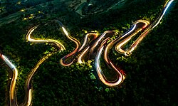 หุบเขาปาตราตุ | |
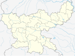  ปาตราตุ ตั้งอยู่ในรัฐฌาร์ขันด์ ประเทศอินเดีย 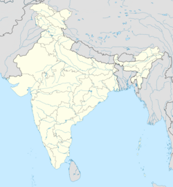 ปาตราตุ ปาตราตุ (อินเดีย) | |
| พิกัด: 23.67°เหนือ 85.28°ตะวันออก23°40′เหนือ85°17′ตะวันออก/ | |
| ประเทศ |  อินเดีย อินเดีย |
| สถานะ | จาร์คันด์ |
| เขต | รามการ์ห์ |
| พื้นที่ | |
• ทั้งหมด | 1.392 ตาราง กิโลเมตร(0.537 ตารางไมล์) |
| ระดับความสูง | 405 เมตร (1,329 ฟุต) |
| ประชากร (2011) | |
• ทั้งหมด | 32,899 |
| • ความหนาแน่น | 23,630/ตร.กม. ( 61,210/ตร. ไมล์) |
| ภาษา | |
| • เป็นทางการ | ภาษาฮินดีภาษาอูร์ดู |
| เขตเวลา | 5:30 น. ( เวลาอินเดีย ) (UTC+1 ) |
| เข็มหมุด | 829118 |
| หมายเลขโทรศัพท์/ รหัสพื้นที่ | 0651 |
| การลงทะเบียนยานพาหนะ | เจเอช |
| เขตเลือกตั้งโลคสภา | ฮาซาริบาห์ |
| เขตเลือกตั้งสภาวิธานสภา | รามการ์ห์ |
| เว็บไซต์ | ramgarh |
ปาตราตูเป็นเมืองที่จัดทำสำมะโนประชากร ตั้งอยู่ในเขตพัฒนาชุมชนปาตราตูในตำบลรามการ์อำเภอรามการ์จังหวัดฌาร์ขันด์ประเทศ อินเดีย
ภูมิศาสตร์


[[Balkundra]] (CT)
\", \"description\": \" ([https://geohack.toolforge.org/geohack.php?params=23.64194;85.32083_dim:2000 23.64194,85.32083])\", \"marker-symbol\": \"-number-F1092\", \"marker-size\": \"medium\", \"marker-color\": \"#a40000\" }, \"geometry\": {\"type\": \"Point\", \"coordinates\": [85.32083,23.64194] } }, { \"type\": \"Feature\", \"properties\": { \"title\": \"CT
[[Barkakana]] (CT)
\", \"description\": \" ([https://geohack.toolforge.org/geohack.php?params=23.61389;85.48333_dim:2000 23.61389,85.48333])\", \"marker-symbol\": \"-number-F1092\", \"marker-size\": \"medium\", \"marker-color\": \"#a40000\" }, \"geometry\": {\"type\": \"Point\", \"coordinates\": [85.48333,23.61389] } }, { \"type\": \"Feature\", \"properties\": { \"title\": \"CT
[[Ara, Ramgarh]] (CT)
\", \"description\": \" ([https://geohack.toolforge.org/geohack.php?params=23.74583;85.55556_dim:2000 23.74583,85.55556])\", \"marker-symbol\": \"-number-F1092\", \"marker-size\": \"medium\", \"marker-color\": \"#a40000\" }, \"geometry\": {\"type\": \"Point\", \"coordinates\": [85.55556,23.74583] } }, { \"type\": \"Feature\", \"properties\": { \"title\": \"CT
[[Barughutu]] (CT)
\", \"description\": \" ([https://geohack.toolforge.org/geohack.php?params=23.7875;85.5525_dim:2000 23.7875,85.5525])\", \"marker-symbol\": \"-number-F1092\", \"marker-size\": \"medium\", \"marker-color\": \"#a40000\" }, \"geometry\": {\"type\": \"Point\", \"coordinates\": [85.5525,23.7875] } }, { \"type\": \"Feature\", \"properties\": { \"title\": \"CT
[[Bongabar]] (CT)
\", \"description\": \" ([https://geohack.toolforge.org/geohack.php?params=23.70139;85.52417_dim:2000 23.70139,85.52417])\", \"marker-symbol\": \"-number-F1092\", \"marker-size\": \"medium\", \"marker-color\": \"#a40000\" }, \"geometry\": {\"type\": \"Point\", \"coordinates\": [85.52417,23.70139] } }, { \"type\": \"Feature\", \"properties\": { \"title\": \"CT
[[Chitarpur]] (CT)
\", \"description\": \" ([https://geohack.toolforge.org/geohack.php?params=23.57639;85.65472_dim:2000 23.57639,85.65472])\", \"marker-symbol\": \"-number-F1092\", \"marker-size\": \"medium\", \"marker-color\": \"#a40000\" }, \"geometry\": {\"type\": \"Point\", \"coordinates\": [85.65472,23.57639] } }, { \"type\": \"Feature\", \"properties\": { \"title\": \"CT
[[Hesla, Ramgarh]] (CT)
\", \"description\": \" ([https://geohack.toolforge.org/geohack.php?params=23.61389;85.28361_dim:2000 23.61389,85.28361])\", \"marker-symbol\": \"-number-F1092\", \"marker-size\": \"medium\", \"marker-color\": \"#a40000\" }, \"geometry\": {\"type\": \"Point\", \"coordinates\": [85.28361,23.61389] } }, { \"type\": \"Feature\", \"properties\": { \"title\": \"CT
[[Jainagar, Ramgarh]] (CT)
\", \"description\": \" ([https://geohack.toolforge.org/geohack.php?params=23.66111;85.31667_dim:2000 23.66111,85.31667])\", \"marker-symbol\": \"-number-F1092\", \"marker-size\": \"medium\", \"marker-color\": \"#a40000\" }, \"geometry\": {\"type\": \"Point\", \"coordinates\": [85.31667,23.66111] } }, { \"type\": \"Feature\", \"properties\": { \"title\": \"CT
[[Kedla]] (CT)
\", \"description\": \" ([https://geohack.toolforge.org/geohack.php?params=23.78917;85.59_dim:2000 23.78917,85.59])\", \"marker-symbol\": \"-number-F1092\", \"marker-size\": \"medium\", \"marker-color\": \"#a40000\" }, \"geometry\": {\"type\": \"Point\", \"coordinates\": [85.59,23.78917] } }, { \"type\": \"Feature\", \"properties\": { \"title\": \"CT
[[Kuju, Ramgarh]] (CT)
\", \"description\": \" ([https://geohack.toolforge.org/geohack.php?params=23.725;85.51111_dim:2000 23.725,85.51111])\", \"marker-symbol\": \"-number-F1092\", \"marker-size\": \"medium\", \"marker-color\": \"#a40000\" }, \"geometry\": {\"type\": \"Point\", \"coordinates\": [85.51111,23.725] } }, { \"type\": \"Feature\", \"properties\": { \"title\": \"CT
[[Lapanga, Ramgarh]] (CT)
\", \"description\": \" ([https://geohack.toolforge.org/geohack.php?params=23.65306;85.40972_dim:2000 23.65306,85.40972])\", \"marker-symbol\": \"-number-F1092\", \"marker-size\": \"medium\", \"marker-color\": \"#a40000\" }, \"geometry\": {\"type\": \"Point\", \"coordinates\": [85.40972,23.65306] } }, { \"type\": \"Feature\", \"properties\": { \"title\": \"CT
[[Mandu, Jharkhand]] (CT)
\", \"description\": \" ([https://geohack.toolforge.org/geohack.php?params=23.79417;85.47_dim:2000 23.79417,85.47])\", \"marker-symbol\": \"-number-F1092\", \"marker-size\": \"medium\", \"marker-color\": \"#a40000\" }, \"geometry\": {\"type\": \"Point\", \"coordinates\": [85.47,23.79417] } }, { \"type\": \"Feature\", \"properties\": { \"title\": \"CT
[[Marar, Ramgarh]] (CT)
\", \"description\": \" ([https://geohack.toolforge.org/geohack.php?params=23.67833;85.50694_dim:2000 23.67833,85.50694])\", \"marker-symbol\": \"-number-F1092\", \"marker-size\": \"medium\", \"marker-color\": \"#a40000\" }, \"geometry\": {\"type\": \"Point\", \"coordinates\": [85.50694,23.67833] } }, { \"type\": \"Feature\", \"properties\": { \"title\": \"CT
[[Orla, Jharkhand]] (CT)
\", \"description\": \" ([https://geohack.toolforge.org/geohack.php?params=23.72222;85.47389_dim:2000 23.72222,85.47389])\", \"marker-symbol\": \"-number-F1092\", \"marker-size\": \"medium\", \"marker-color\": \"#a40000\" }, \"geometry\": {\"type\": \"Point\", \"coordinates\": [85.47389,23.72222] } }, { \"type\": \"Feature\", \"properties\": { \"title\": \"CT
Patratu (CT)
\", \"description\": \" ([https://geohack.toolforge.org/geohack.php?params=23.67417;85.28_dim:2000 23.67417,85.28])\", \"marker-symbol\": \"-number-F1092\", \"marker-size\": \"medium\", \"marker-color\": \"#000000\" }, \"geometry\": {\"type\": \"Point\", \"coordinates\": [85.28,23.67417] } }, { \"type\": \"Feature\", \"properties\": { \"title\": \"CT
[[Sanri]] (CT)
\", \"description\": \" ([https://geohack.toolforge.org/geohack.php?params=23.69722;85.49694_dim:2000 23.69722,85.49694])\", \"marker-symbol\": \"-number-F1092\", \"marker-size\": \"medium\", \"marker-color\": \"#a40000\" }, \"geometry\": {\"type\": \"Point\", \"coordinates\": [85.49694,23.69722] } }, { \"type\": \"Feature\", \"properties\": { \"title\": \"CT
[[Saunda]] (CT)
\", \"description\": \" ([https://geohack.toolforge.org/geohack.php?params=23.65306;85.34722_dim:2000 23.65306,85.34722])\", \"marker-symbol\": \"-number-F1092\", \"marker-size\": \"medium\", \"marker-color\": \"#a40000\" }, \"geometry\": {\"type\": \"Point\", \"coordinates\": [85.34722,23.65306] } }, { \"type\": \"Feature\", \"properties\": { \"title\": \"CT
[[Seota]] (CT)
\", \"description\": \" ([https://geohack.toolforge.org/geohack.php?params=23.68111;85.52194_dim:2000 23.68111,85.52194])\", \"marker-symbol\": \"-number-F1092\", \"marker-size\": \"medium\", \"marker-color\": \"#a40000\" }, \"geometry\": {\"type\": \"Point\", \"coordinates\": [85.52194,23.68111] } }, { \"type\": \"Feature\", \"properties\": { \"title\": \"CT
[[Sewai]] (CT)
\", \"description\": \" ([https://geohack.toolforge.org/geohack.php?params=23.61;85.68_dim:2000 23.61,85.68])\", \"marker-symbol\": \"-number-F1092\", \"marker-size\": \"medium\", \"marker-color\": \"#a40000\" }, \"geometry\": {\"type\": \"Point\", \"coordinates\": [85.68,23.61] } }, { \"type\": \"Feature\", \"properties\": { \"title\": \"CT
[[Sirka, India]] (CT)
\", \"description\": \" ([https://geohack.toolforge.org/geohack.php?params=23.65417;85.4325_dim:2000 23.65417,85.4325])\", \"marker-symbol\": \"-number-F1092\", \"marker-size\": \"medium\", \"marker-color\": \"#a40000\" }, \"geometry\": {\"type\": \"Point\", \"coordinates\": [85.4325,23.65417] } }, { \"type\": \"Feature\", \"properties\": { \"title\": \"CT
[[Taping, Ramgarh]] (CT)
\", \"description\": \" ([https://geohack.toolforge.org/geohack.php?params=23.83556;85.49417_dim:2000 23.83556,85.49417])\", \"marker-symbol\": \"-number-F1092\", \"marker-size\": \"medium\", \"marker-color\": \"#a40000\" }, \"geometry\": {\"type\": \"Point\", \"coordinates\": [85.49417,23.83556] } }, { \"type\": \"Feature\", \"properties\": { \"title\": \"CT
[[Topa]] (CT)
\", \"description\": \" ([https://geohack.toolforge.org/geohack.php?params=23.74417;85.47556_dim:2000 23.74417,85.47556])\", \"marker-symbol\": \"-number-F1092\", \"marker-size\": \"medium\", \"marker-color\": \"#a40000\" }, \"geometry\": {\"type\": \"Point\", \"coordinates\": [85.47556,23.74417] } }, { \"type\": \"Feature\", \"properties\": { \"title\": \"M
[[Ramgarh Cantonment]] (M)
\", \"description\": \" ([https://geohack.toolforge.org/geohack.php?params=23.62222;85.51417_dim:2000 23.62222,85.51417])\", \"marker-symbol\": \"-number-F1092\", \"marker-size\": \"medium\", \"marker-color\": \"#a40000\" }, \"geometry\": {\"type\": \"Point\", \"coordinates\": [85.51417,23.62222] } }, { \"type\": \"Feature\", \"properties\": { \"title\": \"R
[[Bhadani Nagar]] (R)
\", \"description\": \" ([https://geohack.toolforge.org/geohack.php?params=23.60972;85.47222_dim:2000 23.60972,85.47222])\", \"marker-symbol\": \"-number-F1092\", \"marker-size\": \"medium\", \"marker-color\": \"#c40000\" }, \"geometry\": {\"type\": \"Point\", \"coordinates\": [85.47222,23.60972] } }, { \"type\": \"Feature\", \"properties\": { \"title\": \"R
[[Bhurkunda]] (R)
\", \"description\": \" ([https://geohack.toolforge.org/geohack.php?params=23.65639;85.36389_dim:2000 23.65639,85.36389])\", \"marker-symbol\": \"-number-F1092\", \"marker-size\": \"medium\", \"marker-color\": \"#c40000\" }, \"geometry\": {\"type\": \"Point\", \"coordinates\": [85.36389,23.65639] } }, { \"type\": \"Feature\", \"properties\": { \"title\": \"R
[[Dulmi]] (R)
\", \"description\": \" ([https://geohack.toolforge.org/geohack.php?params=23.53056;85.6025_dim:2000 23.53056,85.6025])\", \"marker-symbol\": \"-number-F1092\", \"marker-size\": \"medium\", \"marker-color\": \"#c40000\" }, \"geometry\": {\"type\": \"Point\", \"coordinates\": [85.6025,23.53056] } }, { \"type\": \"Feature\", \"properties\": { \"title\": \"R
[[Ghatotand]] (R)
\", \"description\": \" ([https://geohack.toolforge.org/geohack.php?params=23.7975;85.57444_dim:2000 23.7975,85.57444])\", \"marker-symbol\": \"-number-F1092\", \"marker-size\": \"medium\", \"marker-color\": \"#c40000\" }, \"geometry\": {\"type\": \"Point\", \"coordinates\": [85.57444,23.7975] } }, { \"type\": \"Feature\", \"properties\": { \"title\": \"R
[[Gola, Ramgarh]] (R)
\", \"description\": \" ([https://geohack.toolforge.org/geohack.php?params=23.53694;85.71694_dim:2000 23.53694,85.71694])\", \"marker-symbol\": \"-number-F1092\", \"marker-size\": \"medium\", \"marker-color\": \"#c40000\" }, \"geometry\": {\"type\": \"Point\", \"coordinates\": [85.71694,23.53694] } }, { \"type\": \"Feature\", \"properties\": { \"title\": \"T
[[Rajrappa]] (T)
\", \"description\": \" ([https://geohack.toolforge.org/geohack.php?params=23.63194;85.71111_dim:2000 23.63194,85.71111])\", \"marker-symbol\": \"-number-F1092\", \"marker-size\": \"medium\", \"marker-color\": \"#74c365\" }, \"geometry\": {\"type\": \"Point\", \"coordinates\": [85.71111,23.63194] } }, { \"type\": \"Feature\", \"properties\": { \"title\": \"P
[[Patratu Super Thermal Power Project]]
\", \"description\": \" ([https://geohack.toolforge.org/geohack.php?params=23.64583;85.29306_dim:2000 23.64583,85.29306])\", \"marker-symbol\": \"-number-F1092\", \"marker-size\": \"medium\", \"marker-color\": \"#967117\" }, \"geometry\": {\"type\": \"Point\", \"coordinates\": [85.29306,23.64583] } }, { \"type\": \"Feature\", \"properties\": { \"title\": \"0
[[Barka Sayal Area]]
\", \"description\": \" ([https://geohack.toolforge.org/geohack.php?params=23.68194;85.32556_dim:2000 23.68194,85.32556])\", \"marker-symbol\": \"-number-F1092\", \"marker-size\": \"medium\", \"marker-color\": \"#aa6666\" }, \"geometry\": {\"type\": \"Point\", \"coordinates\": [85.32556,23.68194] } }, { \"type\": \"Feature\", \"properties\": { \"title\": \"0
[[Argada Area]]
\", \"description\": \" ([https://geohack.toolforge.org/geohack.php?params=23.66667;85.45028_dim:2000 23.66667,85.45028])\", \"marker-symbol\": \"-number-F1092\", \"marker-size\": \"medium\", \"marker-color\": \"#aa6666\" }, \"geometry\": {\"type\": \"Point\", \"coordinates\": [85.45028,23.66667] } }, { \"type\": \"Feature\", \"properties\": { \"title\": \"0
[[Hazaribagh Area]]
\", \"description\": \" ([https://geohack.toolforge.org/geohack.php?params=23.85;85.44111_dim:2000 23.85,85.44111])\", \"marker-symbol\": \"-number-F1092\", \"marker-size\": \"medium\", \"marker-color\": \"#aa6666\" }, \"geometry\": {\"type\": \"Point\", \"coordinates\": [85.44111,23.85] } }, { \"type\": \"Feature\", \"properties\": { \"title\": \"0
[[Kuju Area]]
\", \"description\": \" ([https://geohack.toolforge.org/geohack.php?params=23.71111;85.50278_dim:2000 23.71111,85.50278])\", \"marker-symbol\": \"-number-F1092\", \"marker-size\": \"medium\", \"marker-color\": \"#aa6666\" }, \"geometry\": {\"type\": \"Point\", \"coordinates\": [85.50278,23.71111] } }, { \"type\": \"Feature\", \"properties\": { \"title\": \"0
[[Rajrappa Area]]
\", \"description\": \" ([https://geohack.toolforge.org/geohack.php?params=23.59167;85.67917_dim:2000 23.59167,85.67917])\", \"marker-symbol\": \"-number-F1092\", \"marker-size\": \"medium\", \"marker-color\": \"#aa6666\" }, \"geometry\": {\"type\": \"Point\", \"coordinates\": [85.67917,23.59167] } } ] } ]"}}">
ที่ตั้ง
ปาตราตุตั้งอยู่ที่ละติจูด 23.67°N ลองจิจูด 85.28°E [ 1 ] มีระดับความสูงเฉลี่ย 405 เมตร (1328 ฟุต) เขื่อนปาตราตุสร้างขึ้นภายใต้การวางแผนของวิศวกรชาวอินเดียผู้ยิ่งใหญ่ที่สุดและบิดาแห่งวิศวกรรมของอินเดีย เซอร์โมกษกุนดัม วิสเวสวารายา[ 2 ] เขื่อนนี้อยู่ ห่างจากเมืองรันชี เมืองหลวงของรัฐฌาร์ขันด์ เพียง 40 กิโลเมตร ซึ่งสามารถเดินทางโดยรถยนต์ได้ในเวลาไม่ถึงหนึ่งชั่วโมง และเชื่อมต่อโดยตรงกับเมืองรันชี ปัตนา ชัยปุระจัมเชดปุระ วาราณ สี จั มมู จาบัลปุระ อัลลาฮาบาดเดลีและโกลกาตาโดยทางรถไฟ23°40′เหนือ85°17′ตะวันออก/
ภาพรวมของพื้นที่
อำเภอ รามการ์มีภาคการทำเหมืองถ่านหินที่คึกคัก แผนที่ด้านข้างแสดงเส้นทางไปยังพื้นที่ปฏิบัติการ 5 แห่งของแหล่งถ่านหินกลางซึ่งกระจายอยู่ทั่วแหล่งถ่านหินการันปุระใต้แหล่งถ่านหินรามการ์และแหล่งถ่านหินโบกาโรตะวันตกบล็อกสำมะโนประชากร 4 ใน 6 บล็อกในอำเภอมีเหมืองถ่านหิน ได้แก่ ปาตราตุ รามการ์ มันดู และชิตาร์ปุระ ความหนาแน่นของเมืองตามสำมะโนประชากรในบล็อกเหล่านี้สังเกตได้ชัดเจนในแผนที่ มีเพียง 2 บล็อก คือ โกละและดุลมี เท่านั้นที่เป็นพื้นที่ชนบทโดยสมบูรณ์ อำเภอรามการ์ตั้งอยู่ตอนกลางของที่ราบสูงโชตานาคปุระ หุบเขา ดาโมดาร์ครอบคลุมพื้นที่ส่วนใหญ่ของอำเภอ พื้นที่ป่าในที่สูงทางเหนือและใต้ของหุบเขาสามารถมองเห็นได้ในแผนที่ (ทำเครื่องหมายในพื้นที่แรเงา) [ 3 ] "โชตานาคปุระมีเสน่ห์เฉพาะตัว... พื้นที่ทั้งหมดประกอบกันเป็นทิวทัศน์ที่งดงามที่สุดเท่าที่จะจินตนาการได้ เนินเขาที่อยู่ไกลออกไปในฉากหลังมีสีฟ้าหรือม่วงที่งดงามเมื่อแสงส่องลงมา เนินเขาที่อยู่ใกล้กว่ามีรูปร่างสวยงามและเขียวชอุ่มในทุกเฉดสีเขียว พร้อมด้วยหน้าผาสูงชันสีดำหรือเทา และที่ราบสีน้ำตาลด้านล่างก็มีสีสันที่สวยงาม" [ 4 ]
หมายเหตุ: แผนที่ด้านข้างแสดงสถานที่สำคัญบางแห่งในเขตนี้ สถานที่ทั้งหมดที่ทำเครื่องหมายไว้ในแผนที่นี้เชื่อมโยงไปยังแผนที่ขนาดใหญ่แบบเต็มหน้าจอ
การบริหารราชการส่วนท้องถิ่น
สถานีตำรวจ
สถานีตำรวจภัทราตู ให้บริการบล็อกซีดี ภัทราตู[ 5 ]
บล็อกซีดี HQ
สำนักงานใหญ่ของเขต CD Patratu ตั้งอยู่ที่เมือง Patratu [ 6 ]
ข้อมูลประชากร
จากข้อมูลสำมะโนประชากรของอินเดียปี 2554ปาตราตุมีประชากรทั้งหมด 32,899 คน โดยเป็นชาย 17,305 คน (53%) และหญิง 15,594 คน (47%) ประชากรในช่วงอายุ 0-6 ปี มีจำนวน 3,999 คน (12%) จำนวนผู้รู้หนังสือในปาตราตุมีทั้งหมด 24,382 คน (84.37% ของประชากรที่มีอายุมากกว่า 6 ปี) [ 7 ]
จากข้อมูลสำมะโนประชากรของอินเดียปี 2544 [ 8 ] ปาตราตุมีประชากร 32,132 คน โดยเป็นชาย 17,311 คน (54%) และหญิง 14,821 คน (46%) ประชากรในช่วงอายุ 0-6 ปี มีจำนวน 4,198 คน (13%) ในปี 2544 ปาตราตุมีอัตราการรู้หนังสือเฉลี่ย 70% ซึ่งสูงกว่าค่าเฉลี่ยของประเทศที่ 59.5% โดยอัตราการรู้หนังสือของชายอยู่ที่ 79% และของหญิงอยู่ที่ 61% [ 8 ]
โครงสร้างพื้นฐาน
ตามข้อมูลจากหนังสือสำมะโนประชากรประจำอำเภอปี 2554 รามการ์ห์ อำเภอพาตราตุ มีพื้นที่ 1.392 ตารางกิโลเมตรสิ่งอำนวยความสะดวกสาธารณะประกอบด้วย ถนนยาว 25 กิโลเมตร พร้อมระบบระบายน้ำทั้งแบบเปิดและแบบปิด ระบบประปาประกอบด้วยน้ำประปาจากแหล่งที่ผ่านการบำบัด บ่อน้ำบาดาล และแทงค์น้ำเหนือศีรษะ มีไฟฟ้าใช้ในครัวเรือน 5,822 ครัวเรือน และไฟส่องสว่างริมถนน 120 จุด สถานพยาบาลประกอบด้วยโรงพยาบาล 4 แห่ง สถานีอนามัย 1 แห่ง ศูนย์สุขภาพ 1 แห่ง ศูนย์สวัสดิการครอบครัว 1 แห่ง ศูนย์ดูแลแม่และเด็ก 8 แห่ง บ้านพักคนชรา 6 แห่ง สถานพยาบาลผู้สูงอายุ 16 แห่ง และร้านขายยา 10 แห่ง สถานศึกษาประกอบด้วยโรงเรียนประถมศึกษา 14 แห่ง โรงเรียนมัธยมต้น 6 แห่ง โรงเรียนมัธยมปลาย 5 แห่ง โรงเรียนมัธยมศึกษาตอนปลาย 2 แห่ง และวิทยาลัยทั่วไป 1 แห่ง นอกจากนี้ยังมีศูนย์การศึกษานอกระบบ (สารวะสิกษาอับหิยาน) อีก 1 แห่ง ในบรรดาสิ่งอำนวยความสะดวกทางสังคม สันทนาการ และวัฒนธรรม มีสนามกีฬา 1 แห่ง โรงภาพยนตร์ 1 แห่ง หอประชุม/หอประชุมชุมชน 3 แห่ง ห้องสมุดสาธารณะ 3 แห่ง และห้องอ่านหนังสือ 1 แห่ง สินค้าสำคัญที่ผลิตคือไฟฟ้า มีสำนักงานสาขาของธนาคารของรัฐ 3 แห่ง และสมาคมสินเชื่อเพื่อการเกษตร 1 แห่ง[ 9 ]
การศึกษา
โรงเรียนในปาตราตู ได้แก่:
- โรงเรียนมัธยม SS ก่อตั้งขึ้นเมื่อวันที่ 1 มกราคม 1963 ตั้งอยู่ริมถนนที่มุ่งหน้าไปยังเขื่อนปาตราตุและต่อมาไปยังเมืองรานชี เป็นโรงเรียนระดับมัธยมศึกษาตอนปลาย (10+2) มีพื้นที่กว้างขวางและสนามเด็กเล่นขนาดใหญ่
- เคนดริยา วิทยาละยะ ปาตราตุ
- โรงเรียนรัฐบาล DAV ปาตราตุ
- โรงเรียนโอพี จินดาล ปาตราตุ
- โรงเรียนเศรษฐศาสตร์ปาตราตุ
- Saraswati Shishu Vidya Mandir, ปัทราตู
- ชวาหร นาโวทัย วิทยาลยา, ปัทราตู
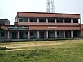 โรงเรียนมัธยม SS 2
วิทยาลัย
วิทยาลัยโรงไฟฟ้าพลังความร้อนปาตราตุ (PTPS) ซึ่งสังกัดมหาวิทยาลัยวิโนบาภาเวก่อตั้งขึ้นที่ปาตราตุในปี พ.ศ. 2515 [ 10 ]
การขนส่ง
แอร์เวย์ส
สนามบินบีร์ซา มุนดา เป็นสนามบิน ที่ใกล้ที่สุด โดยมีเที่ยวบินตรงไปยังเดลี โกลกา ตา มุมไบ ไฮเด อ ราบัด จา ร์ สุคุดา อินด อ ร์ภุพเนศวร บังกาลอร์และปัตนา
ทางรถไฟ
สถานีรถไฟปาตราตุเป็นสถานีรถไฟแห่งเดียว มีชานชาลา 3 แห่ง และมีรถไฟตรงไปยังโกลกาตาในขาขึ้น และไปยังนิวเดลีปัตนา และอีกหลายรัฐในอินเดีย เช่นปัญจาบและหรยาณาใน ขาลง
ถนน
ปาตราตูเชื่อมต่อกับทางหลวงหมายเลข 2ของรัฐฌาร์ขันด์ ซึ่งเชื่อมต่อกับศูนย์กลางอำเภอที่รามการ์ห์และเมืองหลวงของรัฐที่รานชีนอกจากนี้ยังมีสถานีขนส่งผู้โดยสารที่มีรถโดยสารให้บริการไปยังหลายเมืองในรัฐฌาร์ขันด์และรัฐเบงกอลตะวันตก
เหตุการณ์ล่าสุด
เมื่อวันที่ 13 กรกฎาคม พ.ศ. 2558 นาย รากูบาร์ ดาสหัวหน้าคณะรัฐมนตรีแห่งรัฐฌา ร์ขันด์ ได้เปิดหน่วยผลิตปูนซีเมนต์เบอร์นปูร์ที่ปาตราตู[ 11 ]
เขื่อนปาตราตู
เขื่อนนี้สร้างขึ้นเพื่อกักเก็บน้ำของแม่น้ำนัลการีเพื่อส่งไปยังพื้นที่ค่ายทหารรามการ์ห์ และยังเป็นอ่างเก็บน้ำหลักสำหรับโรงไฟฟ้าพลังความร้อนปาตราตู (PTPS) อีกด้วย มีแผนที่จะพัฒนาให้เป็นแหล่งท่องเที่ยว[ 12 ]
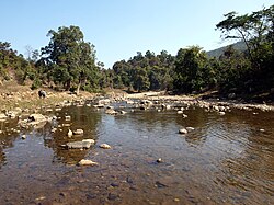 ทิวทัศน์ของแม่น้ำนัลการี
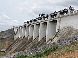 เขื่อน
 ในวันที่ท้องฟ้ามีเมฆมาก
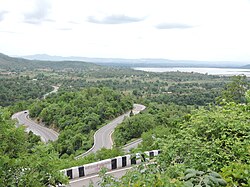
หุบเขาปาตราตุ
ในช่วงการเปลี่ยนแปลงล่าสุด จักรยานลากถ่านหินในพื้นที่ได้รับการสนับสนุนจากนักขี่มอเตอร์ไซค์ในท้องถิ่นโดยแบ่งผลกำไร[ 13 ]
โรงไฟฟ้าพลังความร้อนปาตราตู
เสน่ห์ของเมืองนี้คือถิ่นที่อยู่ตามธรรมชาติและทัศนียภาพที่สวยงาม เมืองนี้ได้รับการพัฒนาให้เป็นพื้นที่อยู่อาศัยสำหรับพนักงานของโรงไฟฟ้าพลังความร้อนปาตราตูโรงไฟฟ้าพลังความร้อนแห่งนี้สร้างขึ้นโดยความร่วมมือกับรัสเซียในปี 1962 มีปล่องไฟสองแห่งที่สร้างโดยบริษัทรัสเซีย ซึ่งเรียกว่าฝั่งรัสเซีย ส่วนปล่องไฟอีกสองแห่งสร้างโดยบริษัทอินเดีย จึงเรียกว่าฝั่งอินเดีย โรงไฟฟ้าแห่งนี้มีกำลังการผลิตไฟฟ้า 840 เมกะวัตต์[ 14 ] [ 15 ] การก่อสร้าง โรงไฟฟ้าขนาด 4,000 เมกะวัตต์กำลังดำเนินอยู่ในปาตราตู โดยหน่วยแรกจะเริ่มดำเนินการในปี 2024 [ 16 ]