
Roscommon, Michigan
Roscommon, Michigan | |
|---|---|
| Village of Roscommon | |
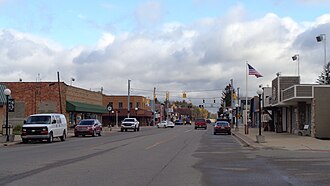 Looking north along Lake Street (M-18) | |
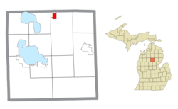 Location within Roscommon County | |
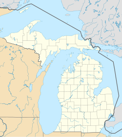  Roscommon Location within the state of Michigan  Roscommon Location within the United States | |
| Coordinates: 44°29′54″N84°35′31″W / 44.49833°เหนือ 84.59194°ตะวันตก | |
| Country | United States |
| State | Michigan |
| County | Roscommon |
| Township | Higgins |
| Settled | 1845 |
| Incorporated | 1882 |
| Government | |
| • Type | Village council |
| • President | Mike Miller |
| • Clerk | Frances Dawson |
| Area | |
• Total | 1.66 sq mi (4.30 km2) |
| • Land | 1.65 sq mi (4.27 km2) |
| • Water | 0.012 sq mi (0.03 km2) |
| Elevation | 1,135 ft (346 m) |
| Population (2020) | |
• Total | 981 |
| • Density | 594.55/sq mi (229.56/km2) |
| Time zone | UTC-5 (Eastern (EST)) |
| • Summer (DST) | UTC-4 (EDT) |
| ZIP code(s) | 48653 |
| Area code | 989 |
| FIPS code | 26-69540[2] |
| GNIS feature ID | 1621434[3] |
| Website | Official website |
Roscommon (/rɒsˈkɒmən/ross-KOM-ən) is a village in and the county seat of Roscommon County, Michigan, United States.[4] The population was 981 at the 2020 census.
History
The community of Roscommon was first settled as early as 1845 by George Robinson of Detroit shortly after Roscommon County was organized in 1840. The community was named after the county, which itself was named after County Roscommon in Ireland. The Roscommon post office was established on January 9, 1873, with Alfred Bennett serving as the first postmaster. In 1875, Roscommon became the county seat and incorporated as a village in 1882.[5]
Beginning in 1979, the annual Michigan's Firemen's Memorial Festival is held in Roscommon and commemorates firefighters who died while protecting their communities.[6]
Geography
According to the U.S. Census Bureau, the village has a total area of 1.66 square miles (4.30 km2), of which 1.65 square miles (4.27 km2) is land and 0.01 square miles (0.03 km2) (0.60%) is water.[1]
Roscommon อยู่ใกล้กับอุทยานแห่งรัฐ 3 แห่ง ได้แก่อุทยานแห่งรัฐ South Higgins Lake , อุทยานแห่งรัฐ North Higgins Lakeและอุทยานแห่งรัฐ Hartwick Pinesพื้นที่ 160 เอเคอร์ (65 เฮกตาร์) ภายในป่าสงวนแห่งรัฐ Au Sableซึ่งเรียกกันว่า Roscommon Red Pines อยู่ห่างจาก Roscommon ไปทางทิศตะวันออก 8 ไมล์ (13 กิโลเมตร) เป็นป่าสนแดงเก่า แก่ [ 7 ] สาขาใต้ของแม่น้ำ Au Sableไหลผ่านหมู่บ้านและเป็นจุดหมายปลายทางยอดนิยมสำหรับการพายเรือคายัคพายเรือแคนูและตกปลา
หมู่บ้าน Roscommon ตั้งอยู่ในHiggins Townshipทางตอนเหนือของเคาน์ตี Roscommon มีที่ทำการไปรษณีย์เป็นของตัวเอง โดยมีรหัสไปรษณีย์ 48653 ซึ่งครอบคลุม Gerrish Townshipทั้งหมด , Lyon Townshipส่วนใหญ่และพื้นที่เล็กๆ ที่ขยายไปยังLake Township , Markey TownshipและAu Sable Townshipนอกจากนี้ยังครอบคลุมบางส่วนของSouth Branch TownshipและBeaver Creek TownshipทางเหนือในCrawford County อีกด้วย [ 8 ]
ทางหลวงสายหลัก
 ทางหลวง หมายเลข I-75อยู่ห่างจากหมู่บ้านไปทางใต้ประมาณ 3.2 กิโลเมตร และสามารถเข้าถึงได้โดยใช้ทางออกหมายเลข 239 (M-18 หรือที่รู้จักกันในชื่อถนนนอร์ธรอสคอมมอน ณ จุดนี้)
 ทางหลวง BL I-75วิ่งคู่ขนานกับทางหลวง M-18 จากทางออกที่ 239
 ถนน M-18 (ถนนเลคสตรีท) วิ่งผ่านใจกลางหมู่บ้าน
ภูมิอากาศ
ตาม ระบบ การจำแนกภูมิอากาศของ Köppen ภูมิอากาศของ Roscommon เป็นแบบทวีปชื้นที่มีฤดูร้อนอบอุ่นซึ่งย่อว่า "Dfb" บนแผนที่ภูมิอากาศ อุณหภูมิที่ร้อนที่สุดที่บันทึกไว้ใน Roscommon คือ 103 °F (39.4 °C) เมื่อวันที่ 19 มิถุนายน พ.ศ. 2538 ในขณะที่อุณหภูมิที่หนาวที่สุดที่บันทึกไว้คือ −34 °F (−36.7 °C) เมื่อวันที่ 17 กุมภาพันธ์ พ.ศ. 2522 [ 9 ]
| ข้อมูลสภาพอากาศสำหรับเมืองรอสคอมมอน รัฐมิชิแกน ( สนามบินฮอตันเลคสเตท ) ปี 1991–2020 ค่าเฉลี่ย และค่าสุดขั้วตั้งแต่ปี 1964 จนถึงปัจจุบัน | |||||||||||||
|---|---|---|---|---|---|---|---|---|---|---|---|---|---|
| เดือน | ม.ค | กุมภาพันธ์ | มีนาคม | เมษายน | อาจ | จุน | กรกฎาคม | ส.ค. | กันยายน | ตุลาคม | พฤศจิกายน | ธันวาคม | ปี |
| บันทึกอุณหภูมิสูงสุด °F (°C) | 54 (12) | 59 (15) | 85 (29) | 86 (30) | 91 (33) | 103 (39) | 98 (37) | 96 (36) | 92 (33) | 85 (29) | 73 (23) | 64 (18) | 103 (39) |
| ค่าเฉลี่ยสูงสุด °F (°C) | 44.5 (6.9) | 47.0 (8.3) | 61.7 (16.5) | 74.7 (23.7) | 84.4 (29.1) | 89.6 (32.0) | 90.1 (32.3) | 88.6 (31.4) | 84.8 (29.3) | 75.5 (24.2) | 60.1 (15.6) | 48.0 (8.9) | 92.1 (33.4) |
| อุณหภูมิสูงสุดเฉลี่ยรายวัน °F (°C) | 26.9 (−2.8) | 29.6 (−1.3) | 40.4 (4.7) | 53.8 (12.1) | 67.2 (19.6) | 76.7 (24.8) | 80.5 (26.9) | 78.3 (25.7) | 70.6 (21.4) | 56.8 (13.8) | 43.1 (6.2) | 32.1 (0.1) | 54.7 (12.6) |
| ค่าเฉลี่ยรายวัน °F (°C) | 19.1 (−7.2) | 20.3 (−6.5) | 29.7 (−1.3) | 42.2 (5.7) | 54.7 (12.6) | 63.9 (17.7) | 67.8 (19.9) | 65.8 (18.8) | 58.3 (14.6) | 46.8 (8.2) | 35.5 (1.9) | 25.6 (−3.6) | 44.1 (6.7) |
| อุณหภูมิต่ำสุดเฉลี่ยรายวัน °F (°C) | 11.4 (−11.4) | 11.0 (−11.7) | 19.1 (−7.2) | 30.7 (−0.7) | 42.3 (5.7) | 51.1 (10.6) | 55.0 (12.8) | 53.3 (11.8) | 46.1 (7.8) | 36.8 (2.7) | 27.9 (−2.3) | 19.0 (−7.2) | 33.6 (0.9) |
| ค่าเฉลี่ยต่ำสุด °F (°C) | −11.2 (−24.0) | −12.0 (−24.4) | −4.8 (−20.4) | 16.4 (−8.7) | 28.0 (−2.2) | 36.8 (2.7) | 41.8 (5.4) | 39.1 (3.9) | 30.4 (−0.9) | 22.9 (−5.1) | 12.9 (−10.6) | −0.1 (−17.8) | −16.4 (−26.9) |
| บันทึกอุณหภูมิต่ำสุด °F (°C) | −26 (−32) | −34 (−37) | −24 (−31) | 2 (−17) | 21 (−6) | 29 (−2) | 33 (1) | 29 (−2) | 21 (−6) | 16 (−9) | −5 (−21) | −21 (−29) | −34 (−37) |
| ปริมาณ น้ำฝนเฉลี่ย(มม.) | 1.70 (43) | 1.41 (36) | 1.78 (45) | 3.10 (79) | 3.15 (80) | 3.22 (82) | 2.74 (70) | 2.86 (73) | 2.59 (66) | 3.08 (78) | 2.20 (56) | 1.76 (45) | 29.59 (753) |
| ปริมาณหิมะเฉลี่ย (นิ้ว/ซม.) | 16.4 (42) | 13.6 (35) | 8.3 (21) | 4.4 (11) | 0.1 (0.25) | 0.0 (0.0) | 0.0 (0.0) | 0.0 (0.0) | 0.0 (0.0) | 0.5 (1.3) | 7.5 (19) | 15.1 (38) | 65.9 (167.55) |
| ความลึกของหิมะสูงสุดโดยเฉลี่ย (นิ้ว/ซม.) | 11.2 (28) | 13.6 (35) | 11.8 (30) | 2.8 (7.1) | 0.1 (0.25) | 0.0 (0.0) | 0.0 (0.0) | 0.0 (0.0) | 0.0 (0.0) | 0.1 (0.25) | 3.7 (9.4) | 7.7 (20) | 15.3 (39) |
| จำนวนวันที่มีฝนตกโดยเฉลี่ย(≥ 0.01 นิ้ว) | 14.0 | 11.4 | 10.5 | 12.0 | 11.7 | 10.9 | 10.0 | 9.5 | 10.9 | 13.5 | 13.2 | 13.5 | 141.1 |
| จำนวนวันที่มีหิมะตกโดยเฉลี่ย(≥ 0.1 นิ้ว) | 12.8 | 10.6 | 5.9 | 2.9 | 0.1 | 0.0 | 0.0 | 0.0 | 0.0 | 0.3 | 5.8 | 10.6 | 49.0 |
| แหล่งที่มา 1: NOAA [ 10 ] | |||||||||||||
| แหล่งที่มา 2: สำนักงานบริการสภาพอากาศแห่งชาติ[ 9 ] | |||||||||||||
ข้อมูลประชากร
| สำมะโนประชากร | โผล่. | บันทึก | %± |
|---|---|---|---|
| 1890 | 511 | — | |
| ปี ค.ศ. 1900 | 465 | −9.0% | |
| 1910 | 425 | −8.6% | |
| 1920 | 357 | −16.0% | |
| 1930 | 412 | 15.4% | |
| 1940 | 619 | 50.2% | |
| 1950 | 877 | 41.7% | |
| 1960 | 867 | -1.1% | |
| 1970 | 810 | −6.6% | |
| 1980 | 834 | 3.0% | |
| 1990 | 858 | 2.9% | |
| 2000 | 1,133 | 32.1% | |
| 2010 | 1,075 | −5.1% | |
| 2020 | 981 | −8.7% | |
| สำมะโนประชากรทุกสิบปีของสหรัฐอเมริกา[ 11 ] | |||
สำมะโนประชากรปี 2010
จากการสำรวจสำมะโนประชากร[ 12 ]ในปี 2553 มีประชากร 1,075 คน 423 ครัวเรือน และ 233 ครอบครัวอาศัยอยู่ในหมู่บ้าน ความหนาแน่นของประชากรอยู่ที่ 721.5 คนต่อตารางไมล์ (278.6 คนต่อตารางกิโลเมตร)มีหน่วยที่อยู่อาศัย 507 หน่วย โดยมีความหนาแน่นเฉลี่ย 340.3 หน่วยต่อตารางไมล์ (131.4 หน่วยต่อตารางกิโลเมตร) องค์ประกอบทางเชื้อชาติของหมู่บ้านประกอบด้วย ชาวผิวขาว 95.6% ชาว แอฟริกันอเมริกัน 0.3% ชาวอเมริกันพื้นเมือง 0.7% ชาวเอเชีย 0.8% และ 2.6% จากสองเชื้อชาติขึ้นไปชาวฮิสแปนิกหรือลาตินไม่ว่าจะเป็นเชื้อชาติใดก็ตามคิดเป็น 0.2% ของประชากร
มีครัวเรือนทั้งหมด 423 ครัวเรือน โดย 29.8% มีเด็กอายุต่ำกว่า 18 ปีอาศัยอยู่ด้วย 31.4% เป็นคู่สมรสที่อาศัยอยู่ด้วยกัน 16.3% เป็นหัวหน้าครัวเรือนหญิงที่ไม่มีสามี 7.3% เป็นหัวหน้าครัวเรือนชายที่ไม่มีภรรยา และ 44.9% เป็นครัวเรือนที่ไม่ใช่ครอบครัว 42.8% ของครัวเรือนทั้งหมดประกอบด้วยบุคคลเพียงคนเดียว และ 18.5% มีผู้ที่อาศัยอยู่คนเดียวที่มีอายุ 65 ปีขึ้นไป ขนาดครัวเรือนโดยเฉลี่ยอยู่ที่ 2.13 และขนาดครอบครัวโดยเฉลี่ยอยู่ที่ 2.88
อายุเฉลี่ยของประชากรในหมู่บ้านคือ 43.6 ปี ร้อยละ 22.1 ของผู้อยู่อาศัยมีอายุต่ำกว่า 18 ปี ร้อยละ 8.1 มีอายุระหว่าง 18 ถึง 24 ปี ร้อยละ 21.4 มีอายุระหว่าง 25 ถึง 44 ปี ร้อยละ 25.4 มีอายุระหว่าง 45 ถึง 64 ปี และร้อยละ 22.9 มีอายุ 65 ปีขึ้นไป สัดส่วนเพศของประชากรในหมู่บ้านคือ ชาย ร้อยละ 47.8 และหญิง ร้อยละ 52.2
สำมะโนประชากรปี 2000
As of the census[2] of 2000, there were 1,133 people, 436 households, and 235 families living in the village. The population density was 695.1 inhabitants per square mile (268.4/km2). There were 491 housing units at an average density of 301.2 per square mile (116.3/km2). The racial makeup of the village was 96.03% White, 1.24% African American, 0.79% Native American, 0.44% Asian, and 1.50% from two or more races. Hispanic or Latino of any race were 0.18% of the population.
There were 436 households, out of which 28.9% had children under the age of 18 living with them, 36.2% were married couples living together, 14.7% had a female householder with no husband present, and 45.9% were non-families. 40.8% of all households were made up of individuals, and 19.3% had someone living alone who was 65 years of age or older. The average household size was 2.19 and the average family size was 3.01.
In the village, the population was spread out, with 22.9% under the age of 18, 10.3% from 18 to 24, 24.4% from 25 to 44, 19.3% from 45 to 64, and 23.1% who were 65 years of age or older. The median age was 39 years. For every 100 females, there were 85.7 males. For every 100 females age 18 and over, there were 80.6 males.
The median income for a household in the village was $28,229, and the median income for a family was $33,929. Males had a median income of $29,844 versus $18,875 for females. The per capita income for the village was $14,746. About 19.3% of families and 21.2% of the population were below the poverty line, including 34.4% of those under age 18 and 8.5% of those age 65 or over.
Education
The village of Roscommon is served by Roscommon Area Public Schools, which has a single main campus located just to the west of the village in Gerrish Township.[13][14]
Notable people
- Ralph Ostling, politician who served in the Michigan House of Representatives
Images
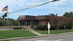 U.S. Post Office in Roscommon
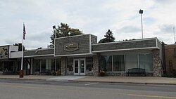 Roscommon village office
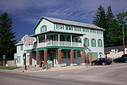 The historic Pioneer House
ลิงก์ภายนอก

- เว็บไซต์อย่างเป็นทางการของหมู่บ้านรอสคอมมอน