
Sardara
Sardara | |
|---|---|
| Comune di Sardara | |
 Panorama from Monreale Castle | |
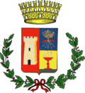 Coat of arms | |
  Sardara Location of Sardara in Sardinia | |
| Coordinates: 39°37′N8°50′E / 39.617°N 8.833°E / 39.617; 8.833 | |
| Country | Italy |
| Region | Sardinia |
| Province | Medio Campidano |
| Government | |
| • Mayor | Giorgio Zucca |
| Area | |
• Total | 56.23 km2 (21.71 sq mi) |
| Population (2026)[2] | |
• Total | 3,711 |
| • Density | 66.00/km2 (170.9/sq mi) |
| Demonym | Sardaresi |
| Time zone | UTC+1 (CET) |
| • Summer (DST) | UTC+2 (CEST) |
| Postal code | 09030 |
| Dialing code | 070 |
Sardara (Sardinian: Sàrdara) is a town and comune (municipality) in the Province of Medio Campidano in the autonomous island region of Sardinia in Italy, located about 50 kilometres (31 mi) northwest of Cagliari and about 8 kilometres (5 mi) northwest of Sanluri. It has 3,711 inhabitants.[2]
Located in the Campidano plain, Sardara is part of the historical region of Marmilla, and borders the municipalities of Collinas, Mogoro, Pabillonis, San Gavino Monreale, Sanluri, Villanovaforru.
Demographics
As of 2026, the population is 3,711, of which 49.6% are male, and 50.4% are female. Minors make up 12.1% of the population, and seniors make up 30.3%.[2]
Historical population | |||||||||||||||||||||||||||||||||||||||||||||||||||||||
|
| ||||||||||||||||||||||||||||||||||||||||||||||||||||||
| Source: ISTAT[3][4] | |||||||||||||||||||||||||||||||||||||||||||||||||||||||
Immigration
ณ ปี 2025 ผู้อพยพคิดเป็น 2.8% ของประชากร ประเทศต้นกำเนิดที่ใหญ่ที่สุด 5 อันดับแรกได้แก่ฝรั่งเศสเยอรมนีโรมาเนียยูเครนและสหราชอาณาจักร[ 5 ]
แหล่งมรดก
กฎหมายนี้ถูกบังคับใช้โดยอำนาจปกครองของผู้นำปราสาทซึ่งครอบงำภูมิภาค ในขณะเดียวกันก็ปกป้องประชากร นักบวช และกิจการค้าด้วยความช่วยเหลือจากกองทัพจูดิคัล ซึ่งประกอบด้วยทหารและพลเมืองอิสระภายใต้การนำของหน่วยรบชั้นยอดและพลธนูชาวเจนัว