
เซลซ์ (แม่น้ำ)
แม่น้ำเซลซ์ (Selz)เป็นแม่น้ำในรัฐไรน์แลนด์-พาลาทิเนตประเทศเยอรมนีและเป็นสาขาทางซ้ายของแม่น้ำไรน์ไหลผ่านภูมิภาคผลิตไวน์ ที่ใหญ่ที่สุดของเยอรมนี คือ ไรน์เฮสเซิน ( Rheinhessen หรือ Rhenish Hesse )
แม่น้ำสายนี้ มีต้นกำเนิดใกล้หมู่บ้านออร์บิสในเขตดอนเนอร์สเบิร์กไครส์ไหลข้ามพรมแดนจากพาลาทิเนตเข้าสู่เฮสเซในแคว้นไรน์ และหลังจากนั้นประมาณ8 กิโลเมตร (5 ไมล์) ก็ไหล ผ่านเมืองอัลเซย์ใน เขต อัลเซย์-เวิร์มส์ที่นั่นแม่น้ำไหลผ่านสระน้ำ และหายไปใต้ดิน ไหลผ่านคูน้ำใต้เมือง ระหว่างทาง แม่น้ำไหลผ่านเกา-โอเดิร์นไฮม์ นีเดอร์ - โอล์มและอินเกลไฮม์ก่อนจะไหลลงสู่แม่น้ำไรน์ในไฟร-ไวน์ไฮ ม์ ซึ่งเป็น เขตหนึ่งของอินเกลไฮม์
แม่น้ำเซลซ์มีพื้นที่ลุ่มน้ำ 375 ตารางกิโลเมตร (145 ตารางไมล์) มีลักษณะภูมิอากาศอบอุ่นและแห้งแล้ง โดยมีปริมาณน้ำฝน เฉลี่ยต่อปี ประมาณ500 มิลลิเมตร (20 นิ้ว)แม้ว่าจะมีปริมาณน้ำไหลน้อยและไม่สม่ำเสมอ แต่แม่น้ำเซลซ์ก็ถือเป็นแม่น้ำสายหลักในพื้นที่ราบแห้งแล้งของแคว้นไรน์-เฮสเซ ในช่วงที่ระดับน้ำต่ำ น้ำในแม่น้ำจะมีน้ำเสียสะอาดจากโรงบำบัดน้ำเสียปนเปื้อนอยู่เป็นจำนวนมาก
การฟื้นฟูสิ่งแวดล้อม
ตลอดหลายทศวรรษของศตวรรษที่ 20 มีการขุดคลองและปรับเส้นทางน้ำในแม่น้ำและลำธารจำนวนมากในเยอรมนี ผลจากการปรับเส้นทางน้ำให้ตรงขึ้นซึ่งดำเนินการระหว่างปี 1958 ถึง 1963 ทำให้ลำธารเซลซ์ถูกบีบให้แคบลงระหว่างคันกั้นน้ำและไหลคดเคี้ยวไปตามที่ราบระหว่างเนินเขาอันเลื่องชื่อของไรน์-เฮสเซ เพื่อป้องกันการเสื่อมโทรมของพื้นแม่น้ำและเพื่อปรับปรุงทั้งความหลากหลายทางชีวภาพและการป้องกันน้ำท่วมสมาคมอนุรักษ์ธรรมชาติในท้องถิ่น ( Selztalverband ) และเขตปกครองไมนซ์-บิงเงนได้ร่วมกันฟื้นฟูลำธารเซลซ์เป็นระยะทางยาวระหว่างฮาห์นไฮม์อุนเดนไฮม์และซอร์เกนลอค
The loss of the floodplain and shorter sections of river caused higher water levels and risk of flood than in the past. Some floods that nearly caused a disaster were the reason for a restoration concept. The concept includes flood protection, river bed stabilization and renaturization measures. The main objectives are:
- flood protection up to a 100-year flood
- improvement of the ecological situation
- stabilizing river bed/erosion control
- stabilizing groundwater level
Floodplains have been widened to between 50 and 100 metres (160 and 330 ft). Nature is allowed to develop undisturbed in biotopes, which protect and promote the biodiversity of the landscape with its meadows, ditches, bank slopes, marsh areas, wetland, Phragmites, willows, hedges and boundary ridges. During the past 25 years, the village of Hahnheim has planted 27,000 trees and hedges along the Selz within its boundaries.
Since the Selz renaturation project covers several miles of the Selz's riverbank, it has increased the overall length of the river.
Tributaries
Settlements
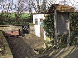
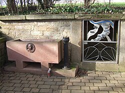
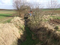
The following villages and towns are located on the Selz (from source to mouth):
- Orbis
- Morschheim
- Mauchenheim
- Alzey
- Alzey-Schafhausen
- Framersheim (confluence of Weidas and Selz)
- Gau-Köngernheim
- Gau-Odernheim
- Bechtolsheim
- Undenheim
- Friesenheim
- Köngernheim
- Selzen
- Hahnheim
- Sörgenloch
- Nieder-Olm, the reason for the foundation of Nieder-Olm is given by the passage of an old Roman road over the Selz river which led to the Roman camps around Mainz and the city itself.
- Stadecken-Elsheim
- Bubenheim
- Schwabenheim an der Selz
- Großwinternheim
- Ingelheim am Rhein
Cycle track
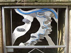
A signposted cycle track along the Selz, the Selztalradweg, does partially use two old railway tracks of the Amiche and Zuckerlottche. Both trackbeds now have a tarmac surface. Sometimes the cycle path along the river bed may be used in dry weather. Both routes are covered by tall trees, shading the cycleway from the hot sun.
See also
External links
- restoring Selz RiverArchived 2004-12-21 at the Wayback Machine
- "pathways along the Selz"(PDF). (3.37 MB)