
ศรีนิเกตัน
ศรีนิเกตัน | |
|---|---|
ละแวกบ้าน | |
  ศรีนิเกตัน ตั้งอยู่ในรัฐเวสต์เบงกอล ประเทศอินเดีย | |
| พิกัด: 23°40′05″N 87°39′55″E / 23.66806°N 87.66528°E / 23.66806; 87.66528 | |
| ประเทศ |  อินเดีย อินเดีย |
| สถานะ | รัฐเวสต์เบงกอล |
| เขต | บีร์บุม |
| ภาษา | |
| • เป็นทางการ | ภาษาเบ งกาลีภาษาอังกฤษ |
| เขตเวลา | 5:30 น. ( เวลา UTC+ IST ) |
| เขตเลือกตั้งโลคสภา | โบลปูร์ |
| เขตเลือกตั้งสภาวิธานสภา | โบลปูร์ |
| เว็บไซต์ | visva-bharati |
Sriniketan (สะกดว่าSri Niketan ) เป็นย่านหนึ่งของSurulในตำบล Bolpurของเขต Birbhumในรัฐเบงกอลตะวันตกของอินเดีย อยู่ติดกับศานตินิเกตันและเป็นที่ตั้งของวิทยาเขตแห่งที่ 2 ของมหาวิทยาลัย Visva- Bharati Palli Samgathana Vibhag (สถาบันการฟื้นฟูชนบท) และ Palli Siksha Bhavana (สถาบันวิทยาศาสตร์การเกษตร) ตั้งอยู่ในเบงกอลตะวันตก
ภูมิศาสตร์


[[Ilambazar]] (CT)
\", \"description\": \" ([https://geohack.toolforge.org/geohack.php?params=23.62917;87.54167_dim:2000 23.62917,87.54167])\", \"marker-symbol\": \"-number-F1114\", \"marker-size\": \"medium\", \"marker-color\": \"#a40000\" }, \"geometry\": {\"type\": \"Point\", \"coordinates\": [87.54167,23.62917] } }, { \"type\": \"Feature\", \"properties\": { \"title\": \"CT
[[Surul]] (CT)
\", \"description\": \" ([https://geohack.toolforge.org/geohack.php?params=23.67028;87.65139_dim:2000 23.67028,87.65139])\", \"marker-symbol\": \"-number-F1114\", \"marker-size\": \"medium\", \"marker-color\": \"#a40000\" }, \"geometry\": {\"type\": \"Point\", \"coordinates\": [87.65139,23.67028] } }, { \"type\": \"Feature\", \"properties\": { \"title\": \"CT
[[Parota, Birbhum]] (CT)
\", \"description\": \" ([https://geohack.toolforge.org/geohack.php?params=23.77889;87.8725_dim:2000 23.77889,87.8725])\", \"marker-symbol\": \"-number-F1114\", \"marker-size\": \"medium\", \"marker-color\": \"#a40000\" }, \"geometry\": {\"type\": \"Point\", \"coordinates\": [87.8725,23.77889] } }, { \"type\": \"Feature\", \"properties\": { \"title\": \"CT
[[Labhpur]] (CT)
\", \"description\": \" ([https://geohack.toolforge.org/geohack.php?params=23.82972;87.79694_dim:2000 23.82972,87.79694])\", \"marker-symbol\": \"-number-F1114\", \"marker-size\": \"medium\", \"marker-color\": \"#a40000\" }, \"geometry\": {\"type\": \"Point\", \"coordinates\": [87.79694,23.82972] } }, { \"type\": \"Feature\", \"properties\": { \"title\": \"M
[[Bolpur]] (M)
\", \"description\": \" ([https://geohack.toolforge.org/geohack.php?params=23.67111;87.68861_dim:2000 23.67111,87.68861])\", \"marker-symbol\": \"-number-F1114\", \"marker-size\": \"medium\", \"marker-color\": \"#a40000\" }, \"geometry\": {\"type\": \"Point\", \"coordinates\": [87.68861,23.67111] } }, { \"type\": \"Feature\", \"properties\": { \"title\": \"R
[[Shantiniketan]] (R)
\", \"description\": \" ([https://geohack.toolforge.org/geohack.php?params=23.68611;87.66111_dim:2000 23.68611,87.66111])\", \"marker-symbol\": \"-number-F1114\", \"marker-size\": \"medium\", \"marker-color\": \"#a40000\" }, \"geometry\": {\"type\": \"Point\", \"coordinates\": [87.66111,23.68611] } }, { \"type\": \"Feature\", \"properties\": { \"title\": \"R
[[Nanoor]] (R)
\", \"description\": \" ([https://geohack.toolforge.org/geohack.php?params=23.7;87.86_dim:2000 23.7,87.86])\", \"marker-symbol\": \"-number-F1114\", \"marker-size\": \"medium\", \"marker-color\": \"#a40000\" }, \"geometry\": {\"type\": \"Point\", \"coordinates\": [87.86,23.7] } }, { \"type\": \"Feature\", \"properties\": { \"title\": \"R
Sriniketan (R)
\", \"description\": \" ([https://geohack.toolforge.org/geohack.php?params=23.65833;87.66111_dim:2000 23.65833,87.66111])\", \"marker-symbol\": \"-number-F1114\", \"marker-size\": \"medium\", \"marker-color\": \"#000000\" }, \"geometry\": {\"type\": \"Point\", \"coordinates\": [87.66111,23.65833] } }, { \"type\": \"Feature\", \"properties\": { \"title\": \"R
[[Kirnahar]] (R)
\", \"description\": \" ([https://geohack.toolforge.org/geohack.php?params=23.76306;87.87778_dim:2000 23.76306,87.87778])\", \"marker-symbol\": \"-number-F1114\", \"marker-size\": \"medium\", \"marker-color\": \"#a40000\" }, \"geometry\": {\"type\": \"Point\", \"coordinates\": [87.87778,23.76306] } }, { \"type\": \"Feature\", \"properties\": { \"title\": \"R
[[Raipur, Birbhum]] (R)
\", \"description\": \" ([https://geohack.toolforge.org/geohack.php?params=23.63667;87.64694_dim:2000 23.63667,87.64694])\", \"marker-symbol\": \"-number-F1114\", \"marker-size\": \"medium\", \"marker-color\": \"#a40000\" }, \"geometry\": {\"type\": \"Point\", \"coordinates\": [87.64694,23.63667] } }, { \"type\": \"Feature\", \"properties\": { \"title\": \"R
[[Khujutipara]] (R)
\", \"description\": \" ([https://geohack.toolforge.org/geohack.php?params=23.61083;87.89694_dim:2000 23.61083,87.89694])\", \"marker-symbol\": \"-number-F1114\", \"marker-size\": \"medium\", \"marker-color\": \"#a40000\" }, \"geometry\": {\"type\": \"Point\", \"coordinates\": [87.89694,23.61083] } }, { \"type\": \"Feature\", \"properties\": { \"title\": \"R
[[Khustigiri]] (R)
\", \"description\": \" ([https://geohack.toolforge.org/geohack.php?params=23.76056;87.53639_dim:2000 23.76056,87.53639])\", \"marker-symbol\": \"-number-F1114\", \"marker-size\": \"medium\", \"marker-color\": \"#a40000\" }, \"geometry\": {\"type\": \"Point\", \"coordinates\": [87.53639,23.76056] } }, { \"type\": \"Feature\", \"properties\": { \"title\": \"R
[[Jaydev Kenduli]] (R)
\", \"description\": \" ([https://geohack.toolforge.org/geohack.php?params=23.64444;87.43_dim:2000 23.64444,87.43])\", \"marker-symbol\": \"-number-F1114\", \"marker-size\": \"medium\", \"marker-color\": \"#a40000\" }, \"geometry\": {\"type\": \"Point\", \"coordinates\": [87.43,23.64444] } }, { \"type\": \"Feature\", \"properties\": { \"title\": \"R
[[Kankalitala]] (R)
\", \"description\": \" ([https://geohack.toolforge.org/geohack.php?params=23.71472;87.72278_dim:2000 23.71472,87.72278])\", \"marker-symbol\": \"-number-F1114\", \"marker-size\": \"medium\", \"marker-color\": \"#a40000\" }, \"geometry\": {\"type\": \"Point\", \"coordinates\": [87.72278,23.71472] } }, { \"type\": \"Feature\", \"properties\": { \"title\": \"U
[[Visva-Bharati University]] (U)
\", \"description\": \" ([https://geohack.toolforge.org/geohack.php?params=23.68333;87.67361_dim:2000 23.68333,87.67361])\", \"marker-symbol\": \"-number-F1114\", \"marker-size\": \"medium\", \"marker-color\": \"#967117\" }, \"geometry\": {\"type\": \"Point\", \"coordinates\": [87.67361,23.68333] } } ] } ]"}}">
ที่ตั้ง
ศรีนิเกตันมีระดับความสูงเฉลี่ย49 เมตร (161 ฟุต ) [ 1 ]
ในแผนที่ของเขตการปกครอง Bolpur-Sriniketan ในหน้า 718 ของคู่มือสำมะโนประชากรประจำอำเภอ Birbhum (ภาค A) นั้น Sriniketan ถูกแสดงว่าเป็นส่วนหนึ่งของSurul
หมายเหตุ: แผนที่ด้านข้างแสดงสถานที่สำคัญบางแห่งในบริเวณนี้ สถานที่ทั้งหมดที่ทำเครื่องหมายไว้ในแผนที่นี้เชื่อมโยงไปยังแผนที่ขนาดใหญ่แบบเต็มหน้าจอ
ภูมิอากาศ
| เดือน | ม.ค | กุมภาพันธ์ | มีนาคม | เมษายน | อาจ | จุน | กรกฎาคม | ส.ค. | กันยายน | ตุลาคม | พฤศจิกายน | ธันวาคม | ปี |
|---|---|---|---|---|---|---|---|---|---|---|---|---|---|
| บันทึกอุณหภูมิสูงสุด °C (°F) | 33.0 (91.4) | 37.0 (98.6) | 42.0 (107.6) | 45.9 (114.6) | 46.6 (115.9) | 47.0 (116.6) | 41.6 (106.9) | 36.8 (98.2) | 39.1 (102.4) | 37.1 (98.8) | 34.2 (93.6) | 31.8 (89.2) | 47.0 (116.6) |
| อุณหภูมิสูงสุดเฉลี่ยรายวัน °C (°F) | 24.7 (76.5) | 28.5 (83.3) | 33.6 (92.5) | 36.5 (97.7) | 36.7 (98.1) | 35.4 (95.7) | 33.1 (91.6) | 32.8 (91.0) | 32.8 (91.0) | 31.9 (89.4) | 29.7 (85.5) | 26.1 (79.0) | 31.8 (89.2) |
| อุณหภูมิต่ำสุดเฉลี่ยรายวัน °C (°F) | 11.1 (52.0) | 14.6 (58.3) | 19.4 (66.9) | 23.5 (74.3) | 25.1 (77.2) | 26.1 (79.0) | 26.1 (79.0) | 26.1 (79.0) | 25.5 (77.9) | 22.5 (72.5) | 17.3 (63.1) | 12.7 (54.9) | 20.8 (69.4) |
| บันทึกอุณหภูมิต่ำสุด °C (°F) | 4.9 (40.8) | 6.0 (42.8) | 11.2 (52.2) | 14.6 (58.3) | 18.1 (64.6) | 18.7 (65.7) | 20.0 (68.0) | 22.4 (72.3) | 17.7 (63.9) | 15.6 (60.1) | 9.7 (49.5) | 6.1 (43.0) | 4.9 (40.8) |
| ปริมาณน้ำฝนเฉลี่ย (มม./นิ้ว) | 12.6 (0.50) | 20.2 (0.80) | 28.4 (1.12) | 53.9 (2.12) | 113.1 (4.45) | 216.2 (8.51) | 341.9 (13.46) | 290.7 (11.44) | 258.4 (10.17) | 102.9 (4.05) | 5.9 (0.23) | 8.6 (0.34) | 1,452.7 (57.19) |
| จำนวนวันฝนตกโดยเฉลี่ย | 1.2 | 1.7 | 1.9 | 3.6 | 6.3 | 11.2 | 15.6 | 14.5 | 11.3 | 4.8 | 0.7 | 0.4 | 73.3 |
| ความชื้นสัมพัทธ์เฉลี่ย(%) (เวลา 17:30 น. ตามเวลามาตรฐานอินเดีย ) | 60 | 52 | 45 | 50 | 59 | 73 | 82 | 82 | 83 | 80 | 70 | 65 | 67 |
| แหล่งที่มา: กรมอุตุนิยมวิทยาอินเดีย[ 2 ] [ 3 ] [ 4 ] | |||||||||||||
บล็อกซีดี HQ
สำนักงานใหญ่ของ เขตพัฒนาชุมชน โบลปูร์ศรีนิเกตันตั้งอยู่ที่ศรีนิเกตัน[ 5 ]
ประวัติศาสตร์
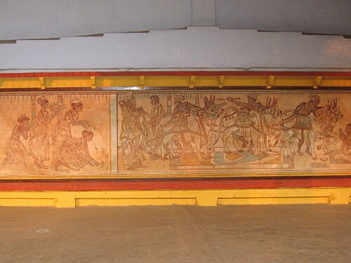
ในปี พ.ศ. 2464 รบินทรานาถ ทาโกร์ได้ซื้อคฤหาสน์หลังใหญ่พร้อมที่ดินโดยรอบในสุรุล ซึ่ง อยู่ห่างจาก สันตินิเกตัน 3 กิโลเมตร จากตระกูลสินหาแห่งไรปุระเขาได้ก่อตั้งสถาบันฟื้นฟูชนบทขึ้นในคฤหาสน์หลังนี้ในปี พ.ศ. 2465 โดยมีเลียวนาร์ด ไนท์ เอล์มเฮิร์สต์เป็นผู้อำนวยการคนแรกรบินทรานาถ ทาโกร์ , สันโตษ จันทรา มาซุมดาร์, กอร์โก ปาล โฆษ , กาลิโมฮัน โฆษ และคิม ทาโร กาซาฮาระ ได้เข้าร่วมงานกับเอล์มเฮิร์สต์[ 6 ]
วิทยาเขตที่สองของวิศวะภารตี ซึ่งอยู่ติดกัน นั้น ได้ถูกตั้งขึ้นในบริเวณเดียวกันในปี พ.ศ. 2466 และต่อมาได้เป็นที่รู้จักในชื่อศรีนิเกตัน ศิลปภาวนาที่สันตินิเกตันได้เริ่มฝึกอบรมด้านหัตถกรรมแล้ว ศรีนิเกตันรับช่วงต่อโดยมีวัตถุประสงค์เพื่อฟื้นฟูชีวิตให้สมบูรณ์แก่หมู่บ้านต่างๆ และช่วยให้ผู้คนสามารถแก้ไขปัญหาของตนเองได้ แทนที่จะให้คนอื่นมาแก้ไขปัญหาให้จากภายนอก มีการเน้นการศึกษาเชิงวิทยาศาสตร์เกี่ยวกับปัญหาของหมู่บ้านก่อนที่จะพยายามหาทางแก้ไข[ 6 ]
เพื่อให้สอดคล้องกับแนวคิดเกี่ยวกับการฟื้นฟูชีวิตในหมู่บ้าน จึงได้มีการริเริ่มโรงเรียนรูปแบบใหม่ขึ้น โดยมุ่งเน้นที่เด็กๆ จากหมู่บ้านใกล้เคียง ซึ่งจะนำความรู้ที่ได้รับมาใช้เพื่อประโยชน์ของชุมชนในหมู่บ้าน โรงเรียนสิกษาสัตรา (Siksha-Satra)เป็นโรงเรียนประเภทดังกล่าวที่จัดตั้งขึ้นที่สันตินิเกตันในปี 1924 แต่ได้ย้ายไปที่ศรีนิเกตันในปี 1927 องค์กร โลกาสิกษาสัมสาด (Loka-Siksha Samsad)ซึ่งเป็นองค์กรเพื่อเผยแพร่การศึกษานอกระบบในหมู่ผู้ที่ไม่สามารถเข้าถึงโอกาสทางการศึกษาตามปกติ ได้ก่อตั้งขึ้นในปี 1936 ตามมาด้วยสิกษาจาร ษา (Siksha Charcha)สำหรับการฝึกอบรมครูโรงเรียนในหมู่บ้านในปีถัดมา ในปี 1963 ได้มีการจัดตั้งวิทยาลัยเกษตรขึ้นที่ศรีนิเกตัน และในปี 1977 ได้มีการจัดตั้งศูนย์วิจัยชนบทขึ้น[ 6 ]
อ่านเพิ่มเติม
ดาส กุปตะ, อุมา (2022) ประวัติศาสตร์ศรีนิเกตัน: งานบุกเบิกของรพินทรนาถ ฐากูรในการฟื้นฟูชนบท หนังสือนิโยกิ.