
ทิไลยา
ทิไลยา ทิไลอา | |
|---|---|
หมู่บ้าน | |
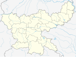  ทิไลยา ตั้งอยู่ในรัฐฌาร์ขันด์ ประเทศอินเดีย 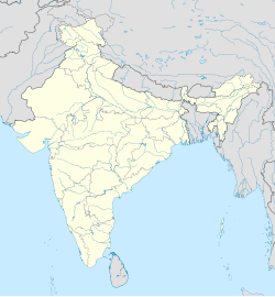 ทิไลยา ทิไลยา (อินเดีย) | |
| พิกัด: 24.3192200°N 85.5296900°E24°19′09″เหนือ85°31′47″ตะวันออก/ | |
| ประเทศ |  อินเดีย อินเดีย |
| สถานะ | จาร์คันด์ |
| เขต | โคเดอร์มา |
| ภาษา (*สำหรับรายละเอียดเกี่ยวกับภาษา โปรดดูที่Chandwara (เขตพัฒนาชุมชน)#ภาษาและศาสนา ) | |
| • เป็นทางการ | ภาษาฮินดีภาษาอูร์ดู |
| เขตเวลา | 5:30 น. ( เวลา UTC+ IST ) |
| เข็มหมุด | 825413 |
| การลงทะเบียนยานพาหนะ | เจเอช-12 |
| เมืองที่ใกล้ที่สุด | จุมรี เทไลยา , โคดาร์มา , ฮาซารีบากห์ , คยา |
| เว็บไซต์ | koderma |
ติไลยาเป็นหมู่บ้านในเขตการปกครองจันด์วารา ในตำบลโคเดอร์มาอำเภอโคเดอร์มาจังหวัดจาร์คันด์ประเทศอินเดีย
ภูมิศาสตร์


[[Chandwara]] (R)
\", \"description\": \" ([https://geohack.toolforge.org/geohack.php?params=24.39111;85.47611_dim:2000 24.39111,85.47611])\", \"marker-symbol\": \"-number-F11018333\", \"marker-size\": \"medium\", \"marker-color\": \"#c40000\" }, \"geometry\": {\"type\": \"Point\", \"coordinates\": [85.47611,24.39111] } }, { \"type\": \"Feature\", \"properties\": { \"title\": \"R
[[Dhab]] (R)
\", \"description\": \" ([https://geohack.toolforge.org/geohack.php?params=24.58;85.77167_dim:2000 24.58,85.77167])\", \"marker-symbol\": \"-number-F11018333\", \"marker-size\": \"medium\", \"marker-color\": \"#c40000\" }, \"geometry\": {\"type\": \"Point\", \"coordinates\": [85.77167,24.58] } }, { \"type\": \"Feature\", \"properties\": { \"title\": \"R
[[Jainagar, Koderma]] (R)
\", \"description\": \" ([https://geohack.toolforge.org/geohack.php?params=24.37583;85.64361_dim:2000 24.37583,85.64361])\", \"marker-symbol\": \"-number-F11018333\", \"marker-size\": \"medium\", \"marker-color\": \"#c40000\" }, \"geometry\": {\"type\": \"Point\", \"coordinates\": [85.64361,24.37583] } }, { \"type\": \"Feature\", \"properties\": { \"title\": \"R
[[Markacho]] (R)
\", \"description\": \" ([https://geohack.toolforge.org/geohack.php?params=24.32722;85.83444_dim:2000 24.32722,85.83444])\", \"marker-symbol\": \"-number-F11018333\", \"marker-size\": \"medium\", \"marker-color\": \"#c40000\" }, \"geometry\": {\"type\": \"Point\", \"coordinates\": [85.83444,24.32722] } }, { \"type\": \"Feature\", \"properties\": { \"title\": \"R
[[Nawadih, Markacho]] (R)
\", \"description\": \" ([https://geohack.toolforge.org/geohack.php?params=24.40722;85.81139_dim:2000 24.40722,85.81139])\", \"marker-symbol\": \"-number-F11018333\", \"marker-size\": \"medium\", \"marker-color\": \"#c40000\" }, \"geometry\": {\"type\": \"Point\", \"coordinates\": [85.81139,24.40722] } }, { \"type\": \"Feature\", \"properties\": { \"title\": \"R
[[Nawalsahi]] (R)
\", \"description\": \" ([https://geohack.toolforge.org/geohack.php?params=24.43083;85.7725_dim:2000 24.43083,85.7725])\", \"marker-symbol\": \"-number-F11018333\", \"marker-size\": \"medium\", \"marker-color\": \"#c40000\" }, \"geometry\": {\"type\": \"Point\", \"coordinates\": [85.7725,24.43083] } }, { \"type\": \"Feature\", \"properties\": { \"title\": \"R
[[Satgawan]] (R)
\", \"description\": \" ([https://geohack.toolforge.org/geohack.php?params=24.74639;85.76944_dim:2000 24.74639,85.76944])\", \"marker-symbol\": \"-number-F11018333\", \"marker-size\": \"medium\", \"marker-color\": \"#c40000\" }, \"geometry\": {\"type\": \"Point\", \"coordinates\": [85.76944,24.74639] } }, { \"type\": \"Feature\", \"properties\": { \"title\": \"R
Tilaiya (R)
\", \"description\": \" ([https://geohack.toolforge.org/geohack.php?params=24.33194;85.51667_dim:2000 24.33194,85.51667])\", \"marker-symbol\": \"-number-F11018333\", \"marker-size\": \"medium\", \"marker-color\": \"#000000\" }, \"geometry\": {\"type\": \"Point\", \"coordinates\": [85.51667,24.33194] } }, { \"type\": \"Feature\", \"properties\": { \"title\": \"R
[[Urwan]] (R)
\", \"description\": \" ([https://geohack.toolforge.org/geohack.php?params=24.35556;85.46528_dim:2000 24.35556,85.46528])\", \"marker-symbol\": \"-number-F11018333\", \"marker-size\": \"medium\", \"marker-color\": \"#c40000\" }, \"geometry\": {\"type\": \"Point\", \"coordinates\": [85.46528,24.35556] } }, { \"type\": \"Feature\", \"properties\": { \"title\": \"M
[[Kodarma]] (M)
\", \"description\": \" ([https://geohack.toolforge.org/geohack.php?params=24.47;85.6_dim:2000 24.47,85.6])\", \"marker-symbol\": \"-number-F11018333\", \"marker-size\": \"medium\", \"marker-color\": \"#c40000\" }, \"geometry\": {\"type\": \"Point\", \"coordinates\": [85.6,24.47] } }, { \"type\": \"Feature\", \"properties\": { \"title\": \"M
[[Jhumri Telaiya]] (M)
\", \"description\": \" ([https://geohack.toolforge.org/geohack.php?params=24.42889;85.53528_dim:2000 24.42889,85.53528])\", \"marker-symbol\": \"-number-F11018333\", \"marker-size\": \"medium\", \"marker-color\": \"#c40000\" }, \"geometry\": {\"type\": \"Point\", \"coordinates\": [85.53528,24.42889] } }, { \"type\": \"Feature\", \"properties\": { \"title\": \"CT
[[Domchanch]] (CT)
\", \"description\": \" ([https://geohack.toolforge.org/geohack.php?params=24.47306;85.68972_dim:2000 24.47306,85.68972])\", \"marker-symbol\": \"-number-F11018333\", \"marker-size\": \"medium\", \"marker-color\": \"#a40000\" }, \"geometry\": {\"type\": \"Point\", \"coordinates\": [85.68972,24.47306] } }, { \"type\": \"Feature\", \"properties\": { \"title\": \"CT
[[Bekobar]] (CT)
\", \"description\": \" ([https://geohack.toolforge.org/geohack.php?params=24.43056;85.58944_dim:2000 24.43056,85.58944])\", \"marker-symbol\": \"-number-F11018333\", \"marker-size\": \"medium\", \"marker-color\": \"#a40000\" }, \"geometry\": {\"type\": \"Point\", \"coordinates\": [85.58944,24.43056] } }, { \"type\": \"Feature\", \"properties\": { \"title\": \"CT
[[Karma, Koderma]] (CT)
\", \"description\": \" ([https://geohack.toolforge.org/geohack.php?params=24.44444;85.5525_dim:2000 24.44444,85.5525])\", \"marker-symbol\": \"-number-F11018333\", \"marker-size\": \"medium\", \"marker-color\": \"#a40000\" }, \"geometry\": {\"type\": \"Point\", \"coordinates\": [85.5525,24.44444] } }, { \"type\": \"Feature\", \"properties\": { \"title\": \"D
[[Tilaiya Dam]]
\", \"description\": \" ([https://geohack.toolforge.org/geohack.php?params=24.32389;85.52778_dim:2000 24.32389,85.52778])\", \"marker-symbol\": \"-number-F11018333\", \"marker-size\": \"medium\", \"marker-color\": \"#c42222\" }, \"geometry\": {\"type\": \"Point\", \"coordinates\": [85.52778,24.32389] } }, { \"type\": \"Feature\", \"properties\": { \"title\": \"P
[[Koderma Thermal Power Station]]
\", \"description\": \" ([https://geohack.toolforge.org/geohack.php?params=24.39111;85.56111_dim:2000 24.39111,85.56111])\", \"marker-symbol\": \"-number-F11018333\", \"marker-size\": \"medium\", \"marker-color\": \"#967117\" }, \"geometry\": {\"type\": \"Point\", \"coordinates\": [85.56111,24.39111] } }, { \"type\": \"Feature\", \"properties\": { \"title\": \"T
[[Koderma Wildlife Sanctuary]] (T)
\", \"description\": \" ([https://geohack.toolforge.org/geohack.php?params=24.56667;85.6_dim:2000 24.56667,85.6])\", \"marker-symbol\": \"-number-F11018333\", \"marker-size\": \"medium\", \"marker-color\": \"#74c365\" }, \"geometry\": {\"type\": \"Point\", \"coordinates\": [85.6,24.56667] } } ] } ]"}}">
ที่ตั้ง
เมืองติไลยาตั้งอยู่ที่พิกัด24°19′09″เหนือ85°31′47″ตะวันออก/24.3192200°N 85.5296900°E
ภาพรวม
เขตโคเดอร์มาเป็นพื้นที่ราบสูง และพื้นที่ประมาณ 60% ของพื้นที่ทั้งหมดปกคลุมด้วยป่าไม้ เขื่อนแห่งแรกของบริษัทดาโมดาร์วัลเลย์ที่ติไลยา สร้างขึ้นข้ามแม่น้ำบาราการ์และเปิดใช้งานในปี 1953 สถานีรถไฟโคเดอร์มาจังก์ชันได้กลายเป็นศูนย์กลางทางรถไฟที่สำคัญในภูมิภาคนี้ เขตนี้ส่วนใหญ่เป็นพื้นที่ชนบท มีประชากรในเมืองเพียง 19.72% [ 1 ] [ 2 ] [ 3 ]
หมายเหตุ: แผนที่ด้านข้างแสดงสถานที่สำคัญบางแห่งในเขตนี้ สถานที่ทั้งหมดที่ทำเครื่องหมายไว้ในแผนที่นี้เชื่อมโยงไปยังแผนที่ขนาดใหญ่แบบเต็มหน้าจอ
เขื่อนติไลยา
เขื่อนติไลยาถูกสร้างขึ้นโดยบริษัทดาโมดาร์วัลเลย์ข้ามแม่น้ำบาราการ์ในปี 1953 มี ความยาว 366 เมตร (1,201 ฟุต)และ สูง 30.18 เมตร (99.0 ฟุต)เขื่อนแห่งนี้มีทัศนียภาพอันงดงามพร้อมอ่างเก็บน้ำซึ่งมีขนาดกว้างถึง 36 ตารางกิโลเมตรสถานีไฟฟ้าพลังน้ำติไลยาตั้งอยู่บนฝั่งซ้ายของแม่น้ำบาราการ์ โครงสร้างทำจากคอนกรีตเสริมเหล็กทั้งหมด มีหน่วยผลิตไฟฟ้า 2 หน่วย หน่วยละ 2 เมกะวัตต์[ 4 ] [ 5 ]
ประชากรศาสตร์
หมู่บ้านกันติ ใกล้เขื่อนติไลยา ตั้งอยู่ทางฝั่งใต้ (หรือฝั่งซ้าย) ของแม่น้ำบาราการ์ มีประชากรตามสำมะโนประชากรของอินเดียปี 2011จำนวน 4,601 คน (ชาย 2,785 คน และหญิง 1,826 คน) ตั้งอยู่ในเขตพัฒนาชุมชนจันด์วาราถัดไปไม่ไกลนักคือบาร์กี ดัมไร มีประชากร 3,277 คน และโชตกี ดัมไร มีประชากร 1,290 คน ติไลยาเป็นหมู่บ้านเล็กกว่าที่อยู่อีกฝั่งหนึ่งของแม่น้ำบาราการ์ อาจเป็นที่มาของชื่อเขื่อน[ 6 ]
ขนส่ง
- เขื่อนติไลยาอยู่นอกทางหลวงปัตนา-รันชี ( NH 20 ) ซึ่งทางหลวงสายนี้ผ่านอ่างเก็บน้ำ[ 4 ] ในขณะที่เขื่อนติไลยา (DVC) อยู่ห่างจากNH 20 Urwan 7 กิโลเมตร (4.3 ไมล์)
- เขื่อนติไลยาอยู่ห่างจากสถานีรถไฟโคเดอร์มาจังก์ชันซึ่งตั้งอยู่ในจุมรี ติไลยา 20 กิโลเมตร (12 ไมล์)
- เมืองบาร์ฮีบนทางหลวงหมายเลข 19อยู่ห่างออกไป17 กิโลเมตร (11 ไมล์)