
Uruará
Coordinates: 3°43′04″S53°44′13″W / 3.71778°S 53.7369°W / -3.71778; -53.7369
Uruará | |
|---|---|
Municipality | |
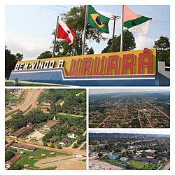 Images (top to bottom-left) Welcome to Uruará sign. Local church. Aerial photo of Uruará. CCJ/SCFV | |
 Flag 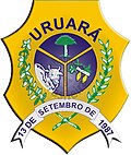 Coat of arms | |
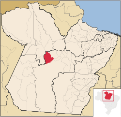 Location of Uruará from Pará | |
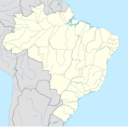  Uruará Location in Brazil | |
| Coordinates: 03°43′03″S53°44′12″W / 3.71750°S 53.73667°W / -3.71750; -53.73667 | |
| Country |  Brazil Brazil |
| Region | Northern |
| State | Pará |
| Mesoregion | Sudoeste Paraense |
| Bordering municipalites | Medicilândia, Placas, Santarém, Prainha, Mojuí dos Campos, Brasil Novo e Altamira |
| Distance away from Capital | 634km |
| Foundation | September 13, 1987 |
| Inaugurated | May 5, 1988 |
| Districts | Vila Brasil, Centro, Fluminense, Jardim Morumbi, Mini Indústria, Aeroporto |
| Government | |
| • Mayor | Carlos Antônio Zancan |
| Area | |
• Municipality | 4,166.550 sq mi (10,791.315 km2) |
| • Water | 0 sq mi (0 km2) 0% |
| • Urban | 3.68 sq mi (9.54 km2) |
| Dimensions | |
| • Length | 1.35 mi (2.18 km) |
| Elevation | 423 ft (129 m) |
| Population (2020 [1]) | |
• Municipality | 45,435 |
| • Density | 11/sq mi (4.2/km2) |
| Time zone | UTC−3 (BRT) |
| Area code | 1508159 |
Uruará is a municipality in the state of Pará in the Northern region of Brazil.[2][3][4][5]
Infrastructure
Communication
TV Vale do Uruará is Uruara's first television station in the municipality. Since its foundation in 1995. Then TV Talento sometime later.
Highway
Highways BR-230 and PA-370 is the only two highways that connects Uruará to Amazonas and Santarém respectively.
Sports
Uruará's major sports complex is the "Complexo Esportivo Vila Brasil" at the Vila Brasil district. The complex hosted events in the city over the years.
See also
 | This Pará, Brazil location article is a stub. You can help Wikipedia by adding missing information. |