
บันทาลา
บันทาลา | |
|---|---|
ละแวกบ้าน | |
 ศูนย์บริการของ Cognizant ที่บันตาลา | |
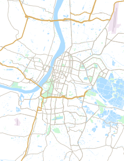  บันทาลา ตั้งอยู่ในเมืองโกลกาตา | |
| พิกัด: 22.507343°เหนือ 88.459054°ตะวันออก22°30′26″เหนือ88°27′33″ตะวันออก/ | |
| ประเทศ |  อินเดีย อินเดีย |
| สถานะ | รัฐเวสต์เบงกอล |
| เมือง | โกลกาตา |
| เขต | โกลกาตาและเซาท์ 24 ปาร์กานาส[ 1 ] [ 2 ] [ 3 ] |
| สถานีรถไฟใต้ดิน | ฤทวิก ฆฏัก (กำลังก่อสร้าง) |
| เทศบาลนคร | เทศบาลนครโกลกาตา |
| เขตKMC | 108 |
| ระดับความสูง | 36 ฟุต (11 เมตร) |
| ประชากร | |
• ทั้งหมด | สำหรับข้อมูลจำนวนประชากร โปรดดูที่หน้าข้อมูลเขต KMC ที่เชื่อมโยงไว้ |
| เขตเวลา | 5:30 น. (เวลาสหรัฐอเมริกาตะวันออก) |
| เข็มหมุด | 700150, 743502 |
| รหัสพื้นที่ | +91 33 |
| เขตเลือกตั้งโลคสภา | โกลกาตา ดักชินและจาดาฟปูร์ |
| เขตเลือกตั้งสภาวิธานสภา | กัสบาและบังการ์ |
บันตาลาเป็นเขตอุตสาหกรรมทางตะวันออกของเมืองโกลกาตาในรัฐเวสต์เบงกอลประเทศอินเดีย ตั้งอยู่บริเวณชายขอบด้านตะวันออกของเมืองโกลกาตา
ภูมิศาสตร์


[[Radhanagar, Sonarpur]] (CT)
\", \"description\": \" ([https://geohack.toolforge.org/geohack.php?params=22.45139;88.47167_dim:2000 22.45139,88.47167])\", \"marker-symbol\": \"-number-F111\", \"marker-size\": \"medium\", \"marker-color\": \"#a40000\" }, \"geometry\": {\"type\": \"Point\", \"coordinates\": [88.47167,22.45139] } }, { \"type\": \"Feature\", \"properties\": { \"title\": \"CT
[[Danga, Sonarpur]] (CT)
\", \"description\": \" ([https://geohack.toolforge.org/geohack.php?params=22.41944;88.35694_dim:2000 22.41944,88.35694])\", \"marker-symbol\": \"-number-F111\", \"marker-size\": \"medium\", \"marker-color\": \"#a40000\" }, \"geometry\": {\"type\": \"Point\", \"coordinates\": [88.35694,22.41944] } }, { \"type\": \"Feature\", \"properties\": { \"title\": \"CT
[[Ramchandrapur, Sonarpur]] (CT)
\", \"description\": \" ([https://geohack.toolforge.org/geohack.php?params=22.43333;88.37361_dim:2000 22.43333,88.37361])\", \"marker-symbol\": \"-number-F111\", \"marker-size\": \"medium\", \"marker-color\": \"#a40000\" }, \"geometry\": {\"type\": \"Point\", \"coordinates\": [88.37361,22.43333] } }, { \"type\": \"Feature\", \"properties\": { \"title\": \"CT
[[Bidyadharpur]] (CT)
\", \"description\": \" ([https://geohack.toolforge.org/geohack.php?params=22.40972;88.45361_dim:2000 22.40972,88.45361])\", \"marker-symbol\": \"-number-F111\", \"marker-size\": \"medium\", \"marker-color\": \"#a40000\" }, \"geometry\": {\"type\": \"Point\", \"coordinates\": [88.45361,22.40972] } }, { \"type\": \"Feature\", \"properties\": { \"title\": \"CT
[[Kalikapur, Sonarpur]] (CT)
\", \"description\": \" ([https://geohack.toolforge.org/geohack.php?params=22.42222;88.50833_dim:2000 22.42222,88.50833])\", \"marker-symbol\": \"-number-F111\", \"marker-size\": \"medium\", \"marker-color\": \"#a40000\" }, \"geometry\": {\"type\": \"Point\", \"coordinates\": [88.50833,22.42222] } }, { \"type\": \"Feature\", \"properties\": { \"title\": \"CT
[[Chak Baria]] (CT)
\", \"description\": \" ([https://geohack.toolforge.org/geohack.php?params=22.4375;88.51944_dim:2000 22.4375,88.51944])\", \"marker-symbol\": \"-number-F111\", \"marker-size\": \"medium\", \"marker-color\": \"#a40000\" }, \"geometry\": {\"type\": \"Point\", \"coordinates\": [88.51944,22.4375] } }, { \"type\": \"Feature\", \"properties\": { \"title\": \"CT
[[Sahebpur]] (CT)
\", \"description\": \" ([https://geohack.toolforge.org/geohack.php?params=22.39583;88.49167_dim:2000 22.39583,88.49167])\", \"marker-symbol\": \"-number-F111\", \"marker-size\": \"medium\", \"marker-color\": \"#a40000\" }, \"geometry\": {\"type\": \"Point\", \"coordinates\": [88.49167,22.39583] } }, { \"type\": \"Feature\", \"properties\": { \"title\": \"M
[[Rajpur Sonarpur]] (M)
\", \"description\": \" ([https://geohack.toolforge.org/geohack.php?params=22.44861;88.41806_dim:2000 22.44861,88.41806])\", \"marker-symbol\": \"-number-F111\", \"marker-size\": \"medium\", \"marker-color\": \"#800000\" }, \"geometry\": {\"type\": \"Point\", \"coordinates\": [88.41806,22.44861] } }, { \"type\": \"Feature\", \"properties\": { \"title\": \"N
[[Narendrapur]] (N)
\", \"description\": \" ([https://geohack.toolforge.org/geohack.php?params=22.44722;88.39667_dim:2000 22.44722,88.39667])\", \"marker-symbol\": \"-number-F111\", \"marker-size\": \"medium\", \"marker-color\": \"#c42222\" }, \"geometry\": {\"type\": \"Point\", \"coordinates\": [88.39667,22.44722] } }, { \"type\": \"Feature\", \"properties\": { \"title\": \"N
[[Subhashgram]] (N)
\", \"description\": \" ([https://geohack.toolforge.org/geohack.php?params=22.40694;88.43472_dim:2000 22.40694,88.43472])\", \"marker-symbol\": \"-number-F111\", \"marker-size\": \"medium\", \"marker-color\": \"#c42222\" }, \"geometry\": {\"type\": \"Point\", \"coordinates\": [88.43472,22.40694] } }, { \"type\": \"Feature\", \"properties\": { \"title\": \"CT
[[Maricha, Bhangar]] (CT)
\", \"description\": \" ([https://geohack.toolforge.org/geohack.php?params=22.51111;88.59389_dim:2000 22.51111,88.59389])\", \"marker-symbol\": \"-number-F111\", \"marker-size\": \"medium\", \"marker-color\": \"#a40000\" }, \"geometry\": {\"type\": \"Point\", \"coordinates\": [88.59389,22.51111] } }, { \"type\": \"Feature\", \"properties\": { \"title\": \"CT
[[Bhangar Raghunathpur]] (CT)
\", \"description\": \" ([https://geohack.toolforge.org/geohack.php?params=22.51944;88.50944_dim:2000 22.51944,88.50944])\", \"marker-symbol\": \"-number-F111\", \"marker-size\": \"medium\", \"marker-color\": \"#a40000\" }, \"geometry\": {\"type\": \"Point\", \"coordinates\": [88.50944,22.51944] } }, { \"type\": \"Feature\", \"properties\": { \"title\": \"CT
[[Gobindapur, Bhangar]] (CT)
\", \"description\": \" ([https://geohack.toolforge.org/geohack.php?params=22.50694;88.61667_dim:2000 22.50694,88.61667])\", \"marker-symbol\": \"-number-F111\", \"marker-size\": \"medium\", \"marker-color\": \"#a40000\" }, \"geometry\": {\"type\": \"Point\", \"coordinates\": [88.61667,22.50694] } }, { \"type\": \"Feature\", \"properties\": { \"title\": \"R
Bantala (R)
\", \"description\": \" ([https://geohack.toolforge.org/geohack.php?params=22.50278;88.45889_dim:2000 22.50278,88.45889])\", \"marker-symbol\": \"-number-F111\", \"marker-size\": \"medium\", \"marker-color\": \"#000000\" }, \"geometry\": {\"type\": \"Point\", \"coordinates\": [88.45889,22.50278] } }, { \"type\": \"Feature\", \"properties\": { \"title\": \"R
[[Uttar Kasipur]] (R)
\", \"description\": \" ([https://geohack.toolforge.org/geohack.php?params=22.57639;88.58667_dim:2000 22.57639,88.58667])\", \"marker-symbol\": \"-number-F111\", \"marker-size\": \"medium\", \"marker-color\": \"#c42222\" }, \"geometry\": {\"type\": \"Point\", \"coordinates\": [88.58667,22.57639] } }, { \"type\": \"Feature\", \"properties\": { \"title\": \"R
[[Nalmuri]] (R)
\", \"description\": \" ([https://geohack.toolforge.org/geohack.php?params=22.49306;88.60111_dim:2000 22.49306,88.60111])\", \"marker-symbol\": \"-number-F111\", \"marker-size\": \"medium\", \"marker-color\": \"#c42222\" }, \"geometry\": {\"type\": \"Point\", \"coordinates\": [88.60111,22.49306] } }, { \"type\": \"Feature\", \"properties\": { \"title\": \"R
[[Jirongachhi]] (R)
\", \"description\": \" ([https://geohack.toolforge.org/geohack.php?params=22.54667;88.63944_dim:2000 22.54667,88.63944])\", \"marker-symbol\": \"-number-F111\", \"marker-size\": \"medium\", \"marker-color\": \"#c42222\" }, \"geometry\": {\"type\": \"Point\", \"coordinates\": [88.63944,22.54667] } }, { \"type\": \"Feature\", \"properties\": { \"title\": \"N
[[Harinavi]] (N)
\", \"description\": \" ([https://geohack.toolforge.org/geohack.php?params=22.42222;88.41861_dim:2000 22.42222,88.41861])\", \"marker-symbol\": \"-number-F111\", \"marker-size\": \"medium\", \"marker-color\": \"#c42222\" }, \"geometry\": {\"type\": \"Point\", \"coordinates\": [88.41861,22.42222] } } ] } ]"}}">
ภาพรวมพื้นที่
เขตย่อยบารุอิปูร์เป็นเขตย่อยในชนบทที่มีระดับความเป็นเมืองปานกลาง ประชากร 31.05% อาศัยอยู่ในเขตเมือง และ 68.95% อาศัยอยู่ในเขตชนบท ในส่วนเหนือของเขตย่อย (แสดงในแผนที่ด้านข้าง) มีเมืองสำมะโนประชากร 10 แห่ง เขตทั้งหมดตั้งอยู่ในบริเวณสามเหลี่ยมปากแม่น้ำคงคาและส่วนเหนือของเขตย่อยเป็นที่ราบติดกับมหานครโกลกาตา[ 4 ] [ 5 ] [ 6 ]
หมายเหตุ: แผนที่ด้านข้างแสดงสถานที่สำคัญบางแห่งในหมู่บ้านจัดสรร สถานที่ทั้งหมดที่ทำเครื่องหมายไว้ในแผนที่นี้เชื่อมโยงไปยังแผนที่ขนาดใหญ่แบบเต็มหน้าจอ
ที่ตั้ง
บันตาลาตั้งอยู่ที่22.507343°N 88.459054° E22°30′26″เหนือ88°27′33″ตะวันออก/
การบริหารราชการส่วนท้องถิ่น
สถานีตำรวจ
สถานีตำรวจ Kolkata Leather Complex เป็นส่วนหนึ่งของ กองบังคับการ ตำรวจภาคตะวันออกของ เมืองโกลกาตา ตั้งอยู่ที่ Karaidanga, PO Bhojerhat-743502 [ 7 ]สถานีตำรวจ Kolkata Leather Complex ก่อตั้งขึ้นในปี 2017 ภายใต้เขตตำรวจอุตสาหกรรมภาคใต้ในเขต South 24 Parganas และโอนไปยังตำรวจโกลกาตาในปีเดียวกัน[ 8 ] [ 9 ]สถานีตำรวจ Kolkata Leather Complex มีเขตอำนาจศาลครอบคลุม บล็อก Bhangar IและBhangar II CD [ 10 ]
เศรษฐกิจ
คอมเพล็กซ์เครื่องหนังโกลกาตา
Kolkata Leather Complex เป็นพื้นที่ที่ตั้งของอุตสาหกรรมเครื่องหนังของ เมืองโกลกาตา ครอบคลุมพื้นที่450 เฮกตาร์ (4.5 ตารางกิโลเมตร)มีกำลังการผลิตหนังสัตว์ 1,000 ตันต่อวัน เป็นศูนย์ฟอกหนังที่สำคัญเป็นอันดับสองของประเทศ คิดเป็นประมาณ 22-25% ของการฟอกหนังทั้งหมดในประเทศ[ 11 ] Kolkata Leather Complex ก่อตั้งขึ้นตามคำสั่งของศาลฎีกาเมื่อวันที่ 19 ธันวาคม พ.ศ. 2539 ให้โรงฟอกหนังของเมืองย้ายไปที่บันตาลา และเปิดอย่างเป็นทางการเมื่อวันที่ 30 กรกฎาคม พ.ศ. 2548 [ 12 ]
เทคโนโลยีสารสนเทศ
เขต เศรษฐกิจพิเศษไอทีบันตาลาครอบคลุมพื้นที่ 130 เอเคอร์CTSดำเนินงานจากวิทยาเขตขนาด 20 เอเคอร์[ 13 ] [ 14 ]
ขนส่ง
ทางหลวง Basanti (ส่วนหนึ่งของ ทางหลวง หมายเลข 3 ของรัฐ ) เป็นเส้นทางหลักของพื้นที่ ถนนสายนี้เชื่อมต่อกับทางเลี่ยง EMที่Dhapa [ 15 ]
รสบัส
รถบัสส่วนตัว
- 213 Ghatakpukur - Babughat
- 213A Ghatakpukur - Rajabazar
- 213/1 Ghatakpukur - สวนพฤกษศาสตร์ Shibpur
- DN16/1 ธามาคาลี - บาราซัต
- SD24 Sonakhali, Basanti - สวนสัตว์ Alipore
รถบัส CTC
- C2A Ghatakpukur - Tollygunge
- T12 ไชทัล กัต - สถานีโฮวราห์
เส้นทางรถประจำทางที่ไม่มีหมายเลข
รถไฟ
สถานีรถไฟ Park Circusบนสาย Sealdah Southเป็นสถานีรถไฟที่ใกล้ที่สุด
ลิงก์ภายนอก
 คู่มือท่องเที่ยว เมืองโกลกาตา/ภาคตะวันออกจาก Wikivoyage