
Deulghata
| Deulghata | |
|---|---|
| Deulghat | |
  Location of Deulghata in West Bengal Show map of West Bengal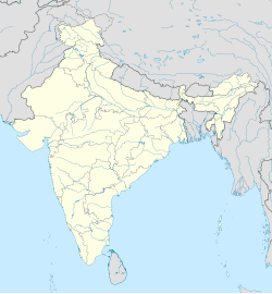 Deulghata (India) Show map of India | |
| 23°22′47″N86°07′52″E / 23.3796°N 86.1311°E / 23.3796; 86.1311 | |
| Type | Ancient/Medieval temples |
| Location | Arsha (community development block), Purulia district |
| Region | West Bengal, India |
| History | |
| Built | 9th/10th century |
Deulghata (also called Deulghat), near Baram in the Arsha (community development block) in the Purulia Sadar subdivision of the Purulia district of West Bengal, India. It has ancient/ medieval temples.
Geography


[[Lagda]] (CT)
\", \"description\": \" ([https://geohack.toolforge.org/geohack.php?params=23.37222;86.32083_dim:2000 23.37222,86.32083])\", \"marker-symbol\": \"-number-F10963889\", \"marker-size\": \"medium\", \"marker-color\": \"#a40000\" }, \"geometry\": {\"type\": \"Point\", \"coordinates\": [86.32083,23.37222] } }, { \"type\": \"Feature\", \"properties\": { \"title\": \"CT
[[Raghabpur]] (CT)
\", \"description\": \" ([https://geohack.toolforge.org/geohack.php?params=23.36528;86.36111_dim:2000 23.36528,86.36111])\", \"marker-symbol\": \"-number-F10963889\", \"marker-size\": \"medium\", \"marker-color\": \"#a40000\" }, \"geometry\": {\"type\": \"Point\", \"coordinates\": [86.36111,23.36528] } }, { \"type\": \"Feature\", \"properties\": { \"title\": \"CT
[[Hutmura]] (CT)
\", \"description\": \" ([https://geohack.toolforge.org/geohack.php?params=23.35444;86.48556_dim:2000 23.35444,86.48556])\", \"marker-symbol\": \"-number-F10963889\", \"marker-size\": \"medium\", \"marker-color\": \"#a40000\" }, \"geometry\": {\"type\": \"Point\", \"coordinates\": [86.48556,23.35444] } }, { \"type\": \"Feature\", \"properties\": { \"title\": \"CT
[[Balarampur, Purulia]] (CT)
\", \"description\": \" ([https://geohack.toolforge.org/geohack.php?params=23.11667;86.22_dim:2000 23.11667,86.22])\", \"marker-symbol\": \"-number-F10963889\", \"marker-size\": \"medium\", \"marker-color\": \"#a40000\" }, \"geometry\": {\"type\": \"Point\", \"coordinates\": [86.22,23.11667] } }, { \"type\": \"Feature\", \"properties\": { \"title\": \"M
[[Purulia]] (M)
\", \"description\": \" ([https://geohack.toolforge.org/geohack.php?params=23.34;86.36_dim:2000 23.34,86.36])\", \"marker-symbol\": \"-number-F10963889\", \"marker-size\": \"medium\", \"marker-color\": \"#800000\" }, \"geometry\": {\"type\": \"Point\", \"coordinates\": [86.36,23.34] } }, { \"type\": \"Feature\", \"properties\": { \"title\": \"H
[[Anaijambad]] (H)
\", \"description\": \" ([https://geohack.toolforge.org/geohack.php?params=23.27861;86.44222_dim:2000 23.27861,86.44222])\", \"marker-symbol\": \"-number-F10963889\", \"marker-size\": \"medium\", \"marker-color\": \"#aa6666\" }, \"geometry\": {\"type\": \"Point\", \"coordinates\": [86.44222,23.27861] } }, { \"type\": \"Feature\", \"properties\": { \"title\": \"R
[[Arsha, Purulia]] (R)
\", \"description\": \" ([https://geohack.toolforge.org/geohack.php?params=23.33111;86.17222_dim:2000 23.33111,86.17222])\", \"marker-symbol\": \"-number-F10963889\", \"marker-size\": \"medium\", \"marker-color\": \"#c42222\" }, \"geometry\": {\"type\": \"Point\", \"coordinates\": [86.17222,23.33111] } }, { \"type\": \"Feature\", \"properties\": { \"title\": \"R
[[Baghadih]] (R)
\", \"description\": \" ([https://geohack.toolforge.org/geohack.php?params=23.08611;86.23389_dim:2000 23.08611,86.23389])\", \"marker-symbol\": \"-number-F10963889\", \"marker-size\": \"medium\", \"marker-color\": \"#c42222\" }, \"geometry\": {\"type\": \"Point\", \"coordinates\": [86.23389,23.08611] } }, { \"type\": \"Feature\", \"properties\": { \"title\": \"R
[[Bongabari]] (R)
\", \"description\": \" ([https://geohack.toolforge.org/geohack.php?params=23.35778;86.38722_dim:2000 23.35778,86.38722])\", \"marker-symbol\": \"-number-F10963889\", \"marker-size\": \"medium\", \"marker-color\": \"#c42222\" }, \"geometry\": {\"type\": \"Point\", \"coordinates\": [86.38722,23.35778] } }, { \"type\": \"Feature\", \"properties\": { \"title\": \"R
[[Chakaltor]] (R)
\", \"description\": \" ([https://geohack.toolforge.org/geohack.php?params=23.23972;86.32556_dim:2000 23.23972,86.32556])\", \"marker-symbol\": \"-number-F10963889\", \"marker-size\": \"medium\", \"marker-color\": \"#c42222\" }, \"geometry\": {\"type\": \"Point\", \"coordinates\": [86.32556,23.23972] } }, { \"type\": \"Feature\", \"properties\": { \"title\": \"R
[[Chakda, Purulia]] (R)
\", \"description\": \" ([https://geohack.toolforge.org/geohack.php?params=23.31528;86.33611_dim:2000 23.31528,86.33611])\", \"marker-symbol\": \"-number-F10963889\", \"marker-size\": \"medium\", \"marker-color\": \"#c42222\" }, \"geometry\": {\"type\": \"Point\", \"coordinates\": [86.33611,23.31528] } }, { \"type\": \"Feature\", \"properties\": { \"title\": \"H
[[Chharra, Purulia]] (H)
\", \"description\": \" ([https://geohack.toolforge.org/geohack.php?params=23.38111;86.41694_dim:2000 23.38111,86.41694])\", \"marker-symbol\": \"-number-F10963889\", \"marker-size\": \"medium\", \"marker-color\": \"#aa6666\" }, \"geometry\": {\"type\": \"Point\", \"coordinates\": [86.41694,23.38111] } }, { \"type\": \"Feature\", \"properties\": { \"title\": \"R
[[Daldali]] (R)
\", \"description\": \" ([https://geohack.toolforge.org/geohack.php?params=23.30444;86.61194_dim:2000 23.30444,86.61194])\", \"marker-symbol\": \"-number-F10963889\", \"marker-size\": \"medium\", \"marker-color\": \"#c42222\" }, \"geometry\": {\"type\": \"Point\", \"coordinates\": [86.61194,23.30444] } }, { \"type\": \"Feature\", \"properties\": { \"title\": \"R
[[Hura, Purulia]] (R)
\", \"description\": \" ([https://geohack.toolforge.org/geohack.php?params=23.3;86.65_dim:2000 23.3,86.65])\", \"marker-symbol\": \"-number-F10963889\", \"marker-size\": \"medium\", \"marker-color\": \"#c42222\" }, \"geometry\": {\"type\": \"Point\", \"coordinates\": [86.65,23.3] } }, { \"type\": \"Feature\", \"properties\": { \"title\": \"R
[[Sirkabad]] (R)
\", \"description\": \" ([https://geohack.toolforge.org/geohack.php?params=23.26944;86.19278_dim:2000 23.26944,86.19278])\", \"marker-symbol\": \"-number-F10963889\", \"marker-size\": \"medium\", \"marker-color\": \"#c42222\" }, \"geometry\": {\"type\": \"Point\", \"coordinates\": [86.19278,23.26944] } }, { \"type\": \"Feature\", \"properties\": { \"title\": \"R
[[Hatuara]] (R)
\", \"description\": \" ([https://geohack.toolforge.org/geohack.php?params=23.34583;86.40611_dim:2000 23.34583,86.40611])\", \"marker-symbol\": \"-number-F10963889\", \"marker-size\": \"medium\", \"marker-color\": \"#c42222\" }, \"geometry\": {\"type\": \"Point\", \"coordinates\": [86.40611,23.34583] } }, { \"type\": \"Feature\", \"properties\": { \"title\": \"H
Deulghata (H)
\", \"description\": \" ([https://geohack.toolforge.org/geohack.php?params=23.38194;86.13111_dim:2000 23.38194,86.13111])\", \"marker-symbol\": \"-number-F10963889\", \"marker-size\": \"medium\", \"marker-color\": \"#000000\" }, \"geometry\": {\"type\": \"Point\", \"coordinates\": [86.13111,23.38194] } }, { \"type\": \"Feature\", \"properties\": { \"title\": \"F
[[Sidho Kanho Birsha University]] (F)
\", \"description\": \" ([https://geohack.toolforge.org/geohack.php?params=23.36111;86.33972_dim:2000 23.36111,86.33972])\", \"marker-symbol\": \"-number-F10963889\", \"marker-size\": \"medium\", \"marker-color\": \"#967117\" }, \"geometry\": {\"type\": \"Point\", \"coordinates\": [86.33972,23.36111] } }, { \"type\": \"Feature\", \"properties\": { \"title\": \"F
[[Sainik School, Purulia]] (F)
\", \"description\": \" ([https://geohack.toolforge.org/geohack.php?params=23.35;86.34083_dim:2000 23.35,86.34083])\", \"marker-symbol\": \"-number-F10963889\", \"marker-size\": \"medium\", \"marker-color\": \"#967117\" }, \"geometry\": {\"type\": \"Point\", \"coordinates\": [86.34083,23.35] } } ] } ]"}}">
Location
Deulghata is located at 23°22′47″N86°07′52″E / 23.3796°N 86.1311°E / 23.3796; 86.1311
Note: The map alongside presents some of the notable locations in the subdivision. All places marked in the map are linked in the larger full screen map.
Background
Deulghata, on the bank of the Kangsabati, some 6 km south of Jaypur and about 25 km from Purulia town once had 15 temples and some small shrines, built around the 9th-10th century. The Archaeological Survey of India has taken over the place that includes three tall surviving temples.[1]
History
In 1864–65, E.T. Dalton, Commissioner of Chhotanagpur, visited the place and found three large temples in the midst of the ruins of many more.[2] J.D. Beglar, of the Archaeological Survey of India, also reports the three temples in 1872–73.[3]
Rekha deul
David J. McCutchionกล่าวว่ารูปแบบสถาปัตยกรรมดั้งเดิมที่โดดเด่นสำหรับวัดในพื้นที่ทางตะวันตกของเบงกอลในยุคก่อนมุสลิมคือเรขาเดอุลทรงโค้งสูง และมีการพัฒนาอย่างต่อเนื่องตั้งแต่ปลายศตวรรษที่ 7 หรือต้นศตวรรษที่ 8 จนถึงประมาณศตวรรษที่ 12 โดยมีความซับซ้อนและความสูงเพิ่มขึ้น แต่ยังคงรักษาคุณลักษณะพื้นฐานไว้ วัดเหล่านี้มี “ ศิขระทรง โค้ง พร้อม การตกแต่งด้วยฉัตร เจดีย์ประดับด้วยยอดอะมาลากะและกาลาสะขนาด ใหญ่ ตัวอย่างของเดอุล ที่ทรุดโทรมเหล่านี้ ยังคงตั้งอยู่ที่Satdeula (ใน Bardhaman), BahularaและSonatapal (ใน Bankura) และ Deulghat (ใน Purulia) บนเดอุล อิฐ ที่กล่าวถึงไปแล้วข้างต้น รวมถึงJatar (ใน 24 Parganas) และPara (ใน Purulia) “เราพบ งาน ปูนปั้น ที่กว้างขวางและประณีตอย่างน่าทึ่ง บนอิฐแกะสลัก” [ 4 ]
สถานการณ์ปัจจุบัน
มีเดอุล อิฐสูงสามหลังที่ตกแต่ง ด้วยปูนปั้นวิหารอื่นๆ ที่เดอุลฆาตะส่วนใหญ่สร้างด้วยหินได้พังทลายลงแล้ว “วิหารทั้งสามหลังมี ทางเข้า โค้ง รูปสามเหลี่ยม พร้อมหอคอยที่สร้างขึ้นโดยการโค้งภายใน ทางเข้าโค้งของวิหารทางใต้สูงและสง่างามด้วยเส้นโค้งที่ละเอียดอ่อน วิหารทั้งหมดมีงานก่ออิฐโค้งที่ประณีตพร้อมการตกแต่งด้วยปูนปั้น พวกมันแสดงภาพเจดีย์และลวดลายเรขาขนาดเล็ก การตกแต่งด้วยปูนปั้นประกอบด้วยลวดลายม้วนงอที่มีห่านและใบไม้ คนแคระที่คุ้นเคยจาก ศิลปะยุค ปาละ - เสนาปูนปั้นนั้นละเอียดและดูเหมือนจะมีอายุอยู่ในช่วงเวลาเดียวกันกับ วิหาร บาฮูลาราและสัตเดอุลยา ” [ 1 ]
แกลเลอรี่ภาพ
 อิฐสองก้อน คู่
 เดอุลแรก
 เดอุลที่สอง
 พระแม่ทุรคา
 ผนังตกแต่ง
 ผนังตกแต่ง
ลิงก์ภายนอก
