มัลลาร์ปูร์
มัลลาร์ปูร์ | |
|---|---|
เมืองสำมะโนประชากร | |
 งานแกะสลักดินเผา ณ บริเวณวัดมัลเลสวารา | |
  มัลลาร์ปูร์ ตั้งอยู่ในรัฐเวสต์เบงกอล ประเทศอินเดีย | |
| พิกัด: 24°05′02″N 87°42′36″E / 24.083789°N 87.709934°E / 24.083789; 87.709934 | |
| ประเทศ |  อินเดีย อินเดีย |
| สถานะ |  รัฐเวสต์เบงกอล รัฐเวสต์เบงกอล |
| เขต | บีร์บุม |
| พื้นที่ | |
• ทั้งหมด | 5.30 ตาราง กิโลเมตร(2.05 ตารางไมล์) |
| ระดับความสูง | 47 เมตร (154 ฟุต) |
| ประชากร (2011) | |
• ทั้งหมด | 6,471 |
| • ความหนาแน่น | 1,220/ตร.กม. ( 3,160/ตร. ไมล์) |
| ภาษา | |
| • เป็นทางการ | เบงกาลี |
| • เจ้าหน้าที่ เพิ่มเติม | ภาษาอังกฤษ |
| เขตเวลา | 5:30 น. ( เวลาอินเดีย ) (UTC+1 ) |
| เข็มหมุด | 731216 |
| หมายเลขโทรศัพท์/ รหัสพื้นที่ | +91 / 03461 |
| เขตเลือกตั้งโลคสภา | โบลปูร์ |
| เขตเลือกตั้งสภาวิธานสภา | มายูเรสวาร์ |
| เว็บไซต์ | birbhum |
มัลลาร์ปูร์เป็นเมืองที่ตั้งอยู่ในเขตสำมะโนประชากรบล็อกมายูเรสวาร์ 1 ในตำบลรามปูร์ฮัตอำเภอเบอร์บุมรัฐ เวส ต์เบงกอลประเทศอินเดีย
นิรุกติศาสตร์
ชื่อเมืองมัลลาร์ปุระมาจากราชวงศ์มัลลา อาจมีความเกี่ยวข้องกับพระเจ้าวีรหัมบีร์กษัตริย์ ผู้ยิ่งใหญ่แห่งราชวงศ์มัลลา
ภูมิศาสตร์


[[Murarai]] (CT)
\", \"description\": \" ([https://geohack.toolforge.org/geohack.php?params=24.42222;87.8575_dim:2000 24.42222,87.8575])\", \"marker-symbol\": \"-number-F11208333\", \"marker-size\": \"medium\", \"marker-color\": \"#a40000\" }, \"geometry\": {\"type\": \"Point\", \"coordinates\": [87.8575,24.42222] } }, { \"type\": \"Feature\", \"properties\": { \"title\": \"CT
[[Ambhua]] (CT)
\", \"description\": \" ([https://geohack.toolforge.org/geohack.php?params=24.55694;87.865_dim:2000 24.55694,87.865])\", \"marker-symbol\": \"-number-F11208333\", \"marker-size\": \"medium\", \"marker-color\": \"#a40000\" }, \"geometry\": {\"type\": \"Point\", \"coordinates\": [87.865,24.55694] } }, { \"type\": \"Feature\", \"properties\": { \"title\": \"CT
[[Barua Gopalpur]] (CT)
\", \"description\": \" ([https://geohack.toolforge.org/geohack.php?params=24.56194;87.81222_dim:2000 24.56194,87.81222])\", \"marker-symbol\": \"-number-F11208333\", \"marker-size\": \"medium\", \"marker-color\": \"#a40000\" }, \"geometry\": {\"type\": \"Point\", \"coordinates\": [87.81222,24.56194] } }, { \"type\": \"Feature\", \"properties\": { \"title\": \"CT
[[Kashimnagar]] (CT)
\", \"description\": \" ([https://geohack.toolforge.org/geohack.php?params=24.4625;87.925_dim:2000 24.4625,87.925])\", \"marker-symbol\": \"-number-F11208333\", \"marker-size\": \"medium\", \"marker-color\": \"#a40000\" }, \"geometry\": {\"type\": \"Point\", \"coordinates\": [87.925,24.4625] } }, { \"type\": \"Feature\", \"properties\": { \"title\": \"CT
[[Bishnupur, Birbhum]] (CT)
\", \"description\": \" ([https://geohack.toolforge.org/geohack.php?params=24.12222;87.89028_dim:2000 24.12222,87.89028])\", \"marker-symbol\": \"-number-F11208333\", \"marker-size\": \"medium\", \"marker-color\": \"#a40000\" }, \"geometry\": {\"type\": \"Point\", \"coordinates\": [87.89028,24.12222] } }, { \"type\": \"Feature\", \"properties\": { \"title\": \"CT
[[Fatehpur, Birbhum]] (CT)
\", \"description\": \" ([https://geohack.toolforge.org/geohack.php?params=24.07917;87.74722_dim:2000 24.07917,87.74722])\", \"marker-symbol\": \"-number-F11208333\", \"marker-size\": \"medium\", \"marker-color\": \"#a40000\" }, \"geometry\": {\"type\": \"Point\", \"coordinates\": [87.74722,24.07917] } }, { \"type\": \"Feature\", \"properties\": { \"title\": \"M
[[Nalhati]] (M)
\", \"description\": \" ([https://geohack.toolforge.org/geohack.php?params=24.29389;87.83889_dim:2000 24.29389,87.83889])\", \"marker-symbol\": \"-number-F11208333\", \"marker-size\": \"medium\", \"marker-color\": \"#a40000\" }, \"geometry\": {\"type\": \"Point\", \"coordinates\": [87.83889,24.29389] } }, { \"type\": \"Feature\", \"properties\": { \"title\": \"M
[[Rampurhat]] (M)
\", \"description\": \" ([https://geohack.toolforge.org/geohack.php?params=24.18611;87.77722_dim:2000 24.18611,87.77722])\", \"marker-symbol\": \"-number-F11208333\", \"marker-size\": \"medium\", \"marker-color\": \"#a40000\" }, \"geometry\": {\"type\": \"Point\", \"coordinates\": [87.77722,24.18611] } }, { \"type\": \"Feature\", \"properties\": { \"title\": \"R
[[Mayureswar]] (R)
\", \"description\": \" ([https://geohack.toolforge.org/geohack.php?params=23.99361;87.76472_dim:2000 23.99361,87.76472])\", \"marker-symbol\": \"-number-F11208333\", \"marker-size\": \"medium\", \"marker-color\": \"#a40000\" }, \"geometry\": {\"type\": \"Point\", \"coordinates\": [87.76472,23.99361] } }, { \"type\": \"Feature\", \"properties\": { \"title\": \"R
[[Margram]] (R)
\", \"description\": \" ([https://geohack.toolforge.org/geohack.php?params=24.14583;87.84222_dim:2000 24.14583,87.84222])\", \"marker-symbol\": \"-number-F11208333\", \"marker-size\": \"medium\", \"marker-color\": \"#a40000\" }, \"geometry\": {\"type\": \"Point\", \"coordinates\": [87.84222,24.14583] } }, { \"type\": \"Feature\", \"properties\": { \"title\": \"R
[[Tarapith]] (R)
\", \"description\": \" ([https://geohack.toolforge.org/geohack.php?params=24.10833;87.79722_dim:2000 24.10833,87.79722])\", \"marker-symbol\": \"-number-F11208333\", \"marker-size\": \"medium\", \"marker-color\": \"#a40000\" }, \"geometry\": {\"type\": \"Point\", \"coordinates\": [87.79722,24.10833] } }, { \"type\": \"Feature\", \"properties\": { \"title\": \"R
Mallarpur (R)
\", \"description\": \" ([https://geohack.toolforge.org/geohack.php?params=24.07833;87.71278_dim:2000 24.07833,87.71278])\", \"marker-symbol\": \"-number-F11208333\", \"marker-size\": \"medium\", \"marker-color\": \"#000000\" }, \"geometry\": {\"type\": \"Point\", \"coordinates\": [87.71278,24.07833] } }, { \"type\": \"Feature\", \"properties\": { \"title\": \"R
[[Paikar]] (R)
\", \"description\": \" ([https://geohack.toolforge.org/geohack.php?params=24.42639;87.91111_dim:2000 24.42639,87.91111])\", \"marker-symbol\": \"-number-F11208333\", \"marker-size\": \"medium\", \"marker-color\": \"#a40000\" }, \"geometry\": {\"type\": \"Point\", \"coordinates\": [87.91111,24.42639] } }, { \"type\": \"Feature\", \"properties\": { \"title\": \"R
[[Lohapur]] (R)
\", \"description\": \" ([https://geohack.toolforge.org/geohack.php?params=24.31222;87.96222_dim:2000 24.31222,87.96222])\", \"marker-symbol\": \"-number-F11208333\", \"marker-size\": \"medium\", \"marker-color\": \"#a40000\" }, \"geometry\": {\"type\": \"Point\", \"coordinates\": [87.96222,24.31222] } }, { \"type\": \"Feature\", \"properties\": { \"title\": \"R
[[Kotasur]] (R)
\", \"description\": \" ([https://geohack.toolforge.org/geohack.php?params=23.96361;87.74583_dim:2000 23.96361,87.74583])\", \"marker-symbol\": \"-number-F11208333\", \"marker-size\": \"medium\", \"marker-color\": \"#a40000\" }, \"geometry\": {\"type\": \"Point\", \"coordinates\": [87.74583,23.96361] } }, { \"type\": \"Feature\", \"properties\": { \"title\": \"R
[[Hansan, Birbhum]] (R)
\", \"description\": \" ([https://geohack.toolforge.org/geohack.php?params=24.20139;87.88222_dim:2000 24.20139,87.88222])\", \"marker-symbol\": \"-number-F11208333\", \"marker-size\": \"medium\", \"marker-color\": \"#a40000\" }, \"geometry\": {\"type\": \"Point\", \"coordinates\": [87.88222,24.20139] } }, { \"type\": \"Feature\", \"properties\": { \"title\": \"R
[[Ekachakra]] (R)
\", \"description\": \" ([https://geohack.toolforge.org/geohack.php?params=24.05;87.84778_dim:2000 24.05,87.84778])\", \"marker-symbol\": \"-number-F11208333\", \"marker-size\": \"medium\", \"marker-color\": \"#a40000\" }, \"geometry\": {\"type\": \"Point\", \"coordinates\": [87.84778,24.05] } }, { \"type\": \"Feature\", \"properties\": { \"title\": \"R
[[Lokpara]] (R)
\", \"description\": \" ([https://geohack.toolforge.org/geohack.php?params=23.93833;87.835_dim:2000 23.93833,87.835])\", \"marker-symbol\": \"-number-F11208333\", \"marker-size\": \"medium\", \"marker-color\": \"#a40000\" }, \"geometry\": {\"type\": \"Point\", \"coordinates\": [87.835,23.93833] } }, { \"type\": \"Feature\", \"properties\": { \"title\": \"R
[[Madian, Birbhum]] (R)
\", \"description\": \" ([https://geohack.toolforge.org/geohack.php?params=24.05417;87.69528_dim:2000 24.05417,87.69528])\", \"marker-symbol\": \"-number-F11208333\", \"marker-size\": \"medium\", \"marker-color\": \"#a40000\" }, \"geometry\": {\"type\": \"Point\", \"coordinates\": [87.69528,24.05417] } }, { \"type\": \"Feature\", \"properties\": { \"title\": \"R
[[Basoa]] (R)
\", \"description\": \" ([https://geohack.toolforge.org/geohack.php?params=24.14722;87.88028_dim:2000 24.14722,87.88028])\", \"marker-symbol\": \"-number-F11208333\", \"marker-size\": \"medium\", \"marker-color\": \"#a40000\" }, \"geometry\": {\"type\": \"Point\", \"coordinates\": [87.88028,24.14722] } }, { \"type\": \"Feature\", \"properties\": { \"title\": \"R
[[Chakmandala]] (R)
\", \"description\": \" ([https://geohack.toolforge.org/geohack.php?params=24.19722;87.725_dim:2000 24.19722,87.725])\", \"marker-symbol\": \"-number-F11208333\", \"marker-size\": \"medium\", \"marker-color\": \"#a40000\" }, \"geometry\": {\"type\": \"Point\", \"coordinates\": [87.725,24.19722] } }, { \"type\": \"Feature\", \"properties\": { \"title\": \"R
[[Satpalsa]] (R)
\", \"description\": \" ([https://geohack.toolforge.org/geohack.php?params=23.91667;87.79583_dim:2000 23.91667,87.79583])\", \"marker-symbol\": \"-number-F11208333\", \"marker-size\": \"medium\", \"marker-color\": \"#a40000\" }, \"geometry\": {\"type\": \"Point\", \"coordinates\": [87.79583,23.91667] } }, { \"type\": \"Feature\", \"properties\": { \"title\": \"R
[[Rajgram, West Bengal|Rajgram]] (R)
\", \"description\": \" ([https://geohack.toolforge.org/geohack.php?params=24.53472;87.82222_dim:2000 24.53472,87.82222])\", \"marker-symbol\": \"-number-F11208333\", \"marker-size\": \"medium\", \"marker-color\": \"#a40000\" }, \"geometry\": {\"type\": \"Point\", \"coordinates\": [87.82222,24.53472] } } ] } ]"}}">
ที่ตั้ง
หมู่บ้านสี่แห่งที่แยกจากกัน ได้แก่อัมบาฟาเตห์ปูร์บาฮินา และมัลลาร์ปูร์ ได้รวมตัวกันก่อตั้งเป็นเมืองเล็กๆ ชื่อมัลลาร์ปูร์
ภาพสะท้อนของอดีต
เมื่อขับรถไปยังมัลลาร์ปูร์ ออกจากทางหลวงที่พลุกพล่านในปัจจุบัน จะเห็นซากปรักหักพังเก่าแก่ขนาดใหญ่ตั้งตระหง่านอยู่เหนือทิวทัศน์โดยรอบเป็นระยะทางหลายไมล์ นี่คือคาเชรี บารี หรือศาล สร้างขึ้นในปลายศตวรรษที่ 18 อาคารแห่งนี้คงจะงดงามมากในยุครุ่งเรือง เมื่อเดินผ่านประตูเหล็กที่เคยยิ่งใหญ่แต่ตอนนี้ขึ้นสนิมแล้ว จะพบกับสนามหญ้าด้านหน้ายาวประมาณ 50 หลา ที่ปลายสุดของสนามหญ้า คาเชรี บารี ซึ่งเป็นบ้านผีสิง ตั้งอยู่เหมือนแมงมุมยักษ์[ 1 ] [ 2 ]
มี " Vanavasi Kalyan Ashram Hostel" ใกล้กับAmbaที่ Mollarpur ข้างอาศรม Ramkrishna [ 3 ]
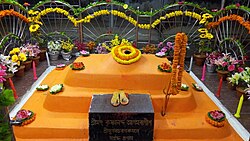
มีสถานที่ฝังพระศพ (สมาธิ) ของพระกฤษณนันทน์ อคามาวากีษะในบริเวณวัด โมลลศวร พระศิวะKrishnananda Agamavagishaเป็นตันตริกผู้ยิ่งใหญ่และเป็นผู้เขียน "Brihat Tantrasara" และเป็นผู้ประดิษฐ์ เทวรูป Dakshina KaliและกูรูของRamprasad Sen [ 4 ]
หมายเหตุ: แผนที่ด้านข้างแสดงสถานที่สำคัญบางแห่งในบริเวณนี้ สถานที่ทั้งหมดที่ทำเครื่องหมายไว้ในแผนที่นี้เชื่อมโยงไปยังแผนที่ขนาดใหญ่แบบเต็มหน้าจอ
สถานีตำรวจ
มีสถานีตำรวจอยู่ที่มัลลาร์ปูร์[ 5 ]
บล็อกซีดี HQ
สำนักงานใหญ่ของบล็อก Mayureswar I CD ตั้งอยู่ที่ Mallarpur [ 6 ]
ข้อมูลประชากร
ตามสำมะโนประชากรของอินเดียปี 2554มัลลาร์ปูร์มีประชากรทั้งหมด 6,471 คน โดยเป็นชาย 3,310 คน (51%) และหญิง 3,161 คน (49%) ประชากรที่มีอายุต่ำกว่า 6 ปีมีจำนวน 735 คน จำนวนผู้รู้หนังสือในมัลลาร์ปูร์มีทั้งหมด 4,584 คน (79.92% ของประชากรที่มีอายุมากกว่า 6 ปี) [ 7 ]
ขนส่ง


Mallarpur เป็นสถานีบนเส้นทางSahibganj Loop [ 8 ]
เนื่องจากทางหลวงปานาการ์ห์-มอร์แกรมตัดผ่านเมือง การคมนาคมทางถนนจึงได้รับการพัฒนาอย่างดีควบคู่ไปกับการคมนาคมทางรถไฟทางหลวงหมายเลข 14 (หมายเลขเดิมคือทางหลวงหมายเลข 60) ผ่านเมืองมัลลาร์ปูร์ไปยังศูนย์กลางอำเภอสุรีผ่านเมืองกันปูร์และเดอชา
การศึกษาและการฝึกอบรม
Mallarpur High School, Mollarpur Dharani Deben Siksha Niketan และ Mollarpur Girl's High School เป็นโรงเรียนที่มีชื่อเสียงใน Mollarpur Turku Hansda-Lapsa Hemram Mahavidyalayaตั้งอยู่ใกล้กับ Mallarpur (บน NH 14 ที่Madian )
มีโรงเรียน สถาบัน และองค์กรต่างๆ ทั้งภาครัฐและเอกชนที่ร่วมมือกันในการให้การศึกษาและฝึกอบรมแก่ประชาชน
วัฒนธรรม
David J. McCutchion กล่าวถึงวัด ชาร์ชาลาขนาดเล็กจำนวนมากในศตวรรษที่ 18 และ 19 ซึ่งสร้างด้วยอิฐและมีด้านหน้าอาคารที่แกะสลักอย่างวิจิตรบรรจงที่ Mallarpur [ 9 ]
ชาวเมืองมัลลาร์ปูร์เฉลิมฉลองเทศกาลต่างๆ ด้วยความกระตือรือร้นเท่าเทียมกัน เทศกาลหลักๆ ได้แก่อีด , ดูร์กาปูจา , กาลีปูจา, ฉัทปูจาเป็นต้น ชุมชน ชาวบิฮารี เฉลิม ฉลองฉัทปูจาที่กาลีทาลาในหมู่บ้านบาฮินา และชาวมุสลิมเฉลิมฉลองอีดที่มัลลาร์ปูร์มุสลิมปารา
งาน Poush Sankrantiจัดขึ้นที่ Shibpur ในบริเวณสถานีตำรวจ Mayureswar งาน ศิวะราตรีจัดขึ้นที่ดาบุก งาน Gosaidas จัดขึ้นที่ Dakshingram
ShivaratriและGajanจัดขึ้นที่วัด Malleswar Shiva ที่ Gram Mallarpur Phulhela (แปลว่า การเล่นดอกไม้) จัดขึ้นในช่วงCharak Pujaที่ Malleswar ที่พุลเขลานี้ ภักตัสเดินบนฟืนที่กำลังลุกไหม้
งานเทศกาล ธรรมะปูโจจัดขึ้นที่เมืองรัตมา เนื่องในโอกาสวันพุทธปุรณิมา
ในวันศิวาราตรี จะมีการ จัดงานมหกรรมใหญ่ขึ้นที่ลานนิมิตาลา ซึ่งอยู่ติดกับ ทางหลวงหมายเลข 14
เทศกาลรัถยาตราเป็นหนึ่งในเทศกาลที่ยิ่งใหญ่ที่สุดของเมืองมัลลาร์ปูร์
การดูแลสุขภาพ
โรงพยาบาลชนบทมัลลาร์ปูร์ที่มัลลาร์ปูร์ มีเตียง 30 เตียง เป็นสถานพยาบาลหลักของรัฐบาลในเขต Mayureswar I CD [ 10 ]
แกลเลอรี่
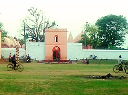 วัด พระอิศวร Mallarpur Birbhum
 กลุ่มวัดมัลเลสวาราที่มัลลาร์ปุระ