
มันดาร์มานี
มันดาร์โมนี | |
|---|---|
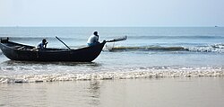 หาดมันดาร์มานี | |
  มันดาร์โมนี ตั้งอยู่ในรัฐเวสต์เบงกอล ประเทศอินเดีย แสดงแผนที่ของรัฐเวสต์เบงกอล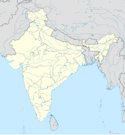 มันดาร์โมนี มันดาร์โมนี (อินเดีย) แสดงแผนที่ประเทศอินเดีย | |
| พิกัด: 21°39′58″N 87°42′18″E / 21.666°N 87.705°E / 21.666; 87.705 | |
| ประเทศ |  อินเดีย อินเดีย |
| สถานะ | รัฐเวสต์เบงกอล |
| เขต | อีสต์เมดินิปูร์ |
| รัฐบาล | |
| • ร่างกาย | แกรมปันชายัต |
| พื้นที่ | |
• ทั้งหมด | 24.36 ตาราง กิโลเมตร(9.41 ตารางไมล์) |
| ประชากร (2011) | |
• ทั้งหมด | 12,307 |
| • ความหนาแน่น | 492/กม. (1,270/ตร. ไมล์) |
| ภาษา | |
| • เป็นทางการ | ภาษาเบ งกาลีภาษาอังกฤษ |
| เขตเวลา | 5:30 น. ( เวลาอินเดีย ) (UTC+1 ) |
| รหัส ISO 3166 | อิน-ดับเบิลยูบี |
| การลงทะเบียนยานพาหนะ | ดับเบิลยูบี |
| เมืองที่ใกล้ที่สุด | โกลกาตา |
| อัตราส่วนเพศ | 976 ชาย / หญิง |
| การรู้หนังสือ | 65% |
| ภูมิอากาศ | ค่าเฉลี่ย( Köppen ) |
มันดาร์มานีเป็นหมู่บ้านตากอากาศริมทะเลในรัฐเวสต์เบงกอลประเทศอินเดียตั้งอยู่ใน เขต อีสต์มิดนาปอร์ทางตอนเหนือสุดของอ่าวเบงกอลเป็นหนึ่งในรีสอร์ทริมทะเลที่ใหญ่ที่สุดของเวสต์เบงกอลและกำลังพัฒนาอย่างรวดเร็ว
ภูมิศาสตร์


[[Contai]] (M)
\", \"description\": \" ([https://geohack.toolforge.org/geohack.php?params=21.77444;87.75_dim:2000 21.77444,87.75])\", \"marker-symbol\": \"-number-F1095\", \"marker-size\": \"medium\", \"marker-color\": \"#800000\" }, \"geometry\": {\"type\": \"Point\", \"coordinates\": [87.75,21.77444] } }, { \"type\": \"Feature\", \"properties\": { \"title\": \"CT
[[Basantia]] (CT)
\", \"description\": \" ([https://geohack.toolforge.org/geohack.php?params=21.83056;87.79167_dim:2000 21.83056,87.79167])\", \"marker-symbol\": \"-number-F1095\", \"marker-size\": \"medium\", \"marker-color\": \"#c40000\" }, \"geometry\": {\"type\": \"Point\", \"coordinates\": [87.79167,21.83056] } }, { \"type\": \"Feature\", \"properties\": { \"title\": \"CT
[[Khadalgobra]] (CT)
\", \"description\": \" ([https://geohack.toolforge.org/geohack.php?params=21.63333;87.52472_dim:2000 21.63333,87.52472])\", \"marker-symbol\": \"-number-F1095\", \"marker-size\": \"medium\", \"marker-color\": \"#c40000\" }, \"geometry\": {\"type\": \"Point\", \"coordinates\": [87.52472,21.63333] } }, { \"type\": \"Feature\", \"properties\": { \"title\": \"R
[[Digha]] (R)
\", \"description\": \" ([https://geohack.toolforge.org/geohack.php?params=21.63833;87.50944_dim:2000 21.63833,87.50944])\", \"marker-symbol\": \"-number-F1095\", \"marker-size\": \"medium\", \"marker-color\": \"#c40000\" }, \"geometry\": {\"type\": \"Point\", \"coordinates\": [87.50944,21.63833] } }, { \"type\": \"Feature\", \"properties\": { \"title\": \"R
[[Ramnagar, Purba Medinipur]] (R)
\", \"description\": \" ([https://geohack.toolforge.org/geohack.php?params=21.67444;87.55917_dim:2000 21.67444,87.55917])\", \"marker-symbol\": \"-number-F1095\", \"marker-size\": \"medium\", \"marker-color\": \"#c40000\" }, \"geometry\": {\"type\": \"Point\", \"coordinates\": [87.55917,21.67444] } }, { \"type\": \"Feature\", \"properties\": { \"title\": \"R
[[Marishda]] (R)
\", \"description\": \" ([https://geohack.toolforge.org/geohack.php?params=21.85278;87.74333_dim:2000 21.85278,87.74333])\", \"marker-symbol\": \"-number-F1095\", \"marker-size\": \"medium\", \"marker-color\": \"#c40000\" }, \"geometry\": {\"type\": \"Point\", \"coordinates\": [87.74333,21.85278] } }, { \"type\": \"Feature\", \"properties\": { \"title\": \"R
[[Bhupatinagar]] (R)
\", \"description\": \" ([https://geohack.toolforge.org/geohack.php?params=22.00056;87.72806_dim:2000 22.00056,87.72806])\", \"marker-symbol\": \"-number-F1095\", \"marker-size\": \"medium\", \"marker-color\": \"#c40000\" }, \"geometry\": {\"type\": \"Point\", \"coordinates\": [87.72806,22.00056] } }, { \"type\": \"Feature\", \"properties\": { \"title\": \"R
[[Majna]] (R)
\", \"description\": \" ([https://geohack.toolforge.org/geohack.php?params=21.77556;87.675_dim:2000 21.77556,87.675])\", \"marker-symbol\": \"-number-F1095\", \"marker-size\": \"medium\", \"marker-color\": \"#c40000\" }, \"geometry\": {\"type\": \"Point\", \"coordinates\": [87.675,21.77556] } }, { \"type\": \"Feature\", \"properties\": { \"title\": \"R
[[Khejuri]] (R)
\", \"description\": \" ([https://geohack.toolforge.org/geohack.php?params=21.87083;87.95056_dim:2000 21.87083,87.95056])\", \"marker-symbol\": \"-number-F1095\", \"marker-size\": \"medium\", \"marker-color\": \"#c40000\" }, \"geometry\": {\"type\": \"Point\", \"coordinates\": [87.95056,21.87083] } }, { \"type\": \"Feature\", \"properties\": { \"title\": \"R
[[Kamarda]] (R)
\", \"description\": \" ([https://geohack.toolforge.org/geohack.php?params=21.86806;87.73111_dim:2000 21.86806,87.73111])\", \"marker-symbol\": \"-number-F1095\", \"marker-size\": \"medium\", \"marker-color\": \"#c40000\" }, \"geometry\": {\"type\": \"Point\", \"coordinates\": [87.73111,21.86806] } }, { \"type\": \"Feature\", \"properties\": { \"title\": \"R
[[Janka, Contai]] (R)
\", \"description\": \" ([https://geohack.toolforge.org/geohack.php?params=21.85556;87.90139_dim:2000 21.85556,87.90139])\", \"marker-symbol\": \"-number-F1095\", \"marker-size\": \"medium\", \"marker-color\": \"#c40000\" }, \"geometry\": {\"type\": \"Point\", \"coordinates\": [87.90139,21.85556] } }, { \"type\": \"Feature\", \"properties\": { \"title\": \"R
[[Bara Bankuya]] (R)
\", \"description\": \" ([https://geohack.toolforge.org/geohack.php?params=21.67944;87.59_dim:2000 21.67944,87.59])\", \"marker-symbol\": \"-number-F1095\", \"marker-size\": \"medium\", \"marker-color\": \"#c40000\" }, \"geometry\": {\"type\": \"Point\", \"coordinates\": [87.59,21.67944] } }, { \"type\": \"Feature\", \"properties\": { \"title\": \"R
[[Dholmari]] (R)
\", \"description\": \" ([https://geohack.toolforge.org/geohack.php?params=21.825;87.83194_dim:2000 21.825,87.83194])\", \"marker-symbol\": \"-number-F1095\", \"marker-size\": \"medium\", \"marker-color\": \"#c40000\" }, \"geometry\": {\"type\": \"Point\", \"coordinates\": [87.83194,21.825] } }, { \"type\": \"Feature\", \"properties\": { \"title\": \"R
[[Baratala]] (R)
\", \"description\": \" ([https://geohack.toolforge.org/geohack.php?params=21.91444;87.92639_dim:2000 21.91444,87.92639])\", \"marker-symbol\": \"-number-F1095\", \"marker-size\": \"medium\", \"marker-color\": \"#c40000\" }, \"geometry\": {\"type\": \"Point\", \"coordinates\": [87.92639,21.91444] } }, { \"type\": \"Feature\", \"properties\": { \"title\": \"R
[[Durmut]] (R)
\", \"description\": \" ([https://geohack.toolforge.org/geohack.php?params=21.81056;87.77667_dim:2000 21.81056,87.77667])\", \"marker-symbol\": \"-number-F1095\", \"marker-size\": \"medium\", \"marker-color\": \"#c40000\" }, \"geometry\": {\"type\": \"Point\", \"coordinates\": [87.77667,21.81056] } }, { \"type\": \"Feature\", \"properties\": { \"title\": \"R
[[Depal]] (R)
\", \"description\": \" ([https://geohack.toolforge.org/geohack.php?params=21.73306;87.54778_dim:2000 21.73306,87.54778])\", \"marker-symbol\": \"-number-F1095\", \"marker-size\": \"medium\", \"marker-color\": \"#c40000\" }, \"geometry\": {\"type\": \"Point\", \"coordinates\": [87.54778,21.73306] } }, { \"type\": \"Feature\", \"properties\": { \"title\": \"R
[[Silaberia]] (R)
\", \"description\": \" ([https://geohack.toolforge.org/geohack.php?params=21.84111;87.90139_dim:2000 21.84111,87.90139])\", \"marker-symbol\": \"-number-F1095\", \"marker-size\": \"medium\", \"marker-color\": \"#c40000\" }, \"geometry\": {\"type\": \"Point\", \"coordinates\": [87.90139,21.84111] } }, { \"type\": \"Feature\", \"properties\": { \"title\": \"R
[[Kharipukuria]] (R)
\", \"description\": \" ([https://geohack.toolforge.org/geohack.php?params=21.89556;87.75056_dim:2000 21.89556,87.75056])\", \"marker-symbol\": \"-number-F1095\", \"marker-size\": \"medium\", \"marker-color\": \"#c40000\" }, \"geometry\": {\"type\": \"Point\", \"coordinates\": [87.75056,21.89556] } }, { \"type\": \"Feature\", \"properties\": { \"title\": \"S
[[Digha]] (S)
\", \"description\": \" ([https://geohack.toolforge.org/geohack.php?params=21.61389;87.5_dim:2000 21.61389,87.5])\", \"marker-symbol\": \"-number-F1095\", \"marker-size\": \"medium\", \"marker-color\": \"#0048ba\" }, \"geometry\": {\"type\": \"Point\", \"coordinates\": [87.5,21.61389] } }, { \"type\": \"Feature\", \"properties\": { \"title\": \"S
[[Shankarpur]] (S)
\", \"description\": \" ([https://geohack.toolforge.org/geohack.php?params=21.6375;87.56972_dim:2000 21.6375,87.56972])\", \"marker-symbol\": \"-number-F1095\", \"marker-size\": \"medium\", \"marker-color\": \"#0048ba\" }, \"geometry\": {\"type\": \"Point\", \"coordinates\": [87.56972,21.6375] } }, { \"type\": \"Feature\", \"properties\": { \"title\": \"S
[[Tajpur Port]] (S)
\", \"description\": \" ([https://geohack.toolforge.org/geohack.php?params=21.64;87.58889_dim:2000 21.64,87.58889])\", \"marker-symbol\": \"-number-F1095\", \"marker-size\": \"medium\", \"marker-color\": \"#0048ba\" }, \"geometry\": {\"type\": \"Point\", \"coordinates\": [87.58889,21.64] } }, { \"type\": \"Feature\", \"properties\": { \"title\": \"S
Mandarmani
\", \"description\": \" ([https://geohack.toolforge.org/geohack.php?params=21.66389;87.71278_dim:2000 21.66389,87.71278])\", \"marker-symbol\": \"-number-F1095\", \"marker-size\": \"medium\", \"marker-color\": \"#0048ba\" }, \"geometry\": {\"type\": \"Point\", \"coordinates\": [87.71278,21.66389] } }, { \"type\": \"Feature\", \"properties\": { \"title\": \"S
[[Junput]]
\", \"description\": \" ([https://geohack.toolforge.org/geohack.php?params=21.72472;87.81194_dim:2000 21.72472,87.81194])\", \"marker-symbol\": \"-number-F1095\", \"marker-size\": \"medium\", \"marker-color\": \"#0048ba\" }, \"geometry\": {\"type\": \"Point\", \"coordinates\": [87.81194,21.72472] } }, { \"type\": \"Feature\", \"properties\": { \"title\": \"S
[[Petuaghat Fishing Harbour]]
\", \"description\": \" ([https://geohack.toolforge.org/geohack.php?params=21.79472;87.88333_dim:2000 21.79472,87.88333])\", \"marker-symbol\": \"-number-F1095\", \"marker-size\": \"medium\", \"marker-color\": \"#0048ba\" }, \"geometry\": {\"type\": \"Point\", \"coordinates\": [87.88333,21.79472] } }, { \"type\": \"Feature\", \"properties\": { \"title\": \"H
[[Dihibahiri]] (H)
\", \"description\": \" ([https://geohack.toolforge.org/geohack.php?params=21.86667;87.77528_dim:2000 21.86667,87.77528])\", \"marker-symbol\": \"-number-F1095\", \"marker-size\": \"medium\", \"marker-color\": \"#aa6666\" }, \"geometry\": {\"type\": \"Point\", \"coordinates\": [87.77528,21.86667] } }, { \"type\": \"Feature\", \"properties\": { \"title\": \"R
[[Dariapur, Purba Medinipur]] (R)
\", \"description\": \" ([https://geohack.toolforge.org/geohack.php?params=21.79444;87.85889_dim:2000 21.79444,87.85889])\", \"marker-symbol\": \"-number-F1095\", \"marker-size\": \"medium\", \"marker-color\": \"#c40000\" }, \"geometry\": {\"type\": \"Point\", \"coordinates\": [87.85889,21.79444] } }, { \"type\": \"Feature\", \"properties\": { \"title\": \"H
[[Jukhia]] (H)
\", \"description\": \" ([https://geohack.toolforge.org/geohack.php?params=21.9825;87.76389_dim:2000 21.9825,87.76389])\", \"marker-symbol\": \"-number-F1095\", \"marker-size\": \"medium\", \"marker-color\": \"#aa6666\" }, \"geometry\": {\"type\": \"Point\", \"coordinates\": [87.76389,21.9825] } } ] } ]"}}">
ที่ตั้ง
อยู่ ห่างจากสนามบิน โกลกาตา เกือบ 200 กิโลเมตรบนเส้นทางเดลีสายเก่า ปูแดงที่คลานไปมาบนชายหาดยาว 13 กิโลเมตร เป็นเสน่ห์พิเศษของหาดมันดาร์มานี มีการกล่าวอ้างว่าเป็นชายหาดที่สามารถขับรถเข้าไป ได้ยาวที่สุดในอินเดีย[ 1 ] [ 2 ]ตั้งอยู่ในเขตย่อยคอนไต
ในทางธรณีสัณฐานวิทยา บริเวณนี้มีคลื่นค่อนข้างต่ำเมื่อเทียบกับชายหาดท่องเที่ยวใกล้เคียงอย่างหาดดีฆา อย่างไรก็ตาม ชายหาดแห่งนี้ยังคงมีการสะสมตะกอนและเกิดเนินทรายใหม่ในหลายพื้นที่ โดยเฉพาะบริเวณรอบๆ ดาดันปัตราบาร์
นิรุกติศาสตร์
ในตอนแรกหลังจากการค้นพบ ชายหาดแห่งนี้มีชื่อว่า Mandarboni และ Madar Mani แต่เมื่อเวลาผ่านไปก็เป็นที่รู้จักในชื่อ Mandarmani [ 1 ]
การขนส่ง
การเดินทางไปยังมันดาร์มานีที่สะดวกที่สุดคือทางถนน อย่างไรก็ตาม ปัจจุบันตำรวจท้องถิ่นจำกัดไม่ให้รถยนต์ส่วนตัวขับผ่านชายหาด แต่ได้มีการสร้างถนนที่เหมาะสมแล้ว ทำให้นักท่องเที่ยวสามารถเดินทางไปยังโรงแรมจากด้านหลังได้สะดวก
โดยรถไฟ
สถานีรถไฟที่ใกล้ที่สุดคือสถานีรถไฟContai (17 กม.) และสถานีรถไฟ Ashapurna Deviและสนามบินที่ใกล้ที่สุดคือสนามบินKolkata [ 3 ] นอกจากนี้ยังมีรถบัสหลายสายวิ่งทุกครึ่งชั่วโมงตั้งแต่ 7 โมงเช้าถึง 6 โมงเย็น
โดยรถยนต์
จากโกลกาตา หลังจากข้ามสะพานวิทยาสาครแล้ว ทางด่วนโคนาจะนำไปสู่ถนนมุมไบ การเดินทางทั้งหมดใช้เวลาประมาณ 3.5-4 ชั่วโมงจากโกลกาตา ผ่านโคลาฆัตและนันดากุมาร์ จากนันดากุมาร์จะมีทางเลี้ยวขวาไปยังคอนไต บนทางหลวงโกลกาตา-ดีฆาดังกล่าว มีจุดจอดพักชื่อชาวัลโฆลา ซึ่งถนนในหมู่บ้านทางด้านซ้ายจะไปสิ้นสุดที่หมู่บ้านริมทะเลชื่อมันดาร์มานี
มีด่านเก็บค่าผ่านทางสองแห่งบนเส้นทางนี้ คือที่ Dhulagori และ Sonapetya
กิจกรรม
ชายหาดเป็นสถานที่ท่องเที่ยวหลักที่ดึงดูดนักท่องเที่ยวให้มาเพลิดเพลินกับทะเลตั้งแต่เช้าตรู่จนถึงช่วงบ่ายแก่ๆ ตั้งแต่เวลา 15.00 น. เป็นต้นไป ผู้คนจะเริ่มออกไปเที่ยวตามรีสอร์ทต่างๆ ที่มีบริการจักรยานชายหาด กระเช้าลอยฟ้า ฯลฯ นอกจากนี้ยังมีร้านค้าท้องถิ่นมากมายขายเปลือกหอย เครื่องประดับทำมือ และงานหัตถกรรมต่างๆ ชาวบ้านบางส่วนยังจัดทริปไปเที่ยวชมปากแม่น้ำ (โมฮานา) ในช่วงพระอาทิตย์ตกดินอีกด้วย
แกลเลอรี่
 หาดมันดาร์มานี
 ชายหาดมันดาร์มานี
 มันดาร์มานี ฆัต
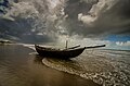 หาดมันดาร์มานี
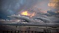 พระอาทิตย์ตกที่หาดมันดาร์มานี
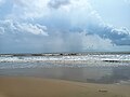 ชายหาดมันดาร์มานีที่งดงามน่าหลงใหล
ลิงก์ภายนอก

 คู่มือการท่องเที่ยว เมืองมันดาร์มานีจาก Wikivoyage
- MIDNAPORE.IN - มรดกแห่งมิดนาปอร์
- ข้อมูลทั้งหมดเกี่ยวกับ Mandarmani เก็บถาวรเมื่อวันที่ 18 กันยายน 2020 ที่Wayback Machine
 | บทความนี้เกี่ยวกับสถานที่แห่งหนึ่งในเขตปุรบาเมดินิปุร์รัฐเวสต์เบงกอลเป็นบทความที่ไม่สมบูรณ์คุณสามารถช่วยวิกิพีเดียได้โดยการเพิ่มข้อมูลที่ขาดหายไป |