
เม็กเซ็ก
เม็กเซ็ก | |
|---|---|
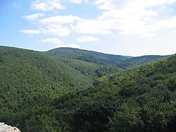 วิวจากปราสาท Máré ใกล้กับMagyaregregy | |
 แผนที่แบบอินเทอร์แอ็กทีฟของเมืองเม็กเซก | |
| ที่ตั้ง | เทศมณฑลบารันยาและโทลนาประเทศฮังการี |
| พื้นที่ | |
| • ทั้งหมด | 500 ตาราง กิโลเมตร(190 ตารางไมล์) |
| ระดับความสูงสูงสุด | 682 เมตร (2,238 ฟุต) ( เจิ้งเกอ ) |

เมชเชค ( ฮังการี: [ ˈmɛt͡ʃɛk ] ; โครเอเชีย: Meček ; เซอร์เบีย : Mečekหรือ Мечек; เยอรมัน: Metscheck ) เป็นเทือกเขาในภาคใต้ของฮังการีตั้งอยู่ใน ภูมิภาค บารานยาทางตอนเหนือของเมืองเปช
นิรุกติศาสตร์
ชื่อสถานที่ของฮังการี "Mecsek" มาจากชื่อเล่นของชื่อ Mihály (Michael) เดิมทีใช้เฉพาะกับเนินเขาที่อยู่ติดกับPécsเท่านั้น ชื่อ Mecsek ถูกกล่าวถึงครั้งแรกในศตวรรษที่ 16 [ 1 ]
ภูมิศาสตร์
เทือกเขานี้ครอบคลุมพื้นที่ประมาณ 500 ตารางกิโลเมตรยอดเขาที่สูงที่สุดในเทือกเขานี้คือZengő (แปลตรงตัวว่า 'ก้องกังวาน') ซึ่งมีความสูง 682 เมตร (2,238 ฟุต) เทือกเขา Mecsek ประกอบด้วยเทือกเขาบล็อกที่มีลักษณะคล้ายที่ราบสูง มีโครงสร้างที่แตกหักและพับงอ ฐานของเทือกเขาเป็นหินผลึกที่มีต้นกำเนิดจากยุค Variscan ปกคลุมด้วยหินปูนและโดโลไมต์ยุค Triassic และ Jurassic และหินยุค Tertiary ที่ก่อตัวเป็นบล็อกหลัก เทือกเขานี้ถูกแบ่งออกโดยรอยเลื่อนโครงสร้างที่ทอดยาวจากทิศตะวันตกเฉียงเหนือไปยังทิศตะวันออกเฉียงใต้ ส่วนตะวันออกส่วนใหญ่ประกอบด้วยสันเขาสูงของหินตะกอน ส่วนตะวันตกมีที่ราบสูงหินปูนกว้างขวางและพื้นที่ที่ส่วนใหญ่เป็นหินทรายในยุค Permian-Triassic มีปรากฏการณ์คาร์สต์ที่สำคัญบนที่ราบสูงหินปูน[ 2 ] Mecsek อุดมไปด้วยแร่ธาตุ (รวมถึงยูเรเนียม ) เมื่อเทียบกับดินแดนอื่นๆของฮังการีสภาพภูมิอากาศเป็นแบบผสมผสาน โดยมีองค์ประกอบของ ภูมิอากาศ แบบเมดิเตอร์เรเนียนและแบบทวีปพื้นที่นี้เป็นที่อยู่อาศัยของพืช 20-30 ชนิดที่ไม่พบในส่วนอื่นๆ ของลุ่มน้ำคาร์พาเทียน
ยอดเขาสูงที่สุด
| จุดสูงสุด | ระดับความสูง (เมตร) | ที่ตั้ง |
|---|---|---|
| เจิ้งโก้ | 682 | เมกเซกตะวันออก |
| ท่อ | 611 | เม็กเซกตะวันตก |
| ฮาร์มาส-เฮกี | 604 | เมกเซกตะวันออก |
| จาคับ-เฮกี | 602 | เม็กเซกตะวันตก |
| โดโบโก้ | 594 | เมกเซกตะวันออก |
| บอร์ซาส-เตโต้ | 591 | เมกเซกตะวันออก |
| โซเซ็ก | 586 | เมกเซกตะวันออก |
| คิส-ทิวบ์ | 577 | เม็กเซกตะวันตก |
| ซอมลโย | 572 | เมกเซกตะวันออก |
| ซามาร์-เฮกี | 564 | เมกเซกตะวันออก |
| Dögkút-tető | 556 | เมกเซกตะวันออก |
| Hárs-tető | 545 | เมกเซกตะวันออก |
| Csalán-hegy | 536 | เมกเซกตะวันออก |
| มิสินา | 535 | เม็กเซกตะวันตก |
ประวัติศาสตร์การเมืองและวัฒนธรรม
เนื่องจากมีขนาดค่อนข้างเล็กและความสูงปานกลาง เนินเขาเม็กเซกจึงมีความเชื่อมโยงทางการเมืองและเศรษฐกิจกับที่ราบลุ่มบารานยาและโทลนา ที่อยู่ใกล้เคียงมาโดยตลอด โดยทำหน้าที่หลักเป็นแหล่งไม้ นอกจากนี้ เนินเขาที่ปกคลุมด้วยป่ายังเป็นปราการสำคัญในการป้องกันศัตรูที่อาจเกิดขึ้นได้
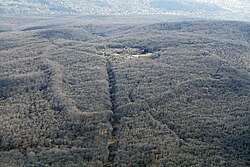
ศูนย์กลางทางการเมืองที่สำคัญแห่งแรกของภูมิภาคนี้ก่อตั้งขึ้นบนยอดเขาJakab-hegyในช่วงยุคเหล็กซึ่งต่อมาถูกยึดครองและพัฒนาเป็นเมืองโดยชาวเคลต์ในศตวรรษที่ 2 ก่อนคริสต์ศักราช[ 3 ]หลังจากการพิชิตแพนโนเนีย ของโรมัน ประชากรของชุมชน เช่นเดียวกับกรณีที่คล้ายกันของBibracteหรือEntremontอาจถูกบังคับให้ย้ายไปยังเนินเขาทางใต้ของ Mecsek ซึ่งเป็นที่ตั้งของ Sopianae ซึ่งเป็น เมืองต้นกำเนิดของ Pécs
Throughout the HungarianMiddle Ages the valleys of the Mecsek became more densely populated, providing raw materials for the thriving episcopal city of Pécs. The castles of Szászvár, Márévár and Kantavár were built in the era as residencies of nobles or the Church. The Order of Saint Paul the First Hermit partially stemmed from the hermit communities of the Mecsek, whom the Bishop of Pécs founded a monastery at Jakab-hegy in 1225.[4] The significant Pécsvárad Abbey also controlled substantial areas in the region.
Due to the Ottoman occupation of Hungary and the following wars, raids and over-taxation the population growth stagnated, however the everyday and religious life of the locals didn't change much.[5] The region was protected by its remoteness. After the Treaty of Karlowitz, the local nobles invited German settlers to the region. The territories east of Mecsek became a part of the German ethnic island commonly referred to as Swabian Turkey.
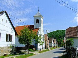
Significant amounts of black coal were discovered in the 19th century, the strategic resource greatly advanced the industrialization of the region. Mines were opened in Pécs, Szászvár and Komló which were all subsequently connected to the Hungarian economy with railways. In the aftermath of World War I and the collapse of Austria-Hungary, the Kingdom of Serbs, Croats and Slovenes occupied the region, but the Treaty of Trianon eventually left the area in the possession of Hungary.
A huge part of the German-speaking population of the area was expelled from Hungary after World War II, although many German communities lingered. The socialist Hungary further developed the coal mines of Pécs and Komló. Uranium was also discovered and mined near Kővágószőlős from the 1950s. The Mecsek Hills were the scene of pitched battles during the Hungarian Revolution in November 1956 between Hungarian units dubbed "the Mecsek Invisibles" and the invading Soviet forces.
After the fall of communism in Hungary, the economically unsustainable mines were closed. The Mecsek now serves mostly as a recreational area with moderate forestry activities.[6]
Parts
Mecsek is divided to two parts:
Settlements
แกลเลอรี
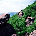 รอบๆจาคอบ-เฮกี
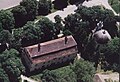 Mecseknádasd - ปราสาทจากเบื้องบน
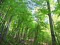 ป่าใกล้เมืองโอบานยา
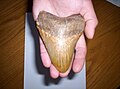 ขุดพบฟัน เมกาโลดอนที่ Danitz-puszta, Mecsek ( Miocene )
 เนินเขาที่เม็กเซคนาดาสด์
ดูเพิ่มเติม
ลิงก์ภายนอก
- ประวัติศาสตร์เม็กเซ็ก-1956
46°06′N 18°05′E / 46.100°N 18.083°E / 46.100; 18.083
