
Scalasaig
Coordinates: 56°04′N6°11′W / 56.07°N 6.19°W / 56.07; -6.19
Scalasaig
| |
|---|---|
 | |
  Scalasaig | |
| OS grid reference | NR394941 |
| • Edinburgh | 116 mi (187 km) |
| • London | 400 mi (644 km) |
| Council area | |
| Lieutenancy area | |
| Country | Scotland |
| Sovereign state | United Kingdom |
| Post town | ISLE OF COLONSAY |
| Postcode district | PA61 |
| Dialling code | 01951 |
| Police | Scotland |
| Fire | Scottish |
| Ambulance | Scottish |
| UK Parliament | |
| Scottish Parliament | |

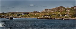
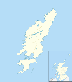
Scalasaig (Scottish Gaelic: Sgalasaig) lies on the east coast of Colonsay, in the council area of Argyll and Bute of Scotland. It is the main settlement on the island[1] and its only port; thus tourists arriving by ferry must pass through it on the way to any part of the isle. It contains the island's shop[2] and post office (in the same building),[3]parish church,[4] microbrewery,[5] doctor's surgery,[6] village hall,[7] cafe and hotel/bar.[8]
History
The name "Scalasaig" is Norse and means "Skali's bay".[9]


 | บทความเกี่ยวกับสถานที่ตั้งของอาร์กิลล์และบิวต์นี้ ยัง ไม่สมบูรณ์คุณสามารถช่วยวิกิพีเดียได้โดยการเพิ่มข้อมูลที่ขาดหายไป |