
โทรุ
ราศีพฤษภ | |
|---|---|
| โทรุ | |
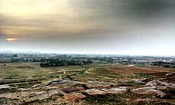 | |
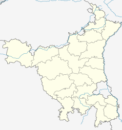  ราศีพฤษภ ตั้งอยู่ในรัฐหรยาณา ประเทศอินเดีย แสดงแผนที่ของรัฐหรยาณา ราศีพฤษภ เตารุ (อินเดีย) แสดงแผนที่ประเทศอินเดีย | |
| พิกัด: 28°13′N 76°57′E / 28.22°N 76.95°E / 28.22; 76.95 | |
| ประเทศ |  อินเดีย อินเดีย |
| สถานะ | ฮารยานา |
| เขต | นูห์ |
| ที่จัดตั้งขึ้น | = |
| ระดับความสูง | 262 เมตร (860 ฟุต) |
| ประชากร (2011) | |
• ทั้งหมด | 22,599 |
| ภาษา | |
| • เป็นทางการ | ฮินดีเมวาตีอาหิรวาตี |
| เขตเวลา | 5:30 น. ( เวลาอินเดีย ) (UTC+1 ) |
| เข็มหมุด | 122105 |
| รหัสโทรศัพท์ | 01267 |
| รหัส ISO 3166 | อิน-เอชอาร์ |
| การลงทะเบียนยานพาหนะ | เอชอาร์ 96 |
| เว็บไซต์ | haryana.gov.in |
TaoruหรือTauruเป็นเมืองที่อยู่ใกล้เมือง Nuhในเขต NuhในรัฐHaryanaของอินเดีย [ 1 ]
ประวัติศาสตร์
ป้อม
ป้อม Taoruหรือที่เรียกว่าป้อม Taoru ของ Raja Nahar Singhมีห้องและห้องต่างๆ ล้อมรอบด้วยกำแพงสูง ปัจจุบันใช้เป็นสถานีตำรวจ[ 2 ]
สุสานทาโอรุ
Taoru Tomb Complex is a 3.5 acres (1.4 ha) walled tomb complex with 7 tombs, 2 of which has been restored by INTACH and Ansal University's Sushant School of Art and Architecture, of Tuglaq, Lodhi and Mughal architecture. It is rare in Delhi NCR region where multiple architectural styles of different eras are found in one complex itself. In 1828, The Imperial Gazetteer of India of the East India Company called this area "Lesser Balochistan", a likely reference to arrival of people from Balochistan during Lodhi era who might have been the rulers of Ferozepur Jhirka (a state which exited at least since Lodhi era which was later abolished by the British Raj in 1858 after the Rebellion of 1857) built these tombs during the successive dynasties. The largest tomb belongs to a Baloch.[3][4] The complex located on Taoru-Sohna section of NH 919 is only 12 kilometres (7.5 mi) from the Delhi-Jaipur NH48. It is 40 kilometres (25 mi) from Gurgaon and 70 kilometres (43 mi) from Delhi.
In 2025, Haryana government announced a INR 95 crore restoration plan for upgrade of 20 monuments across the state including the Taoru tomb complex.[5]
Government
Taoru is part of the Sohna-Taoru Assembly constituency. Previously Taoru had its own Assembly constitiuency under its own name, Taoru. It is part of the Gurgaon Lok Sabha constituency.
Geography
Taoru is located at 28°13′N76°57′E / 28.22°N 76.95°E / 28.22; 76.95. It has an average elevation of 262 metres (859 feet). It is surrounded by Aravalli Range from three sides.
สามารถเดินทางมาได้โดยทางถนนจากเมืองธารูเฮรา ใน เขตเรวารีซึ่งตั้งอยู่บนทางหลวงหมายเลข 48และจากเมืองโซห์นา ใน เขตคุรุแกรม ถนน สายเรวารี - ธารู เฮรา - ภิวาดี - ทาโอรู- โซห์นา - ปัลวัลเรียกว่าทางหลวงหมายเลข 919 (NH 919)ทางด่วนวงแหวนตะวันตกไปยังมาเนซาร์หรือปัลวัลอยู่ห่างจากทาโอรูประมาณ 5 กิโลเมตร บนทางหลวงหมายเลข 919
ข้อมูลประชากร
ข้อมูล ณ ปี 2001จากการสำรวจสำมะโนประชากรของอินเดีย[ 6 ] Taoru มีประชากร 17,227 คน เพศชายคิดเป็น 53% ของประชากร และเพศหญิง 47% Taoru มีอัตราการรู้หนังสือเฉลี่ย 86.5% [ 7 ]ซึ่งสูงกว่าค่าเฉลี่ยของประเทศที่ 69.5% โดยอัตราการรู้หนังสือของเพศชายอยู่ที่ 87% และอัตราการรู้หนังสือของเพศหญิงอยู่ที่ 85% ใน Taoru ประชากร 17% มีอายุต่ำกว่า 8 ปี
| ศาสนาในเตารุ เตห์ซิล[ 8 ] | ||
|---|---|---|
| ศาสนา | ประชากรทั้งหมด | เปอร์เซ็นต์ |
| ทั้งหมด | 1,66,778 | 100% |
| มุสลิม | 96,164 | 57.66% |
| ฮินดู | 70,050 | 42.00% |
| ซิก | 295 | 0.18% |
| คริสเตียน | 177 | 0.11% |
| ไม่ได้ระบุ | 55 | 0.03% |
| เชน | 23 | 0.01% |
| พุทธศาสนา | 14 | 0.01% |
| ศาสนาอื่นๆ | 0 | 0% |
หมู่บ้านต่างๆ ในเขต Taoru Tehsil
อำเภอเทารูประกอบด้วยหมู่บ้าน 84 แห่ง ได้แก่:
Sikharpur, Buraka, Bhajlaka, Silkho, Chila, Sala-ka, Mala-ka, Mohmadpur, Pethredi, Hasanpur, Panchgaon, Chilawli, Charoda, Masit, Dhelamki, Nurpur, Bawla, Mandarka, Nanuka, Kangarka, Subasedi, Bhogipur, Didhara, Nijampur, Kalarpuri, Raniaki, Sewka, Gunawat, Chundika, Sunari, Khoire, Chote Khoire, Rathiwas, Uton, Jaurasi, Jhamwas, Fatepar, Kalwadi, Pada, Sekhpur, Gudha, Gudhi, Subras, Nanduki, Nihalgarh, Gogjaka, Goyla, Kalyaki, Sundh, Bhango, Jafrabad, Beri, Chahalka, Kharak Jalalpur, Khad Khadi, Rahadi, Nai Nangla, ดุลวัต , ปาเทนี, เคดกี, Baghanki, Kota, Bissar, Sarai, Dadu, Dawla Pati ฯลฯ
โรงเรียน
ในเมือง Taoru มีโรงเรียนเอกชนและโรงเรียนของรัฐอยู่หลายแห่ง ได้แก่ โรงเรียนมัธยมศึกษาตอนปลาย Chandravati, โรงเรียนมัธยม Hind, โรงเรียนมัธยม Janta, โรงเรียนมัธยมศึกษาตอนปลายของรัฐบาล, โรงเรียน Green Dales Public School และโรงเรียน Spring Daisy Public School หนึ่งในนั้นคือโรงเรียน Mewat Model School Taoru ซึ่งบริหารงานโดย Mewat Development Agency โดยมีเป้าหมายเพื่อขจัดปัญหาทางสังคมต่างๆ เช่น ความยากจนและความล้าหลังทางสังคมในภูมิภาคMewat [ 9 ]
ดูเพิ่มเติม
ลิงก์ภายนอก
- "แผนที่ภูมิภาคคุรุแกรม: บาดชาห์ปูร์ — ทาโอรู | แผนที่ดาวเทียม Google อินเดีย" . www.maplandia.com . สืบค้นเมื่อ18 สิงหาคม 2025 .
- "ชื่อเรื่องไม่ระบุ"
{{cite web}}: ข้อมูลหายไปหรือว่างเปล่า|url=( ขอความช่วยเหลือ ) - "ชื่อเรื่องไม่ระบุ"
{{cite web}}: ข้อมูลหายไปหรือว่างเปล่า|url=( ขอความช่วยเหลือ ) - "Oasis Fast Foods :: การท่องเที่ยวรัฐหรยาณา"เก็บถาวรจากต้นฉบับเมื่อวันที่ 7 พฤศจิกายน 2550 เรียกดูเมื่อวันที่ 18 สิงหาคม 2568
- การเลือกตั้ง
- "พิพิธภัณฑ์การขนส่งมรดก มาเนซาร์ กู ร์กอน - คอลเล็กชันของวัตถุที่เกี่ยวข้องกับการขนส่งในอินเดีย!" heritagetransportmuseum.orgสืบค้นเมื่อ18 สิงหาคม 2568
- ฮินดูสถานไทมส์