
Alabama State Route 301
 State Route 301 | ||||
|---|---|---|---|---|
 | ||||
| Route information | ||||
| Maintained by ALDOT | ||||
| Length | 0.428 mi[1] (689 m) | |||
| Existed | 2016–present | |||
| Major junctions | ||||
| South end |   I-20 / US 431 near Oxford I-20 / US 431 near Oxford | |||
| North end |  US 78 in DeArmanville US 78 in DeArmanville | |||
| Location | ||||
| Country | United States | |||
| State | Alabama | |||
| Counties | Calhoun | |||
| Highway system | ||||
| ||||
| ||||


State Route 301 (SR 301) is a north–south route located entirely in Calhoun County in east-central Alabama.[2] The route is 0.428 miles (0.689 km) long.
Route description
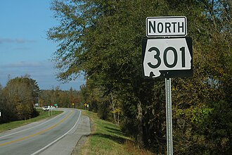
SR 301 is a former alignment of U.S. Route 431 (US 431) in the Oxford area. It begins at a junction with US 78 on the north side, and it ends at a junction with Interstate 20 (I-20) and US 431 at exit 191.[2]
History
The SR 301 designation was established in February 2016 when US 431 was re-routed onto I-20 after the completion of the Anniston Eastern Bypass. US 431 followed a concurrency with US 78, but this short link road between the two U.S. Highways became known as SR 301.
Major intersections
The entire route is in DeArmanville, Calhoun County.
| mi[1] | km | Destinations | Notes | ||
|---|---|---|---|---|---|
| 0.00 | 0.00 | I-20 / US 431 ( SR 1 ) – เบอร์มิงแฮม , แอตแลนต้า , เวโดวี | จุดสิ้นสุดทางใต้: ทางออกหมายเลข 191 ของทางหลวงหมายเลข I-20; ถนนจะทอดยาวไปทางใต้เป็นทางหลวงหมายเลข US 431 (SR 1) | ||
| 0.428 | 0.689 | US 78 ( SR 4 ) – Heflin , Oxford | จุดสิ้นสุดทางเหนือ | ||
| 1.000 ไมล์ = 1.609 กม.; 1.000 กม. = 0.621 ไมล์ | |||||
ดูเพิ่มเติม
 พอร์ทัลถนนของสหรัฐอเมริกา
 พอร์ทัลสหรัฐอเมริกา
ลิงก์ภายนอก
แม่แบบ:แนบ KML/ทางหลวงรัฐอลาบามาหมายเลข 301
KML ไม่ได้มาจากวิกิดาต้า
 สื่อที่เกี่ยวข้องกับเส้นทางหลวงหมายเลข 301 ของรัฐแอละแบมาในวิกิมีเดียคอมมอนส์