
ลำธารไวเวตู
| ลำธารไวเวตู | |
|---|---|
 | |
 | |
| ที่ตั้ง | |
| ประเทศ | นิวซีแลนด์ |
| ภูมิภาค | เวลลิงตัน |
| ลักษณะทางกายภาพ | |
| แหล่งที่มา | |
| • ที่ตั้ง | หุบเขาฮัตต์ |
| ปาก | |
• ที่ตั้ง | ท่าเรือเวลลิงตัน |
• ระดับความสูง | 0 เมตร (0 ฟุต) |
| ความยาว | 9 กม. (5.6 ไมล์) |
ขนาดอ่าง | 18 ตาราง กิโลเมตร(6.9 ตารางไมล์) |
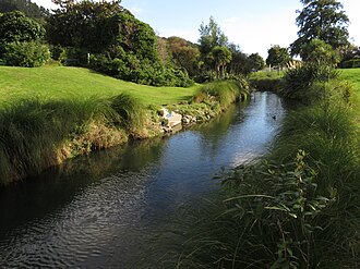
ลำธารไวเวทูเป็นลำน้ำสายเล็กในโลเวอร์ฮัทท์บนเกาะเหนือของนิวซีแลนด์ ลำธารนี้ระบายน้ำจากด้านตะวันออกของหุบเขาฮัทท์และไหลลงสู่ท่าเรือเวลลิงตันที่ ปาก แม่น้ำฮัทท์การพัฒนาและการขยายตัวของเมืองในหุบเขาฮัทท์นับตั้งแต่การมาถึงของผู้อพยพนำไปสู่มลภาวะที่เพิ่มขึ้นและการเสื่อมโทรมของสภาพแวดล้อมในลำธาร ลำธารถูกเบี่ยงไปใช้ท่อระบายน้ำคอนกรีตในบางส่วนเพื่อพยายามลดปัญหาน้ำท่วม
การพัฒนาอุตสาหกรรมในพื้นที่บริเวณตอนล่างของลำธารส่งผลให้บริเวณนั้นกลายเป็นท่อระบายน้ำเสียจากอุตสาหกรรม การปล่อยของเสียจากอุตสาหกรรมลงสู่ลำธารตอนล่างหยุดลงในทศวรรษ 1980 เมื่อมีการต่อท่อระบายน้ำเสียจากอุตสาหกรรมเข้ากับท่อระบายน้ำหลัก อย่างไรก็ตาม ลำธารยังคงปนเปื้อนด้วยตะกอนพิษอย่างรุนแรง ในปี 2010 ลำธารแห่งนี้ถูกระบุว่าเป็นหนึ่งในทางน้ำที่ปนเปื้อนมากที่สุดในนิวซีแลนด์ แรงกดดันจากชุมชนที่เริ่มขึ้นประมาณปี 2003 ช่วยกระตุ้นให้เกิดโครงการขนาดใหญ่เพื่อทำความสะอาดลำธารตอนล่าง โครงการนี้ประกาศว่าเสร็จสมบูรณ์ในเดือนมิถุนายน 2010 หลังจากกำจัดของเสียพิษได้ 56,000 ตัน
ในปี 2010–2011 ได้มีการจัดตั้งกลุ่มชุมชนขึ้นเพื่อเป็นผู้นำในการฟื้นฟูพื้นที่ต้นน้ำของลำธาร ตลอดระยะเวลา 10 ปี อาสาสมัครได้กำจัดวัชพืชน้ำรุกรานและขยะออกจาก ลำธารเป็นระยะทาง 6 กิโลเมตร (3.7 ไมล์)และปลูกต้นไม้พื้นเมืองที่หาได้จากในท้องถิ่นประมาณ 34,000 ต้นบนฝั่งลำธาร
ชื่อสถานที่
Waiwhetū หมายถึง "น้ำที่สะท้อนดวงดาว" ในภาษาเมารี [ 1 ]และเป็นชื่อที่ตั้งให้กับ พื้นที่ ปา เดิม ในบริเวณนั้นมาราเอท้องถิ่น ชานเมือง และลำธาร Waiwhetū Stream เป็นชื่ออย่างเป็นทางการที่ได้รับการยอมรับจาก คณะ กรรมการภูมิศาสตร์แห่งนิวซีแลนด์[ 2 ]
ภูมิศาสตร์

ลำธารนี้มีต้นน้ำอยู่ในเนินเขาฮัตต์ตะวันออก เหนือย่านชานเมืองวิงเกตและนาเอนาเอในโลเวอร์ฮัตต์ มีพื้นที่ลุ่มน้ำประมาณ18 ตารางกิโลเมตร (6.9 ตารางไมล์)ลำธารมีความยาวประมาณ9 กิโลเมตร (5.6 ไมล์)และไหลผ่านย่านชานเมืองทางตะวันออกของแฟร์ฟิลด์วอเตอร์ลูและไวเวทูรวมถึงพื้นที่อุตสาหกรรมของซีวิวและเกรซฟิลด์ก่อนที่จะไหลลงสู่ปากแม่น้ำฮัตต์ เตอาวา ไครังงีเมื่อถึงท่าเรือเวลลิงตัน[ 3 ] : 13
ประวัติศาสตร์
ลำธารนี้เป็นแหล่งอาหารดั้งเดิมของชาวเมารี ในท้องถิ่น โดยมีปลาไวท์เบทปลาไหลและผักวอเตอร์เครส[ 4 ] [ 5 ]
ก่อนเกิดแผ่นดินไหวไวราราปาในปี พ.ศ. 2498เรือขนาดใหญ่พอสำหรับการค้าชายฝั่งสามารถแล่นผ่านบริเวณตอนล่างของลำธารไวเวตูได้ และมีอู่ต่อเรือหลายแห่ง[ 6 ] [ 7 ] [ 8 ]อู่ต่อเรือแห่งหนึ่งตั้งอยู่ใกล้กับจุดที่ไวท์สไลน์อีสต์ตัดกับลำธาร[ 9 ] : 23อย่างไรก็ตาม แผ่นดินไหวทำให้ระดับพื้นหุบเขาสูงขึ้น1.5 เมตร (4 ฟุต 11 นิ้ว)และลำธารก็ไม่สามารถเดินเรือได้อีกต่อไป
น้ำท่วม
แผนการเบื้องต้นของผู้อพยพชาวยุโรปที่อพยพมายังนิวซีแลนด์นั้นรวมถึงการสร้างเมืองใหม่ชื่อบริทาเนีย ซึ่งจะตั้งอยู่ในหุบเขาฮัตต์ โดยมีเนินเขาทางทิศตะวันตกและลำธารไวเวทูทางทิศตะวันออก และมีแม่น้ำฮัตต์ไหลผ่านตรงกลาง อย่างไรก็ตาม แผนการเหล่านี้ได้เปลี่ยนไปในเวลาไม่นาน หลังจากเกิดน้ำท่วมครั้งใหญ่ในแม่น้ำฮัตต์ ทำให้ผู้อพยพเชื่อว่าเมืองควรตั้งอยู่ฝั่งตรงข้ามของอ่าว เมืองใหม่นี้มีชื่อว่าเวลลิงตัน[ 10 ]
ตั้งแต่สมัยการตั้งถิ่นฐานในยุคอาณานิคม ลำธารไวเวทูเป็นแหล่งที่มาของน้ำท่วมเป็นครั้งคราว ซึ่งทำให้ปศุสัตว์เสียหายและทรัพย์สินได้รับความเสียหาย[ 11 ]ฝนตกหนักในเดือนกรกฎาคม พ.ศ. 2455 และสิงหาคม พ.ศ. 2461 ทำให้ลำธารไวเวทูเอ่อล้นตลิ่งและท่วมสวนสาธารณะฮัตต์ที่อยู่ใกล้เคียงและพื้นที่โดยรอบ[ 12 ] [ 13 ]ผู้อยู่อาศัยที่อยู่ใกล้ลำธารต้องอพยพออกจากบ้านในวันที่ 15 พฤศจิกายน พ.ศ. 2559 เนื่องจากระดับน้ำท่วมสูง[ 14 ]
โรงสีฟล็อค

โรงสีฟล็อกก่อตั้งขึ้นในปี 1898 ในแฟร์ฟิลด์ ติดกับลำธารไวเวทู ณ จุดตัดของถนนรัมเกย์และถนนริเวอร์ไซด์ในปัจจุบัน โรงสีแห่งนี้ใช้ฝายในลำธารและกังหานน้ำแบบยิงลูกดอกเป็นแหล่งพลังงานกล โรงสีฟล็อกดำเนินการมาประมาณ 50 ปี แต่เป็นประเด็นของการฟ้องร้องในปี 1909–1910 ซึ่งได้รับการพิจารณาในศาลฎีกาเกี่ยวกับผลกระทบของน้ำท่วมที่เกิดจากการสร้างฝายในลำธาร[ 15 ]
ปลา
ในปี พ.ศ. 2419 มีการจับ ปลาไหลขนาดใหญ่มากตัวหนึ่งที่มีน้ำหนักเกือบ11 กิโลกรัม (25 ปอนด์)ได้ในลำธาร[ 16 ]สมาคมการปรับตัวได้ปล่อยปลาเพิร์ชลงในลำธารไวเวทูในปี พ.ศ. 2456 [ 17 ]ในปี พ.ศ. 2467 มีการจับปลาแลมเพรย์ ได้เป็นจำนวนมาก ในลำธาร ซึ่งเป็นเรื่องผิดปกติ [ 18 ]
การรับรู้ของสาธารณชน
ในปี พ.ศ. 2449 หนังสือพิมพ์ฉบับหนึ่งได้นำเสนอภาพถ่ายทิวทัศน์อันงดงามบนต้นน้ำของลำธารไวเวทู[ 19 ] [ 20 ]ในโฆษณาขายอสังหาริมทรัพย์ในปี พ.ศ. 2461 ลำธารไวเวทูถูกอธิบายว่าเป็น "เอวอนแห่งเวลลิงตัน" [ 21 ]ในปี พ.ศ. 2480 คณะกรรมการที่ดูแลฮัทท์พาร์คได้พิจารณาข้อเสนอที่จะสร้างฝายกั้นน้ำในลำธารไวเวทูที่อยู่ติดกัน เพื่อให้สามารถใช้สำหรับการอาบน้ำได้แม้ในช่วงน้ำลง[ 22 ]
มลพิษ
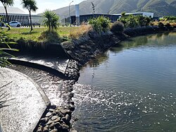
ในปี พ.ศ. 2447 มีการวิพากษ์วิจารณ์อย่างรุนแรงต่อกรมอนามัยที่อนุญาตให้มีการปล่อยน้ำเสียจากลูกค้าหลายพันคนในสนามแข่งม้าฮัทท์พาร์คลงสู่ลำธารไวเวทูตอนล่างอย่างต่อเนื่อง[ 23 ]มีรายงานการทิ้งขยะอย่างผิดกฎหมายลงในลำธารไวเวทูตั้งแต่ปี พ.ศ. 2461 [ 24 ]ในปี พ.ศ. 2469 รัฐบาลรับการประมูลสำหรับการก่อสร้างโรงงานซ่อมรถไฟแห่งใหม่ในพื้นที่อุตสาหกรรมใกล้กับลำธารไวเวทู[ 25 ]ในเดือนเมษายน พ.ศ. 2462 สภาเทศบาลเมืองโลเวอร์ฮัทท์ได้จัดสรรเงิน 6,250 ปอนด์สำหรับการก่อสร้างถังบำบัดน้ำเสียใกล้กับทางออกของลำธารไวเวทู[ 26 ]ในปี พ.ศ. 2479 มีการออกคำสั่งให้โรงงานฟล็อคหยุดการปล่อยฝุ่นลงสู่ลำธาร[ 27 ]ในปี พ.ศ. 2479 พ.ศ. 2480 และ พ.ศ. 2481 มีการร้องเรียนหลายครั้งจากผู้ดูแลสวนฮัทท์พาร์คและวิศวกรของคณะกรรมการแม่น้ำฮัทท์ว่าลำธารกำลังถูกปนเปื้อนด้วยการปล่อยน้ำมันอย่างต่อเนื่องจากโรงงานซ่อมบำรุงรถไฟ[ 28 ] [ 29 ] [ 30 ] [ 31 ]ภายในปี พ.ศ. 2481 เด็กๆ ถูกห้ามไม่ให้ว่ายน้ำในลำธาร[ 32 ]
การพัฒนาในหุบเขาฮัตต์และการขยายตัวของเมืองนำไปสู่การถางป่าริมฝั่งลำธารและการเปลี่ยนแปลงรูปทรงตามธรรมชาติของลำธาร ลำธารจึงเกิดมลพิษและได้รับผลกระทบจากการทิ้งขยะอย่างผิดกฎหมาย บริเวณตอนล่างของลำธารปนเปื้อนด้วยของเสียจากอุตสาหกรรม รวมถึงสีย้อมจากโรงงานผลิตพรมที่อยู่ใกล้เคียง ในปี พ.ศ. 2515 ลำธารเกิดไฟไหม้เนื่องจากปริมาณตัวทำละลายที่ถูกปล่อยออกมา[ 33 ] [ 34 ]
มีการจัดตั้งกลุ่มทำงานลำธารไวเวทูขึ้นในปี พ.ศ. 2543 เพื่อสนับสนุนการฟื้นฟูลำธาร[ 3 ] : 18ในปี พ.ศ. 2546 รายงานเกี่ยวกับสถานการณ์สิ่งแวดล้อมที่เผยแพร่โดยสภาภูมิภาคเกรทเทอร์เวลลิงตันระบุว่าลำธารไวเวทูเป็นหนึ่งในห้าลำธารที่มีมลพิษมากที่สุดในภูมิภาค[ 35 ]
ในเดือนกรกฎาคม พ.ศ. 2564 ลำธารถูกปนเปื้อนด้วยการปล่อยน้ำเสียที่ไม่ได้ผ่านการบำบัดจากสถานีสูบน้ำเป็นระยะเวลาสั้นๆ หลังฝนตกหนักผิดปกติ[ 36 ]ในช่วงที่มีฝนตกหนักอีกครั้งในเดือนธันวาคม พ.ศ. 2564 มีการปล่อยน้ำเสียฉุกเฉินจากสถานีสูบน้ำลงสู่ลำธารอีกครั้ง ส่งผลให้ชาวเมารีในท้องถิ่นออกมาประท้วง[ 37 ]
การเคลียร์ลำธาร (ทศวรรษ 1920–1940)
The Hutt River Board called tenders in November 1925 for clearing the upper reaches of the stream.[38] In 1928, the Hutt River Board agreed to the clearing of the stream between the road bridge and the outlet.[39] Later in 1929, the Hutt River Board commenced work on deepening and clearing the outlet of the stream.[40][41]
In 1931, the Hutt River Board reported that it had spent £1,000 in the previous 12 months on dredging the Waiwhetū Stream.[42] In 1935, the Hutt Park committee received support from the Department of Lands and Survey for a project to plant trees on either side of Waiwhetū Stream in the vicinity of Hutt Park.[43]
Restoration (from 2010)
Removal of toxic waste
The lower reaches of the stream had been used as an industrial sewer. In 2001, despite 20 years having passed since the closure of the trade waste discharges from the industries in the area, the river was still highly polluted with toxic sediments.[44] Mud in the stream bed down to a depth of 1.5 metres (4 ft 11 in) was heavily contaminated with lead, zinc, DDT and hydrocarbons including diesel, oil and petrol. In 2003, it was estimated that there was 30,000 cubic metres (1,100,000 cu ft) of heavily contaminated sediment in a short section of the stream between Seaview Road and the rail bridge just north of Hutt Park Holiday Village. Local groups urged that a cleanup be undertaken.[34][45]
A major cleanup project commenced in 2009 to remove 12,000 cubic metres (420,000 cu ft) of contaminated mud from the lower reaches of the stream. The work was funded by Hutt City Council, Greater Wellington Regional Council and the Ministry for the Environment, and cost over $20 million. At the time, the stream was described as one of the country's most polluted waterways.[46] The cleanup was declared complete in June 2010, after the removal of 56,000 tonnes of toxic waste.[47]
Restoration of the stream

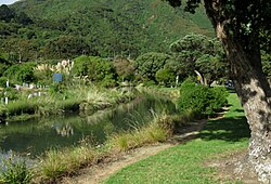
In 2010–2011, a volunteer group of residents was formed as the Friends of Waiwhetū Stream to act as guardians and take action to restore the upper reaches of the stream, with the support of the Greater Wellington Regional Council and Hutt City Council.[48] One of the early tasks undertaken was the removal of the invasive aquatic plant Cape pond weed that had smothered the stream and impeded water flows. Over a period of three years, volunteers removed by hand approximately 300,000 plants from 3.4 kilometres (2.1 mi) of the stream.[3]:26 In 2023, the Friends of Waiwhetū Stream reported that annual sweeps of the river had shown that there are no longer any Cape pond weed plants present.[5] The group also controls other invasive plants on the banks of the stream such as tradescantia and blackberry, and contributes to surveys of fish and invertebrates in the stream.[5]
Over the period from 2011 to 2021, volunteers planted 34,000 eco-sourced[49] plants, along six kilometres (3.7 mi) of the stream's banks.[3]:33 From 2015-2017, two small projects were undertaken in Naenae on a stretch of the stream that had been turned into a concrete channel in the 1930s or 1940s. A section of concrete berm along the channel was removed and plants put in. Removing the concrete berm was expensive, so another solution tried was to plant the edges of the concrete berm to soften the edges of the stream. Rocks were placed into the stream channel to slow the flow of water, which enabled inanga to navigate upstream as well as creating a more attractive watercourse.[3]
In April 2019, the Hutt City Council commissioned a mosaic mural that celebrates the return of flora and fauna following the restoration of the stream.[50]
Seaview wastewater treatment plant and outfall
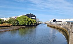
Prior to 2001, wastewater from the entire Hutt Valley was screened and then pumped without any further treatment via a pipeline along the eastern coastline of Wellington Harbour to an ocean outfall near the harbour entrance at Pencarrow Head. By the 1990s, the discharge of untreated sewage into the ocean had become environmentally unacceptable.[51] Planning for a new sewage treatment plan began in the mid 1990s. In 1998, tenders were called for a design, build and operate contract for a treatment plant to be built in Seaview that would provide secondary treatment of all sewage from the Hutt Valley and Wainuiomata.[51] It was to be located close to the Waiwhetū Stream. A contract was let in 1999,[52] and the plant was commissioned in 2001.[53]
In 2011, the Hutt City Council sought a 35 year consent for temporary discharges of treated effluent directly into the Waiwhetū Stream. These discharges would be required when maintenance was required on the main outfall pipeline. The temporary discharges cause pollution in the lower reaches of Waiwhetū Stream and in the estuary of the Hutt River, making it unsafe to collect shellfish, fish or swim in the area. The consent was opposed by the Friends of Waiwhetū Stream and local Māori.[54]
In March 2022, Wellington Water reported a leak in the pipeline to the outfall, in the Seaview area. Repairs required the shutdown of the pipeline, and the discharge of fully treated wastewater into Waiwhetū Stream while the repairs were carried out.[55] In September 2023, Wellington Water predicted that pipeline shutdowns for repairs will become increasingly frequent, possibly rising to 30 times per year, with a typical repair time of 1 week, leading to repeated discharges of treated wastewater into the Waiwhetū Stream. Options presented to the Hutt City and Upper Hutt councils included refurbishment of the existing pipeline, or the construction of a new pipeline in Wellington Harbour. The forecast costs of a new outfall pipeline were approximately $700 million, with a further $300 million required for upgrades to the Seaview treatment plant, including a replacement sludge drier.[56]
See also
ลิงก์ภายนอก

- ประวัติ Waiwhetūที่DigitalNZ
- กลุ่มเพื่อนของลำธารไวเวทู
- คลิปวิดีโอโดยกลุ่มเพื่อนของลำธารไวเวทู
- คุณภาพน้ำ – ลำธารไวเวทู บริเวณไวท์สไลน์ตะวันออก
- วิดีโอ The Waiwhetū Stream, Wellingtonโดย Land, Air, Water Aotearoa, กันยายน 2015
- ภาพถ่ายแสดงมลพิษในลำธารไวเวทูเมื่อปี 1975
- ภาพคลองระบายน้ำจากนาเอเนไปยังถนนวอดดิงตันไดรฟ์ รวมถึงคนงานของเทศบาลกำลังหว่านเมล็ดหญ้าที่สวนนาเอเนในส่วนหน้าของภาพ ปี 1958 จากคอลเล็กชันของหนังสือพิมพ์อีฟนิงโพสต์ หอสมุดอเล็กซานเดอร์ เทิร์นบูลล์
41°13′16″ส174°55′26″E / 41.221°S 174.924°E / -41.221; 174.924