
Taburno Camposauro
| Taburno Camposauro | |
|---|---|
 | |
| Highest point | |
| Peak | Monte Taburno |
| Elevation | 1,394 m (4,573 ft)[1] |
| Prominence | 1,115 m (3,658 ft) |
| Listing | Ribu |
| Coordinates | 41°6′30″N14°36′30″E / 41.10833°N 14.60833°E |
| Geography | |
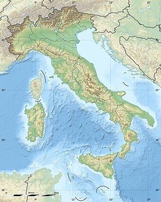  Taburno Camposauro Location of the Taburno Camposauro within Italy | |
| Location | Province of Benevento, Campania, Italy |
| Parent range | Campanian Apennines |
| Geology | |
| Rock age | Mesozoic |
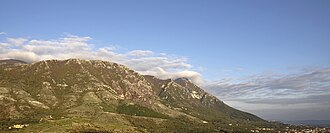
Taburno Camposauro is a massif located in the Apennines, to the west of Benevento, in the Campania region of Southern Italy. Its highest peak is the Taburno, at 1,393 m. It is composed of two groups of calcareous mountains separated by a plain. The fauna is affected by human activities, but the birdlife is very diverse. Several historical structures, mainly religious, are located on the massif. A DOC wine is produced in the area.
History
The Romans knew the mountain by the name Taburnus. It lay in the Caudine part of the Samnium, near the location of the famous Battle of the Caudine Forks. The name seems to come from the Oscan language.[2] The mountain was mentioned by Virgil in the Aeneid and in the Georgics, where he described it as "mighty".[3][4] In his Cynegeticon, Gratius Faliscus described the mountain as "craggy".[5]
Bands of brigands used the massif as a refuge and a base for their activities, especially immediately after the unification of Italy.[6]
Geography and geology

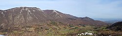
Taburno Camposauro is an isolated calcareous massif in the Campanian Apennines whose formation dates back to the Mesozoic. It lacks superficial waters. Karst phenomena including hollows and caves are frequent on the massif. The southern slopes are much steeper and more craggy than the northern ones.[7] Because of the type of clay and the fossil sand found there it is believed that in the mid-Pliocene there was a shallow sea in the area. The oldest limestone rocks in the province are found on the massif. At the foot of the southern group is the Fizzo source, that provides water to the Royal Palace of Caserta via the Aqueduct of Vanvitelli.[8]
It is located west of Benevento, and it falls wholly within its province. It is composed of two groups of mountains, the Taburno in the south and the Camposauro in the north, separated by the Prata plain.[7] The Valle Telesina separates the Taburno Camposauro from the Matese mountains, while the densely settled Valle Caudina separates it from the Partenio massif. The highest peaks are: Taburno (1393 m), Camposauro (1390 m), Alto Rotondi (1305 m), Gaudello (1226 m), Sant'Angelo (1189 m), and Pentime (1168 m), which are placed in a semicircle thus shaping the Vitulano Valley in the center.[9][10]
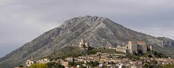
Its territory is shared by fourteen comuni: Bonea, Bucciano, Cautano, Foglianise, Frasso Telesino, Melizzano, Moiano, Montesarchio, Paupisi, Sant'Agata de' Goti, Solopaca, Tocco Caudio, Torrecuso and Vitulano. The tallest peak is in the municipality of Bonea. Seen from Benevento the profile of the mountain resembles a sleeping woman; for this reason it is referred to as “Samnium’s sleeper” (la dormiente del Sannio).[11] The massif is protected as part of the Regional Park of Taburno-Camposauro, which extends for 12,370 hectares, with a total population of about 25,000.[7]
Fauna
สัตว์ป่าในเทือกเขามีความหลากหลาย แม้ว่าแรงกดดันจากกิจกรรมของมนุษย์จะนำไปสู่การหายไปของสัตว์หายากในพื้นที่ และการขาดแคลนแหล่งน้ำจำกัดความหลากหลายของสายพันธุ์ แต่ Taburno Camposauro ก็มีสัตว์ป่าที่หลากหลายที่สุดในจังหวัดเบเนเวนโต เนื่องจากมีสภาพแวดล้อมที่แตกต่างกันมากมาย[ 12 ]ด้วยความหลากหลายนี้ ทำให้มีนกหลากหลายสายพันธุ์จำนวนมาก โดยมีการสังเกตพบถึง 94 สายพันธุ์ ซึ่งในจำนวนนี้มี 75 สายพันธุ์ที่ทำรังนกกานกเหยี่ยวนกไต่ไม้ นกเรดวิงและ นก กินแมลง หลาย ชนิดสามารถพบเห็นได้ในเทือกเขานี้
สัตว์เลี้ยงลูกด้วยนมได้รับผลกระทบจากการรุกรานของมนุษย์และโครงสร้างพื้นฐานถนนที่กว้างขวาง สัตว์ที่พบได้บ่อยที่สุด ได้แก่ หนู ค้างคาวเม่นยุโรปตัวตุ่น และสุนัขจิ้งจอก การมีอยู่ของหมาป่านั้นไม่แน่นอน เชื่อกันว่าพวกมันอาจผ่านเข้ามาในพื้นที่นี้ในช่วงที่มีการเคลื่อนย้าย แต่ไม่เคยมีการสังเกตพบประชากรหมาป่าที่มั่นคง กระต่ายและหมูป่าที่พบในเทือกเขานั้นถูกนำเข้ามาเพื่อการล่าสัตว์เป็นหลัก
จำนวนสัตว์สะเทินน้ำสะเทินบกได้รับผลกระทบจากการขาดแคลนน้ำคางคกธรรมดา และ คางคกเขียวยุโรปซึ่งพบได้ยากกว่าสามารถพบได้ในร่องน้ำ ในขณะที่ใกล้กับแหล่งน้ำพุในระดับความสูงที่ต่ำกว่า จะพบกบต้นไม้อิตาลีและกบลำธารอิตาลีมีงูสองชนิดที่ทราบกันดีว่าอาศัยอยู่ ได้แก่งูสี่แถบและงูแอสคิวลาเปียนในขณะที่สัตว์เลื้อยคลานขนาดเล็กหลายชนิดอาศัยอยู่ในเทือกเขา ซึ่งรวมถึงจิ้งจกผนังอิตาลีและจิ้งจกตุ๊กแก[ 13 ] [ 14 ]
ฟลอร่า
ที่ระดับความสูงต่ำกว่า 800 เมตรเหนือระดับน้ำทะเล ผลกระทบจากกิจกรรมของมนุษย์นั้นรุนแรง และพืชพรรณส่วนใหญ่เป็นต้นมะกอกในกลุ่ม Taburno และไร่องุ่นในกลุ่ม Camposauro ที่ระดับความสูงระหว่าง 800 ถึง 1000 เมตร พืชพรรณส่วนใหญ่คือFraxinus ornus , Carpinus orientalis , Ostrya carpinifoliaและfield elmที่ระดับความสูงเหนือ 1000 เมตร ต้นไม้ที่โดดเด่นใน Taburno คือต้นสนเงินยุโรปและต้นบีชพร้อมด้วยพืชต่างๆ เช่นต้นฮอลลี่ทั่วไปและต้นเบลลาดอนนาในขณะที่ Camposauro มีป่าผสม โดยมีต้นโอ๊กเขียวตลอดปี เป็นส่วนใหญ่ ทางทิศตะวันตกเฉียงเหนือและบนยอดเขา และมีต้นโอ๊กขนปุยและต้นเมเปิลอยู่บนเนินเขาทางทิศเหนือ[ 7 ]
The European silver firs found on the Taburno were planted by the Bourbons around 1846, and are now part of the State-Owned Forest of Taburno (Foresta demaniale del Taburno), which extends for 614 hectares and hosts mostly beeches.[8]
Landmarks

The ruins of the abbey of Santa Maria in Gruptis are located in the Camposauro group, on the side of a gorge overlooking the Valle Telesina. It was founded in the 10th century and used by several monastic orders, before being deconsecrated in 1705.[15]
On the southern slopes of Mount Taburno, in the comune of Bucciano, is the Sanctuary of the Virgin of Taburnus, built at the end of the 15th century and used by Dominican friars. The complex includes a church, a convent, a cloister and a bell-tower. After falling into disrepair, it was slowly restored starting in 1892.[16]
In the Taburno group, there are the ruins of the Casina Reale, a hunting lodge used by the Bourbon royalty. The rocky southern mountainside hosts several caves, among which is Saint Simeon's cave, with frescoes dating back to 1600.[8] In the northeastern part of the massif, high above Vitulano, is the Hermitage of Saint Mennas built in the 9th century.[17] On the exact point of the tallest peak of the massif is a large cross with a CAI summit book.[18]
Wine production
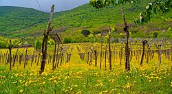
Italian wine, both red, white, rose and sparkling, under the Taburno DOC appellation comes from vineyards in the foothills around the mountains in Campania. Grapes destined for DOC production must be harvested up to a maximum yield of 13 tonnes/hectare, with the finished wines fermented to a minimum alcohol level of 11%.[19] The Taburno DOC is currently a subzone of the Sannio DOC label.[20]
Red and rose Taburno is a blend of 40-50% Sangiovese, 30-40% Aglianico with up to 30% of other grape varieties (both red and white), such as Barbera del Sannio, permitted to fill in the remainder of the blend. The whites are made from 40-50% Trebbiano, 30-40% Falanghina and up to 30% of other local white grape varieties. A sparkling spumante is produced under the Taburno DOC from a minimum 60% blend of Coda di Volpe and/or Falanghina with other local white varieties permitted to fill in up to 40% of the blend. Taburno wines labeled as Riserva must attain a minimum alcohol level of 12% and be aged for at least three years prior to release.[19]
External links
- List of all flora species found on the massif (pdf)
- Official website of the regional park