อ่าน 26 นาที
สมาพันธ์มุยสกา (หน่วยทางการเมือง)
สมาพันธ์มุยสกา เป็น สมาพันธ์ หลวมๆ ของ หัวหน้าเผ่า มุยสกา ต่างๆ ใน ที่ราบสูง แอนเดียนตะวันออก ของ โคลอมเบีย ในปัจจุบันก่อนที่ สเปนจะพิชิต อเมริกาใต้ตอนเหนือ [ 7 ] สหภาพเหล่านี้...
สมาพันธ์มุยสกา (หน่วยทางการเมือง)
สังคมที่ซับซ้อนของชาวมุยสกา | |||||||||
|---|---|---|---|---|---|---|---|---|---|
| ประมาณ ค.ศ. 800 [ 1 ] –1540 | |||||||||
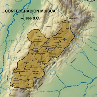
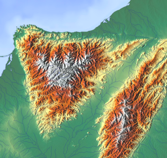
![แผนที่อาณาเขตของชาวมุยสกาตาม Falchetti และ Plazas ในช่วงทศวรรษ 1970 แผนที่นี้ได้รับการวิพากษ์วิจารณ์ เนื่องจากส่วนใหญ่ใช้บันทึกเหตุการณ์ของ Lucas Fernández de Piedrahita ในช่วงปลายศตวรรษที่ 17 ซึ่งถือว่าไม่น่าเชื่อถือ[2] ตามเอกสารอาณานิคม สมาพันธ์ของ Sogamoso และ Duitama เป็นอิสระจาก Tunja และมีความสำคัญอย่างมาก[3]](https://upload.wikimedia.org/wikipedia/commons/thumb/3/35/Mapa_del_Territorio_Muisca.svg/250px-Mapa_del_Territorio_Muisca.svg.png) แผนที่อาณาเขตของชาวมุยสกาตามฟัลเชตติและพลาซาสในช่วงทศวรรษ 1970 แผนที่นี้ได้รับการวิพากษ์วิจารณ์ เนื่องจากส่วนใหญ่ใช้บันทึกเหตุการณ์ของลูคัส เฟอร์นันเดซ เด ปิเอดราฮิตา ในช่วงปลายศตวรรษที่ 17 ซึ่งถือว่าไม่น่าเชื่อถือ[ 2 ]ตามเอกสารอาณานิคม สมาพันธ์โซกาโมโซและดูอิตามาเป็นอิสระจากตุนฮาและมีความสำคัญอย่างมาก[ 3 ] | |||||||||
| เมืองหลวง | บากาตา ( โบโกตา ), ฮุนซาและซัวม็อกซ์ตุนดามา(800–1540) | ||||||||
| ภาษาทั่วไป | ภาษาถิ่นมุยสคูบุน[ 4 ] | ||||||||
| ศาสนา | ศาสนามุยสกา | ||||||||
| รัฐบาล | สมาพันธ์อิสระของหัวหน้าเผ่าต่างๆ | ||||||||
| ชื่อเรื่องต่างๆ | |||||||||
• ประมาณปี ค.ศ. 1450–1470 (บันทึกเหตุการณ์ในยุคอาณานิคมโดย Piedrahíta) | ซาเกฮันซาฮูอาซิปาเมอิกูชูกา | ||||||||
• 1470–1490 (ปีเอดราฮีตา นักบันทึกเหตุการณ์ในยุคอาณานิคม) | zaque Saguamanchica zipa Michuá | ||||||||
• 1490–1537 (นักบันทึกเหตุการณ์ในยุคอาณานิคม ปิเอดราฮีตา) 1490–1514 (นักบันทึกเหตุการณ์ในยุคอาณานิคม ปิเอดราฮีตา) | zaque Quemuenchatocha zipa เนเมเกเน่ | ||||||||
• 1514–1537 (ปีเอดราฮีตา นักบันทึกเหตุการณ์ในยุคอาณานิคม) | zipa Tisquesusa | ||||||||
• 1537–1540 (นักบันทึกเหตุการณ์ในยุคอาณานิคม ปีเอดราฮีตา) 1537–1539 (นักบันทึกเหตุการณ์ในยุคอาณานิคม ปีเอดราฮีตา) | zaque Aquiminzaque ซิปาซากิปา | ||||||||
| ยุคประวัติศาสตร์ | ยุคก่อนโคลัมบัส | ||||||||
• ที่จัดตั้งขึ้น | ประมาณ ค.ศ. 800 [ 1 ] | ||||||||
| มีนาคม ค.ศ. 1537 | |||||||||
| 20 เมษายน ค.ศ. 1537 | |||||||||
• การพิชิตฮุนซา | 20 สิงหาคม ค.ศ. 1537 | ||||||||
• การทำลายวิหารสุริยะ | กันยายน ค.ศ. 1537 | ||||||||
• การก่อตั้งเมืองโบโกตายุทธการที่โตกาเรมา | 6 สิงหาคม 1538 20 สิงหาคม 1538 | ||||||||
| 6 สิงหาคม 1539 ธันวาคม 1539 | |||||||||
• การประหารชีวิตอากิมินซาเก | 1540 | ||||||||
| พื้นที่ | |||||||||
• ทั้งหมด | 22.000 [ 5 ] กม. 2 (8.494 ตร.ไมล์) | ||||||||
| ประชากร | |||||||||
• ต้นศตวรรษที่ 16 [ 6 ] | 2 ล้าน | ||||||||
| |||||||||
| วันนี้เป็นส่วนหนึ่งของ | โคลอมเบีย - กุนดินามาร์กา - โบยากา - ซานตานเดร์ | ||||||||
สมาพันธ์มุยสกาเป็นสมาพันธ์ หลวมๆ ของหัวหน้าเผ่ามุยสกา ต่างๆ ใน ที่ราบสูง แอนเดียนตะวันออก ของ โคลอมเบียในปัจจุบันก่อนที่สเปนจะพิชิตอเมริกาใต้ตอนเหนือ[ 7 ]สหภาพเหล่านี้ ซึ่งมีศูนย์กลางอยู่ที่หัวหน้าเผ่าหลักที่ได้รับการยอมรับจากหัวหน้าเผ่าย่อย ไม่ใช่สมาพันธ์มุยสกาเดียว หรือแม้แต่สมาพันธ์หลวมๆ ของหัวหน้าเผ่า แต่เป็นหน่วยงานระดับภูมิภาคอิสระหลายแห่ง[ 8 ]พื้นที่ซึ่งปัจจุบันเรียกว่าAltiplano Cundiboyacenseประกอบด้วยจังหวัด Boyacá , Cundinamarcaและส่วนเล็กๆ ของSantander ในปัจจุบัน [ 9 ]
โดยปกติแล้วอาณาจักรของมุยสกาประกอบด้วยหน่วยพื้นฐานที่สืบเชื้อสายทางมารดาหลายหน่วย ( utaหน่วยย่อย หรือsibynหน่วยใหญ่) ซึ่งชาวสเปน เรียกว่า capitanías [ 10 ]อย่างไรก็ตาม อำนาจนั้นขึ้นอยู่กับพันธมิตรของผู้นำมุยสกา แต่ละคน กับครัวเรือนหรือหน่วยพื้นฐาน[ 11 ]บ่อยครั้งที่sibynคือหมู่บ้าน และuta คือ กลุ่มบ้าน[ 12 ]มีการจัดตั้งสมาพันธ์อาณาจักรขึ้น 4 แห่งในดินแดนของมุยสกา ได้แก่โบโกตาตุนฮา ดูอิตามาและโซกาโมโซ [ 7 ] นอกจาก นี้ กัวเนและลาเชที่พูดภาษาชิบชายังอยู่ภายใต้การปกครองของสมาพันธ์กัวเนนตาและสมาพันธ์เอลโคคูยตามลำดับ[ 13 ] [ 14 ]มีแบบจำลองที่แตกต่างกันเพื่ออธิบายลักษณะของอำนาจในหมู่ชนชั้นนำของมุยสกา[ 15 ]
ภูมิศาสตร์

ภูมิอากาศ
| แผนภูมิสภาพภูมิอากาศแสดงสภาวะสุดขั้วและแหล่งที่อยู่อาศัยที่สำคัญที่สุดสี่แห่งของสมาพันธ์มุยสกา | |||||||||||||||||||||||||||||||||||||||||||||||||||||||||||||||||||||||||||||||||||||||||||||||||||||||||||||||||||||||||||||||||||||||||||||||||||||||||||||||||||||||||||||||||||||||||||||||||||||||||||||||||||||||||||||||||||||||||||||||||||||||||||||||||||||||||||||||||||||||||||||||||||||||||||||||||||||||||||||||||||||||||||||||||||||||||||||||||||||||||||||||||||||||||||||||||||||||||||||||||||||||||||||||||||||||||||||||||||||||||||||||||||||||||||||||||||||||||||||||||||||||||||||||||||
|
|
|
| ||||||||||||||||||||||||||||||||||||||||||||||||||||||||||||||||||||||||||||||||||||||||||||||||||||||||||||||||||||||||||||||||||||||||||||||||||||||||||||||||||||||||||||||||||||||||||||||||||||||||||||||||||||||||||||||||||||||||||||||||||||||||||||||||||||||||||||||||||||||||||||||||||||||||||||||||||||||||||||||||||||||||||||||||||||||||||||||||||||||||||||||||||||||||||||||||||||||||||||||||||||||||||||||||||||||||||||||||||||||||||||||||||||||||||||||||||||||||||||||||||||||||||||||||
|  |  |
| ||||||||||||||||||||||||||||||||||||||||||||||||||||||||||||||||||||||||||||||||||||||||||||||||||||||||||||||||||||||||||||||||||||||||||||||||||||||||||||||||||||||||||||||||||||||||||||||||||||||||||||||||||||||||||||||||||||||||||||||||||||||||||||||||||||||||||||||||||||||||||||||||||||||||||||||||||||||||||||||||||||||||||||||||||||||||||||||||||||||||||||||||||||||||||||||||||||||||||||||||||||||||||||||||||||||||||||||||||||||||||||||||||||||||||||||||||||||||||||||||||||||||||||||||
|
|
|
| ||||||||||||||||||||||||||||||||||||||||||||||||||||||||||||||||||||||||||||||||||||||||||||||||||||||||||||||||||||||||||||||||||||||||||||||||||||||||||||||||||||||||||||||||||||||||||||||||||||||||||||||||||||||||||||||||||||||||||||||||||||||||||||||||||||||||||||||||||||||||||||||||||||||||||||||||||||||||||||||||||||||||||||||||||||||||||||||||||||||||||||||||||||||||||||||||||||||||||||||||||||||||||||||||||||||||||||||||||||||||||||||||||||||||||||||||||||||||||||||||||||||||||||||||
| สภาพภูมิอากาศ ( Af - Cfb - Cwb ) ของพื้นที่ทางภูมิศาสตร์ (ตะวันตกเฉียงเหนือ ตะวันออกเฉียงเหนือ ตะวันตกเฉียงใต้ และตะวันออกเฉียงใต้) และลักษณะภูมิประเทศสุดขั้ว สำหรับชุมชนหลักทั้งสี่แห่งของสมาพันธ์มุยสกาที่ตั้งอยู่บนที่ราบสูงอัลติปลาโนจากตะวันตกเฉียงใต้ไปตะวันออกเฉียงเหนือ ได้แก่บากาตา ฮุนซา ซูอาม็อกซ์และทุนดามาค่อนข้างคงที่ตลอดทั้งปี โดยมีช่วงที่ฝนตกชุกกว่าในเดือนเมษายน-พฤษภาคม และตุลาคม-พฤศจิกายน | |||||||||||||||||||||||||||||||||||||||||||||||||||||||||||||||||||||||||||||||||||||||||||||||||||||||||||||||||||||||||||||||||||||||||||||||||||||||||||||||||||||||||||||||||||||||||||||||||||||||||||||||||||||||||||||||||||||||||||||||||||||||||||||||||||||||||||||||||||||||||||||||||||||||||||||||||||||||||||||||||||||||||||||||||||||||||||||||||||||||||||||||||||||||||||||||||||||||||||||||||||||||||||||||||||||||||||||||||||||||||||||||||||||||||||||||||||||||||||||||||||||||||||||||||||
สมาพันธ์มุยสกา

ชาวมุยสกาอาศัยอยู่ในเทือกเขาแอนเดสโอเรียนทาเลสในดินแดนที่มีพื้นที่ประมาณ 22,000 ตารางกิโลเมตร[ 5 ] ในช่วงเวลาที่สเปนเข้ายึดครองดินแดน มี สมาพันธ์อยู่ 4 แห่งในดินแดนของพวกเขา ( โบโกตา , ตุนฮา , ดูอิตามา , โซกาโมโซ ) [ 7 ]ตามเอกสารของอาณานิคม สมาพันธ์โซกาโมโซและดูอิตามาเป็นอิสระจากตุนฮาและมีความสำคัญอย่างมาก[ 3 ]อำนาจทางการเมืองไม่ได้ขึ้นอยู่กับการอยู่ภายใต้การปกครองทางเศรษฐกิจหรือการเมือง แต่เป็นการยอมรับอำนาจบางอย่าง ซึ่งบางครั้งอาจมีหลายแห่งพร้อมกัน[ 16 ]ขนาดของประชากรมุยสกายังคงเป็นที่ถกเถียงกันอยู่[ 17 ]หัวหน้าเผ่าที่มีอำนาจมากที่สุดในช่วงเวลาที่สเปนเข้ายึดครองดินแดนคือโบโกตา[ 18 ]นอกจากนี้ยังมีหัวหน้าเผ่าอิสระทางตะวันตกเฉียงเหนือ ซึ่งไม่ได้สังกัดสมาพันธ์ใดๆ[ 19 ]
ชุมชน Muisca ได้รับการจัดระเบียบโดยรอบรั้วหรือ cercadoของหัวหน้าเผ่า[ 20 ] [ 21 ]มีถนนเชื่อมต่อชุมชนต่างๆ เข้าด้วยกันและเชื่อมต่อกับกลุ่มชนพื้นเมืองโดยรอบ ซึ่งกลุ่มGuane และ Lache ทางเหนือกลุ่ม PancheและMuzoทางตะวันตก และกลุ่ม Guayupe , AchaguaและTeguaทางตะวันออก เป็นกลุ่มที่สำคัญที่สุด
ประวัติศาสตร์
ยุคก่อนประวัติศาสตร์
ชาวอเมริกันพื้นเมืองยุคแรกๆ ดำรงชีวิตแบบล่าสัตว์และเก็บของป่าท่ามกลางสัตว์ขนาดใหญ่ที่ ยังคงมีชีวิตอยู่จนถึงปัจจุบัน อาศัยอยู่ในแหล่งที่อยู่อาศัยที่เย็นสบายรอบๆ ทะเลสาบในยุคไพลสโตซีน ซึ่งทะเลสาบฮูเมดาลในโบโกตาทะเลสาบซูเอสกาทะเลสาบฟูเกเนและทะเลสาบเฮอร์เรราเป็นตัวอย่างที่โดดเด่นมีการค้นพบ หลักฐานมากมายเกี่ยวกับการตั้งถิ่นฐาน ของประชากร ในช่วงปลายยุค ไพลสโตซีนถึงกลางยุคโฮโลซีน ในทุ่งหญ้าสะวันนาโบโกตา ที่ราบสูงในเทือกเขาแอนดีสของโคลอมเบีย เช่นเดียวกับ ถ้ำและที่พักอาศัยในโขดหินทั่วไปเทเกนดามามีผู้คนอาศัยอยู่ตั้งแต่ประมาณ 11,000 ปีที่แล้ว และต่อเนื่องมาจนถึงยุคก่อนประวัติศาสตร์ ยุค เฮอร์เรราและ ยุค มุยสกาทำให้เป็นแหล่งโบราณสถานเก่าแก่ที่สุดของโคลอมเบีย ร่วมกับเอล อับรา (12,500 ปีที่แล้ว) ซึ่งตั้งอยู่ทางเหนือของซิปากีราและทิบิโตซึ่งตั้งอยู่ภายในเขตแดนของโตกันซิปา (11,740 ปีที่แล้ว) [ 22 ] [ 23 ]ซากมนุษย์ที่เก่าแก่ที่สุดและโครงกระดูกที่สมบูรณ์ที่เก่าแก่ที่สุดถูกค้นพบที่ Tequendama และได้รับการตั้งชื่อว่า "Hombre del Tequendama" หรือHomo Tequendamaสิ่งประดิษฐ์อื่นๆ ถูกค้นพบในGachalá (9100 ปีก่อนปัจจุบัน), Sueva ( Junín ) และZipacón [ 24 ]ทางตะวันตกของที่ราบสูง Altiplano พบซากโบราณสถานทางโบราณคดีที่เก่าแก่ที่สุดในPubenza ซึ่ง เป็นส่วนหนึ่งของ Tocaima และมีอายุประมาณ 16,000 ปีก่อนปัจจุบัน[ 25 ]
ยุคก่อนโคลัมบัส
| ลำดับเหตุการณ์การตั้งถิ่นฐานในที่ราบสูงกุนดิโบยาเซนเซ ประเทศโคลอมเบีย | |
 |    |
ยุคเฮอร์เรรา
| ชื่อ ช่วงเวลา | อายุ เริ่ม ต้น | ยุค สุดท้าย |
|---|---|---|
| เฮอร์เรรา | 800 ปีก่อนคริสตกาล | 800 |
| ดนตรีสมัยต้น | 800 | 1200 |
| มิวสก้าตอนปลาย | 1200 | 1537 |
| Kruschek, 2003 [ 1 ] | ||
ยุคเฮอร์เรราเป็นยุคประวัติศาสตร์ที่ตั้งชื่อตามทะเลสาบลาเฮอร์เรราทางใต้ของโบโกตา เกิดขึ้นประมาณระหว่าง 800 ปีก่อนคริสตกาลถึง 800 ปีหลังคริสตกาล[ 26 ] [ 27 ]อย่างไรก็ตาม ความเห็นพ้องทางวิชาการในปัจจุบันถือว่ายุคนี้มีช่วงเวลาตั้งแต่ 400 ปีก่อนคริสตกาลถึง 1000 ปีหลังคริสตกาล โดยมีความแตกต่างกันในแต่ละภูมิภาค[ 28 ]การมาถึงของชาวมุยสกาที่อัลติปลาโน คุนดิเบียเซนเซ น่าจะเกิดขึ้นก่อนการเริ่มต้นของยุคเฮอร์เรรา[ 29 ]อย่างไรก็ตาม วันที่แน่นอนของการมาถึงของพวกเขายังไม่เป็นที่ทราบแน่ชัด และวันที่เก่าที่สุดน่าจะเป็นช่วงกลางของสหัสวรรษแรกก่อนคริสตกาล[ 29 ]
โดยทั่วไป ยุคเฮอร์เรรามีลักษณะเด่นคือการเกษตร ประเพณีการทำเครื่องปั้นดินเผา และการใช้แหล่งเกลือ[ 30 ]การจัดระเบียบทางการเมืองและระดับความซับซ้อนทางสังคมในยุคเฮอร์เรรายังไม่แน่นอน[ 31 ]
มุยสกา
 |
| ส่วนหนึ่งของชุดบทความเกี่ยวกับ |
| วัฒนธรรมมุยสกา |
|---|
| หัวข้อ |
| ภูมิศาสตร์ |
| คนเกลือ |
| เพื่อนบ้านหลัก |
| ประวัติและลำดับเหตุการณ์ |
นักวิชาการแบ่งช่วงเวลาที่เรียกว่า "มุยสกา" ออกเป็น "มุยสกาตอนต้น" (ประมาณ ค.ศ. 1000–1200 ) และ "มุยสกาตอนปลาย" (ประมาณ ค.ศ. 1200–1600) [ 32 ]ช่วงเวลานี้เกี่ยวข้องกับการเกิดขึ้นของอาณาจักรหัวหน้าเผ่ามุยสกา[ 33 ] [ 34 ]ด้วยการสร้างโครงสร้างขนาดใหญ่ ชนชั้นสูงจึงได้รับอำนาจควบคุมทางอุดมการณ์มากกว่าการควบคุมทางเศรษฐกิจโดยตรง[ 35 ]สาเหตุของการขยายตัวของอาณาจักรหัวหน้าเผ่ายังไม่เป็นที่แน่ชัด[ 7 ]ตามที่ Gerardo Reichel-Dolmatoff กล่าว อาณาจักรหัวหน้าเผ่าอิสระทางตะวันตกเฉียงเหนือเป็นตัวแทนของสถานะของสังคมมุยสกาก่อนการก่อตั้งสมาพันธ์[ 19 ]เป็นไปได้ว่า การแต่งงานระหว่างกันซึ่งดำเนินการอย่างอิสระจาก "อาณาเขต" ที่กำหนดให้กับแต่ละอาณาจักรหัวหน้าเผ่า มีบทบาทสำคัญ[ 36 ]บันทึกเหตุการณ์สองฉบับรายงานการขยายอำนาจของโบโกตาในเวอร์ชันที่แตกต่างกัน: [ 37 ]ตามที่Juan Rodríguez Freyle กล่าว การขยายอำนาจของโบโกตาเริ่มต้นเพียงหนึ่งปีก่อนการพิชิตของสเปน หลังจากที่ก่อการกบฏต่อหัวหน้าเผ่า Guatavita ที่เคยมีอำนาจเหนือกว่า[ 37 ]ในทางกลับกัน Lucas Fernández de Piedrahíta เล่าถึงการขยายอำนาจของโบโกตาในช่วง 67 ปี ซึ่งเป็นผลมาจากการรณรงค์ทางทหารต่างๆ ที่นำโดยหัวหน้าเผ่าหลายคน[ 37 ]ตามที่ Martha Herrera Angel กล่าว งานเขียนในยุคอาณานิคม แม้จะเต็มไปด้วยการกล่าวเกินจริงและความเข้าใจผิด แต่ก็มีแก่นแท้ของความจริงทางประวัติศาสตร์อยู่[ 9 ]
แนวคิดเรื่องgue (“บ้าน”) เป็นสิ่งจำเป็นสำหรับหัวหน้าเผ่ามุยสกาในการรักษาความชอบธรรมของพวกเขา[ 38 ]ซึ่งอิงตามกฎการสืบทอดตำแหน่งและความยินยอมของประชาชนในระดับหนึ่ง[ 21 ]บทบาทของพวกเขาคือการกระจายสินค้าส่วนเกินที่สะสมไว้ ไม่ใช่การสะสมสินค้า[ 39 ]การมีอยู่ของผู้เชี่ยวชาญทางศาสนาสามารถอธิบายได้จากความจำเป็นในการรักษาสมดุลของโลก[ 40 ]
ชาว มุยสกาใช้ระบบการนับแบบทศนิยม โดยอิงจากนิ้วมือ ระบบของพวกเขามีตั้งแต่ 1 ถึง 10 และสำหรับการนับเลขที่สูงกว่านั้น พวกเขาใช้คำนำหน้าว่าquihichaหรือqhichaซึ่งหมายถึง "เท้า" ในภาษาชิบชา (Muysccubun) ของพวกเขา ดังนั้น 11 จึงกลายเป็น "เท้าหนึ่ง" 12 "เท้าสอง" เป็นต้น เช่นเดียวกับอารยธรรม ก่อนยุคโคลัมบัสอื่นๆเลข 20 มีความสำคัญเป็นพิเศษ เพราะเป็นจำนวนรวมของอวัยวะส่วนปลายทั้งหมด ได้แก่ นิ้วมือและนิ้วเท้า ชาวมุยสกาใช้สองรูปแบบในการแสดงเลข 20 คือ "เท้าสิบ"; quihícha ubchihicaหรือคำเฉพาะของพวกเขา คือ guetaซึ่งมาจากgueที่หมายถึง "บ้าน" ตัวเลขระหว่าง 20 ถึง 30 นับเป็นgueta asaqui ata ("ยี่สิบบวกหนึ่ง"; 21) และgueta asaqui ubchihica ("ยี่สิบบวกสิบ"; 30) ตัวเลขที่มากกว่านั้นจะนับเป็นพหุคูณของยี่สิบgue-bosa ("20 คูณ 2"; 40), gue-hisca ("20 คูณ 5"; 100) อักษรของชาวมุยสกาประกอบด้วยอักษรภาพซึ่งใช้สำหรับตัวเลขเท่านั้น[ 41 ]ทองคำไม่ใช่สิ่งของหลักที่แสดงถึงเกียรติยศ แต่มีความสำคัญทางศาสนา เนื่องจากหัวหน้าเผ่านิยมสวมใส่เสื้อผ้าแปลกใหม่และมีรั้วไม้โอ่อ่าเพื่อแสดงอำนาจของตน[ 42 ]ชาวมุยสกาไม่มีสกุลเงิน[ 7 ]
การจัดระเบียบตามเขตแดน
| ประวัติศาสตร์ของชาวมุยสกา | |||||||||
 | |||||||||
| |  |  |  |  |  |  |  |  |
บาคาต้า

- เมืองหลวง – บากาตา
- พื้นที่ – 5,430 ตารางกิโลเมตร (2,100 ตารางไมล์)
- ระดับความสูงเฉลี่ย – 2,470 เมตร (8,100 ฟุต)
- ผู้ปกครองคนสุดท้าย – zipas Tisquesusa , Sagipa
- วันที่พิชิต – 20 เมษายน ค.ศ. 1537 (ฟุนซา) – ฆิเมเนซ และเปเรซ เด เกซาดา
- เมืองแรก – 6 สิงหาคม ค.ศ. 1538 (โบโกตา) – กอนซาโล ฆิเมเนซ เด เกซาดา
| เทศบาล | แผนกที่เป็นตัวหนาคือตัวพิมพ์ใหญ่ | ไม้บรรทัดที่เป็นตัวหนาคือที่นั่ง | ระดับความสูงของเขตเมือง (เมตร) | พื้นที่ผิว( ตร.กม. ) | หมายเหตุ | แผนที่ |
|---|---|---|---|---|---|---|
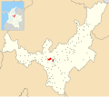
| บาคาต้า | คุนดินามาร์กา | ซิปา | 2640 | 1587 | พบมัมมี่มุยสกา พบ เมืองตลาดสำคัญพบ ภาพสลักหิน |  |
| โบจาคา | คุนดินามาร์กา | ซิปา | 2598 | 109 | พบ ภาพสลักหินที่ทะเลสาบเฮอร์เรรา |  |
| กาฮิกา | คุนดินามาร์กา | ซิปา | 2558 | 50.4 |  | |
| ลา กาเลรา | คุนดินามาร์กา | ซิปา | 2718 | 317 | พบ ภาพสลักหิน |  |
| กาเกซา | คุนดินามาร์กา | ซิปา | 1746 | 38 |  | |
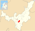
| เชีย | คุนดินามาร์กา | ซิปา | 2564 | 80 | พบ ภาพสลักหินที่แหล่ง โบราณสถาน วิหารพระจันทร์เฮอร์ เรรา |  |
| โชอาชี | คุนดินามาร์กา | ซิปา | 1923 | 223 | พบ หินโชอาชี |  |
| โชคอนตา | คุนดินามาร์กา | ซิปา | 2655 | 301.1 | เมืองตลาดสำคัญสมรภูมิโชคอนตา (~1490) ป้อมปราการระหว่างซิปาและซาเก |  |
| โคกัว | คุนดินามาร์กา | ซิปา | 2600 | 113 | พบ ภาพสลักหินจากการผลิตเครื่องปั้นดินเผาของชาวมุยสกา |  |
| โคตา | คุนดินามาร์กา | ซิปา | 2566 | 55 | ภาพสลักหินที่พบชาวมุยสกายังคงอาศัยอยู่ |  |
| คูคูนูบา | คุนดินามาร์กา | ซิปา | 2590 | 112 | พบ ภาพสลักหิน |  |
| ฟาคาตาติวา | คุนดินามาร์กา | ซิปา | 2586 | 158 | ปิเอดราส เดล ตุนโฆ |  |
| ฟันซ่า | คุนดินามาร์กา | ซิปา | 2548 | 70 | เมืองตลาดสำคัญ |  |
| กาชันซิปา | คุนดินามาร์กา | ซิปา | 2568 | 44 | พบมัมมี่มุยสกาการผลิตเครื่องปั้นดินเผาของชาวมุยสกา |  |
| กัวสก้า | คุนดินามาร์กา | ซิปา | 2710 | 346 | พบ ภาพสลักหินจากการผลิตเครื่องปั้นดินเผาของชาวมุยสกาที่ทะเลสาบซีชา |  |
| มาดริด | คุนดินามาร์กา | ซิปา | 2554 | 120.5 | พบ ภาพสลักหินที่ทะเลสาบเฮอร์เรรา |  |
| มอสเกรา | คุนดินามาร์กา | ซิปา | 2516 | 107 | พบ ภาพสลักหินที่ทะเลสาบเฮอร์เรรา |  |
| เนโมคอน | คุนดินามาร์กา | ซิปา | 2585 | 98.1 | เหมืองเกลือมุยสกาแหล่งโบราณสถานยุคก่อน เครื่องปั้นดินเผา เชกัวพบภาพ สลักหิน |  |
| ปาโช | คุนดินามาร์กา | ซิปา | 2136 | 403.3 | เมืองตลาดสำคัญ |  |
| ปาสก้า | คุนดินามาร์กา | ซิปา | 2180 | 246.24 | ยุทธการปาสคา (~1470) พบ แพ Muisca |  |
| เอล โรซาล | คุนดินามาร์กา | ซิปา | 2685 | 86.48 |  | |
| ซาน อันโตนิโอเดล เตเกนดามา | คุนดินามาร์กา | ซิปา | 1540 | 82 | พบ ภาพสลักหินป้อมปราการน้ำตกเตเกนดามาต่อต้านปันเช |  |
| เซสกิเล่ | คุนดินามาร์กา | ซิปา | 2595 | 141 | เหมืองเกลือทะเลสาบ Guatavita Minor Muisca |  |
| ซิบาเต้ | คุนดินามาร์กา | ซิปา | 2700 | 125.6 | พบ ภาพสลักหิน |  |
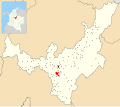
| โซอาชา | คุนดินามาร์กา | ซิปา | 2565 | 184.45 | ไซต์พรีเซรามิก ไซต์ Tequendama Herrera การผลิตเซรามิก Muiscaพบ Petrographs |  |
| โซโป | คุนดินามาร์กา | ซิปา | 2650 | 111.5 | เว็บไซต์ของเฮอร์เรรา |  |
| ซูบาโชเก | คุนดินามาร์กา | ซิปา | 2663 | 211.53 | พบ ภาพสลักหิน |  |
| ซูเอสก้า | คุนดินามาร์กา | ซิปา | 2584 | 177 | พบมัมมี่มุยสกา 150 ร่าง ที่ทะเลสาบซูเอสกาการผลิตเครื่องปั้นดินเผาของชาวมุยสกาเมืองตลาดสำคัญพบ ภาพสลักหิน |  |
| สุตาตะอุสะ | คุนดินามาร์กา | ซิปา | 2550 | 67 | พบ ภาพสลักหิน |  |
| ทาบิโอ | คุนดินามาร์กา | ซิปา | 2569 | 74.5 | บ่อน้ำพุร้อนที่ชาวมุยสกาใช้ |  |
| เทาซา | คุนดินามาร์กา | ซิปา | 2931 | 204 | พบ ภาพสลักหินในเหมืองเกลือมุยสกา |  |
| เทน่า | คุนดินามาร์กา | ซิปา | 1384 | 55 | พบ ป้อมปราการป้องกันปันเช่(ภาพสลักหิน) |  |
| เท็นโจ | คุนดินามาร์กา | ซิปา | 2587 | 108 | พบ ภาพสลักหิน |  |
| ทิบาคูย | คุนดินามาร์กา | ซิปาแอนด์ปานเช่ | 1647 | 84.4 | พบ ภาพสลักหินบริเวณชายแดนติดกับป้อมปราการปันเชและสุตาเกา |  |
| โตกันซิปา | คุนดินามาร์กา | ซิปา | 2605 | 73.51 | แหล่งโบราณคดีก่อนยุคเครื่องปั้นดินเผาTibitó แหล่งผลิตเครื่องปั้นดินเผาของชาวมุยสกาเมืองตลาดสำคัญพบ ภาพสลักหิน |  |
| ซิปากีรา | คุนดินามาร์กา | ซิปา | 2650 | 197 | เหมืองเกลือเอล อับ รา มุยสกา เมืองตลาดสำคัญพบ ภาพสลักและภาพเขียนบนหิน |  |
| ฟูเกเน | คุนดินามาร์กา | ซิปาซาเก | 2750 | 90 | ทะเลสาบฟูเกเน |  |
| ซิมิยากา | คุนดินามาร์กา | ซิปา (1490–1537) | 2559 | 107 | พิชิตโดยzipa Saguamanchicaบนzaque Michuá (~1490) |  |
| ซูซา | คุนดินามาร์กา | ซิปา (1490–1537) | 2655 | 86 | พิชิตโดยzipa Saguamanchicaบนzaque Michuá (~ 1490) ทะเลสาบ Fúquene |  |
| อูบาเต้ | คุนดินามาร์กา | ซิปา (1490–1537) | 2556 | 102 | พิชิตโดยzipa Saguamanchicaบนzaque Michuá (~1490) พบ มัมมี่ Muisca |  |
| ซิปาคอน | คุนดินามาร์กา | ซิปา | 2550 | 70 | สถานที่ เกษตรกรรมสถานที่ทำสมาธิของชาวซิปาพบ ภาพสลักหิน |  |
ชิปาซาเก

| เทศบาล | แผนก | ผู้ปกครอง | ระดับความสูง(เมตร) | พื้นที่ผิว( ตร.กม. ) | หมายเหตุ | แผนที่ |
|---|---|---|---|---|---|---|
| จูนิน | คุนดินามาร์กา | ชิปาซาเก้ | 2300 | 337 | พบ ภาพสลักหินร่วมกันระหว่างซิปาและซาเก |  |
ฮุนซ่า

- เมืองหลวง – ฮุนซา
- พื้นที่ – 4,700 ตารางกิโลเมตร (1,800 ตารางไมล์)
- ระดับความสูงเฉลี่ย – 2,270 เมตร (7,450 ฟุต)
- ผู้ปกครองคนสุดท้าย – zaques Quemuenchatocha , Aquiminzaque
- วันที่พิชิต – 20 สิงหาคม 1537 (ฮุนซา) – ฆิเมเนซ และเปเรซ เด เกซาดา
- เมืองแรก – 6 สิงหาคม 1539 (ตุนยา) – กอนซาโล ซัวเรซ เรนดอน


อิรากา

- แคปิตอล – ซูอาม็อกซ์
- พื้นที่ – 4,163 ตารางกิโลเมตร (1,607 ตารางไมล์)
- ระดับความสูงเฉลี่ย – 2,630 เมตร (8,630 ฟุต)
- ผู้ปกครองคนสุดท้าย – อิรากาซูกามูซี
- วันที่พิชิต – ต้นเดือนกันยายน ค.ศ. 1537 (โซกาโมโซ) – ฆิเมเนซ และเปเรซ เด เกซาดา
- การตั้งถิ่นฐานที่สำคัญ – ซัวม็อกซ์, บุสบันซา, ฟิราวิโตบา, กาเมซา และโตตา
- โบราณสถาน – มัมมี่ , การบูรณะวิหารสุริยะ , ทะเลสาบโตตา
| เทศบาล | แผนก | ไม้บรรทัดที่เป็นตัวหนาคือที่นั่ง | ระดับความสูง(เมตร) | พื้นที่ผิว( ตร.กม. ) | หมายเหตุ | แผนที่ |
|---|---|---|---|---|---|---|
| ซูอาม็อกซ์ | โบยากา | iraca Nompanim Sugamuxi | 2569 | 208.54 | มัมมี่ Sun Temple Muiscaพบเหมืองคาร์บอน Muisca |  |
| อากีตาเนีย | โบยากา | อิรากา | 3030 | 943 | ทะเลสาบโตตา |  |
| บุสบันซา | โบยากา | อิรากา | 2472 | 22.5 | ผู้เลือกตั้งแห่ง อิรากาใหม่ |  |
| คูติวา | โบยากา | อิรากา | 2750 | 43 | รูปปั้นโบชิกาที่ทะเลสาบโตตา | 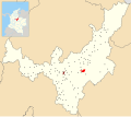 |
| ฟิราวิโตบา | โบยากา | อิรากา | 2500 | 109.9 | ผู้เลือกตั้งแห่ง อิรากาใหม่ | 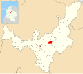 |
| กาเมซ่า | โบยากา | อิรากา | 2750 | 88 | เว็บไซต์ Herreraพบมัมมี่ Muisca เหมืองเกลือ Minor Muisca เหมืองคาร์บอน Muiscaพบ Petrographs | 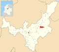 |
| อิซ่า | โบยากา | อิรากา | 2560 | 34 | พบ ภาพสลักหินที่ แหล่งโบราณคดี เฮอร์เรรา บริเวณทะเลสาบโตตา |  |
| มงกัว | โบยากา | อิรากา | 2975 | 365.5 | พบ ภาพสลักหิน |  |
| มงกี | โบยากา | อิรากา | 2900 | 81 | สถานที่เกิดของภาพสลักหิน ( ทอร์ โทลิทัส ) |  |
| เปสก้า | โบยากา | อิรากา | 2858 | 282 |  | |
| ทาสโก้ | โบยากา | อิรากา | 2530 | 167 | พบ มัมมี่ชาวมุยสกา |  |
| โทกา | โบยากา | อิรากา | 2810 | 165 |  | |
| รวม | โบยากา | อิรากา | 2870 | 314 | ทะเลสาบโตตา |  |
| โซโคตา | โบยากา | iracaทุนดามา | 2443 | 600.11 | พบ มัมมี่ชาวมุยสกา | 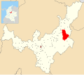 |
| ทิบาโซซา | โบยากา | ทุนดามาอิรากา | 2538 | 94.3 |  |
ทุนดามา

- เมืองหลวง – ทุนดามา
- พื้นที่ – 2,920 ตารางกิโลเมตร (1,130 ตารางไมล์)
- ระดับความสูงเฉลี่ย – 2,470 เมตร (8,100 ฟุต)
- ผู้ปกครองคนสุดท้าย – ทุนดามา
- วันที่พิชิต – ปลายเดือนธันวาคม ค.ศ. 1539 (ดุยตามา) – บัลตาซาร์ มัลโดนาโด
- การตั้งถิ่นฐานที่สำคัญ – Tundama, Onzaga, Soatá, Chitagoto (ปัจจุบันคือ Paz de Río)
| เทศบาล | แผนก | ไม้บรรทัดที่เป็นตัวหนาคือที่นั่ง | ระดับความสูง(เมตร) | พื้นที่ผิว( ตร.กม. ) | หมายเหตุ | แผนที่ |
|---|---|---|---|---|---|---|
| ทุนดามา | โบยากา | ทุนดามา | 2590 | 266.93 | ที่ตั้งของทุนดามาในทะเลสาบโบราณ |  |
| ออนซาก้า | ซานแทนเดอร์ | ทุนดามา | 1960 | 486.76 | มีความสำคัญต่อการผลิตขนสัตว์และฝ้าย |  |
| เซรินซ่า | โบยากา | ทุนดามา | 2750 | 61.63 | Monument to the Muisca |  |
| Paz de Río | Boyacá | Tundama | 2200 | 116 | Coca market town | 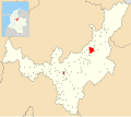 |
| Paipa | Boyacá | Tundama | 2525 | 305.924 | Thermal springs |  |
| Sativanorte | Boyacá | Tundama | 2600 | 184 | Herrera site |  |
| Sativasur | Boyacá | Tundama | 2600 | 81 | Muisca mummy SO10-IX foundHerrera site |  |
| Soatá | Boyacá | Tundama | 1950 | 136 | Herrera siteCoca market town | 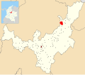 |
| Belén | Boyacá | Tundama | 2650 | 83.6 | Petrographs found | 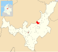 |
| Corrales | Boyacá | Tundama | 2470 | 60.85 |  | |
| Floresta | Boyacá | Tundama | 2506 | 86 |  | |
| Nobsa | Boyacá | Tundama | 2510 | 55.39 |  | |
| Santa Rosa de Viterbo | Boyacá | Tundama | 2753 | 107 |  | |
| Susacón | Boyacá | Tundama | 2480 | 191 |  | |
| Tibasosa | Boyacá | Tundamairaca | 2538 | 94.3 | | |
| Socotá | Boyacá | iracaTundama | 2443 | 600.11 | Muisca mummy found | |
Independent caciques
- Capital – none
- Area – 3,080 square kilometres (1,190 sq mi)
- Average elevation – 2,140 metres (7,020 ft)
- Important caciques – Guatavita, Ubaté, Chiquinquirá, Ubaque, Tenza, Vélez
| Municipalitybold is major cacique | Department | Ruler(s) | Altitude(m) | Surface area(km2) | Remarks | Map |
|---|---|---|---|---|---|---|
| Vélez | Santander | cacique | 2050 | 271.34 | 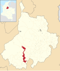 | |
| Chipatá | Santander | cacique | 1820 | 94.17 | First town conquered by the Spanish | 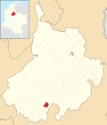 |
| Güepsa | Santander | cacique | 1540 | 33.08 | Border with GuaneBorder with Yarigui |  |
| Charalá | Santander | cacique | 1290 | 411 | Border with Guane |  |
| Arcabuco | Boyacá | cacique | 2739 | 155 | Statue honouring the Muisca warriors |  |
| Betéitiva | Boyacá | cacique | 2575 | 123 | 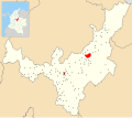 | |
| Boavita | Boyacá | cacique | 2114 | 159 | Muisca mummy found |  |
| Chiquinquirá | Boyacá | cacique | 2556 | 133 | 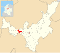 | |
| Cómbita | Boyacá | cacique | 2825 | 149 |  | |
| Covarachía | Boyacá | cacique | 2320 | 103 | Herrera site |  |
| Guateque | Boyacá | cacique | 1815 | 36.04 | Religious rituals at Guatoc hill | 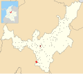 |
| Guayatá | Boyacá | cacique | 1767 | 112 | Muisca money (tejuelo) found |  |
| Moniquirá | Boyacá | cacique | 1669 | 220 | Muisca mummy foundMuisca copper mines |  |
| Pisba | Boyacá | cacique | 2400 | 469.12 | Muisca mummy found |  |
| Ráquira | Boyacá | cacique | 2150 | 233 | Muisca ceramics production | 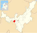 |
| Saboyá | Boyacá | cacique | 2600 | 246.9 | Petrographs found |  |
| Tópaga | Boyacá | cacique | 2900 | 37 | Muisca mummy foundMuisca carbon mines |  |
| Tutazá | Boyacá | cacique | 1890 | 135 | Muisca ceramics production |  |
| Tenza | Boyacá | cacique | 1600 | 51 | Tenza Valley |  |
| Chivor | Boyacá | cacique | 1800 | 108.36 | Muisca emerald mines | 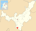 |
| Úmbita | Boyacá | cacique | 2480 | 148.17 | 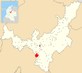 | |
| Carmen de Carupa | Cundinamarca | cacique | 2600 | 228 | Tunjo found | 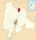 |
| Guatavita | Cundinamarca | cacique | 2680 | 247.3 | Muisca ceramics productionMain goldworking townPetrographs found |  |
| Gachetá | Cundinamarca | caciqueGuatavita | 1745 | 262.2 |  | |
| Guachetá | Cundinamarca | cacique | 2688 | 177.45 | Minor Muisca salt minesPetrographs found |  |
| Manta | Cundinamarca | cacique | 1924 | 105 |  | |
| Ubaque | Cundinamarca | cacique | 1867 | 104.96 | Last public religious ritual (1563) Lake Ubaque |  |
| Ubalá | Cundinamarca | cacique | 1949 | 505 | Muisca emerald mines |  |
| Chipaque | Cundinamarca | cacique | 2400 | 139.45 | Petrographs found |  |
| Fómeque | Cundinamarca | cacique | 1895 | 555.7 |  | |
| Quetame | Cundinamarca | cacique | 1496 | 138.47 |  | |
| Une | Cundinamarca | cacique | 2376 | 221 |  | |
| Fosca | Cundinamarca | cacique | 2080 | 126.02 | Fortification against Guayupe |  |
Neighbouring indigenous groups
| Yarigui | Guane | Lache | U'wa | ||
| Muzo | |  | |||
| Panche | Achagua | ||||
| Sutagao | Guayupe | Tegua | |||
| Cariban languages • Chibchan languages • Arawakan languages | |||||
| Yarigui and Lache not shown on map • Tegua shown as Tecua • U'wa shown as Tunebo | |||||
| [44][45][46][47][48][49][50][51][52][53] | |||||
- Panche
- Cariban-speaking
- frequent warfare
- beaten in the Battle of Tocarema
- pathways to gold
- conquest by Hernán Venegas Carrillo (1543–44)
- Muzo or The Emerald people
- Cariban-speaking
- trading access to western neighbours
- Furatena
- pathways to gold
- conquest by Luis Lanchero (1539–1559)
- Guane
- Chibcha-speaking
- producers of cotton for mantle making
- producers of fruits
- access to La Tora (Barrancabermeja); trading sea shells at Magdalena River
- conquest by Martín Galeano (1539–1551)
Sacred sites
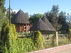
The sacred sites of the Muisca Confederation were based in the Muisca religion and mythology. The Muisca were a highly religious people with their own beliefs on the origin of the Earth and life and human sacrifices were no exception to please the gods for good harvests and prosperity.
Lake Guatavita, Guatavita, was the location where the new zipa would be inaugurated. It became known with the Spanish conquerors as the site of El Dorado where the new zipa was covered in gold dust and installed as the new ruler of the southern Muisca.[54]
In the legends of the Muisca, humankind originated in Lake Iguaque, Monquirá, when the goddess Bachué came out from the lake with a boy in her arms. When the boy grew, they populated the Earth. They are considered the ancestors of the human race. Finally, they disappeared unto the lake in the shape of snakes.[55]
According to Muisca myths, the Tequendama Falls, outside Soacha, was the site where the first zipaMeicuchuca lost his lover who turned in a snake and disappeared in the waters of the Bogotá River.[56][57]
El Infiernito, close to the present town of Villa de Leyva was a sacred site where the Muisca erected structures based on astronomical parameters.[58][59][60]
Other sacred sites
- Sun Temple, Sogamoso
- Hunzahúa Well, Tunja
- Goranchacha Temple, Tunja
- Cojines del Zaque, Tunja
- Moon Temple, Chía
 Lake Guatavita; site of El Dorado
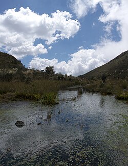 Lake Iguaque
 Tequendama Falls
 El Infiernito; astronomical site
 Cojines del Zaque


Spanish conquests


Conquest and early colonial period


The conquest of the Muisca was the heaviest of all four Spanish expeditions to the great American civilisations.[61] More than 80 percent of the soldiers and horses that started the journey of a year to the northern Muisca Confederation did not survive it.[62][63][64] Various settlements were founded by the Spanish between 1537 and 1539.[65][66][67][68][69][70][71][72][73][74]
A delegation of more than 900 men left the tropical city of Santa Marta and went on a harsh expedition through the heartlands of Colombia in search of El Dorado and the civilisation that produced all this precious gold. The leader of the first and main expedition under Spanish flag was Gonzalo Jiménez de Quesada, with his brother Hernán second in command.[64] Several other soldiers were participating in the journey, who would later become encomenderos and taking part in the conquest of other parts of Colombia. Other contemporaneous expeditions into the unknown interior of the Andes, all searching for the mythical land of gold, were starting from later Venezuela, led by Bavarian and other German conquistadors and from the south, starting in the previously founded Kingdom of Quito in later Ecuador.
The first phase of the conquest was ended by the victory of the few conquistadors left over Tisquesusa, the last zipa of Bacatá, who fell and died after the battle at Funza, on the Bogotá savanna, 20 April 1537. The arrival of the Spanish conquerors was revealed to Tisquesusa by the mohan Popón, from the village of Ubaque. He told the Muisca ruler that foreigners were coming and Tisquesusa would die "bathing in his own blood".[75] When Tisquesusa was informed of the advancing invasion of the Spanish soldiers, he sent a spy to Suesca to find out more about their army strength, weapons and with how many warriors they could be beaten. The zipa left the capital Bacatá and took shelter in Nemocón which directed the Spanish troops to there, during this march attacked by more than 600 Muisca warriors.[76]
When Tisquesusa retreated in his fort in Cajicá he allegedly told his men he would not be able to combat against the strong Spanish army in possession of weapons that produced "thunder and lightning". He chose to return to Bacatá and ordered the capital to be evacuated, resulting in an abandoned site when the Spanish arrived. In search for the Muisca ruler the conquistadores went north to find Tisquesusa in the surroundings of Facatativá where they attacked him at night.
Tisquesusa was thrusted by the sword of one of De Quesada's soldiers but without knowing he was the zipa he let him go, after taking the expensive mantle of the ruler. Tisquesusa fled hurt into the mountains and died of his wounds there. His body was only discovered a year later because of the black vultures circling over it.
When Gonzalo Jiménez de Quesada found out the caciques were conspiring against him, he sent out several expeditions of soldiers. His captain Juan de Céspedes went south to found Pasca on 15 July 1537.[77] Hernán was sent north and Gonzalo himself went northeast, to search for the mythical Land of Gold El Dorado. There he did not find golden cities, but emeralds, the Muisca were extracting in Chivor and Somondoco. First foundation was Engativá, presently a locality of Bogotá, on 22 May 1537.[70] Passing through Suba, Chía, Cajicá, Tocancipá, Gachancipá, Guatavita and Sesquilé, he arrived in Chocontá, founding the modern town on 9 June.[71] The journey went eastward into the Tenza Valley through Machetá, Tibiritá, Guateque, Sutatenza and Tenza, founded on San Juan; 24 June.[72] On the same day, Hernán founded Sutatausa.[73] Gonzalo continued northwest through La Capilla and Úmbita. He arrived in Turmequé that he founded on 20 July.[74]
In August 1537 Gonzalo Jiménez de Quesada entered the territories of the zaque, who ruled from Hunza. When the Spanish conquerors entered the outskirts of Hunza and found a hill with poles were bodies were dangling, they named it Cerro de la Horca ("Gallow Hill").[78] At the time of the conquest Quemuenchatocha was the zaque and he ordered his men to not submit to the European invaders or show them the way to his bohío. He sent messengers to the Spanish conquistadors with valuable peace offers. While this was happening, Quemuenchatocha had hidden his treasures from the Spanish. Hunza was located in a valley not as green as the Bogotá savanna. The advantage of the Spanish weaponry and the use of the horses quickly beat the Muisca warriors.[64]
When Gonzalo arrived at the main bohío of Quemuenchatocha, he found the Muisca ruler sitting in his throne and surrounded by his closest companions. All men were dressed in expensive mantles and adorned with golden crowns. On 20 August 1537, the Spanish beat the zaque and the big and strong Muisca ruler was taken captive to Suesca. There he was tortured and the Spanish soldiers hoped he would reveal where he hid his precious properties. The absence of Quemuenchatocha paved the route for his nephew Aquiminzaque to succeed him as ruler of the northern Muisca, a practice common in Muisca traditions. When Quemuenchatocha was finally released from captivity in Suesca, he fled to Ramiriquí, where he died shortly after. The Spanish soldiers found gold, emeralds, silver, mantles and other valuables in Tunja. They were not able to take all the precious pieces and many were secretly taken away by the Muisca, using folded deer skins. They hid the valuables in nearby hills.[64]
 | Feb 1537 | First contact @ Chipatá | ||
| Mar–Apr 1537 | Expedition into Muisca Confederation | |||
| 20 Apr 1537 | Conquest of Funza upon zipaTisquesusa | |||
| May–Aug 1537 | Expedition & conquest in Tenza Valley | |||
| 20 Aug 1537 | Conquest Hunza, zaqueQuemuenchatocha | |||
| Early Sep 1537 | Conquest Sugamuxi, iracaSugamuxi | |||
 | Oct 1537 – Feb 1538 | Other foundations on Altiplano & valleys | ||
| 6 Aug 1538 | Foundation Santafé de Bogotá, by Gonzalo | |||
| 20 Aug 1538 | B. of Tocarema; Spanish & zipa beat Panche | |||
| 6 Aug 1539 | Foundation Tunja, by Gonzalo Suárez | |||
| 15 Dec 1539 | Conquest Tundama, by Baltasar Maldonado | |||
| Early 1540 | Decapitation last zaqueAquiminzaque, Hernán | |||
- I – Soldiers of the main expedition – Santa Marta-Funza and on – February – 20 April 1537
| Nameleader in bold | Nationality | Yearsactive | Encounteredbold is conquered | Yearofdeath | Image | Notes |
|---|---|---|---|---|---|---|
| Gonzalo Jiménezde Quesada | Granadian | 1536–391569–72 | zipazaque | 1579 |  | [61][62][64] |
| Juan Maldonado | Castilian | 1536–391569–72 | Muisca | [62][note 1] | ||
| Gonzalo Macías | Castilian | 1536–391569–71 | Muisca | 1571~ | [62][79] | |
| Hernán Pérezde Quesada | Granadian | 1536–391540–42 | Muisca | 1544 | [62][64] | |
| Gonzalo Suárez Rendón | Castilian | 1536–39 | zipa, zaque | 1590 | [62][64][80] | |
| Martín Galeano | Castilian | 1536–391540–45 | Muisca | 1554~ | [62][64][81] | |
| Lázaro Fonte | Castilian | 1536–391540–42 | Muisca | 1542 | [62][64] | |
| Juan de Céspedes | Castilian | 1525–43 | Muisca | 1573 or 1576 | [62][64][82][83] | |
| Juan de San Martín | Castilian | 1536–391540–45 | Muisca | [62][64] | ||
| Antonio de Lebrija | Castilian | 1536–39 | Muisca | 1540 | [62] | |
| Ortún Velázquez de Velasco | Castilian | 1536–39 | Muisca | 1584 | [62][84] | |
| Bartolomé Camacho Zambrano | Castilian | 1536–39 | Muisca | [62] | ||
| Antonio Díaz de Cardoso | Castilian | 1536–39 | Muisca | [62] | ||
| Pedro Fernández de Valenzuela | Castilian | 1536–39 | Muisca | [62] | ||
| 640+ conquistadors~80% | mostly Castilian | April 1536-April 1537 | Diseases, jaguars, crocodiles, climate,various indigenous warfare | 15361537 |  | [62][64] |
- II & III – Soldiers of the expeditions De Belalcázar & Federmann (1535–1539)
| Nameleader in bold | Nationality | Yearsactive | Encounteredbold is conquered | Yearofdeath | Image | Notes |
|---|---|---|---|---|---|---|
| Sebastián de Belalcázar | Castilian | 1514–39 | Muisca | 1551 | [61][64] | |
| Baltasar Maldonado | Castilian | 1543–52 | Muisca | 1552 | [85][86][87][88] | |
| Nikolaus Federmann | Bavarian | 1535–39 | Muisca | 1542 | [61][64] | |
| Miguel Holguín y Figueroa | Castilian | 1535–39 | Muisca | 1576> | [89] |
- I – 1 – Main expedition – inland and up from Chipatá to Funza – March – April 1537
| Settlementbold is founded | Department | Date | Year | Altitude (m)urban centre | Notes | Map |
|---|---|---|---|---|---|---|
| Chipatá | Santander | 8 March | 1537 | 1820 | [64][65] | |
| Barbosa | Santander | March | 1537 | 1610 | 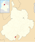 | |
| Moniquirá | Boyacá | March | 1537 | 1669 | [90][note 2] | |
| Santa Sofía | Boyacá | March | 1537 | 2387 |  | |
| Sutamarchán | Boyacá | March | 1537 | 1800 |  | |
| Ráquira | Boyacá | March | 1537 | 2150 | [91] | |
| Simijaca | Cundinamarca | March | 1537 | 2559 | | |
| Susa | Cundinamarca | March | 1537 | 2655 | | |
| Fúquene | Cundinamarca | March | 1537 | 2750 | | |
| Guachetá | Cundinamarca | 12 March | 1537 | 2688 | [66] | |
| Lenguazaque | Cundinamarca | 13 March | 1537 | 2589 | [67] |  |
| Cucunubá | Cundinamarca | 13–14 March | 1537 | 2590 | | |
| Suesca | Cundinamarca | 14 March | 1537 | 2584 | [68] | |
| Nemocón | Cundinamarca | March | 1537 | 2585 | [64] | |
| Zipaquirá | Cundinamarca | March | 1537 | 2650 | | |
| Cajicá | Cundinamarca | 23 March | 1537 | 2558 | [64][92] | |
| Chía | Cundinamarca | 24 March | 1537 | 2564 | [64][93] | |
| Cota | Cundinamarca | March–April | 1537 | 2566 | | |
| Funza | Cundinamarca | 20 April | 1537 | 2548 | [64][69] | |
- I – 2 – Gonzalo – Tenza Valley – Conquest of Hunza & Sugamuxi – May – 20 August & September 1537
| Settlementbold is founded | Department | Date | Year | Note(s) | Map |
|---|---|---|---|---|---|
| Engativá | Cundinamarca | 22 May | 1537 | [70] |  |
| Suba | Cundinamarca | May | 1537 | 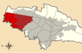 | |
| Chía | Cundinamarca | May | 1537 | | |
| Cajicá | Cundinamarca | May | 1537 | | |
| Tocancipá | Cundinamarca | May–June | 1537 | | |
| Gachancipá | Cundinamarca | May–June | 1537 | | |
| Guatavita | Cundinamarca | May–June | 1537 | | |
| SesquiléLake GuatavitaEl Dorado | Cundinamarca | May–June | 1537 | | |
| Chocontá | Cundinamarca | 9 June | 1537 | [71] | |
| Machetá | Cundinamarca | June | 1537 |  | |
| Tibiritá | Cundinamarca | June | 1537 |  | |
| Guateque | Boyacá | June | 1537 | | |
| Sutatenza | Boyacá | June | 1537 |  | |
| Tenza | Boyacá | 24 June | 1537 | [72] | |
| La Capilla | Boyacá | June–July | 1537 |  | |
| Chivor | Boyacá | July | 1537 | [94] | |
| Úmbita | Boyacá | July | 1537 | | |
| Turmequé | Boyacá | 20 July | 1537 | [74] |  |
| Boyacá | Boyacá | 8 August | 1537 | [95] | 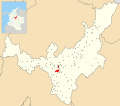 |
| Ciénega | Boyacá | August | 1537 |  | |
| Soracá | Boyacá | 20 August ~15:00 | 1537 | [96] |  |
| Hunza | Boyacá | 20 August | 1537 | [96] |  |
- 3 – Hernán – Foundation of Sutatausa – 24 June 1537
| Name | Department | Date | Year | Note(s) | Map |
|---|---|---|---|---|---|
| Sutatausa | Cundinamarca | 24 June | 1537 | [73] | |
- 4 – Juan de Céspedes – Southern savanna – 1537
| Name | Department | Date | Year | Note(s) | Map |
|---|---|---|---|---|---|
| Pasca | Cundinamarca | 15 July | 1537 | [77] | |
| San Antonio del Tequendama | Cundinamarca | 1539 | [97] | |
- 5 – Juan de San Martín – 1537–1550
| Name | Department | Date | Year | Note(s) | Map |
|---|---|---|---|---|---|
| El Colegio | Cundinamarca | 1537 | [98] |  | |
| Cuítiva | Boyacá | 19 January | 1550 | [99] | |
- 6 – Gonzalo et al. – Foundations of Bogotá and savanna
| Name | Department | Date | Year | Note(s) | Map |
|---|---|---|---|---|---|
| Bojacá | Cundinamarca | 16 October | 1537 | [100] | |
| Somondoco | Boyacá | 1 November | 1537 | [101] |  |
| Une | Cundinamarca | 23 February | 1538 | [102] | |
- 7 – Gonzalo Suárez Rendón – Foundation of Tunja – 6 August 1539
| Name | Department | Date | Year | Note(s) | Map |
|---|---|---|---|---|---|
| Tunja | Boyacá | 6 August | 1539 | |
- 8 – Baltasar Maldonado – Conquest of Tundama – December 1539
| Name | Department | Date | Year | Note(s) | Map |
|---|---|---|---|---|---|
| Duitama | Boyacá | 15 December | 1539 | [103] | |
- 9 – Hernán & Lázaro Fonte a.o. – 1540
| Name | Department | Date | Year | Note(s) | Map |
|---|---|---|---|---|---|
| Motavita | Boyacá | 1540 | [104] | 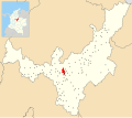 | |
| Nevado del Sumapaz | Cundinamarca | 1540 |  |
Early colonial period
| Year(s) | Epidemic |
|---|---|
| 1537 | Tunja Province: ~250,000 est. inh. |
| 1558< | no data |
| 1558–60 | smallpox, measles |
| 1568–69 | influenza |
| 1587–90 | influenza (or typhus) |
| 1607 | smallpox |
| 1617–18 | measles (after food shortages) |
| 1621 | smallpox |
| 1633 | typhus |
| 1636 | Tunja Province: ~50,000 est. inh.-80% |
Not only the Spanish settlers had lost large percentages of their men due to warfare and diseases. The assessed corregimientos of the province of Tunja between 1537 and 1636 shows a decline of the total Muisca population between 65 and 85%.[105] Epidemics were the main cause of the rapid reduction in population. Various have been reported and many undescribed in the first twenty years of contact.[106]
After the foundation of Bogotá and the installation of the new dependency of the Spanish Crown, several strategies were important to the Spanish conquerors. The rich mineral resources of the Altiplano had to be extracted, the agriculture was quickly reformed, a system of encomiendas was installed and a main concern of the Spanish was the evangelisation of the Muisca. On 9 October 1549, Carlos V sent a royal letter to the New Kingdom directed at the priests about the necessity of population reduction of the Muisca.[107] The indigenous people were working in the encomiendas which limited their religious conversion.[107] To speed up the process of submittance to the Spanish reign, the mobility of the indigenous people was prohibited and the people gathered in resguardos.[108] The formerly celebrated festivities in their religion disappeared. Specific times for the catechesis were controlled by laws, as executed in royal dictates in 1537, 1538 and 1551.[109] The first bishop of Santafé, Juan de los Barrios, ordered to destroy the temples of the Muisca and replace them with Catholic churches.[110] The last public religious ceremony of the Muisca religion was held in Ubaque on 27 December 1563.[111] The second bishop of Santafé, Luis Zapata de Cárdenas, intensified the aggressive policies against the Muisca religion and the burnings of their sacred sites. This formed the final nail in the coffin of the former polytheistic society.[110]
The transition to a mixed agriculture with Old World crops was remarkably fast, mainly to do with the fertility of the lands of the Altiplano permitting European crops to grow there, while in the more tropical areas the soil was not so much suited for the foreign crops. In 1555, the Muisca of Toca were growing European crops as wheat and barley and sugarcane was grown in other areas.[112] The previously self-sustaining economy was quickly transformed into one based on intensive agriculture and mining that produced changes in the landscape and culture of the Muisca.[113]
See also
Notes
Bibliography and further reading
- Acosta, Joaquín (1848), Compendio histórico del descubrimiento y colonización de la Nueva Granada en el siglo décimo sexto [Historical overview of discovery and colonization of New Granada in the sixteenth century], Paris: Beau Press, pp. 1–460, OCLC 23030434, retrieved 8 July 2016
- Francis, John Michael (2002), "Población, enfermedad y cambio demográfico, 1537–1636. Demografía histórica de Tunja: Una mirada crítica", Fronteras de la Historia, 7, ICANH: 13–76, doi:10.22380/20274688.682
- Francis, John Michael (1993), "Muchas hipas, no minas" The Muiscas, a merchant society: Spanish misconceptions and demographic change (M.A.) (M.A.), University of Alberta, pp. 1–118
- Gamboa Mendoza, Jorge (2016), Los muiscas, grupos indígenas del Nuevo Reino de Granada. Una nueva propuesta sobre su organizacíon socio-política y su evolucíon en el siglo XVI – The Muisca, indigenous groups of the New Kingdom of Granada. A new proposal on their social-political organization and their evolution in the 16th century(video) (in Spanish), Museo del Oro, retrieved 8 July 2016
- Gamboa Mendoza, Jorge (2003), "El papel de la minería en la formación de la economía y la sociedad colonial del Nuevo Reino de Granada, siglos XVI-XVIII – The role of mining in the formation of the economy and colonial society of the New Kingdom of Granada, 16th–18th centuries"(PDF), Takwá (in Spanish): 1–24, retrieved 8 July 2016
- Groot de Mahecha, Ana María (2014) [2008], Sal y poder en el altiplano de Bogotá, 1537–1640 (in Spanish), Universidad Nacional de Colombia, pp. 1–174, ISBN 978-958-719-046-5
- Groot de Mahecha, Ana María (1992), Checua: Una secuencia cultural entre 8500 y 3000 años antes del presente - Checua: a cultural sequence between 8500 and 3000 years before present, Banco de la República, pp. 1–95, retrieved 8 July 2016
- Henderson, Hope; Ostler, Nicholas (2005), "Muisca settlement organization and chiefly authority at Suta, Valle de Leyva, Colombia: A critical appraisal of native concepts of house for studies of complex societies", Journal of Anthropological Archaeology, 24 (2), Elsevier: 148–178, doi:10.1016/j.jaa.2005.01.002, ISSN 0278-4165
- Izquierdo Peña, Manuel Arturo (2014), Calendario Muisca – Muisca calendar(video) (in Spanish), retrieved 8 July 2016
- Izquierdo Peña, Manuel Arturo (2009), The Muisca Calendar: An approximation to the timekeeping system of the ancient native people of the northeastern Andes of Colombia (PhD), Université de Montréal, pp. 1–170, arXiv:0812.0574
- Kruschek, Michael H. (2003), The evolution of the Bogotá chiefdom: A household view (PhD)(PDF) (PhD), University of Pittsburgh, pp. 1–271, retrieved 8 July 2016
- Langebaek Rueda, Carl Henrik (2005a), "La élite no siempre piensa lo mismo – The elite does not always think the same", Muiscas: representaciones, cartografías y etnopolíticas de la memoria (in Spanish), Universidad La Javeriana, pp. 180–199, ISBN 958-683-643-6
- Langebaek Rueda, Carl Henrik (2005b), "Fiestas y caciques muiscas en el Infiernito, Colombia: un análisis de la relación entre festejos y organización política - Festivities and Muisca caciques in El Infiernito, Colombia: an analysis of the relation between celebrations and political organisation", Boletín de Arqueología (in Spanish), 9, PUCP: 281–295, ISSN 1029-2004
- Martínez Martín, A. F.; Manrique Corredor, E. J. (2014), "Alimentación prehispánica y transformaciones tras la conquista europea del altiplano cundiboyacense, Colombia" [Pre-Columbian Food and Transformations after European Conquest of Cundiboyacense High Plateau, Colombia], Revista Virtual Universidad Católica del Norte (in Spanish), 41, Universidad Católica del Norte: 96–111, ISSN 0124-5821, retrieved 28 July 2018
- Ocampo López, Javier (2013), Mitos y leyendas indígenas de Colombia – Indigenous myths and legends of Colombia (in Spanish), Bogotá, Colombia: Plaza & Janes Editores Colombia S.A., ISBN 978-958-14-1416-1
- Ocampo López, Javier (2007), Grandes culturas indígenas de América - Great indigenous cultures of the Americas (in Spanish), Bogotá, Colombia: Plaza & Janes Editores Colombia S.A., pp. 1–238, ISBN 978-958-14-0368-4
- Paepe, Paul de; Cardale de Schrimpff, Marianne (1990), "Resultados de un estodio petrológico de cerámicas del Periodo Herrera provenientes de la Sabana de Bogotá y sus implicaciones arqueológicas – Results of a petrological study of ceramics form the Herrera Period coming from the Bogotá savanna and its archaeological implications", Boletín Museo del Oro (in Spanish), Museo del Oro: 99–119, retrieved 8 July 2016
- Cardale de Schrimpff, Marianne (1985), En busca de los primeros agricultores del Altiplano Cundiboyacense – Searching for the first farmers of the Altiplano Cundiboyacense(PDF) (in Spanish), Bogotá, Colombia: Banco de la República, pp. 99–125, retrieved 8 July 2016
- Trimborn, Hermann (2005), "La organización del poder público en las culturas soberanas de los chibchas – The public power organisation in the common cultures of the Chibchas", Muiscas: representaciones, cartografías y etnopolíticas de la memoria (in Spanish), Universidad La Javeriana, pp. 298–314, ISBN 958-683-643-6
{{citation}}: CS1 maint: work parameter with ISBN (link) - Zerda, Liborio (1947) [1883], El Dorado(PDF) (in Spanish), retrieved 8 July 2016
Spanish chroniclers
- "Epítome de la conquista del Nuevo Reino de Granada", Boletín Cultural y Bibliográfico, 16 (3), Banco de la República: 81–97, 1979 [1889 (1539/1548-1559?)], retrieved 24 November 2016
- Jiménez de Quesada, Gonzalo (1576), Memoria de los descubridores, que entraron conmigo a descubrir y conquistar el Reino de Granada (in Spanish), retrieved 8 July 2016
- De Castellanos, Juan (1857) [1589], Elegías de varones ilustres de Indias (in Spanish), pp. 1–567, retrieved 8 July 2016
- De Lugo, Bernardo (1619), Gramática en la lengua general del Nuevo Reyno, llamada mosca – Grammar in the general language of the New Kingdom, called Mosca (Muisca) (in Spanish), Madrid, Spain, pp. 1–162, retrieved 8 July 2016
- Simón, Pedro (1892) [1626], Noticias historiales de las conquistas de Tierra Firme en las Indias occidentales (1882–92) vol.1–5 (in Spanish), retrieved 8 July 2016
- Rodríguez Freyle, Juan; Achury Valenzuela, Darío (1979) [1859 (1638)], El Carnero – Conquista i descubrimiento del nuevo reino de Granada de las Indias Occidentales del mar oceano, i fundacion de la ciudad de Santa Fe de Bogota(PDF) (in Spanish), Fundacion Biblioteca Ayacuch, pp. 1–598, retrieved 21 November 2016
- Fernández de Piedrahita, Lucas (1688), Historia general de las conquistas del Nuevo Reino de Granada (in Spanish), retrieved 8 July 2016
สรุปเนื้อหา
ข้อมูลสำคัญจากบทความ
ข้อมูลสำคัญเกี่ยวกับ สมาพันธ์มุยสกา (หน่วยทางการเมือง)
สมาพันธ์มุยสกา เป็น สมาพันธ์ หลวมๆ ของ หัวหน้าเผ่า มุยสกา ต่างๆ ใน ที่ราบสูง แอนเดียนตะวันออก ของ โคลอมเบีย ในปัจจุบันก่อนที่ สเปนจะพิชิต อเมริกาใต้ตอนเหนือ [ 7 ] สหภาพเหล่านี้...
ภูมิอากาศ
แผนภูมิสภาพภูมิอากาศแสดงสภาวะสุดขั้วและแหล่งที่อยู่อาศัยที่สำคัญที่สุดสี่แห่งของสมาพันธ์มุยสกา ทิศตะวันตกเฉียงเหนือ: เวเลซ – 2050 เมตร แผนภูมิสภาพภูมิอากาศ ( คำอธิบาย ) เจ เอฟ เอ็ม เอ เอ็ม เจ เจ เอ เอส โอ เอ็น ดี 34 19 7 46 19 8 67 19 9 113 19 9 102 18 9 63...
สมาพันธ์มุยสกา
ชาวมุยสกาอาศัยอยู่ใน เทือกเขาแอนเดสโอเรียนทาเลส ในดินแดนที่มีพื้นที่ประมาณ 22,000 ตารางกิโลเมตร [ 5 ] ใน ช่วงเวลาที่ สเปนเข้ายึดครองดินแดน มี สมาพันธ์อยู่ 4 แห่งในดินแดนของพวกเขา ( โบโกตา , ตุนฮา , ดูอิตามา , โซกาโมโซ ) [ 7 ] ตามเอกสารของอาณานิคม...
ประวัติศาสตร์
ชาวอเมริกันพื้นเมืองยุคแรกๆ ดำรงชีวิตแบบล่าสัตว์และเก็บของป่าท่ามกลาง สัตว์ขนาดใหญ่ที่ ยังคงมีชีวิตอยู่จนถึงปัจจุบัน อาศัยอยู่ในแหล่งที่อยู่อาศัยที่เย็นสบายรอบๆ ทะเลสาบในยุคไพลสโตซีน ซึ่งทะเลสาบ ฮูเมดาล ในโบโกตา ทะเลสาบซูเอสกา ทะเลสาบ ฟูเกเน และทะเลสาบ...