
Shefa-Amr
Shefa-Amr
| |
|---|---|
| Hebrew transcription(s) | |
| • ISO 259 | Šparˁam |
| • English Official | Shefar'am[1] |
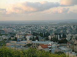 View of Shefa-Amr | |
 Coat of arms | |
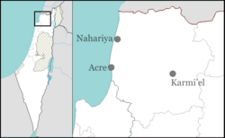  Shefa-Amr  Shefa-Amr | |
| Coordinates: 32°48′20″N35°10′10″E / 32.80556°N 35.16944°E | |
| Grid position | 166/245 PAL |
| Country |  Israel Israel |
| District | Northern |
| Subdistrict | Acre |
| Founded | Bronze age |
| Government | |
| • Mayor | Nahid Khazem (from March, 2024)[2] |
| Area | |
• Total | 19,766 dunams (19.766 km2; 7.632 sq mi) |
| Population (2024)[3] | |
• Total | 43,858 |
| • Density | 2,218.9/km2 (5,746.8/sq mi) |
| Website | www.shefaram.muni.il |
Shefa-Amr or Shefar'am (Arabic: شفاعمرو, romanized: Šafāʻamru; Hebrew: שְׁפַרְעָם, romanized: Šəfarʻam) is an Arab city in the Northern District of Israel. In 2024 it had a population of 43,858 with a Sunni Muslim majority and large Christian Arab and Druze minorities.[3]
Etymology
Palmer writes that the name meant: "The margin or edge of 'Amr. Locally and erroneously supposed to mean the healing of 'Amer (ed Dhaher)."[4] The city is identified with Shefar'am, an ancient Jewish town of great significance during Talmudic times. Some have proposed that its original meaning may be linked to the Hebrew words "Shefer" (שֶׁפֶר), signifying something nice, beautiful or good, and "'Am", (עַם) which translates to people.[5]
History
Ancient period
Walls, installations and pottery sherds from the Early Bronze Age IB and the Middle Bronze Age IIB, Iron, Hellenistic and Roman periods have been excavated at Shefa-ʻAmr.[7]
เชฟา-อัมร์ถูกกล่าวถึงครั้งแรกในชื่อเชฟารัม ( ภาษาฮีบรู : שפרעם ) ในโทเซฟตา ( บทมิควาต 6:1 ) ตามมาด้วยทัลมุดที่เรียบเรียงขึ้นในปี ค.ศ. 500 ซึ่งมีการกล่าวถึงในหลาย ที่ในบทอาโวดาห์ ซาราห์ 8bและรอช ฮาชานาห์ 31bเป็นต้น
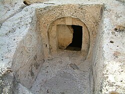
การตั้งถิ่นฐานในบริเวณนั้นดำเนินมาอย่างต่อเนื่องตั้งแต่สมัยโรมัน โดยเป็นหนึ่งในเมืองที่กล่าวถึงในทัลมุดว่าเป็นที่ตั้งของสภาซานเฮดริน ของชาวยิว ในรัชสมัยของมาร์คัส ออเรลิอุส [ 8 ] [ 9 ] ตามธรรมเนียมแล้วเชื่อกันว่าที่ตั้งของสภาซานเฮดรินอยู่ที่บริเวณที่สร้างโบสถ์ยิวเก่า "มาฮาเนห์ เชคินาห์" ขึ้นในภายหลัง[ 8 ]ชุมชนเชฟา-อัมร์เก่าตั้งอยู่ในบริเวณที่ปัจจุบันเป็นที่ตั้งของสถานีตำรวจ โบสถ์ต่างๆ และถนนของชาวยิว[ 10 ]ถ้ำฝังศพที่ตกแต่งอย่างสวยงามได้รับการบันทึกไว้โดยการสำรวจปาเลสไตน์ตะวันตกในช่วงปลายศตวรรษที่ 19 พบว่าเป็นสุสานคริสเตียนจาก ยุค ไบแซนไทน์ซึ่งมีอายุย้อนไปถึงศตวรรษที่ 5 และ 6 คริสต์ศักราชนอกจากนี้ยังพบจารึกภาษากรีก ด้วย [ 6 ]
การขุดค้นทางโบราณคดีในถ้ำและเหมืองหินเผยให้เห็นว่ามีการใช้งานในยุคโรมันและไบแซนไทน์[ 11 ]เชฟา-อัมร์มีซากปรักหักพังของไบแซนไทน์ รวมถึงโบสถ์และสุสาน[ 12 ]
มี การขุดค้นซากโบราณในเขตทางใต้ของเมืองเก่า ซึ่งเผยให้เห็นซากโบราณจากห้าช่วงเวลาในสมัยไบแซนไทน์ตอนปลายและ สมัย อุมัยยาด ตอนต้น สิ่งของที่พบได้แก่เตาอบทาบุนพื้นปูด้วยหินขนาดเล็ก พื้นปูโมเสกซึ่งอาจเป็นส่วนหนึ่งของ พื้นสำหรับเหยียบ องุ่น เครื่องบีบองุ่นทรงสี่เหลี่ยมขนาดเล็ก ภาชนะ คราเตอร์ทำมือชามไซปรัสที่นำเข้า และหม้อปรุงอาหารแบบเปิด นอกจากนี้ยังพบภาชนะแก้วและเครื่องปั้นดินเผาอีกด้วย[ 13 ]
ยุคกลาง
ภายใต้การปกครองของพวกครูเซเดอร์สถานที่แห่งนี้เป็นที่รู้จักในชื่อ "Safran", "Sapharanum", "Castrum Zafetanum", "Saphar castrum" หรือ "Cafram" [ 14 ]พวกครูเซเดอร์ได้สร้างป้อมปราการ ซึ่ง อัศวินเทมพลา ร์ ใช้เป็นที่มั่นในหมู่บ้าน ที่เชิงปราสาทมีที่ตั้งถิ่นฐานที่มีป้อมปราการพร้อมโบสถ์ ซึ่งมีชาวคริสต์ท้องถิ่นหรือพวกครูเซเดอร์อาศัยอยู่[ 15 ]หมู่บ้านแห่งนี้ ซึ่งในขณะนั้นเรียกว่า "Shafar 'Am" ถูกใช้โดยผู้นำมุสลิมซาลาดินระหว่างปี 1190–91 และ 1193-94 เป็นฐานทัพสำหรับการโจมตีเมืองเอเคอร์[ 16 ]
ในปี 1229 สถานที่แห่งนี้กลับมาอยู่ในมือของพวกครูเซเดอร์อีกครั้ง ซึ่งได้รับการยืนยันโดยสุลต่านบายบาร์สในสนธิสัญญาสันติภาพในปี 1271 และโดยสุลต่านกาลาวุนในปี 1283 [ 17 ]พระชาวอิตาลีริคโคลโด ดา มอนเต ดิ โครเชได้มาเยือนหมู่บ้านในปี 1287–88 และบันทึกไว้ว่ามีชาวคริสต์อาศัยอยู่[ 18 ]เห็นได้ชัดว่าอยู่ภายใต้ การควบคุม ของมัมลุกในปี 1291 [ 19 ] [ 20 ]เนื่องจากมีการกล่าวถึงในปีนั้นเมื่อสุลต่านอัล-อัชราฟ คาลิลจัดสรรรายได้ของเมืองให้กับองค์กรการกุศลในกรุงไคโร[ 21 ]
สมัยออตโตมัน
ภูมิภาคนี้กลายเป็นส่วนหนึ่งของจักรวรรดิออตโตมันในปี ค.ศ. 1517 จากการสำรวจสำมะโนประชากรเพื่อเก็บภาษีของออตโตมันในปี ค.ศ. 1525–26 เชฟา-อัมร์มีประชากร 150 คน โดย 90% เป็นชาวมุสลิม และ 10% เป็นชาวยิว ประชากรเพิ่มขึ้นเป็น 388 คนในการสำรวจสำมะโนประชากรปี ค.ศ. 1538–39 โดยชาวยิวคิดเป็น 13% ของประชากรทั้งหมด จากบันทึกในปี ค.ศ. 1547–48 และ 1555–56 เชฟา-อัมร์มีประชากร 423 และ 594 คนตามลำดับ ซึ่งทั้งหมดเป็นชาวมุสลิม[ 22 ]ในปี ค.ศ. 1564 รายได้ของหมู่บ้านเชฟา-อัมร์ถูกจัดสรรให้กับวาคฟ์ (กองทุน) ใหม่ของฮัสเซกี สุลต่าน อิมาเร็ตในเยรูซาเลม ซึ่งก่อตั้งโดยฮัสเซกี ฮูร์เรม สุลต่าน ( ร็อกเซลานา ) ภรรยาของสุลต่าน สุไลมา นผู้ยิ่งใหญ่[ 23 ]
In the census of c. 1572, the village had a population of 510 Muslims.[22] A 1573 firman (decree) mentioned that Shefa-Amr was among a group of villages in the nahiya (sub district) of Acre in rebellion against the state. By 1577, the village had accumulated an arsenal of 200 muskets.[24] In the 1596 tax records, Shefa-Amr was part of the nahiya of Acre, part of Safed Sanjak, with a population of 83 households (khana), and eight bachelors, all Muslims. The total revenue was 13,600 akçe, most of which was given in fixed amounts.[25] The taxable produce also comprised occasional revenues, goats and beehives, and the inhabitants paid for the use or ownership of an olive oil press.[26][27]

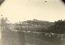
During the 18th century Shefa-Amr was the center of its own fiscal district in the province of Sidon. Its importance derived from its position in the heart of the Galilee's cotton-growing area and its natural and man-made defenses. The significance of cotton to the growth of Shefa-Amr was fundamental. Tax returns for the village attest to the large returns expected of this crop.[28] Its local prominence was headed by the sheikhs of the Zayadina (sing. Zaydani), a local family of multazims (limited-term tax farmers), in charge of collecting taxes for the governor of Sidon.[29] As early as 1704, the village was held as a tax farm by the Zaydani sheikh Ali ibn Salih, along with other villages in the Lower Galilee.[30] At an unknown point after, the Zayadina lost Shefa-Amr but Ali's son Muhammad of al-Damun had regained control of it by c. 1740, during a period when the Zayadina were expanding their holdings across the Galilee under the leadership of Daher al-Umar (Muhammad's first cousin).[31]
It is known that there was a castle in the village by this time.[29] Its fortifications were strengthened by the Zayadina in c. 1742 during a respite in the sieges of the Zaydani stronghold of Tiberias by the governor of Damascus.[32] Afterward, in 1743, Muhammad was arrested and executed by Daher's order to remove him as an obstacle to Daher's regional ambitions.[33] In 1761, Daher offered to grant Shefa-Amr to his son Uthman in exchange for the latter assassinating Daher's brother Sa'd. Although Uthman complied, Daher reneged following protestations by Shefa-Amr's inhabitants. Uthman and his brothers Ahmad and Sa'id besieged the village in 1765 but were repulsed by its local defenders with Daher's support.[34] Uthman was nevertheless granted Shefa-Amr at some point by Daher.[35][36] He is generally credited as the builder of its large fortress.[37]
After Daher's death in 1775, the Ottoman-appointed governor Jazzar Pasha allowed Uthman to continue as subgovernor of Shefa-Amr in return for a promise of loyalty and advance payment of taxes.[38] Jazzar Pasha ignored orders from Constantinople to demolish the village's fortress.[39] Several years later Uthman was removed and replaced by Ibrahim Abu Qalush, an appointee of Jazzar Pasha,[29] who rebelled against him in 1789.[40] A map by Pierre Jacotin from Napoleon's invasion of 1799 showed the place, named as Chafa Amr.[41]

ชุมชนชาวยิวได้ก่อตั้งขึ้นในหมู่บ้านภายใต้การปกครองของดาเฮอร์[ 42 ]ในปี พ.ศ. 2382 โมเสส มอนเตฟิโอเร นับ ชาวยิวเซ ฟาร์ดิก ได้ 107 คนอาศัยอยู่ในเชฟา-อัมร์[ 43 ]สภาพความเป็นอยู่ของพวกเขาแย่ลงเมื่อผู้นำปกครองตนเองของอียิปต์มูฮัมหมัด อาลี ปาชา ออกจากตำแหน่ง ในช่วงเวลานั้น เชฟา-อัมร์เกือบจะว่างเปล่าจากผู้อยู่อาศัยที่เป็นชาวยิว ซึ่งเลือกที่จะย้ายไปอยู่ที่ไฮฟาและทิเบเรียส[ 44 ]เจมส์ ฟินน์เขียนไว้ในปี พ.ศ. 2420 ว่า "ประชากรส่วนใหญ่เป็นชาวดรูซ มีชาวมุสลิมและชาวคริสต์ อยู่บ้าง แต่ [ในปี พ.ศ. 2493] มีครอบครัวชาวยิว 30 ครอบครัวที่ประกอบอาชีพเกษตรกรรม ปลูกธัญพืชและมะกอกบนที่ดินของตนเอง ซึ่งส่วนใหญ่เป็นมรดกตกทอดของครอบครัว บางคนในกลุ่มนี้มีเชื้อสายแอลจีเรีย พวกเขามีโบสถ์ยิวของตนเองและคนขายเนื้อที่ได้รับอนุญาตตามกฎหมาย และจำนวนของพวกเขาก่อนหน้านี้มีมากกว่านี้" อย่างไรก็ตาม "ต่อมาพวกเขาลดจำนวนลงเหลือเพียง 2 ครอบครัว ส่วนที่เหลือย้ายไปที่ [ไฮฟา] เนื่องจากท่าเรือแห่งนั้นเจริญรุ่งเรืองขึ้น" [ 45 ]
คอนเดอร์และคิทเชเนอร์ ซึ่งมาเยือนในปี พ.ศ. 2418 ได้รับแจ้งว่าชุมชนประกอบด้วย "ประชากร 2,500 คน โดย 1,200 คนเป็นชาวมุสลิม ที่เหลือเป็นชาวดรูซ ชาวกรีก และชาวละติน" [ 46 ]ชุมชนชาวดรูซในเมืองนี้ลดจำนวนลงอย่างมากในช่วงทศวรรษ พ.ศ. 2423 เนื่องจากสมาชิกอพยพไปทางตะวันออกสู่ ที่ราบ เฮารานเพื่อหลีกเลี่ยงการเกณฑ์ทหารโดยทางการออตโตมัน[ 47 ]รายชื่อประชากรจากประมาณปี พ.ศ. 2430 แสดงให้เห็นว่าเชฟา-อัมร์มีประชากรประมาณ 2,750 คน ประกอบด้วยชาวมุสลิม 795 คน ชาวกรีกคาทอลิก 95 คน ชาวคาทอลิก 1,100 คน ชาวละติน 140 คนชาวมาโรไนต์ /โปรเตสแตนต์ 175 คน ชาวยิว 30 คน และชาวดรูซ 440 คน[ 48 ]ในปีนั้น ครอบครัวชาวยิวประมาณ 42 ครอบครัวจากโมร็อกโกได้มาตั้งถิ่นฐานในเชฟา-อัมร์[ 49 ]
อาณานิคมอังกฤษ

การปกครองปาเลสไตน์ภายใต้อาณัติของอังกฤษก่อตั้งขึ้นในปี 1920 ในเวลานั้นชาวยิวในเชฟา-อัมร์ทั้งหมดได้ย้ายออกไปแล้ว[ 49 ]จากการสำรวจสำมะโนประชากรของปาเลสไตน์ในปี 1922เชฟา-อัมร์มีประชากร 2,288 คน ประกอบด้วยชาวคริสต์ 1,263 คน ชาวมุสลิม 623 คน และชาวดรูซ 402 คน[ 50 ]ในบรรดาชาวคริสต์นั้น มีชาวเมลไคต์ (กรีกคาทอลิก) 1,054 คน ชาวแองกลิกัน 94 คน ชาวโรมันคาทอลิก 70 คน ชาวกรีกออร์โธดอกซ์ 42 คน และชาวมาโรไนต์ 3 คน[ 51 ]จากการสำรวจสำมะโนประชากรในปี 1931เชฟา-อัมร์มีบ้านที่มีคนอาศัยอยู่ 629 หลัง และมีประชากรชาวคริสต์ 1,321 คน ชาวมุสลิม 1,006 คน ชาวดรูซ 496 คน และชาวยิว 1 คน มีการบันทึกจำนวนมุสลิมเพิ่มเติมอีก 1,197 คนในบ้านที่ถูกยึดครอง 234 หลังสำหรับ "ชานเมืองชาฟาอัมร์" [ 52 ]
สถิติที่รวบรวมโดยรัฐบาลภายใต้การปกครองในปีพ.ศ. 2488แสดงให้เห็นว่าประชากรในเมืองประกอบด้วยชาวคริสต์ 1,560 คน ชาวมุสลิม 1,380 คน ชาวยิว 10 คน และ "อื่นๆ" 690 คน (สันนิษฐานว่าเป็นชาวดรูซ) และประชากรในชนบทประกอบด้วยชาวมุสลิม 3,560 คน[ 53 ] [ 54 ] [ 55 ]
อิสราเอล
ศตวรรษที่ 20
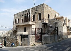
ในปี พ.ศ. 2491 กองทัพอิสราเอลได้ยึด Shefa-Amr ในช่วงแรกของปฏิบัติการ Dekelตั้งแต่วันที่ 8 ถึง 14 กรกฎาคม ประชากรชาวดรูซให้ความร่วมมือกับ IDF อย่างแข็งขัน ย่านมุสลิมถูกโจมตีอย่างหนักและผู้อยู่อาศัยหลายพันคนหนีไปยังSaffuriyehหลังจากนาซาเร็ธล่มสลาย ผู้ลี้ภัยบางส่วนได้รับอนุญาตให้กลับบ้าน[ 56 ]หลังสงครามสิ้นสุดลง ประชากรชาวอาหรับถูกบังคับใช้กฎอัยการศึกอย่างเข้มงวดจนถึงปี พ.ศ. 2510
อิบราฮีม นิมร์ ฮุสเซน อดีตนายกเทศมนตรีเมืองเชฟา-อัมร์ เป็นประธานคณะกรรมการนายกเทศมนตรีชาวอาหรับในอิสราเอล (ต่อมาคือคณะกรรมการติดตามผลชาวอาหรับ) ตั้งแต่เริ่มก่อตั้งในปี 1975 ในปี 1981 องค์กรพัฒนา เอกชนเพื่อส่งเสริมการดูแลสุขภาพในชุมชนชาวอาหรับได้ก่อตั้งขึ้นในเมืองเชฟา-อัมร์ โดยใช้ชื่อว่าสมาคมกาลิลี - สมาคมแห่งชาติอาหรับเพื่อการวิจัยและบริการด้านสุขภาพ[ 57 ]ในปี 1982 หลังจากการรุกรานเลบานอนของอิสราเอล นายกเทศมนตรีอิบราฮีม นิมร์ ฮุสเซน ได้จัดตั้ง "คณะกรรมการติดตามผลสูงสุด" โดยอิงจากคณะกรรมการที่จัดตั้งขึ้นหลังวันแห่งดินแดนประกอบด้วยหัวหน้าสภาท้องถิ่น 11 คน รวมทั้งสมาชิกสภาผู้แทนราษฎรชาวอาหรับ ในช่วงทศวรรษ 1990 คณะกรรมการซึ่งประชุมกันที่เมืองนาซาเรธ ได้ขยายตัวและกลายเป็นรัฐสภาขนาดเล็กที่เป็นตัวแทนของชาวปาเลสไตน์ในกาลิลี[ 58 ]
ศตวรรษที่ 21
On 16 May 2004, Whehebe Moheen, a man in his sixties, murdered Manal Najeeb Abu Raed, his widowed daughter-in-law, wife of his son, and mother of his two granddaughters.[59] Manal had lost her husband to cancer two years earlier, and was living in the couple's home, in the Druze village of Daliat El Carmel, near Haifa. Following this event there was conflict between the families of the victim and of the killer. The final reconciliation took place on 27 February 2009, when about 300 family members, dignitaries and residents of the mixed city of Shefa-Amr and Daliyat al-Carmel participated in the reconciliation ritual.[59] They gathered, along with Christian and Muslim dignitaries, including mayors of the two towns involved, Knesset members (Druze and Muslim), the religious leader of Israel's Druze community, and a sizable contingent of Druze religious leaders from many villages in northern Israel.[59] Following the speeches, the dignitaries signed the sulha (reconciliation) agreement, and after the document was declared officially endorsed, the killer's family handed the leader of the sulha committee, Sheikh Muafak Tarif, a bag containing the blood money (diya) compensation, and Tarif handed the bag to cousins of the murdered woman.[59] The bag contained 200,000 NIS (about US$50,000), about half what a "normal" conciliation payment would be, but the killer's family refused to bring more money, claiming that they had no resources, and were not prepared to make themselves bankrupt because of a "crazy" uncle.[59]
เมื่อวันที่ 4 สิงหาคม 2548 ทหารอิสราเอลที่ขาดราชการโดยไม่ได้รับอนุญาตชื่อเอเดน นาทาน-ซาดาได้เปิดฉากยิงขณะอยู่บนรถโดยสารในเมือง ทำให้ชาวอาหรับเสียชีวิต 4 คน และบาดเจ็บอีก 22 คน หลังจากการยิง นาทาน-ซาดาถูกฝูงชนที่อยู่ใกล้เคียงรุมทำร้าย รุม ประชาทัณฑ์ และถูกทุบตีด้วยก้อนหิน ตามคำบอกเล่าของพยาน คนขับรถโดยสารรู้สึกประหลาดใจที่เห็น ทหารชาวยิวสวมหมวก คิปปาห์กำลังเดินทางไปยังเชฟา-อัมร์โดยรถโดยสารสาธารณะ จึงถามนาทาน-ซาดาว่าแน่ใจหรือไม่ว่าต้องการใช้เส้นทางนี้ ผู้เสียชีวิตทั้งสี่คนเป็นสองพี่น้องอายุประมาณ 20 ต้นๆ ชื่อ ฮาซาร์ และ ดินา ตูร์กี และชายอีกสองคน คือ มิเชล บาฮูธ คนขับรถโดยสาร และ นาเดอร์ ฮาเยก ในวันต่อมาหลังจากการโจมตี มีผู้คน 40,000 คนเข้าร่วมพิธีศพหมู่เพื่อไว้อาลัยแก่ผู้เสียชีวิต สองพี่น้องถูกฝังในสุสานอิสลาม ส่วนชายทั้งสองถูกฝังในสุสานคาทอลิก ผู้บาดเจ็บถูกนำตัวส่งโรงพยาบาลรัมบัมในไฮฟา เทศบาลเมือง Shefa-Amr ได้สร้างอนุสรณ์สถานเพื่อรำลึกถึงผู้เสียชีวิต[ 60 ]
ในเดือนมกราคม พ.ศ. 2551 นายกเทศมนตรี Ursan Yassin ได้พบกับเจ้าหน้าที่ของคณะกรรมการรัฐอิสราเอลเกี่ยวกับการเฉลิมฉลองครบรอบ 60 ปีแห่งเอกราช และประกาศว่า Shefa-Amr ตั้งใจที่จะเข้าร่วมในการเฉลิมฉลอง[ 61 ]ในปี พ.ศ. 2554 ชาวคริสต์ ชาวดรูซ และชาวมุสลิม 7,000 คน ได้ร่วมกันเดินขบวนเพื่อแสดงความเป็นน้ำหนึ่งใจเดียวกันเพื่อสนับสนุนชาวคริสต์ในอิรักและอียิปต์ที่กำลังประสบกับการถูกกดขี่ทางศาสนา[ 62 ]
เมื่อวันที่ 18 พฤศจิกายน พ.ศ. 2567 จรวด ของฮิซบอลลาห์ได้พุ่งชนอาคารที่พักอาศัยในเมือง ทำให้หญิงวัย 50 ปีเสียชีวิต และมีผู้บาดเจ็บอีก 56 คน รวมถึงเด็กและวัยรุ่น 18 คน[ 63 ]
ภูมิศาสตร์
เชฟาอัมร์ตั้งอยู่ในเขตภาคเหนือของอิสราเอลบริเวณทางเข้าสู่แคว้นกาลิลีห่างจากทะเลเมดิเตอร์เรเนียน 13 กิโลเมตร (8.1 ไมล์) และห่างจากเมืองไฮฟาแอครีและนาซาเรธ เมืองละ 20 กิโลเมตร (12 ไมล์) ซึ่งเป็นที่ทำงานของประชากรจำนวนมาก เมืองนี้ตั้งอยู่บนเนินเขาเจ็ดลูก จึงได้ชื่อว่า "โรมน้อย" ความสูงของเมืองและทำเลที่ตั้งเชิงยุทธศาสตร์ซึ่งเชื่อมต่อหุบเขาและภูเขาของกาลิลี ทำให้เมืองนี้เคยเป็นศูนย์กลางของเขตปกครอง โดยเฉพาะอย่างยิ่งในสมัยของอุสมาน บุตรชายของดาเฮอร์ อัล-อุมาร์ ผู้สร้างปราสาทและหอคอยล้อมรอบเมือง จากจุดสูงๆ ในเมือง สามารถมองเห็น อ่าวไฮฟาที่มีทะเลทอดยาวระหว่างไฮฟาและแอครี รวมถึงภูเขาสูงของกาลิลีและหุบเขาที่ล้อมรอบเมืองได้
ข้อมูลประชากร
| พลเมืองอาหรับของอิสราเอล |
|---|
| การเมือง |
| Religion |
| Culture |
| Major population centers |
| Personalities |
| See also |
|
In 1951, the population was 4450, of whom about 10% were internally displaced persons from other villages.[64] During the early 1950s, about 25,000 dunams of the land of Shefa-Amr were expropriated by the following method: the land was declared a closed military area, then after enough time had passed for it to have become legally "uncultivated", the Minister of Agriculture used his powers to "ensure that it was cultivated" by giving it to neighboring Jewish majority communities. Some of the land was owned by Jews.[65] Another 7,579 dunams were expropriated in 1953–4.[66] The total land holdings of the village fell from 58,725 dunams in 1945 to 10,371 dunams in 1962.[66]
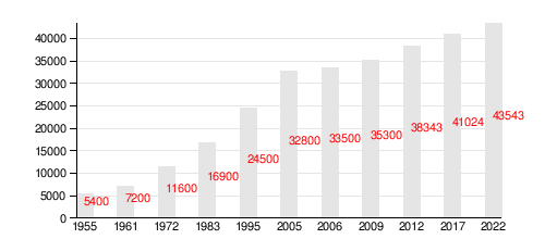
According to CBS, in 2012 the religious and ethnic makeup of the city was mostly Arabs (consisting of 59.2% Muslim, 26.5% Christian, and 14.3% Druze). Shefa-Amr is home to the fourth-largest Arab Christian community in Israel, and are mostly Greek-Melkite Catholics.[67] According to CBS, in 2012 there were 38,300 registered citizens in the city. 40.4% of the population was not over 19 years old, 14.9% between 20 and 29, 21.1% between 30 and 44, 17.8% from 45 to 64, and 5.7% 65 or older. In 2022, 62% of the population was Muslim, 24.4% was Christian and 13.6% was Druze.[68]
Population in Shefa-Amr over the years:
Economy
According to CBS, in 2012 there were 12,494 salaried and 1062 self-employed workers in the city. The mean monthly wage in 2012 for a salaried worker in the city was ILS 5,412. Salaried males had a mean monthly wage of ILS 6,312 versus ILS 3,904 for females. The mean income for the self-employed was ILS 7,381. 235 people received unemployment benefits and 3,971 received an income guarantee.
Education and culture
ในปี 2555 มีโรงเรียน 24 แห่งที่ให้บริการนักเรียน 9,459 คน ประกอบด้วยโรงเรียนประถมศึกษา 15 แห่ง มีนักเรียน 5,360 คน และโรงเรียนมัธยมศึกษา 13 แห่ง มีนักเรียน 4,099 คน ในปี 2555 นักเรียนชั้นมัธยมศึกษาปีที่ 12 ร้อยละ 53.7 ได้รับประกาศนียบัตรจบการศึกษา ในเขตตะวันออกของเมือง องค์กรMifal HaPayisได้สร้างศูนย์คอมพิวเตอร์สาธารณะ ห้องสมุดสาธารณะ หอประชุมขนาดใหญ่ และอื่นๆ อีกมากมาย
นอกจากนี้ Shefa-Amr ยังเป็นที่ตั้งของ Tamrat El Zeitoun ซึ่งเป็นโรงเรียนประถมศึกษา (มีนักเรียนประมาณ 150 คน) ที่โดดเด่นในด้านการให้บริการนักเรียนมุสลิม คริสเตียน และดรูซร่วมกัน และเป็นโรงเรียนวอลดอร์ฟ แห่งเดียวที่ใช้ภาษาอาหรับ ในความร่วมมือกับนักการศึกษาแบบวอลดอร์ฟที่Hardufโรงเรียนได้พัฒนาหลักสูตรภาษาที่รองรับความแตกต่างระหว่างภาษาอาหรับแบบเขียนและแบบพูด โรงเรียนเฉลิมฉลองเทศกาลของทั้งสามศาสนา[ 69 ] [ 70 ] [ 71 ]
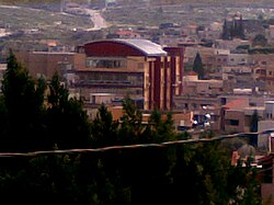
วิทยาลัยดนตรี Beit Almusica ก่อตั้งขึ้นในปี 1999 โดยนักดนตรี Aamer Nakhleh ในใจกลางเมือง Shefa-ʻAmr วิทยาลัยแห่งนี้เปิดสอนหลักสูตรดนตรีตลอดทั้งปีในเครื่องดนตรีหลากหลายชนิด และจัดการแสดงดนตรีและคอนเสิร์ต[ 72 ]ทุกปี Shefa-ʻAmr จะจัดเทศกาลดนตรีที่รู้จักกันในชื่อ "เทศกาลป้อม" เด็กชาวอาหรับจากทั่วประเทศจะแข่งขันกันร้องเพลงอาหรับคลาสสิก และจะมีการเลือก "เสียงแห่งปี" คณะนักร้องประสานเสียง Ba'athซึ่งก่อตั้งโดย Raheeb Haddad จะทำการแสดงทั่วประเทศและเข้าร่วมในงานระดับนานาชาติมากมาย นักร้องReem Talhamiจะทำการแสดงทั่วโลก อาหรับ Tayseer Elias นักเล่น อูดและนักไวโอลิน ซึ่งเป็นบุคลากรของ Beit Almusica เป็นนักแต่งเพลง วาทยกร และนักดนตรีวิทยาที่บรรยายที่มหาวิทยาลัย Bar-Ilan ด้วย[ 73 ] Butrus Lusia จิตรกรผู้เชี่ยวชาญด้านภาพ ไอคอน
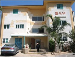
ละครเวทีเรื่องแรกในเชฟา-อัมร์ถูกแสดงโดยกลุ่มลูกเสือคริสเตียนในช่วงทศวรรษ 1950 นับตั้งแต่ทศวรรษ 1970 เป็นต้นมา มีโรงละครเปิดใหม่มากมาย เช่น โรงละครบุตรแห่งเชฟา-อัมร์ โรงละครอาธาร์ บ้านของโรงละครเยาวชน โรงละครอัลกูร์บัล อัลเชฟา-อัมร์ และโรงละครอัลอูฟอก โรงละครที่ใหญ่ที่สุดในเมืองคือโรงละครกูร์บัล ซึ่งเป็นโรงละครอาหรับแห่งชาติ ซาอีด ซาลาเม นักแสดง นักแสดงตลก และนักแสดงละครใบ้ ได้ก่อตั้งเทศกาลละครใบ้นานาชาติ 3 วัน ซึ่งจัดขึ้นเป็นประจำทุกปี
Shefa-Amr is known for its mastic-based ice cream, bozet Shefa-'Amr.The Nakhleh Coffee Company is the leading coffee producer in Israel's Arab community. New restaurant-cafes opened in parts of the old city and encouraged nightlife, being patronised by the youth of Shefa-ʻAmr. The Awt Cafe started holding musical nights where local singers and instruments players including oud and others perform for the audience.
Landmarks and religious sites
- A fort was built in 1760 by Daher al-Umar to secure the entrance to Galilee. The fort was built on the ruins of a Crusader fort called "Le Seffram". The ground floor of the fort stabled the horses, the first floor above ground was for Daher's residential quarters. Daher's fort is considered the biggest fort remaining in the Galilee. After the establishment of the state, the fort was used as a police station. After a new station was built in the "Fawwar" neighbourhood, the fort was renovated and converted to a youth center, which has since closed down.[74]
- "The Tower" or "al Burj" is an old Crusader fort located in the southern part of the city.
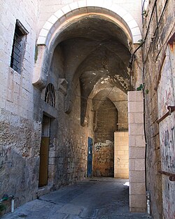
- The old market of Shefa-Amr was once the bustling heart of the city. Now all that remains is one coffee shop where elderly men gather every day to play backgammon and drink coffee. According to the mayor of Shefa-Amr, Nahed Khazem, the government provided a budget for improving and reviving the old market and developing the area around the fort as a tourist attraction.
- The Shfaram Ancient Synagogue is an old synagogue on the site of an even older structure. It is recorded as being active in 1845. A Muslim resident of the town holds the keys.[75] The synagogue was renovated in 2006. The tomb of Rabbi Judah ben Baba, a well-known rabbi from the 2nd century who was captured and executed by the Romans, is still standing and many Jewish believers come to visit it.
- Byzantine period tombs are located in the middle of the city. They were the graves of the 5th and 6th-century Christian community. The tomb entrances are decorated with sculptures of lions and Greek inscriptions which make mention of Jesus.[6]
- In the center of the city, where the Sisters of Nazareth convent now stands, was a 4th-century church, St. Jacob's. This church is mentioned in the notes of ecclesiastical historians, although the original church has been replaced by the monastery. Some marble columns remain, similar to those used to build the earliest churches.
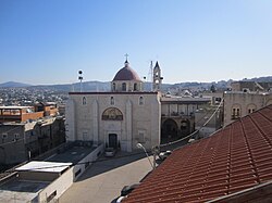
- St. Peter & St. Paul Church is located in one of the town's peaks near the fort, it has a high bell tower and a large purple dome. The church was built by Otman, who made a promise to build it if his fort was finished successfully. The walls of the church began to weaken, and in 1904 the entire church building was reinforced and renovated. This is the main church of the local Greek Catholic community.
- The Mosque of Ali Ibn Abi Talib (Old Mosque) was constructed near the castle in the days of Sulayman Pasha
Notable people
- Jumana Emil Abboud (born 1971), Palestinian artist[76]
- Karimeh Abbud (1893–1940), photographer and artist
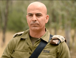
- Ghassan Alian (born 1972), first non-Jewish commander of the Golani Brigade
- Hamad Amar (born 1974), Member of the Knesset
- Mansour F. Armaly (1927–2005), physician who studied glaucoma
- Zahi Armeli (born 1957), former footballer
- Asad Azi (born 1955), Palestinian painter[77][78]
- Mohammad Barakeh (born 1955), Member of the Knesset
- Emile Habibi (1922–1996), Christian Israeli-Palestinian writer and communist politician. his father originated in Shefa-Amr
- Salah-Hassan Hanifes (1913–2002), Member of the Knesset
- Rami Hamadeh (born 1994), Palestinian footballer, who represented Palestine at the 2019 AFC Asian Cup
- Saleh Shahin (born 1982), Israeli Paralympic medalist rower
- Iyad Shalabi (born 1987), represented Israel at the 2020 Summer Paralympics, where he won two gold medals in swimming
See also
- Arab localities in Israel
- People from Shefa-'Amr
บรรณานุกรม
- อบู รายา, ราเฟห์ (2010-08-01) "'รายงานฉบับสุดท้ายของ En Shefar'am" (122) Hadashot Arkheologiyot – การขุดค้นและการสำรวจในอิสราเอล
{{cite journal}}: การอ้างอิงวารสารต้องใช้|journal=( ความช่วยเหลือ ) - Abu Shama (เสียชีวิต 1268) (1969): Livre des deux jardins ("The Book of Two Gardens") Recueil des Historiens des Croisadesอ้างใน Petersen (2001)
- Atrash, Walid (18 กรกฎาคม 2016). "'En Shefar'am Highway 79" (128). Hadashot Arkheologiyot – การขุดค้นและการสำรวจในอิสราเอล
{{cite journal}}: การอ้างอิงวารสารต้องใช้|journal=( ความช่วยเหลือ ) - บาราก, แดน (1979). "แหล่งข้อมูลใหม่เกี่ยวกับขอบเขตสุดท้ายของอาณาจักรละตินแห่งเยรูซาเลม" วารสารการสำรวจอิสราเอล29 : 197– 217.
- บาร์ไน, จาคอบ (1992). ชาวยิวในปาเลสไตน์ในศตวรรษที่สิบแปด: ภายใต้การอุปถัมภ์ของคณะกรรมการเจ้าหน้าที่แห่งอิสตันบูลเพื่อปาเลสไตน์แปลโดย นาโอมิ โกลด์บลัม สำนักพิมพ์มหาวิทยาลัยอลาบามาISBN 978-0-8173-0572-7.
- บีโซล ต. (2021) "שפרעם: צמישתה מכפר לעיר בשלהי התקופה העות'מאנית, 1864-1914" [Shefa'amr: การพัฒนาจากหมู่บ้านสู่เมืองในช่วงปลายยุคออตโตมัน, 1864-1914] ขอบเขตอันไกลโพ้นในภูมิศาสตร์ . 99 : 31– 58. จสตอร์ 27239154 .* Barron, JB, บรรณาธิการ (1923). ปาเลสไตน์: รายงานและบทสรุปทั่วไปของการสำรวจสำมะโนประชากรปี 1922รัฐบาลปาเลสไตน์
- โคเฮน, อัมนอน (1973). ปาเลสไตน์ในศตวรรษที่สิบแปด: รูปแบบการปกครองและการบริหาร . เยรูซาเลม: สำนักพิมพ์แม็กเนสมหาวิทยาลัยฮิบรู . ISBN 1-59045-955-5.อ้างอิงใน Petersen, (2001)
- Conder, CR ; Kitchener, HH (1881). การสำรวจปาเลสไตน์ตะวันตก: บันทึกเกี่ยวกับภูมิประเทศ ภูมิรัฐศาสตร์ อุทกศาสตร์ และโบราณคดีเล่ม 1. ลอนดอน: คณะกรรมการกองทุนสำรวจปาเลสไตน์หน้า 271-273
- กรมสถิติ (พ.ศ. 2488). สถิติหมู่บ้าน เมษายน พ.ศ. 2488.รัฐบาลปาเลสไตน์.
- เอลเลนบลัม, อาร์. (2003). การตั้งถิ่นฐานในชนบทของชาวแฟรงก์ในอาณาจักรละตินแห่งเยรูซาเลมสำนักพิมพ์มหาวิทยาลัยเคมบริดจ์ISBN 9780521521871.
- เฟก, นูริต (2014-08-28). "'รายงานฉบับสุดท้ายของ En Shefar'am" (126) Hadashot Arkheologiyot – การขุดค้นและการสำรวจในอิสราเอล
{{cite journal}}: การอ้างอิงวารสารต้องใช้|journal=( ความช่วยเหลือ ) - ฟินน์, เจ. (1877). เส้นทางในปาเลสไตน์ . ลอนดอน: เจมส์ นิสเบต.
- Firro, Kais (1992). ประวัติศาสตร์ของชาวดรูซ เล่ม 1. BRILL. ISBN 9004094377.
- Guérin, V. (1880) คำอธิบาย Géographique Historique et Archéologique de la Palestine (ในภาษาฝรั่งเศส) ฉบับที่ 3: กาลิลี จุด. 1. ปารีส: L'Imprimerie Nationale
- ฮาดาวี, เอส. (1970). สถิติหมู่บ้านปี 1945: การจำแนกประเภทกรรมสิทธิ์ที่ดินและพื้นที่ในปาเลสไตน์ศูนย์วิจัยองค์การปลดปล่อยปาเลสไตน์
- เฮย์ด, ยูริเอล (1960): เอกสารออตโตมันเกี่ยวกับปาเลสไตน์ ค.ศ. 1552-1615สำนักพิมพ์มหาวิทยาลัยออกซ์ฟอร์ด ออกซ์ฟอร์ด อ้างอิงใน ปีเตอร์เซน (2001)
- Herzog, C. and S. Gazit, The Arab-Israeli Wars, Vintage books, 2005.
- Hütteroth, W.-D.; Abdulfattah, K. (1977). Historical Geography of Palestine, Transjordan and Southern Syria in the Late 16th Century. Erlanger Geographische Arbeiten, Sonderband 5. Erlangen, Germany: Vorstand der Fränkischen Geographischen Gesellschaft. ISBN 3-920405-41-2.
- Joudah, Ahmad Hasan (2013). Revolt in Palestine in the Eighteenth Century: The Era of Shaykh Zahir al-Umar (Second ed.). Gorgias Press. ISBN 978-1-4632-0002-2.
- Karmon, Y. (1960). "An Analysis of Jacotin's Map of Palestine"(PDF). Israel Exploration Journal. 10 (3, 4): 155–173, 244–253.
- Mariti, G. (1792). Travels Through Cyprus, Syria, and Palestine; with a General History of the Levant. Vol. 1. Dublin: P. Byrne. (pp. 366-367)
- Mills, E., ed. (1932). Census of Palestine 1931. Population of Villages, Towns and Administrative Areas. Jerusalem: Government of Palestine.
- Morris, B. (1987). The Birth of the Palestinian refugee problem, 1947-1949. Cambridge University Press. ISBN 0-521-33028-9.
- Morris, B. (1993). Israel's Border Wars, 1949 - 1956. Arab Infiltration, Israeli Retaliation, and the Countdown to the Suez War. Oxford University Press. ISBN 0-19-827850-0.
- Vilnai, Z., "Shefa-'Amr, Between the past and the present", Jerusalem 1962.
- Palmer, E.H. (1881). The Survey of Western Palestine: Arabic and English Name Lists Collected During the Survey by Lieutenants Conder and Kitchener, R. E. Transliterated and Explained by E.H. Palmer. Committee of the Palestine Exploration Fund.
- Petersen, Andrew (2001). A Gazetteer of Buildings in Muslim Palestine (British Academy Monographs in Archaeology). Vol. 1. Oxford University Press. ISBN 978-0-19-727011-0.
- Philipp, T. (2001). Acre: The Rise and Fall of a Palestinian City, 1730–1831. Columbia University Press. ISBN 978-0-231-50603-8.
- Pringle, D. (1997). Secular buildings in the Crusader Kingdom of Jerusalem: an archaeological Gazetter. Cambridge University Press. ISBN 0-521-46010-7.
- พริงเกิล, ดี. (1998). โบสถ์ต่างๆ ในอาณาจักรครูเสดแห่งเยรูซาเลม: LZ (ไม่รวมไทร์)เล่ม 2 สำนักพิมพ์มหาวิทยาลัยเคมบริดจ์ ISBN 0-521-39037-0.
- โรด, เอช. (1979). การบริหารและประชากรของซานจักแห่งซาเฟดในศตวรรษที่สิบหก (ปริญญาเอก). มหาวิทยาลัยโคลัมเบีย .
- โรเจอร์ส, แมรี เอลิซา, (1865): ชีวิตในบ้านเรือนในปาเลสไตน์ (อ้างอิงในปีเตอร์เซน, 2001 ด้วย)
- Schumacher, G. (1888). "รายชื่อประชากรของ Liwa แห่ง Akka"รายงานประจำไตรมาส - กองทุนสำรวจปาเลสไตน์ 20 : 169– 191 .
- ซิงเกอร์, เอ. (2002). การสร้างความเมตตาแบบออตโตมัน: โรงครัวแจกอาหารของจักรพรรดิในเยรูซาเลม . อัลบานี: สำนักพิมพ์มหาวิทยาลัยแห่งรัฐนิวยอร์ก . ISBN 0-7914-5352-9.
- โซเรค, ทามีร์ (2015). การรำลึกถึงชาวปาเลสไตน์ในอิสราเอล: ปฏิทิน อนุสาวรีย์ และวีรชน . สแตนฟอร์ด, แคลิฟอร์เนีย: สำนักพิมพ์มหาวิทยาลัยสแตนฟอร์ด. ISBN 9780804795203.
- ไซออน, แดนนี่; ฮิลมานน์, อาฟเนอร์ (24-04-2549) "'รายงานฉบับสุดท้ายของ En Shefar'am" (118) Hadashot Arkheologiyot – การขุดค้นและการสำรวจในอิสราเอล
{{cite journal}}: การอ้างอิงวารสารต้องใช้|journal=( ความช่วยเหลือ ) - ซาฟรีร์, Y. ; ลีอาห์ ดิ เซญี; จูดิธ กรีน (1994) (TIR): Tabula Imperii Romani: จูเดีย, ปาเลสตินา . เยรูซาเลม: สถาบันวิทยาศาสตร์และมนุษยศาสตร์แห่งอิสราเอลไอเอสบีเอ็น 965-208-107-8.
- ซาฮาโรนี, เอ็ม. [ในภาษาฮิบรู] (1978). คู่มืออิสราเอล - กาลิลีตอนล่างและภูมิภาคกินเนเรต (สารานุกรมที่มีประโยชน์สำหรับความรู้เกี่ยวกับประเทศ) (ในภาษาฮิบรู). เล่ม 3. เยรูซาเลม: สำนักพิมพ์เคเตอร์ร่วมกับกระทรวงกลาโหมอิสราเอล. OCLC 745203905 ., sv שפרעם
ลิงก์ภายนอก

- เว็บไซต์อย่างเป็นทางการ (ภาษาอาหรับหรือภาษาฮิบรู)
- ยินดีต้อนรับสู่ Shafa Amr
- แผนที่สำรวจปาเลสไตน์ตะวันตก แผนที่ 5: IAA , Wikimedia Commons
