
List of counties in California

| Counties of California | |
|---|---|
  | |
| Location | State of California |
| Created |
|
| Number | 58 counties |
| Populations | Minimum: Alpine, 1,043Maximum: Los Angeles, 9,694,934 |
| Areas | Minimum: San Francisco, 47 square miles (120 km2)Maximum: San Bernardino, 20,062 square miles (51,960 km2) |
| Government | |
| Subdivisions | |
The U.S. state of California is divided into 58 counties.[1] The state was first divided into 27 counties on February 18, 1850. These were further sub-divided to form sixteen additional counties by 1860. Another fourteen counties were formed through further subdivision from 1861 to 1893. The most recent county to form was Imperial County, in 1907. California is home to San Bernardino County, the largest county in the contiguous United States, as well as Los Angeles County, the most populous county in the United States.
The counties of California are local arms of the State of California, described by the Supreme Court of California as agents ("the county is merely a political subdivision of state government, exercising only the powers of the state, granted by the state…'") and the property they hold is held on behalf of all the people of the state.[2][3] As such, the State Legislature may delegate any of the functions of the State to the counties but likewise can reassume any delegated duties.[4]
California counties are general law counties by default. Still, they may be chartered as provided in Article XI, Section 3 of the California Constitution.[5] A charter county is granted limited home rule powers. Of the 58 counties in California, the following 15 are governed under a charter: Alameda, Butte, El Dorado, Fresno, Los Angeles, Orange, Placer, Sacramento, San Bernardino, San Diego, San Francisco, San Mateo, Santa Clara, Shasta, and Tehama.[6]
Nine counties in California are named for saints, tied with Louisiana for the largest number. This count omits Santa Cruz ("Holy Cross") County, not named for a saint; Merced County and Los Angeles County, both of whose names refer to Saint Mary (Our Lady of Mercy (Merced) and Our Lady Queen of The Angels (Los Angeles)); and Ventura County, whose name is a shortening of the name of St. Bonaventure, the namesake of the local mission.[7]
List
| County | FIPS code[8] | County seat[9] | Est.[9] | Formed from | Etymology[10] | General Law or Charter[6] | Population(2025)[11] | Area[9] | Map |
|---|---|---|---|---|---|---|---|---|---|
| AlamedaCounty | 001 | Oakland | 1853 | Contra Costa and Santa Clara | The oak and other trees, once abundant in the region; alameda is Spanish for "avenue shaded by trees" or "cottonwood grove". | Charter | 1,636,630 | 738 sq mi(1,911 km2) |  |
| AlpineCounty | 003 | Markleeville | 1864 | Amador, El Dorado, Calaveras, Mono and Tuolumne | Location high in the Sierra Nevada; alpine refers to the Alps or other mountains. | General Law | 1,043 | 739 sq mi(1,914 km2) |  |
| AmadorCounty | 005 | Jackson | 1854 | Calaveras | Jose Maria Amador(1794–1883), a soldier, rancher, and miner who, along with several Native Americans, established a successful gold mining camp near present-day Amador City in 1848 | General Law | 41,876 | 593 sq mi(1,536 km2) |  |
| ButteCounty | 007 | Oroville | 1850 | original | Sutter Buttes, which were mistakenly thought to be in the county at the time of its establishment | Charter | 209,211 | 1,640 sq mi(4,248 km2) |  |
| CalaverasCounty | 009 | San Andreas | 1850 | original | Calaveras River; calaveras is Spanish for "skulls". | General Law | 46,605 | 1,020 sq mi(2,642 km2) |  |
| ColusaCounty | 011 | Colusa | 1850 | original | Rancho Colus land grant from Mexico | General Law | 21,836 | 1,151 ตาราง ไมล์( 2,981 ตาราง กิโลเมตร) |  |
| เคาน์ตีคอนทราคอสตา | 013 | มาร์ติเนซ | 1850 | ต้นฉบับ | ตั้งอยู่ฝั่งตรงข้ามอ่าวซานฟรานซิสโกจาก เมือง ซานฟรานซิสโก ; contra costaเป็นภาษาสเปนแปลว่า "ชายฝั่งตรงข้าม" | กฎหมายทั่วไป | 1,170,070 | 720 ตาราง ไมล์( 1,865ตาราง กิโลเมตร) |  |
| เทศมณฑลเดลนอร์ เต | 015 | เครสเซนต์ซิตี้ | 1857 | คลาแมธ | ตั้งอยู่ตามแนวชายแดนทางเหนือของรัฐแคลิฟอร์เนีย; del norteเป็นภาษาสเปนแปลว่า "เหนือ" | กฎหมายทั่วไป | 26,410 | 1,008 ตาราง ไมล์( 2,611 ตาราง กิโลเมตร) |  |
| เอลโดราโดเคาน์ตี้ | 017 | พลาเซอร์วิลล์ | 1850 | ต้นฉบับ | เอลโดราโดเมืองทองคำในตำนาน เนื่องจากความสำคัญของพื้นที่นี้ในยุคตื่นทองของแคลิฟอร์เนีย | กฎบัตร | 192,323 | 1,712 ตาราง ไมล์( 4,434 ตาราง กิโลเมตร) |  |
| เฟรสโนเคาน์ตี้ | 019 | เฟรสโน | 1856 | มาริโปซา เมอร์เซด และทูลาเร | เมืองเฟรสโน; เฟรสโนในภาษาสเปนแปลว่า "ต้นแอช" | กฎบัตร | 1,035,456 | 5,963 ตาราง ไมล์( 15,444 ตาราง กิโลเมตร) |  |
| เกล็นน์เคาน์ตี้ | 021 | วิลโลว์ | 1891 | โคลูซา | ฮิวจ์ เจ. เกล็นน์นักธุรกิจและนักการเมืองชาวแคลิฟอร์เนีย | กฎหมายทั่วไป | 28,141 | 1,315 ตาราง ไมล์( 3,406 ตาราง กิโลเมตร) |  |
| เทศมณฑลฮัมโบลต์ | 023 | ยูเรก้า | 1853 | ทรีนิตี้ | อเล็กซานเดอร์ ฟอน ฮุมโบลต์นักธรรมชาติวิทยาและนักสำรวจชาวเยอรมัน | กฎหมายทั่วไป | 131,647 | 3,573 ตาราง ไมล์( 9,254 ตาราง กิโลเมตร) |  |
| เทศมณฑลอิมพีเรียล | 025 | เอล เซ็นโทร | 1907 | ซานดิเอโก | หุบเขาอิมพีเรียล (Imperial Valley)ตั้งชื่อตามบริษัทอิมพีเรียลแลนด์ (Imperial Land Company) | กฎหมายทั่วไป | 181,411 | 4,175 ตาราง ไมล์( 10,813 ตาราง กิโลเมตร) |  |
| เขตอินโย | 027 | เอกราช | 1866 | โมโนและทูลาเร | ที่มาของชื่อยังเป็นที่ถกเถียงกันอยู่ ผู้ตั้งถิ่นฐานยุคแรกเชื่อว่าอินโย (Inyo)เป็นชื่อพื้นเมืองของภูเขาในบริเวณนั้น แต่ก็อาจเป็นชื่อของผู้นำชาวอินเดียนเผ่าโมโน (Mono Indian) ก็ได้ | กฎหมายทั่วไป | 18,158 | 10,192 ตาราง ไมล์( 26,397 ตารางกิโลเมตร ) |  |
| เคิร์นเคาน์ตี้ | 029 | เบเคอร์สฟิลด์ | 1866 | ลอสแอนเจลิสและทูลาเร | เอ็ดเวิร์ด เคิร์นนักทำแผนที่ประจำคณะสำรวจของจอห์น ซี. เฟรมอนต์ ในปี ค.ศ. 1845 | กฎหมายทั่วไป | 927,068 | 8,142 ตาราง ไมล์( 21,088 ตาราง กิโลเมตร) |  |
| คิงส์เคาน์ตี้ | 031 | แฮนฟอร์ด | 1893 | ทูลาเร | แม่น้ำคิงส์ (ชื่อภาษาสเปนเดิมคือRio de los Santos Reyes "แม่น้ำแห่งกษัตริย์ผู้ศักดิ์สิทธิ์ ") | กฎหมายทั่วไป | 154,327 | 1,390 ตาราง ไมล์( 3,600 ตาราง กิโลเมตร) |  |
| เลคเคาน์ตี้ | 033 | เลคพอร์ต | 1861 | นาปา | ทะเลสาบเคลียร์ | กฎหมายทั่วไป | 67,772 | 1,258 ตาราง ไมล์( 3,258 ตาราง กิโลเมตร) |  |
| เทศมณฑลลาเซน | 035 | ซูซานวิลล์ | 1864 | พลูมาสและชาสตา และปัจจุบันคือเลคเคาน์ตี รัฐเนวาดา ซึ่ง ปัจจุบันไม่มีอยู่แล้ว | ปีเตอร์ ลาสเซนนักธรรมชาติวิทยาและนักสำรวจชาวเดนมาร์ก | กฎหมายทั่วไป | 28,117 | 4,558 ตาราง ไมล์( 11,805 ตาราง กิโลเมตร) |  |
| ลอสแอนเจลิสเคาน์ตี้ | 037 | ลอสแอนเจลิส | 1850 | ต้นฉบับ | เมืองลอสแอนเจลิส มีที่มาจากชื่อภาษาสเปนดั้งเดิมว่าEl Pueblo de Nuestra Señora la Reina de los Angeles ("หมู่บ้านของพระแม่มารี ราชินีแห่งเหล่าทูตสวรรค์") | กฎบัตร | 9,694,934 | 4,060 ตาราง ไมล์( 10,515 ตาราง กิโลเมตร) |  |
| เทศมณฑลมาเดรา | 039 | มาเดรา | 1893 | เฟรสโน | เมืองมาเดราได้รับการตั้งชื่อตามอุตสาหกรรมไม้ที่เมืองนี้ก่อตั้งขึ้น โดยคำว่ามาเดราในภาษาสเปนแปลว่า "ไม้" หรือ "ท่อนไม้" | กฎหมายทั่วไป | 167,927 | 2,138 ตาราง ไมล์( 5,537 ตาราง กิโลเมตร) |  |
| มารินเคาน์ตี้ | 041 | ซานราฟาเอล | 1850 | ต้นฉบับ | หัวหน้าเผ่ามาริน "หัวหน้าเผ่าผู้ยิ่งใหญ่แห่งเผ่าลิกาติอุต" (สาขาหนึ่งของ ชาว มิวก์ชายฝั่ง ) | กฎหมายทั่วไป | 253,694 | 520 ตาราง ไมล์( 1,347ตาราง กิโลเมตร) |  |
| เทศมณฑลมาริโป ซา | 043 | มาริโปซ่า | 1850 | ต้นฉบับ | เมืองมาริโปซา; มาริโปซาในภาษาสเปนแปลว่า " ผีเสื้อ " | กฎหมายทั่วไป | 16,918 | 1,451 ตาราง ไมล์( 3,758 ตาราง กิโลเมตร) |  |
| เทศมณฑลเมนโดซิโน | 045 | ยูไคอาห์ | 1850 | ต้นฉบับ | อันโตนิโอ เด เมนโดซาอุปราชคนแรกของนิวสเปน | กฎหมายทั่วไป | 88,122 | 3,509 ตาราง ไมล์( 9,088 ตาราง กิโลเมตร) |  |
| เทศมณฑลเมอร์เซด | 047 | เมอร์เซด | 1855 | มาริโปซ่า | เมืองเมอร์เซด มาจากชื่อภาษาสเปนดั้งเดิมว่าEl Río de Nuestra Señora de la Merced ("แม่น้ำแห่งพระแม่แห่งความเมตตา") | กฎหมายทั่วไป | 297,260 | 1,929 ตาราง ไมล์( 4,996 ตาราง กิโลเมตร) |  |
| เทศมณฑลโมด็อก | 049 | อัลตูรัส | 1874 | ซิสคิยู | ชาวโมด็อก | กฎหมายทั่วไป | 8,426 | 3,944 ตาราง ไมล์( 10,215 ตาราง กิโลเมตร) |  |
| เทศมณฑลโมโน | 051 | บริดจ์พอร์ต | 1861 | คาลาเวรัส เฟรสโน และมาริโปซา | Mono Lake; derived from Monachi, a Yokuts name for native peoples of the Sierra Nevada | General Law | 12,505 | 3,044 sq mi(7,884 km2) |  |
| MontereyCounty | 053 | Salinas | 1850 | original | Derived from Monterey Bay, which was named for a Viceroy of New Spain, Gaspar de Zúñiga, 5th Count of Monterrey | General Law | 433,729 | 3,322 sq mi(8,604 km2) |  |
| NapaCounty | 055 | Napa | 1850 | original | Disputed origin; possibly derived from the Patwin word napo, meaning "home" | General Law | 132,949 | 754 sq mi(1,953 km2) |  |
| NevadaCounty | 057 | Nevada City | 1851 | Yuba | The phrase Sierra Nevada; nevada is Spanish for "snow-covered", referencing the area's high elevation. The bordering state was named after the county, which was named after Nevada City. | General Law | 101,911 | 958 sq mi(2,481 km2) |  |
| OrangeCounty | 059 | Santa Ana | 1889 | Los Angeles | Oranges, to illustrate a perception of a region with a semi-tropical atmosphere to those from the eastern parts of the United States | Charter | 3,149,507 | 790 sq mi(2,046 km2) |  |
| PlacerCounty | 061 | Auburn | 1851 | Sacramento | Placer mining, a reference to the area being a center of the California Gold Rush | Charter | 442,081 | 1,404 sq mi(3,636 km2) |  |
| PlumasCounty | 063 | Quincy | 1854 | Butte | The Feather River; plumas is Spanish for "feathers". | General Law | 18,583 | 2,554 sq mi(6,615 km2) |  |
| RiversideCounty | 065 | Riverside | 1893 | San Bernardino and San Diego | The city of Riverside, named for its location on the Santa Ana River | General Law | 2,544,916 | 7,208 sq mi(18,669 km2) |  |
| SacramentoCounty | 067 | Sacramento | 1850 | original | The city of Sacramento, named after the Santísimo Sacramento (Spanish for "Most Holy Sacrament") | Charter | 1,618,460 | 966 sq mi(2,502 km2) |  |
| San BenitoCounty | 069 | Hollister | 1874 | Monterey | นักบุญเบเนดิกต์ ( เบนิโตเป็นชื่อย่อ ในภาษาสเปน ของเบเนดิกต์ ) | กฎหมายทั่วไป | 70,082 | 1,389 ตาราง ไมล์( 3,597 ตาราง กิโลเมตร) |  |
| เทศมณฑลซานเบอร์นาร์ดิโน | 071 | ซานเบอร์นาร์ดิโน | 1853 | ลอสแอนเจลิส | เมืองซานเบอร์นาร์ดิโน ตั้งชื่อตามนักบุญเบอร์นาร์ดิโนแห่งเซียนา (ภาษาสเปนแปลว่า นักบุญเบอร์นาร์ดีน) | กฎบัตร | 2,224,091 | 20,062 ตาราง ไมล์( 51,960 ตารางกิโลเมตร ) |  |
| เขตซานดิเอโก | 073 | ซานดิเอโก | 1850 | ต้นฉบับ | เมืองซานดิเอโก มาจากชื่อมิชชั่นซานดิเอโก (ภาษาสเปนแปลว่านักบุญดิดาคัส ) | กฎบัตร | 3,282,248 | 4,204 ตาราง ไมล์( 10,888 ตาราง กิโลเมตร) |  |
| เมืองและเทศมณฑลซานฟรานซิสโก | 075 | ซานฟรานซิสโก | 1850 | ต้นฉบับ | เมืองซานฟรานซิสโก จากPresidio of San FranciscoและMission San Francisco de Asísตั้งชื่อตามนักบุญฟรานซิสแห่งอัสซีซี (ภาษาสเปนสำหรับนักบุญฟรานซิส) | กฎบัตร | 826,079 | 47 ตาราง ไมล์( 122ตาราง กิโลเมตร) |  |
| เทศมณฑลซานโฮา คิน | 077 | สต็อกตัน | 1850 | ต้นฉบับ | ชื่อภาษาสเปนสำหรับนักบุญโยอาคิมบิดาของพระแม่มารี | กฎหมายทั่วไป | 823,815 | 1,399 ตาราง ไมล์( 3,623 ตาราง กิโลเมตร) |  |
| เทศมณฑลซานลุยส์โอบิสโป | 079 | ซานลุยส์โอบิสโป | 1850 | ต้นฉบับ | เมืองซานลุยส์โอบิสโป มาจากชื่อมิชชั่นซานลุยส์โอบิสโปซึ่งตั้งชื่อตามนักบุญหลุยส์แห่งตูลูส (ภาษาสเปนแปลว่า นักบุญหลุยส์ บิชอป) | กฎหมายทั่วไป | 282,367 | 3,304 ตาราง ไมล์( 8,557 ตาราง กิโลเมตร) |  |
| เทศมณฑลซานมาเต โอ | 081 | เรดวูดซิตี้ | 1856 | ซานฟรานซิสโกและซานตาครูซ | ภาษาสเปนสำหรับนักบุญมัทธิว | กฎบัตร | 743,568 | 449 ตาราง ไมล์( 1,163ตาราง กิโลเมตร) |  |
| เทศมณฑลซานตาบาร์บารา | 083 | ซานตาบาร์บารา | 1850 | ต้นฉบับ | เมืองซานตาบาร์บารา มาจากชื่อมิชชั่นซานตาบาร์บารา (ภาษาสเปนแปลว่านักบุญบาร์บารา ) | กฎหมายทั่วไป | 442,065 | 2,738 ตาราง ไมล์( 7,091 ตาราง กิโลเมตร) |  |
| เทศ มณฑลซานตาคลา รา | 085 | ซานโฮเซ | 1850 | ต้นฉบับ | เมืองซานตาคลารา มาจากชื่อมิชชั่นซานตาคลาราเดออาซิสซึ่งตั้งชื่อตามนักบุญคลาราแห่งอัสซีซี (ภาษาสเปนแปลว่า นักบุญคลารา) | กฎบัตร | 1,914,391 | 1,291 ตาราง ไมล์( 3,344 ตาราง กิโลเมตร) |  |
| เทศมณฑลซานตาครูซ | 087 | ซานตาครูซ | 1850 | ต้นฉบับ | เมืองซานตาครูซ มาจากชื่อมิชชั่นซานตาครูซ (ภาษาสเปนแปลว่า "ไม้กางเขนศักดิ์สิทธิ์") | กฎหมายทั่วไป | 258,852 | 446 ตาราง ไมล์( 1,155ตาราง กิโลเมตร) |  |
| เทศมณฑลชาสตา | 089 | เรดดิง | 1850 | ต้นฉบับ | ภูเขาชาสต้า ; ชนพื้นเมืองชาสต้า | กฎหมายทั่วไป (ซึ่งจะกลายเป็นกฎบัตรตั้งแต่วันที่ 1 มกราคม พ.ศ. 2568 [ 6 ] ) | 181,648 | 3,786 ตาราง ไมล์( 9,806 ตาราง กิโลเมตร) |  |
| เทศมณฑลเซียร์รา | 091 | ดาวนีวิลล์ | 1852 | ยูบา | เซียร์รา (Sierra)เป็นภาษาสเปน แปลว่า " เทือกเขา " ซึ่งหมายถึงลักษณะภูมิประเทศของพื้นที่นั้น | กฎหมายทั่วไป | 3,098 | 953 ตาราง ไมล์( 2,468ตาราง กิโลเมตร) |  |
| เทศมณฑลซิสคิยู | 093 | เยเรก้า | 1852 | ชาสตาและคลาแมธ | เทือกเขาซิสคิยู ; ที่มาของชื่อซิสคิยูยังเป็นที่ถกเถียงกันอยู่ | กฎหมายทั่วไป | 42,013 | 6,287 ตาราง ไมล์( 16,283 ตาราง กิโลเมตร) |  |
| เทศมณฑลโซลาโน | 095 | แฟร์ฟิลด์ | 1850 | ต้นฉบับ | หัวหน้าโซลาโนแห่งซุยซูเนส | กฎหมายทั่วไป | 455,376 | 828 ตาราง ไมล์( 2,145ตาราง กิโลเมตร) |  |
| เทศมณฑลโซโนมา | 097 | ซานตาโรซา | 1850 | ต้นฉบับ | ที่มาของคำนี้ยังเป็นที่ถกเถียงกันอยู่ อาจเป็น คำในภาษา โปโมที่หมายถึง "หุบเขาแห่งดวงจันทร์" ซึ่งอ้างอิงถึงตำนานพื้นเมืองเกี่ยวกับกิจกรรมทางจิตวิญญาณในพื้นที่นั้น | กฎหมายทั่วไป | 486,444 | 1,576 ตาราง ไมล์( 4,082 ตาราง กิโลเมตร) |  |
| เทศมณฑลสแตนิสลอส | 099 | โมเดสโต | 1854 | ทูโอล์มเน | แม่น้ำสแตนิสลอว์ตั้งชื่อตามเอสตานิสลอว์ชาวพื้นเมืองของพื้นที่นี้ในสมัยที่แคลิฟอร์เนียอยู่ภายใต้การปกครองของสเปนและเม็กซิโก | กฎหมายทั่วไป | 557,719 | 1,495 ตาราง ไมล์( 3,872 ตาราง กิโลเมตร) |  |
| ซัตเตอร์เคาน์ตี้ | 101 | เมืองยูบา | 1850 | ต้นฉบับ | จอห์น ซัตเตอร์ชาวสวิสผู้บุกเบิกแคลิฟอร์เนียซึ่งมีส่วนเกี่ยวข้องกับยุคตื่นทองในแคลิฟอร์เนีย | กฎหมายทั่วไป | 98,787 | 603 ตาราง ไมล์( 1,562ตาราง กิโลเมตร) |  |
| เทศมณฑลเทฮามา | 103 | เรดบลัฟฟ์ | 1856 | บัตต์ โคลูซา และชาสตา | เมืองเทฮามาซึ่งน่าจะเป็นคำที่ชาวพื้นเมืองใช้เรียกที่ตั้งของเมืองนี้ | กฎบัตร | 64,665 | 2,951 ตาราง ไมล์( 7,643 ตาราง กิโลเมตร) |  |
| เทศ มณฑลทรินิตี้ | 105 | วีเวอร์วิลล์ | 1850 | ต้นฉบับ | เมืองตรินิแดดซึ่งเป็นชื่อภาษาสเปนแปลว่า "ตรีเอกภาพ" | กฎหมายทั่วไป | 15,720 | 3,179 ตาราง ไมล์( 8,234 ตาราง กิโลเมตร) |  |
| เทศมณฑลทูลาเร | 107 | วิซาเลีย | 1852 | มาริโปซ่า | Tulare Lake, which is named after the tule rush (Schoenoplectus acutus) that grew in the marshes and sloughs along its shores | General Law | 485,146 | 4,824 sq mi(12,494 km2) |  |
| TuolumneCounty | 109 | Sonora | 1850 | original | Exact etymology disputed; probably a corruption of the native term talmalamne, which means "cluster of stone wigwams", a reference to local cave dwelling tribes | General Law | 53,160 | 2,236 sq mi(5,791 km2) | 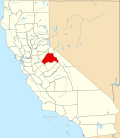 |
| VenturaCounty | 111 | Ventura | 1872 | Santa Barbara | The city of Ventura, derived from Mission San Buenaventura (Spanish for St. Bonaventure) | General Law | 830,851 | 1,846 sq mi(4,781 km2) |  |
| YoloCounty | 113 | Woodland | 1850 | original | The Yolan people, a local Native American tribe | General Law | 224,410 | 1,012 sq mi(2,621 km2) |  |
| YubaCounty | 115 | Marysville | 1850 | original | Named either by the Maidu people, a local Native American tribe who live on the banks of the Feather and Yuba Rivers, for one of their villages, or by Gabriel Moraga for the wild grapes (Vitis californica) that grow abundantly at the edge of the rivers (uva being Spanish for "grape") | General Law | 88,691 | 630 sq mi(1,632 km2) |  |
Defunct counties
- Branciforte County was the original name of Santa Cruz County in 1850. The reference was to the 1797 town of Branciforte.
- Klamath County was created in 1851 from the northern half of Trinity County. Part of the county's territory went to Del Norte County in 1857, and in 1874 the remainder was divided between Humboldt and Siskiyou counties.
- Pautah County, California was created in 1852 out of territory which, the state of California assumed, was to be ceded to it by the United States Congress from territory in what is now the state of Nevada. When the cession never occurred, the California State Legislature officially abolished the never-organized county in 1859.[4]
- Buena Vista County was created in 1855 by the California State Legislature out of the southeastern territory of Tulare County on the west of the Sierra Nevada but was never officially organized. The south of Tulare County was later organized as Kern County in 1866, with additions from Los Angeles and San Bernardino counties.
- Coso County was created in 1864 by the California State Legislature out of territory of Mono County and Tulare County on the east slope of the Sierra Nevada but was never officially organized. The region was later organized in 1866 as Inyo County with additions from Los Angeles and San Bernardino counties.
- Roop County, Nevada encompassed much of Lassen County, including the Honey Lake Valley and the community of Susanville, California; ambiguous organic legislation of Nevada Territory led to confusion about the geographic extent of Nevada's western border. This was later clarified, with the portions of Roop County in California being assigned to Lassen County; the remaining, sparsely portions of Roop County were eventually combined with Washoe County, Nevada.
Proposed counties
- Mojave County, proposed in 1988 that would have split the northern and eastern 90% of San Bernardino County
- Cahuilla County, proposed in the 1980s by the residents of eastern Riverside County
- Corona County, proposed in 2002 by residents of Corona and surrounding communities in Riverside County
- High Desert County, proposed in the 1970s, 80s, and 90s to split from portions of Los Angeles, Kern and San Bernardino counties
- Los Padres County, proposed in 1978 to split the northern portion of Santa Barbara County
- Mission County, proposed in 2006 to split the northern portion of Santa Barbara County
- Sequoia County, proposed in the 1990s, split from parts of southern Humboldt and Northern Mendocino counties
See also
อ่านเพิ่มเติม
- ผู้เขียน, Statf (2022). "ภาพรวมรัฐบาลเทศมณฑลแคลิฟอร์เนีย" (PDF) . ce.naco.org . สมาคมเทศมณฑลแห่งชาติ (NACo) . สืบค้นเมื่อ3 มกราคม 2025 .
ลิงก์ภายนอก
- สมาคมเทศมณฑลแห่งรัฐแคลิฟอร์เนีย
- แผนที่รัฐแสดงชื่อเขตปกครองและลิงก์ไปยังข้อมูลของแต่ละเขตปกครอง
- California State Association of Counties- The Creation of Our 58 Counties, with Maps of the 58 Counties Each Decade ca.1850–1900
- California State Association of Counties, Map of California Counties: c. 1907–Present