Yazur

Yazur يازور | |
|---|---|
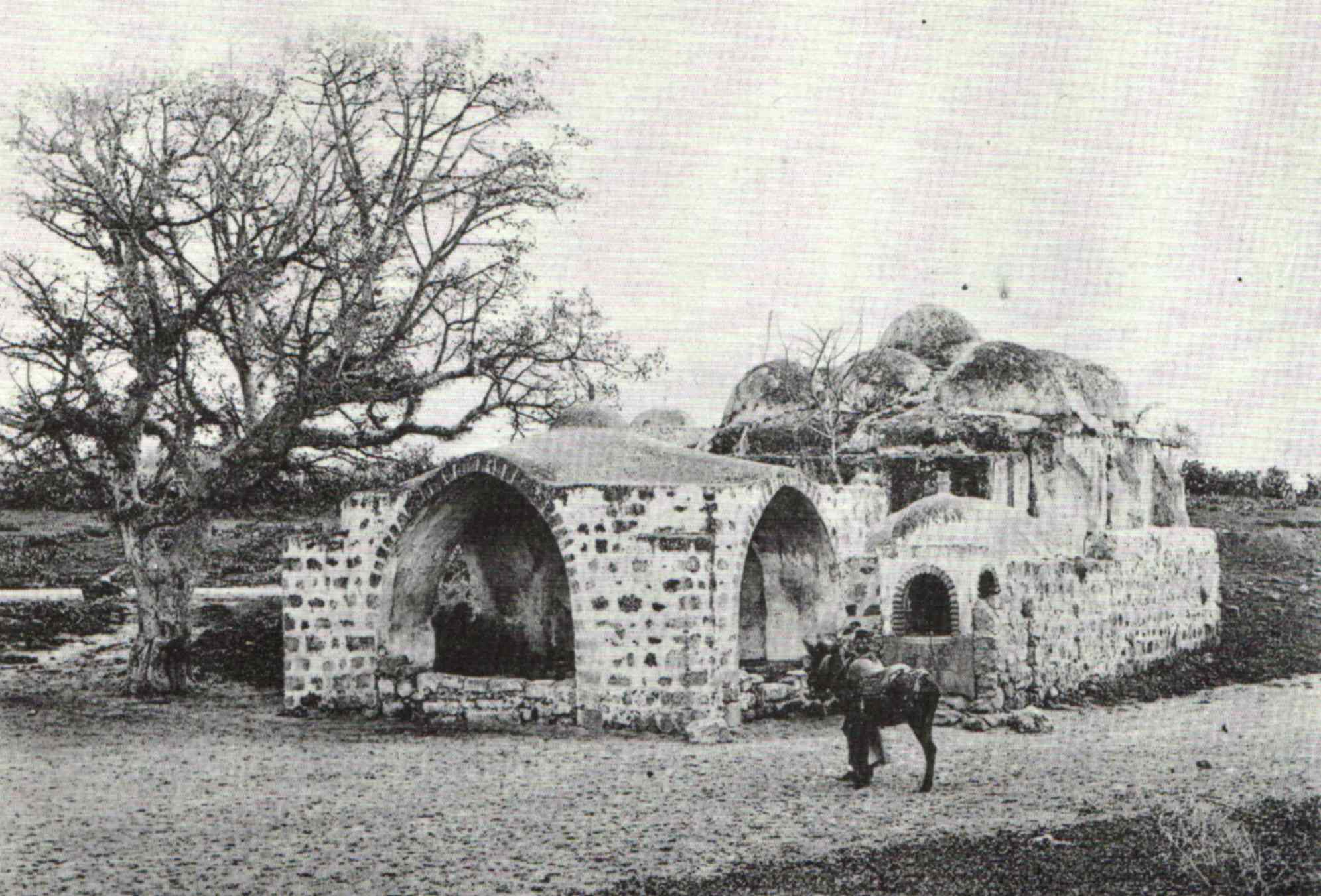
 Maqam (shrine) of Imam ʿAli, in early 1920s, (presently housing the Sha'arei Zion Synagogue) | |
| Etymology: Yazur[1][2] | |
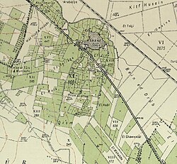
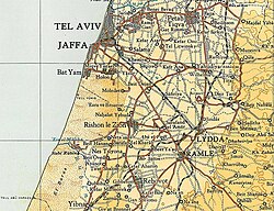
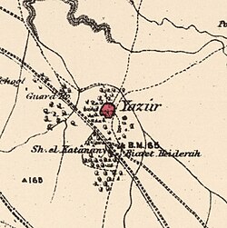 1870s map 1870s map  1940s map 1940s map modern map modern map  1940s with modern overlay map 1940s with modern overlay mapA series of historical maps of the area around Yazur (click the buttons) | |
  Yazur Location within Mandatory Palestine | |
| Coordinates: 32°01′34″N34°48′17″E / 32.02611°N 34.80472°E | |
| Palestine grid | 131/159 |
| Geopolitical entity | Mandatory Palestine |
| Subdistrict | Jaffa |
| Date of depopulation | 1 May 1948[5] |
| Area | |
• Total | 9,742 dunams (9.742 km2; 3.761 sq mi) |
| Population (1945) | |
• Total | 4,030[3][4] |
| Cause(s) of depopulation | Military assault by Yishuv forces |
| Secondary cause | Influence of nearby town's fall |
| Current Localities | Azor,[6]Holon |
Yazur (Arabic: يازور, Hebrew: יאזור) was a Palestinian Arab town located 6 kilometers (3.7 mi) east of Jaffa. Mentioned in 7th century BCE Assyrian texts, the village was a site of contestation between Muslims and Crusaders in the 12th-13th centuries.
During the Fatimid period in Palestine, a number of important people were born in Yazur. In the modern era, the town was the birthplace of Ahmed Jibril, the founder of the Popular Front for the Liberation of Palestine – General Command (PFLP-GC).
Yazur was ethnically cleansed and during the Nakba. It was later demolished and the Israeli town of Azor, reflecting the site's ancient name, was constructed on the site.
Etymology
The earliest occurrence of the name is Babylonian A-zu-ru (in a Neo-Assyrian text from 701 B.C.E.) which is compatible with the Septuagint form Άζωρ.[7]
According to scholars, the name my derive from Semitic root ’-Z-R “to gird, encompass, equip”, originally in Hebrew but with cognates in Jewish Aramaic and Arabic.[7] According to Marom and Zadok, "this derivation is highly hypothetical as this root is so far not productive in the toponymy."[7]
History
Iron Age
The village is mentioned in the annals of the Assyrian ruler Sennacherib (704 – 681 BCE) as Azuro.[8]
Fatimid, Crusader, Ayyubid and Mamluk eras
The Arab geographer Yaqut al-Hamawi (1179–1229) described Yazur as a small town[9] that was the birthplace of several important figures during the Fatimid period. Most prominent among them was al-Hasan ibn ´Ali al-Yazuri, who became a Fatimid minister in 1050 CE.[8] In the twelfth and thirteenth centuries CE, Muslim and Crusader forces fought for control of the village and it changed hands several times, before finally falling under the control of the Mamluks.[8]
Ottoman era
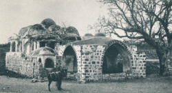
During early Ottoman rule in Palestine, in 1552, the revenues of the village of Yazur were designated for the new waqf of Hasseki Sultan Imaret in Jerusalem, established by Hasseki Hurrem Sultan (Roxelana), the wife of Suleiman the Magnificent.[10][11] In 1586, the Maqam Imam ´Ali in Yazur was seen by Jean Zuallart, who described it as follows: "....a little further was a square mosque with nine little cupolas. Across the road there is a well or cistern."[12]
In the 1596 tax records, Yazur was a village in the nahiya ("subdistrict") of Ramla, part of Sanjak of Gaza. It had a population 50 Muslim households, an estimated 275 persons. The villagers paid a fixed tax rate of 33,3% for the crops that they cultivated, which included wheat, barley, fruit, and sesame, as well as on other types of property, such as goats and beehives; a total of 19,250 akçe. All of the revenue went to a Muslim charitable institution.[13]
In 1602, Seusenius described the Maqam Imam ´Ali as "a mosque with nine cupolas the one in the middle being the highest".[14]
In 1051 AH/1641/2, the Bedouin tribe of al-Sawālima from around Jaffa attacked the villages of Subṭāra, Bayt Dajan, al-Sāfiriya, Jindās, Lydda and Yāzūr belonging to Waqf Haseki Sultan.[15]
The Syrian Sufi teacher and traveller Mustafa al-Bakri al-Siddiqi (1688-1748/9), who travelled in the region in the first half of the eighteenth century, and Mustafa al-Dumyati (d. 1764) reported visiting the shrine of a sage called Sayyiduna ("our master") Haydara in Yazur.[8] The village appeared named Jazour on the map that Pierre Jacotin compiled in 1799 during the French campaign in Egypt and Syria.[16]
In 1863 Victor Guérin visited.[17] While the area was still under the rule of the Ottoman Empire in 1870, Charles Netter from Alliance Israélite Universelle founded the Mikveh Israel southeast of Jaffa. Through a firman of the sultan, he received land for the school. Until then the land had been cultivated by the fellahin of Yazur village. In a Survey of Western Palestine (1882), it is noted that, "Though the land belongs to the Government, the Fellahin, from long usage, have got to look upon it as virtually their own, and resent its occupation by any other person." The peasants became bitter enemies of the school farm.[18]
ในช่วงปลายฤดูร้อนปี 1870 ผู้ว่าการเมืองดามัสกัสได้เดินทางไปเยือนเมืองจาฟฟา โดยมีเน็ตเตอร์และอัศวินเทมพลาร์ สองนาย คือคริสตอฟ ฮอฟฟ์มันน์และเอิร์นส์ ฮาร์เดกก์ ร่วมเดินทางไปด้วย ผู้ว่าการเมืองได้เดินทางผ่านเมืองยาซูร์:
ขณะที่กำลังขี่ม้าระหว่างที่ดินของแนทเทอร์กับเมือง วาลีถูกรุมล้อมด้วยหญิงและชายชาวอาหรับที่ขอร้องเขา โดยจับบังเหียนของล่อและกางเกงของเขาไว้ เพื่อขอความช่วยเหลือในการทวงคืนสิทธิ์ของพวกเขา เนื่องจากชาวยิวกำลังยึดที่ดินของพวกเขาไป พวกเขาชี้ไปที่แนทเทอร์ซึ่งขี่ม้าอยู่ข้างๆ วาลี พร้อมกับตะโกนว่า "ชาวยิว ชาวยิว" ปาชาซึ่งขี่ม้าอยู่อีกด้านหนึ่ง ได้ขอแส้จากเอิร์นสต์และไล่พวกเขาไปเอง วาลีรับคำร้องที่ชีค ยื่นให้เขา ด้วย[ 19 ]
รายงานการสำรวจ ของPEF เกี่ยวกับปาเลสไตน์ตะวันตก ระบุว่าในปี พ.ศ. 2425 โครงสร้าง ของหมู่บ้านสร้างด้วย อิฐ ดินเหนียวมีสวนและบ่อน้ำกระจายอยู่ทั่วไป และยาซูร์มีศาลเจ้าโดม[ 20 ]
ยุคอาณานิคมอังกฤษ

เมืองยาซูร์ในปัจจุบันแบ่งออกเป็นสี่เขต แต่ละเขตเป็นของสี่ตระกูล ( hama´il , เอกพจน์hamula ) ที่อาศัยอยู่ที่นั่น บ้านเรือนแบบดั้งเดิมสร้างด้วยหินหรืออิฐดินเหนียวและฟาง และสร้างเป็นกลุ่มที่เรียกว่าahwash (พหูพจน์ของhawsh , "ลานบ้าน") บ้านแต่ละหลังในกลุ่มดังกล่าวเปิดออกสู่ลานบ้านส่วนกลางที่มีทางเข้าเดียว ซึ่งมักจะเป็นประตูโค้ง ครอบครัวขยายอาศัยอยู่ใน ahwash เหล่านั้น
หมู่บ้านนี้มีโรงเรียนประถมสองแห่ง แห่งหนึ่งสำหรับเด็กชาย (สร้างในปี 1920) และอีกแห่งสำหรับเด็กหญิง (เปิดในปี 1933) โรงเรียนของเด็กชายมีพื้นที่ 27 ดูนุม (ส่วนใหญ่จัดสรรไว้สำหรับการฝึกอบรมด้านเกษตรกรรม) และมีบ่อน้ำบาดาล เป็นของตัวเอง ในปี 1947 มีเด็กชาย 430 คนและเด็กหญิง 160 คนลงทะเบียนเรียนในโรงเรียนเหล่านี้ ซากโบราณสถานของโบสถ์ ครูเสด ที่สร้างโดยริชาร์ดใจสิงห์ในปี 1191 ชื่อว่าCastel des Plainesสามารถมองเห็นได้บนเนินเขาภายในหมู่บ้าน โบสถ์ครูเสดแห่งนี้ได้รับการบูรณะใหม่เพื่อใช้เป็นมัสยิด ของยาซู ร์
จากการสำรวจสำมะโนประชากรของปาเลสไตน์ในปี พ.ศ. 2465ซึ่งดำเนินการโดยหน่วยงานปกครองของอังกฤษยาซูร์มีประชากร 1,284 คน ซึ่งทั้งหมด เป็น ชาวมุสลิม[ 21 ]จากการสำรวจสำมะโนประชากรในปี พ.ศ. 2474ประชากรเพิ่มขึ้นเป็น 2,337 คน ในบ้าน 419 หลัง[ 22 ]
จากการสำรวจสำมะโนประชากรในปี พ.ศ. 2488หมู่บ้านยาซูร์มีประชากร 4,030 คน ส่วนใหญ่เป็นชาวอาหรับมุสลิม และมี ชุมชน ชาวคริสต์อาหรับ ขนาดเล็กเพียง 20 คน[ 3 ] [ 8 ]การเกษตรเป็นรากฐานสำคัญของเศรษฐกิจ ในปี พ.ศ. 2487 มีการปลูกส้มบนพื้นที่ 6,272 ดูนุม และจัดสรรพื้นที่ 1,441 ดูนุมสำหรับปลูกธัญพืช การเกษตรอาศัยทั้งน้ำฝนและระบบชลประทาน โดยมีพื้นที่ 1,689 ดูนุมที่ใช้ระบบชลประทานหรือใช้สำหรับสวนผลไม้ ในช่วงสงครามโลกครั้งที่สองชาวบ้านเริ่มเลี้ยงวัวพันธุ์โฮลสไตน์ ด้วย ในปี พ.ศ. 2490 มีการใช้ บ่อน้ำบาดาล จำนวนมาก เพื่อการชลประทาน[ 8 ]
ช่วงก่อนและหลังสงครามปี 1947-1948
หนังสือพิมพ์ ฟิลาสตินรายงานว่า เมื่อวันที่ 11 ธันวาคม พ.ศ. 2490 สมาชิกของกลุ่มติดอาวุธที่สนับสนุนไซออนิสต์ได้ขับรถด้วยความเร็วสูงผ่านเมือง และขว้างระเบิดใส่ร้านตัดผมและร้านกาแฟ แต่ไม่มีผู้เสียชีวิต อย่างไรก็ตามอาเรฟ อัล-อาเรฟรายงานว่า หนึ่งสัปดาห์ต่อมา ในวันที่ 18 ธันวาคม กองกำลังไซออนิสต์ได้กลับมาอีกครั้ง โดยครั้งนี้ปลอมตัวเป็นทหารอังกฤษ พวกเขาขับรถไปตามถนนสายหลักและขว้างระเบิดหลายลูกใส่ร้านกาแฟ ทำให้ชาวบ้านเสียชีวิต 6 คน[ 23 ]ฟิลาสตินรายงานว่า เมื่อวันที่ 30 ธันวาคม กลุ่มจู่โจมไซออนิสต์อีกกลุ่มหนึ่งพยายามระเบิดบ้านเรือนในหมู่บ้าน แต่กลุ่มนี้ถูกยามของหมู่บ้านพบและขับไล่ไป[ 8 ]มีการโจมตีเพิ่มเติมในช่วงต้นปี พ.ศ. 2491 [ 24 ]
เมื่อวันที่ 22 มกราคม พ.ศ. 2491 ขบวนรถของชาวยิวถูกซุ่มโจมตีที่ยาซูร์หนังสือพิมพ์ไทมส์รายงานว่า "ตำรวจชาวยิว 7 นายถูกฆ่า" และในเหตุการณ์ที่สองอีกครึ่งชั่วโมงต่อมา ชาวอาหรับ 3 คนถูกฆ่าและบาดเจ็บอีก 6 คนในการโจมตีชาวยิวอีกครั้งจากรถที่แล่นผ่าน[ 25 ]
เมื่อวันที่ 12 กุมภาพันธ์ Yazur และAbu Kabirถูกโจมตีด้วยปืนครกและปืนกลของไซออนิสต์ บ้านเรือนหลายหลังใน Yazur ถูกทำลาย[ 26 ]การโจมตีเกิดขึ้นเกือบทุกสัปดาห์ รวมถึงเมื่อวันที่ 20 กุมภาพันธ์ เมื่อกองกำลังไซออนิสต์โจมตีหมู่บ้านด้วยรถถังและยานเกราะ ทำลายโรงงานผลิตน้ำแข็ง บ้านสองหลัง และสังหารชาวบ้านหนึ่งคนและบาดเจ็บอีกสี่คน[ 27 ] [ 28 ]
ระหว่างปฏิบัติการ ฮาเม ตซ์ของฮา กานาห์ ระหว่างวันที่ 28-30 เมษายน พ.ศ. 2491 ประชากรถูกบังคับให้ออกจากยาซูร์หรือถูกฆ่าตาย เหตุการณ์นี้เกิดขึ้นในช่วงสงครามกลางเมืองปี พ.ศ. 2490-2491 ในปาเลสไตน์ภายใต้การปกครองของ อังกฤษ ไม่กี่สัปดาห์ก่อนการปะทุของสงครามอาหรับ-อิสราเอลในปี พ.ศ. 2491 ที่กว้างขวาง กว่า ปฏิบัติการนี้ดำเนินการต่อต้านยาซูร์และกลุ่มหมู่บ้านอาหรับทางตะวันออกของจาฟฟา ตามคำสั่งเตรียมการ วัตถุประสงค์คือ "การเปิดทาง [สำหรับกองกำลังยิว] ไปยังลิดดา" [ 29 ]
แม้ว่าจะไม่มีการกล่าวถึงการปฏิบัติต่อชาวบ้านอย่างชัดเจน แต่คำสั่งดังกล่าวกล่าวถึง "การชำระล้างพื้นที่" [ tihur hashetah ] [ 29 ]คำสั่งปฏิบัติการขั้นสุดท้ายระบุว่า "พลเรือนที่อาศัยอยู่ในสถานที่ที่ถูกยึดครองจะได้รับอนุญาตให้ออกไปหลังจากที่พวกเขาถูกค้นหาอาวุธ" ทหารได้รับคำสั่งไม่ให้ทำร้ายผู้หญิงและเด็ก "เท่าที่จะเป็นไปได้" และไม่ให้ปล้นหมู่บ้านที่ถูกยึด[ 30 ]อาคารส่วนใหญ่ในหมู่บ้านถูกทำลายในการสู้รบ
หมู่บ้านในปัจจุบัน
ตามที่Walid Khalidi กล่าวไว้ ในปี 1992 ศาลเจ้าของชาวมุสลิมสองแห่งยังคงตั้งอยู่ในหมู่บ้าน แห่งหนึ่งสร้างด้วยหินและมีหลังคาที่ประดับด้วยโดมจำนวนหนึ่งโหลเรียงกันรอบโดมที่โดดเด่นกว่าตรงกลาง โครงสร้างและบ้านเรือนอื่นๆ อีกจำนวนหนึ่งยังคงสภาพสมบูรณ์ บางแห่งยังคงใช้งานอยู่ ในขณะที่บางแห่งว่างเปล่า บ้านหลังหนึ่งซึ่งเป็นที่อยู่อาศัยของครอบครัวชาวยิว เป็นบ้านคอนกรีตสองชั้นที่มีประตูรูปสี่เหลี่ยมผืนผ้าและหลังคาจั่วที่ดัดแปลง[ 27 ]
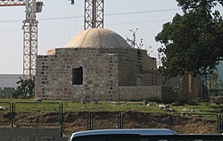
ตามที่ปีเตอร์เซนกล่าว มัสยิด/ศาลเจ้าขนาดเล็กที่ตั้งอยู่ห่างจากมาคัมอิหม่ามอาลีประมาณ 50 เมตร บนฝั่งตรงข้ามถนน เป็นที่รู้จักกันในชื่อเชคอัลคาทานัน เมื่อตรวจสอบในปี 1991 พบว่าสร้างบนผังรูปสี่เหลี่ยมจัตุรัส มีโดมตื้นๆ วางอยู่บนฐานทรงแปดเหลี่ยม ทางเข้าอาคารอยู่ตรงกลางด้านทิศเหนือ ภายในมีหน้าต่างอยู่ทางด้านทิศตะวันตกและทิศตะวันออก ขนาบข้างด้วยซุ้มโค้ง ตรงกลางผนังด้านทิศใต้มีซุ้มโค้งตื้นๆ ซึ่งพบว่าตกแต่งด้วยจารึกที่เขียนด้วยเฮนน่า[ 31 ]
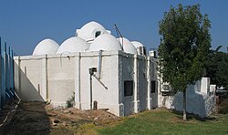
ตามที่Meron Benvenisti กล่าวไว้ ในปี 2000 หมู่บ้าน Yazur เป็นที่ตั้งของสุสานอันศักดิ์สิทธิ์ของอิหม่ามอาลี ผู้มีชื่อเสียงในฐานะผู้ทำปาฏิหาริย์ นอกจากนี้ยังมีสถานที่อีกกว่าสิบแห่งที่อ้างว่ามีสุสานของท่านเช่นกัน สถานที่ Yazur เป็นอาคารขนาดใหญ่ที่มีโดมกลางล้อมรอบด้วยโดมขนาดเล็กอีกเก้าแห่ง เป็นที่เชื่อกันอย่างกว้างขวางว่าเป็นสถานที่ฝังศพที่แท้จริงของอิหม่ามอาลี สุสานของท่านเป็นอนุสรณ์สถานเพียงแห่งเดียวที่เหลืออยู่ในหมู่บ้าน[ 32 ]
ปัจจุบันอาคารสุสานถูกใช้โดยชาวอิสราเอลสำหรับโบสถ์ ยิว Sha´arei Zion และโรงเรียนสอนศาสนาสำหรับชาวยิวออร์โธดอกซ์ บนหลังคาข้างโดมมีการติดตั้งจานรับสัญญาณดาวเทียมเพื่อรับชมการถ่ายทอดสดทางศาสนา มี สุสาน มุสลิม อยู่ติดกัน ซึ่งเหลือเพียงหลุมฝังศพที่แตกหักสองหรือสามหลุมเท่านั้น ปัจจุบันชาวยิวอิสราเอลใช้เป็นที่ทิ้งขยะ "เฉพาะขยะจากสวน" [ 32 ]
ฝั่งตรงข้ามถนน ใน นิคมอุตสาหกรรม โฮลอนมีสถานที่ศักดิ์สิทธิ์ของชาวมุสลิมอีกแห่งหนึ่ง ซึ่งถูกทิ้งร้างและกำลังพังทลายลง[ 32 ]
บุคคลที่เกี่ยวข้องกับยาซูร์
- อาห์เหม็ด จิบริล - ผู้ก่อตั้งและหัวหน้าของPFLP-GC
- ฮัสซัน อิบนุ อาลี อัล-ยาซูรี - เสนาบดี ซุนนีและหัวหน้าผู้พิพากษาของอัล-มุสตันซีร์ บิลลาห์ ผู้ปกครองฟาติมิด ตั้งแต่ปี 1050-58 [ 33 ]
ดูเพิ่มเติม
Bibliography
- Barron, J. B., ed. (1923). Palestine: Report and General Abstracts of the Census of 1922. Government of Palestine.
- Benvenisti, M. (2000). Sacred Landscape: The Buried History of the Holy Land since 1948. University of California Press. (pp. 32–33, 292)
- Brink, van den, Edwin C.M. (2005-04-14). "Azor l Report" (117). Hadashot Arkheologiyot – Excavations and Surveys in Israel.
{{cite journal}}: Cite journal requires|journal=(help) - Buchennino, Aviva (2009-03-12). "Azor l Report" (118). Hadashot Arkheologiyot – Excavations and Surveys in Israel.
{{cite journal}}: Cite journal requires|journal=(help) - Clermont-Ganneau, C.S. (1896). [ARP] Archaeological Researches in Palestine 1873-1874, translated from the French by J. McFarlane. Vol. 2. London: Palestine Exploration Fund. (pp. 5, 254, 489)
- Conder, C.R.; Kitchener, H. H. (1882). The Survey of Western Palestine: Memoirs of the Topography, Orography, Hydrography, and Archaeology. Vol. 2. London: Committee of the Palestine Exploration Fund.
- Department of Statistics (1945). Village Statistics, April, 1945. Government of Palestine.
- Gorzalczany, Amir (2009-03-12). "Azor, Ha-Histadrut Street Final Report l Report" (121). Hadashot Arkheologiyot – Excavations and Surveys in Israel.
{{cite journal}}: Cite journal requires|journal=(help) - Guérin, V. (1868). Description Géographique Historique et Archéologique de la Palestine (in French). Vol. 1: Judee, pt. 1. Paris: L'Imprimerie Nationale.
- Hadawi, S. (1970). Village Statistics of 1945: A Classification of Land and Area ownership in Palestine. Palestine Liberation Organization Research Center.
- Hütteroth, W.-D.; Abdulfattah, K. (1977). Historical Geography of Palestine, Transjordan and Southern Syria in the Late 16th Century. Erlanger Geographische Arbeiten, Sonderband 5. Erlangen, Germany: Vorstand der Fränkischen Geographischen Gesellschaft. ISBN 3-920405-41-2.
- Karmon, Y. (1960). "An Analysis of Jacotin's Map of Palestine"(PDF). Israel Exploration Journal. 10 (3, 4): 155–173, 244–253. Archived from the original(PDF) on 2019-12-22. Retrieved 2017-09-09.
- Khalidi, W. (1992). All That Remains: The Palestinian Villages Occupied and Depopulated by Israel in 1948. Washington D.C.: Institute for Palestine Studies. ISBN 0-88728-224-5.
- Le Strange, G. (1890). Palestine Under the Moslems: A Description of Syria and the Holy Land from A.D. 650 to 1500. Committee of the Palestine Exploration Fund.
- Mariti, G. (1792). Travels Through Cyprus, Syria, and Palestine; with a General History of the Levant. Vol. 1. Dublin: P. Byrne. (pp. 406-7)
- Mills, E., ed. (1932). Census of Palestine 1931. Population of Villages, Towns and Administrative Areas. Jerusalem: Government of Palestine.
- Morris, B. (2004). The Birth of the Palestinian Refugee Problem Revisited. Cambridge University Press. ISBN 978-0-521-00967-6.
- Morris, B. (2008). 1948: A History of the First Arab-Israeli War. Yale University Press. ISBN 9780300126969.
- Palmer, E. H. (1881). The Survey of Western Palestine: Arabic and English Name Lists Collected During the Survey by Lieutenants Conder and Kitchener, R. E. Transliterated and Explained by E.H. Palmer. Committee of the Palestine Exploration Fund.
- Petersen, Andrew (2001). A Gazetteer of Buildings in Muslim Palestine (British Academy Monographs in Archaeology). Vol. I. Oxford University Press. ISBN 978-0-19-727011-0.
- Pringle, D. (1997). Secular buildings in the Crusader Kingdom of Jerusalem: an archaeological Gazetteer. Cambridge University Press. ISBN 0521-46010-7. (p. 108 )
- al-Qawuqji, F. (1972): Memoirs of al-Qawuqji, Fauzi in Journal of Palestine Studies
- "Memoirs, 1948, Part I" in 1, no. 4 (Sum. 72): 27-58., dpf-file, downloadable
- "Memoirs, 1948, Part II" in 2, no. 1 (Aut. 72): 3-33., dpf-file, downloadable
- Romano, Amit (2004-06-09). "Azor Final Report" (116). Hadashot Arkheologiyot – Excavations and Surveys in Israel.
{{cite journal}}: Cite journal requires|journal=(help) - Schölch, Alexander (1993): Palestine in Transformation, 1856–1882,ISBN 0-88728-234-2,
- Singer, A. (2002). Constructing Ottoman Beneficence: An Imperial Soup Kitchen in Jerusalem. Albany: State University of New York Press. ISBN 0-7914-5352-9.
- Torge, Hagit (2005-03-28). "Azor Final Report l Report" (117). Hadashot Arkheologiyot – Excavations and Surveys in Israel.
{{cite journal}}: Cite journal requires|journal=(help) - Wilson, C.W., ed. (c. 1881). Picturesque Palestine, Sinai and Egypt. Vol. 3. New York: D. Appleton. (p. 141, 143 ff )
- Zuallart, J.[in French] (1587). Il devotissimo viaggio di Gervsalemme. Roma.Yazur p. 11 & 112 in the 1585-edition
External links
- Welcome To Yazur
- Yazur, Zochrot
- Survey of Western Palestine, Map 13: IAA, Wikimedia commons
- Yazur at Khalil Sakakini Cultural Center
- Photo of Imam Ali Mosque, circa 1887