
วิวัฒนาการทางดินแดนของสหรัฐอเมริกา

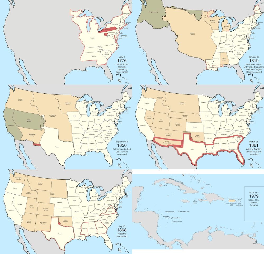
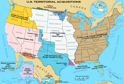
สหรัฐอเมริกาถูกก่อตั้งขึ้นหลังจากอาณานิคมของอังกฤษ 13 แห่งในอเมริกาเหนือประกาศอิสรภาพจากจักรวรรดิอังกฤษเมื่อวันที่ 4 กรกฎาคม ค.ศ. 1776 ในมติลี (Lee Resolution)ซึ่งผ่านโดยสภาแห่งทวีปครั้งที่สอง (Second Continental Congress) สองวันก่อนหน้านั้น อาณานิคมเหล่านั้นได้ลงมติว่าพวกเขาเป็นรัฐอิสระ สหภาพได้รับการทำให้เป็นทางการใน บทบัญญัติ แห่งสมาพันธรัฐ (Articles of Confederation ) ซึ่งมีผลบังคับใช้เมื่อวันที่ 1 มีนาคม ค.ศ. 1781 หลังจากได้รับการให้สัตยาบันจากรัฐทั้ง 13 รัฐ เอกราชของพวกเขาได้รับการยอมรับจากบริเตนใหญ่ในสนธิสัญญาปารีสค.ศ. 1783 ซึ่งเป็นการสิ้นสุดสงครามปฏิวัติอเมริกาสิ่งนี้ทำให้พรมแดนของประเทศใหม่ขยายไปทางตะวันตกเลยเส้นประกาศ (Proclamation Line)ไปจนถึงแม่น้ำมิสซิสซิปปีดินแดนนี้ถูกจัดระเบียบเป็นดินแดนและรัฐต่างๆ แม้ว่าจะยังคงมีความขัดแย้งบางประการเกี่ยวกับการอ้างสิทธิ์ในดินแดนที่ทอดยาวจากทะเลถึงทะเลโดยอาณานิคมดั้งเดิมบางแห่ง ในที่สุด สิทธิ์เหล่านั้นก็ถูกยกให้แก่รัฐบาลกลาง
การขยายอาณาเขตครั้งใหญ่ครั้งแรกของประเทศเกิดขึ้นจากการซื้อดินแดนลุยเซียนาในปี 1803 ซึ่งทำให้อาณาเขตของประเทศเพิ่มขึ้นเป็นสองเท่า แม้ว่าพรมแดนทางตะวันออกเฉียงใต้กับฟลอริดาของสเปนจะเป็นประเด็นข้อพิพาทมากมาย จนกระทั่งพรมแดนดังกล่าวและการอ้างสิทธิ์ของสเปนในดินแดนโอเรกอนถูกยกให้แก่สหรัฐอเมริกาในปี 1821 ดินแดนโอเรกอนทำให้สหรัฐอเมริกาสามารถเข้าถึงมหาสมุทรแปซิฟิกได้ แม้ว่าในช่วงเวลาหนึ่งจะต้องแบ่งปันกับสหราชอาณาจักรการผนวกสาธารณรัฐเท็กซัสในปี 1845 นำไปสู่สงครามเม็กซิโก-อเมริกา โดยตรง หลังจากนั้นสหรัฐอเมริกาผู้ชนะสงครามได้ดินแดนครึ่งเหนือของเม็กซิโก รวมถึงดินแดนที่ต่อมากลาย เป็น รัฐแคลิฟอร์เนีย
เมื่อประเทศขยายตัวไปทางตะวันตก ปัญหาเรื่องทาสก็ยิ่งทวีความสำคัญมากขึ้น มีการถกเถียงกันว่าดินแดนใหม่ ๆ จะอนุญาตให้มีทาสหรือไม่ และเหตุการณ์ต่าง ๆ เช่นข้อตกลงมิสซูรีและเหตุการณ์นองเลือดในแคนซัสสะท้อนให้เห็นถึงความตึงเครียดนั้น รัฐบาลของรัฐทางใต้ประกาศแยกตัวในปี 1860 และ 1861 ก่อตั้งเป็นสมาพันธรัฐอเมริกา สงครามกลางเมืองอเมริกาสิ้นสุดลงด้วยความพ่ายแพ้ของสมาพันธรัฐในปี 1865 และในที่สุดรัฐทางใต้ก็ได้รับการยอมรับกลับเข้าสู่รัฐสภาอีก ครั้ง
สหรัฐอเมริกาเริ่มขยายอำนาจออกไปนอกทวีปอเมริกาเหนือในปี 1856 ด้วยการผ่านร่างพระราชบัญญัติเกาะกัวโนทำให้เกาะเล็กๆ ที่ไม่มีผู้คนอาศัยอยู่ แต่มีความสำคัญทางเศรษฐกิจหลายแห่งในทะเลแคริบเบียนและมหาสมุทรแปซิฟิกถูกอ้างสิทธิ์ การอ้างสิทธิ์ส่วนใหญ่ถูกยกเลิกในที่สุด ส่วนใหญ่เป็นเพราะการอ้างสิทธิ์ที่แข่งขันกันจากประเทศอื่นๆ การขยายอำนาจในมหาสมุทรแปซิฟิกสิ้นสุดลงด้วยการผนวกฮาวายในปี 1898 หลังจากรัฐบาลถูกโค่นล้ม เมื่อห้าปีก่อนหน้านั้น อลาสก้า ซึ่ง เป็นการได้มาซึ่งดินแดนสำคัญครั้งสุดท้ายในอเมริกาเหนือ ถูกซื้อจากรัสเซียในปี 1867 การสนับสนุนเอกราชของคิวบาจากจักรวรรดิสเปนและการจมเรือรบยูเอสเอสเมนนำไปสู่สงครามสเปน-อเมริกาในปี 1898 ซึ่งสหรัฐอเมริกาได้เปอร์โตริโกกวมและฟิลิปปินส์และยึดครองคิวบาเป็นเวลาหลายปีอเมริกันซามัวถูกได้มาในปี 1900 หลังจากการสิ้นสุดของสงครามกลางเมืองซามัวครั้งที่สองสหรัฐอเมริกาซื้อหมู่เกาะเวอร์จินของสหรัฐจากเดนมาร์กในปี 1917
หลังสงครามเกาะหลายแห่งถูกมอบอำนาจให้สหรัฐอเมริกาดูแลโดยองค์การสหประชาชาติและในขณะที่หมู่เกาะนอร์เทิร์นมาเรียนาได้กลายเป็นดินแดนของสหรัฐอเมริกาหมู่เกาะมาร์แชลล์สหพันธรัฐไมโครนีเซียและปาเลา ได้แยกตัวออกจากดินแดนในความดูแลและกลายเป็นประเทศเอกราช การเปลี่ยนแปลงครั้งสำคัญระดับนานาชาติครั้งสุดท้ายคือการเข้าครอบครอง เขตคลองปานามาในปี 1904 และการส่งคืนให้กับปานามาในปี 1979 ซึ่งเป็นดินแดนของสหรัฐอเมริกาที่ไม่ได้รวมเข้าเป็นส่วนหนึ่งของประเทศ และควบคุมคลองปานามาการถ่ายโอนการควบคุมอย่างเป็นทางการเหนือภูมิภาคนี้ให้กับปานามาเสร็จสมบูรณ์ในปี 1999
โดยทั่วไปแล้ว รัฐต่างๆ ยังคงรักษาพรมแดนเดิมไว้ตั้งแต่เริ่มก่อตั้ง มีเพียงสามรัฐ ( เคนตักกี้เมนและเวสต์เวอร์จิเนีย ) เท่านั้นที่ก่อตั้งขึ้นโดยตรงจากพื้นที่ที่เป็นของรัฐอื่น (แม้ว่าในขณะที่เข้าร่วมเป็นส่วนหนึ่งของสหรัฐอเมริการัฐเวอร์มอนต์ตกลงที่จะจ่ายเงินให้กับรัฐนิวยอร์กเพื่อแลกกับการสละสิทธิ์เรียกร้อง) รัฐอื่นๆ ทั้งหมดก่อตั้งขึ้นจากดินแดนของรัฐบาลกลางหรือจากการได้มาซึ่งดินแดนเพิ่มเติม สี่รัฐ ( ลุยเซียนามิสซูรีเนวาดาและเพนซิลเวเนีย)ได้ขยายอาณาเขตอย่างมากโดยการได้มาซึ่งดินแดนของรัฐบาลกลางเพิ่มเติมหลังจากเข้าร่วมเป็นส่วนหนึ่งของสหรัฐอเมริกา ในครั้งแรก ในปี 1912 รัฐแอริโซนาเป็นรัฐสุดท้ายที่ก่อตั้งขึ้นในสหรัฐอเมริกาแผ่นดินใหญ่ในปี 1959 รัฐฮาวายกลายเป็นรัฐที่ 50 และเป็นรัฐล่าสุดที่เข้าร่วมเป็น ส่วนหนึ่งของสหรัฐอเมริกา
ค.ศ. 1776–1784 (การปฏิวัติอเมริกา)
| วันที่ | เหตุการณ์[ก] | เปลี่ยนแผนที่ |
|---|---|---|
| 4 กรกฎาคม พ.ศ. 2319 | อาณานิคม 13 แห่งของราชอาณาจักรบริเตนใหญ่ในอเมริกาเหนือประกาศเอกราช ร่วมกัน ในฐานะสหรัฐอเมริกา[ b ] [ A ]แม้ว่าอาณานิคมหลายแห่งจะประกาศเอกราชเป็นรายบุคคลไปแล้วก็ตาม:
เมืองหลวงยังไม่ได้ถูกกำหนดไว้อย่างเฉพาะเจาะจง ในขณะนั้นสภาแห่งทวีปได้ประชุมกันที่ฟิลาเดลเฟีย[ 45 ] หลายรัฐมีพรมแดนที่กำหนดไว้อย่างคลุมเครือในขณะที่ได้รับเอกราช โดยมีเพียงพรมแดนทางตะวันออกสุดเท่านั้นที่มีการทำแผนที่อย่างสมบูรณ์ พรมแดนของนอร์ทแคโรไลนาได้รับการสำรวจอย่างไม่ดีนัก โดยพรมแดนที่ติดกับเซาท์แคโรไลนาถูกทำเป็นหลายส่วน ซึ่งไม่มีส่วนใดที่ตรงกับเจตนารมณ์ของกฎบัตรอย่างแท้จริง[ 46 ] [ 47 ]และพรมแดนที่ติดกับเวอร์จิเนียก็เบี่ยงเบนไปทางเหนือหลายไมล์จากอุดมคติ เวอร์จิเนียอ้างสิทธิ์ในพื้นที่ทางตะวันตกเฉียงเหนืออันกว้างใหญ่ข้ามแม่น้ำโอไฮโอและคอนเนตทิคัต แมสซาชูเซตส์เบย์ และนิวยอร์กก็อ้างสิทธิ์ในพื้นที่ทางตะวันตกของเขตแดนที่ตั้งถิ่นฐานของตน ซึ่งทับซ้อนกับการอ้างสิทธิ์ของเวอร์จิเนีย[ 48 ] สหราชอาณาจักรอ้างสิทธิ์เหนือดินแดนทั้งหมดของสหรัฐอเมริกาใหม่ รวมถึงเกาะ Machias SealและNorth Rockซึ่งเป็นเกาะเล็กๆ สองเกาะนอกชายฝั่งตะวันออกเฉียงเหนือที่ยังคงเป็นข้อพิพาทกันจนถึงปัจจุบัน[ 49 ] | 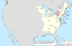 |
| 21 กันยายน พ.ศ. 2319 | มณฑลนิวคาสเซิล เคนต์ และซัสเซ็กซ์ บนเดลาแวร์ ได้ออกรัฐธรรมนูญกลายเป็นรัฐเดลาแวร์[ o ] [ 52 ] | 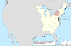 |
| 28 กันยายน พ.ศ. 2319 | รัฐเพนซิลเวเนียได้ออกรัฐธรรมนูญและกลายเป็นเครือรัฐเพนซิลเวเนีย[ 31 ] [ 53 ] | 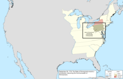 |
| 20 ธันวาคม พ.ศ. 2319 | เพื่อหลีกเลี่ยง กองกำลัง อังกฤษที่กำลังรุกคืบเข้าสู่ฟิลาเดลเฟียสภาคอนติเนนตัลจึงเริ่มประชุมกันที่บัลติมอร์[ 45 ] | 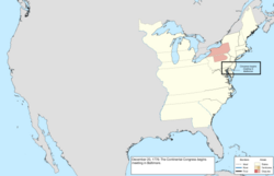 |
| วันที่ 17 มกราคม พ.ศ. 2320 | ภูมิภาคตะวันออกเฉียงเหนือของนิวยอร์กซึ่งรู้จักกันในชื่อนิวแฮมป์เชอร์แกรนท์ได้ประกาศเอกราชเป็นนิวคอนเนตทิคัต[หน้า] [ 54 ] [ 56 ] | 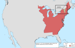 |
| 4 มีนาคม พ.ศ. 2320 | สภาคอนติเนนตัลได้กลับไปยังฟิลาเดลเฟียหลังจากภัยคุกคามจาก กองกำลัง อังกฤษสิ้นสุดลง[ 45 ] | 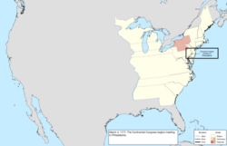 |
| 4 มิถุนายน พ.ศ. 2320 | นิวคอนเนตทิคั ตได้รับการเปลี่ยนชื่อเป็นเวอร์มอนต์[ 54 ] [ 55 ] [ 57 ] | 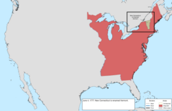 |
| 27 กันยายน พ.ศ. 2320 | สภาคอนติเนนตัลได้หนีออกจากฟิลาเดลเฟียหลังจากความพ่ายแพ้ของอเมริกาในการรบที่แบรนดี้ไวน์และได้ประชุมกันสั้นๆ ที่แลงคาสเตอร์ รัฐเพนซิลเวเนีย[ 45 ] | 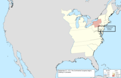 |
| 30 กันยายน พ.ศ. 2320 | สภาคอนติเนนตัลยังคงย้ายออกจากฟิลาเดลเฟียโดยไปตั้งรกรากอยู่ที่ยอร์ก รัฐเพนซิลเวเนีย[ 45 ] | 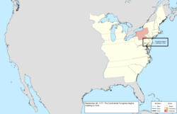 |
| วันที่ 11 มิถุนายน พ.ศ. 2321 | เวอร์มอนต์อ้างสิทธิ์ในสิ่งที่เรียกว่า "สหภาพตะวันออก" ซึ่งประกอบด้วยเมืองบางแห่งในนิวแฮมป์เชอร์[ q ]ที่ยื่นคำร้องขอเข้าร่วมกับเวอร์มอนต์ เนื่องจากกังวลว่ารัฐของตนมุ่งเน้นไปที่ภูมิภาคชายฝั่งมากเกินไป[ 59 ] [ 60 ] [ 61 ] | 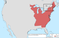 |
| 2 กรกฎาคม พ.ศ. 2321 | สภาคอนติเนนตัลกลับมายังฟิลาเดลเฟียหลังจากอังกฤษถอนทัพ[ 45 ] | 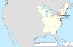 |
| 21 ตุลาคม พ.ศ. 2321 | ภายใต้แรงกดดันจากสภาคอนติเนนตัล เวอร์มอนต์ได้ยกเลิกการผนวกสหภาพตะวันออก สภานิติบัญญัติประกาศเมื่อวันที่ 12 กุมภาพันธ์ พ.ศ. 2322 ว่าสหภาพตะวันออกถือเป็นโมฆะตั้งแต่เริ่มต้น[ 59 ] [ 60 ] [ 62 ] | 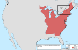 |
| 25 ตุลาคม พ.ศ. 2323 | รัฐแมสซาชูเซตส์เบย์ได้ออกรัฐธรรมนูญและกลายเป็นเครือรัฐแมสซาชูเซตส์[ 14 ] [ 63 ] | 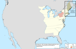 |
| วันที่ 1 มีนาคม พ.ศ. 2324 | บทบัญญัติแห่งสมาพันธรัฐมีผลบังคับใช้[ 64 ] | ไม่มีการเปลี่ยนแปลงแผนที่ |
| 5 เมษายน พ.ศ. 2324 | เวอร์มอนต์อ้างสิทธิ์ในสหภาพตะวันออกอีกครั้ง ซึ่งประกอบด้วยเมืองบางแห่งในนิวแฮมป์เชอร์[ r ]ที่ต้องการเข้าร่วมกับเวอร์มอนต์ มากกว่าในช่วงความพยายามครั้งแรกในปี 1778 [ 59 ] [ 60 ] [ 65 ] | 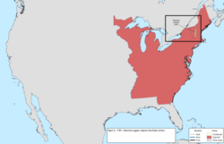 |
| 16 มิถุนายน พ.ศ. 2324 | เวอร์มอนต์อ้างสิทธิ์ในสิ่งที่เรียกว่า "เวสต์ยูเนียน" ซึ่งประกอบด้วยเมืองบางแห่งในนิวยอร์ก [ s ]ส่วนใหญ่เพื่อถ่วงดุลความพยายามของเวอร์มอนต์ในการขยายตัวไปทางตะวันออก[ 67 ] [ 60 ] [ 68 ] | 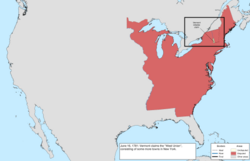 |
| 23 กุมภาพันธ์ พ.ศ. 2325 | รัฐเวอร์มอนต์ได้ยกเลิกความพยายามที่จะผนวกดินแดนอีสต์ยูเนียนจากรัฐนิวแฮมป์เชียร์และดินแดนเวสต์ยูเนียนจากรัฐนิวยอร์ก[ t ] | 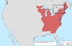 |
| 29 ตุลาคม พ.ศ. 2325 | ดินแดนทางตะวันตกของนิวยอร์กถูกยกให้แก่รัฐบาลกลาง[ u ] [ 71 ]นิวยอร์กประกาศเขตแดนตะวันตกใหม่ของตนให้เป็นเส้นที่ลากลงมาจากปลายด้านตะวันตกของทะเลสาบออนแทรีโอ [ 72 ] ตามการตีความสูงสุด รัฐได้ยกดินแดนที่มีขอบเขตติดกับทะเลสาบอีรีทะเลสาบฮูรอนและทะเลสาบมิชิแกนทางทิศเหนือ แม่น้ำอิลลินอยส์แม่น้ำมิสซิสซิปปีและ แม่น้ำ เทนเนสซีทางทิศตะวันตกและทิศใต้ และเทือกเขาแอปพาเลเชียนและรัฐเพนซิล เวเนีย ทางทิศตะวันออก[ v ]การยกดินแดนนี้รวมถึงปลายสุดของนิวยอร์กทางเหนือของรัฐเพนซิลเวเนีย ซึ่งจะรู้จักกันในชื่อสามเหลี่ยมอีรี[ 75 ] | 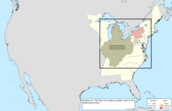 |
| 30 ธันวาคม พ.ศ. 2325 | สภาคองเกรสแห่งสมาพันธรัฐประกาศว่าภูมิภาคที่คอนเนตทิคัตอ้างว่าเป็นเทศมณฑลเวสต์มอร์แลนด์เป็นส่วนหนึ่งของเพนซิลเวเนียโดยพยายามยุติสงครามเพนนามิต-แยงกี[ 76 ] [ 77 ] | 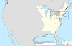 |
| 30 มิถุนายน พ.ศ. 2326 | การก่อจลาจลในเพนซิลเวเนีย และการที่รัฐปฏิเสธที่จะหยุดยั้งการก่อจลาจลนั้น ทำให้สภาคองเกรสแห่งสมาพันธรัฐต้องออกจากฟิลาเดลเฟียไปยัง พ รินซ์ตัน[ 45 ] | 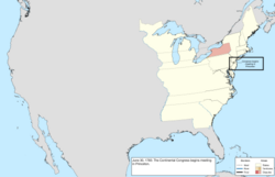 |
| 26 พฤศจิกายน พ.ศ. 2326 | สภาคองเกรสแห่งสมาพันธรัฐได้กลับมาประชุมกันอีกครั้งที่แอนนาโพลิส[ 45 ] | 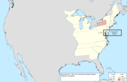 |
| วันที่ 1 มีนาคม พ.ศ. 2327 | ดินแดนเวอร์จิเนียทางตะวันตกเฉียงเหนือของแม่น้ำโอไฮโอถูกยกให้แก่รัฐบาลกลาง[ w ] [ 79 ] | 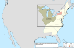 |
| วันที่ 1 เมษายน พ.ศ. 2327 | เพนซิลเวเนียและเวอร์จิเนียตกลงที่จะกำหนดเขตแดนของตนโดยต่อเส้นเมสัน-ดิกสันไปจนถึงจุดที่ห้าองศาทางตะวันตกของแม่น้ำเดลาแวร์แล้วจึงไปทางเหนือ[ x ] [ 82 ] [ 83 ] | 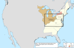 |
| วันที่ 12 พฤษภาคม ค.ศ. 1784 | สหราชอาณาจักรรับรองเอกราชของสหรัฐอเมริกา ยุติการอ้างสิทธิ์ในประเทศนี้[ y ] [ z ] [ 85 ]สนธิสัญญานี้ยุติสงครามปฏิวัติอเมริกาแม้ว่าการปฏิบัติการทางทหารส่วนใหญ่จะยุติลงแล้วหลังจากชัยชนะของฝรั่งเศสและอเมริกา ที่ ยอร์กทาวน์เมื่อวันที่ 19 ตุลาคม ค.ศ. 1781 เนื่องจากความคลุมเครือและการขาดความรู้ด้านภูมิศาสตร์ที่ดีพอ ทำให้สนธิสัญญานี้ไม่ชัดเจนในหลายประเด็น:
ในระหว่างสนธิสัญญาปารีสสหราชอาณาจักรได้ยกดินแดนฟลอริดาให้แก่สเปนในช่วงที่อังกฤษครอบครองฟลอริดาตะวันตกอังกฤษได้เลื่อนพรมแดนไปทางเหนือ และการยกดินแดนให้สเปนดูเหมือนจะครอบคลุมอาณานิคมของอังกฤษทั้งหมด อย่างไรก็ตาม สนธิสัญญาระหว่างอังกฤษและอเมริกาได้ขยายฟลอริดาตะวันตกไปยังสหรัฐอเมริกา ซึ่งทำให้ประเทศขยายไปทางใต้ถึงละติจูด31 ° เหนือ[ aa ]ซึ่งบ่งชี้ว่ามีเพียงฟลอริดาตะวันตกตามนิยามเดิมที่เล็กกว่าเท่านั้นที่จะถูกยกให้สเปน[ 87 ] | 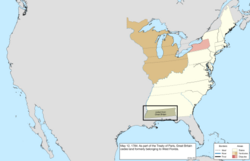 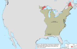 |
ค.ศ. 1784–1803 (การจัดระเบียบดินแดน)
| วันที่ | เหตุการณ์ | เปลี่ยนแผนที่ |
|---|---|---|
| 23 สิงหาคม ค.ศ. 1784 | ภูมิภาคในเขตชายแดนทางตะวันตก ของ นอร์ทแคโรไลนาซึ่งไม่พอใจการปกครองของรัฐในพื้นที่ดังกล่าว ได้ประกาศเอกราชจากรัฐและก่อตั้งเป็นรัฐแฟรงคลิน [ ab ] [ 89 ] [ 90 ] [ 91 ] แฟรงคลินได้ยื่นคำร้องขอสถานะรัฐ โดยได้รับการสนับสนุนจาก 7 ใน 9 รัฐที่จำเป็น[ J ]แต่รัฐนี้จะดำรงอยู่ได้เพียงไม่กี่ปีเท่านั้น | 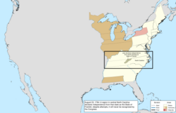 |
| วันที่ 1 พฤศจิกายน พ.ศ. 2327 | สภาแห่งสมาพันธรัฐ ได้ย้ายไปที่ เทรนตันชั่วคราว[ 45 ] | 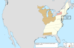 |
| วันที่ 11 มกราคม พ.ศ. 2328 | สภาแห่งสมาพันธรัฐย้ายไปนิวยอร์กและจะตั้งถิ่นฐานอยู่ที่นั่นเป็นเวลาห้าปี[ 45 ] | 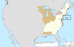 |
| 19 เมษายน พ.ศ. 2328 | ดินแดนทางตะวันตกของแมสซาชูเซตส์ถูกยกให้แก่รัฐบาลกลาง[ ac ] [ ad ] [ 79 ] | 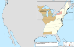 |
| วันที่ 14 กันยายน พ.ศ. 2329 | ดินแดนทางตะวันตกของคอนเนตทิคัตยกเว้นเขตสงวนตะวันตกถูกยกให้แก่รัฐบาลกลาง[ ae ] [ af ] [ 79 ] | 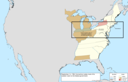 |
| 4 ตุลาคม พ.ศ. 2329 | การสำรวจเขตแดนระหว่างเพนซิลเวเนียและเวอร์จิเนียได้ถูกส่งไปยังเพนซิลเวเนีย[ ag ] [ 82 ] [ 95 ] [ 96 ] | 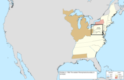 |
| วันที่ 16 ธันวาคม พ.ศ. 2329 | แมสซาชูเซตส์ละทิ้งการอ้างสิทธิ์ในนิวยอร์กตะวันตก[ 97 ] [ 98 ] [ M ] | 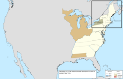 |
| วันที่ 13 กรกฎาคม พ.ศ. 2330 | ภูมิภาคที่อยู่เลยแม่น้ำโอไฮโอซึ่งรัฐต่างๆ ยกให้แก่รัฐบาลกลางนั้นได้รับการจัดตั้งเป็นดินแดนทางตะวันตกเฉียงเหนือของแม่น้ำโอไฮโอ ซึ่งโดยทั่วไปรู้จักกันในชื่อดินแดนตะวันตกเฉียงเหนือ[ 100 ] [ N ] | 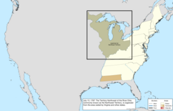 |
| 21 กรกฎาคม พ.ศ. 2330 | การสำรวจชายแดนระหว่างรัฐแมสซาชูเซตส์และนิวยอร์กเสร็จสมบูรณ์แล้ว[ ah ] [ 97 ] | 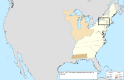 |
| 9 สิงหาคม ค.ศ. 1787 | การอ้างสิทธิ์ทางตะวันตกของเซาท์แคโรไลนาถูกยกให้แก่รัฐบาลกลาง[ ai ] [ 79 ]อย่างไรก็ตาม เป็นผลมาจากภูมิศาสตร์ที่ไม่ถูกต้อง และเซาท์แคโรไลนาไม่เคยอ้างสิทธิ์ในภูมิภาคนี้จริง ๆ การอ้างสิทธิ์นั้นเป็นแถบระหว่างชายแดนของนอร์ทแคโรไลนาและต้นกำเนิดของแม่น้ำทูกาลูแต่ในขณะนั้นไม่ทราบว่าแม่น้ำมีต้นกำเนิดในนอร์ทแคโรไลนา ส่วนทางตะวันออกของการยกให้ครั้งนี้จะตกเป็นของจอร์เจียในปี พ.ศ. 2345 แม้ว่าจอร์เจียจะมีสิทธิ์ในภูมิภาคนี้อยู่แล้วก็ตาม[ 105 ] [ 106 ] | 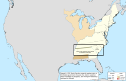 |
| 7 ธันวาคม พ.ศ. 2330 | เดลาแวร์เป็นรัฐแรกที่ให้สัตยาบันรัฐธรรมนูญของสหรัฐอเมริกา[ 107 ] | ไม่มีการเปลี่ยนแปลงแผนที่ |
| วันที่ 12 ธันวาคม พ.ศ. 2330 | เพ นซิลเวเนียเป็นรัฐที่สองที่ให้สัตยาบันรัฐธรรมนูญ[ 107 ] | |
| วันที่ 18 ธันวาคม พ.ศ. 2330 | นิวเจอร์ซีย์ กลายเป็นรัฐที่สาม ที่ให้สัตยาบันรัฐธรรมนูญ[ 107 ] | |
| วันที่ 2 มกราคม พ.ศ. 2331 | จอร์เจีย กลายเป็นรัฐที่สี่ ที่ให้สัตยาบันรัฐธรรมนูญ[ 107 ] | |
| 9 มกราคม พ.ศ. 2331 | คอนเนตทิคัต กลายเป็นรัฐที่ห้า ที่ให้สัตยาบันรัฐธรรมนูญ[ 107 ] | |
| 6 กุมภาพันธ์ พ.ศ. 2331 | แมสซาชูเซตส์ กลายเป็นรัฐที่หก ที่ให้สัตยาบันรัฐธรรมนูญ[ 107 ] | |
| 28 เมษายน พ.ศ. 2331 | แมริแลนด์ กลายเป็นรัฐที่ เจ็ดที่ให้สัตยาบันรัฐธรรมนูญ[ 107 ] | |
| 23 พฤษภาคม 1788 | เซาท์แคโรไลนา เป็นรัฐที่ แปดที่ให้สัตยาบันรัฐธรรมนูญ [ 107 ] | |
| 21 มิถุนายน พ.ศ. 2331 | นิวแฮมป์เชอร์กลายเป็นรัฐที่เก้าที่ให้สัตยาบันรัฐธรรมนูญณ จุดนี้ รัฐธรรมนูญจึงกลายเป็นเอกสารการปกครองที่ใช้บังคับของรัฐทั้งเก้ารัฐที่ให้สัตยาบัน[ 107 ] | |
| 25 มิถุนายน พ.ศ. 2331 | เวอร์จิเนีย กลายเป็นรัฐที่สิบ ที่ให้สัตยาบันรัฐธรรมนูญ [ 107 ] | |
| 26 กรกฎาคม พ.ศ. 2331 | นิวยอร์ก กลายเป็นรัฐที่ 11 ที่ให้สัตยาบันรัฐธรรมนูญ[ 107 ] | |
| กุมภาพันธ์ พ.ศ. 2332 | จอห์น เซเวียร์ผู้ว่าการรัฐแฟรงคลิน ได้ ให้คำมั่นว่าจะจงรักภักดีต่อรัฐนอร์ทแคโรไลนา ในการประชุมศาล เขตกรีนเคาน์ตีในเดือนกุมภาพันธ์ซึ่งเป็นการยุติความเป็นอิสระที่แฟรงคลินอ้างไว้อย่างมีประสิทธิภาพ[ 89 ] [ 108 ] | 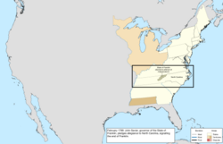 |
| 7 สิงหาคม ค.ศ. 1789 | ดินแดนตะวันตกเฉียงเหนือได้รับการจัดระเบียบใหม่ภายใต้รัฐธรรมนูญ[ R ] | ไม่มีการเปลี่ยนแปลงแผนที่ |
| 29 กันยายน พ.ศ. 2332 | การสำรวจเขตแดนระหว่างนิวยอร์กและเพนซิลเวเนียได้รับการอนุมัติจากเพนซิลเวเนีย[ aj ] [ 109 ] [ 110 ] [ S ] | 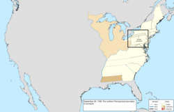 |
| 21 พฤศจิกายน พ.ศ. 2332 | นอร์ทแคโรไลนา เป็นรัฐที่สิบสอง ที่ให้สัตยาบันรัฐธรรมนูญ[ 107 ] | ไม่มีการเปลี่ยนแปลงแผนที่ |
| 2 เมษายน พ.ศ. 2333 | ดินแดนนอร์ทแคโรไลนาทางตะวันตกของเทือกเขาเกรตสโมกี้ถูกยกให้แก่รัฐบาลกลาง[ ak ] [ 79 ] | 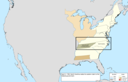 |
| 26 พฤษภาคม พ.ศ. 2333 | ภูมิภาคที่นอร์ทแคโรไลนา เพิ่งยกให้นั้น ได้รับการจัดตั้งเป็นดินแดนทางใต้ของแม่น้ำโอไฮโอ ซึ่งโดยทั่วไปรู้จักกันในชื่อดินแดนตะวันตกเฉียงใต้[ 112 ] [ U ] | 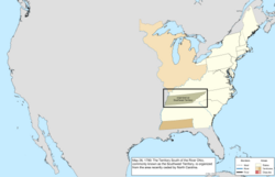 |
| 29 พฤษภาคม พ.ศ. 2333 | โรดไอส์แลนด์ กลายเป็นรัฐที่สิบสาม ที่ให้สัตยาบันรัฐธรรมนูญ[ 107 ] | ไม่มีการเปลี่ยนแปลงแผนที่ |
| วันที่ 10 ตุลาคม พ.ศ. 2333 | การสำรวจเขตแดนระหว่างนิวยอร์กและอีรีไทรแองเกิลเสร็จสมบูรณ์แล้ว[ al ] [ 109 ] | 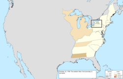 |
| 6 ธันวาคม พ.ศ. 2333 | ฟิลาเดลเฟียได้รับการสถาปนาให้เป็นเมืองหลวงเป็นเวลาสิบปีจนกว่าจะสามารถเตรียมเขตของรัฐบาลกลาง ได้ [ 45 ] [ V ] | 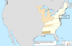 |
| 4 มีนาคม พ.ศ. 2334 | เวอร์มอนต์ซึ่งถือเป็นส่วนหนึ่งของนิวยอร์กแม้ว่าจะดำเนินกิจการอย่างอิสระมาตั้งแต่ปี 1777 ก็ได้รับการยอมรับให้เป็นรัฐที่สิบสี่[ am ] [ an ] [ 116 ] [ W ] | 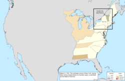 |
| 30 มีนาคม พ.ศ. 2334 | เขตสหพันธรัฐ[ ao ]ที่ตั้งใจจะเป็นที่ตั้งของรัฐบาลภายในปี 1800 ก่อตั้งขึ้นจากพื้นที่ที่แมริแลนด์และเวอร์จิเนีย ยก ให้[ ap ] [ V ]ซึ่งประกอบด้วยรูปเพชร ยาว 10 ไมล์ในแต่ละด้าน โดยมีปลายด้านใต้อยู่ที่Jones Pointและคร่อมแม่น้ำ Potomac [ 121 ] | 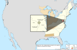 |
| 3 มีนาคม พ.ศ. 2335 | เพน ซิลเวเนียซื้อพื้นที่สามเหลี่ยมอีรีจากรัฐบาลกลาง[ aq ] [ 75 ] | 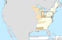 |
| 1 มิถุนายน พ.ศ. 2335 | ครึ่งตะวันตกของเวอร์จิเนียได้รับการยอมรับให้เป็นรัฐที่สิบห้า คือ เครือรัฐเคนตักกี้[ ar ] [ as ] [ 126 ] [ 127 ] [ AB ] | 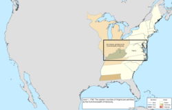 |
| วันที่ 12 มิถุนายน พ.ศ. 2335 | รัฐเดลาแวร์ได้ออกรัฐธรรมนูญฉบับใหม่และกลายเป็นรัฐเดลาแวร์[ 50 ] [ 128 ] | 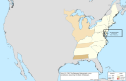 |
| วันที่ 1 มกราคม พ.ศ. 2336 | การสำรวจขอบเขตของเขตสหพันธ์เสร็จสมบูรณ์แล้ว[ ag ] [ 129 ] [ 130 ] | 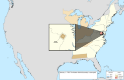 |
| 25 เมษายน พ.ศ. 2339 | สเปนได้ยกดินแดนทางเหนือของเวสต์ฟลอริดาให้แก่ สเปน ซึ่งเป็นการยุติข้อพิพาทเกี่ยวกับภูมิภาคนี้[ที่] [ 132 ] | 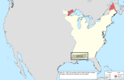 |
| 1 มิถุนายน พ.ศ. 2339 | ดินแดนตะวันตกเฉียงใต้ได้รับการยอมรับให้เป็นรัฐที่สิบหกคือเทนเนสซี[ 133 ] [ 134 ] [ค.ศ. ] | 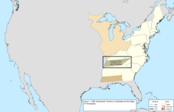 |
| 7 เมษายน พ.ศ. 2341 | เพื่อตอบสนองต่อการฉ้อโกงที่ดินยาซูกฎหมายอนุญาตให้มีการเจรจากับจอร์เจียเกี่ยวกับการยกดินแดนทางตะวันตกให้ กฎหมายฉบับนี้ยังสร้างดินแดนมิสซิสซิปปีขึ้นจากภูมิภาคที่เวสต์ฟลอริดา เพิ่งยก ให้[ 135 ] [ I ] | 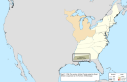 |
| 25 ตุลาคม พ.ศ. 2341 | คณะกรรมาธิการเห็นพ้องต้องกันเกี่ยวกับแหล่งกำเนิดของแม่น้ำเซนต์ครอยซ์ซึ่งกำหนดพรมแดนด้านตะวันออกสุดติดกับบริเตนใหญ่[ 136 ] [ 137 ] | 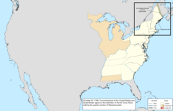 |
| วันที่ 13 มกราคม ค.ศ. 1800 | การสำรวจ ชายแดน เคนตักกี้ - เวอร์จิเนียได้รับการอนุมัติจากเวอร์จิเนีย[ au ] [ 138 ] [ AE ] | 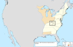 |
| 10 เมษายน ค.ศ. 1800 | การสำรวจชายแดนทางใต้ตามแนวละติจูด 31° เหนือเสร็จสมบูรณ์แล้ว[ av ] [ 141 ] | 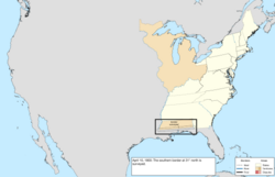 |
| 30 พฤษภาคม ค.ศ. 1800 | เขตสงวนตะวันตกของคอนเนตทิคัต ถูกยกให้แก่รัฐบาลกลาง สันนิษฐานว่าในเวลานั้นถือเป็นส่วนหนึ่งของดินแดนตะวันตกเฉียงเหนือ[ aw ] [ 71 ] [ 74 ] | 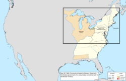 |
| 4 กรกฎาคม ค.ศ. 1800 | ดินแดนอินเดียนาถูกจัดตั้งขึ้นจากครึ่งตะวันตกของดินแดนตะวันตกเฉียงเหนือ[ ax ] [ 143 ] [ AG ] | 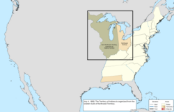 |
| วันที่ 17 พฤศจิกายน ค.ศ. 1800 | รัฐสภาสหรัฐอเมริกาย้ายไปที่วอชิงตันซึ่งสร้างเสร็จและพร้อมที่จะเป็นเมืองหลวงแล้ว[ 45 ] | 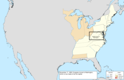 |
| 27 กุมภาพันธ์ พ.ศ. 2444 | เขตสหพันธรัฐได้รับการจัดตั้งขึ้นเป็นเขตโคลัมเบีย[ 144 ] [ AH ] | 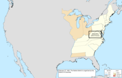 |
| 16 มิถุนายน พ.ศ. 2445 | ดินแดนทางตะวันตกของจอร์เจียซึ่งรู้จักกันในชื่อดินแดนยาซูถูกยกให้แก่รัฐบาลกลาง[ ay ] [ az ] [ 79 ] [ 74 ]ในเวลาเดียวกัน รัฐบาลกลางได้ยกดินแดนส่วนตะวันออกของภูมิภาคที่เซาท์แคโรไลนา เคยยกให้ก่อนหน้านี้ ให้แก่จอร์เจีย แม้ว่าในทางเทคนิคแล้วจอร์เจียจะถือครองกรรมสิทธิ์ในภูมิภาคนี้อยู่แล้วก็ตาม เนื่องจากการยกดินแดนนั้นอยู่บนพื้นฐานของความเข้าใจทางภูมิศาสตร์ที่ผิดพลาด[ 105 ] | 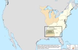 |
| วันที่ 1 มีนาคม พ.ศ. 2446 | ครึ่งใต้ของดินแดนตะวันตกเฉียงเหนือพร้อมกับดินแดนอินเดียนา ส่วนเล็ก ๆ ได้รับการยอมรับให้เป็นรัฐที่สิบเจ็ด คือโอไฮโอ[ ba ] [ bb ] [ 149 ] [ AL ] ส่วนที่เหลือของดินแดนตะวันตกเฉียงเหนือถูกโอนไปยังดินแดนอินเดียนา[ 150 ]พรมแดนด้านตะวันตกเป็นเส้นตรงที่ลากจากปากแม่น้ำเกรตไมอามี ไปทางทิศเหนือ คำจำกัดความของรัฐบาลกลางเกี่ยวกับพรมแดนด้านเหนือคือเส้นที่ลากจากปลายสุดทางใต้ของทะเลสาบมิชิแกน ไปทางทิศตะวันออก ในขณะที่รัฐธรรมนูญของโอไฮโอระบุว่าเส้นควรลากจากปลายสุดทางใต้ของทะเลสาบมิชิแกนไปยังแหลมที่อยู่เหนือสุดของอ่าวมาอูมี [ 151 ] ความสับสนที่เกิดจากคำอธิบายที่ขัดแย้งกันเหล่านี้และความรู้ทางภูมิศาสตร์ที่ไม่ถูกต้องจะนำไปสู่ความขัดแย้งเกี่ยวกับแถบโตเลโด[ 152 ] | 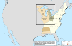 |
| 3 พฤศจิกายน พ.ศ. 2446 | การสำรวจ ชายแดน เทนเนสซี - เวอร์จิเนียได้รับการอนุมัติ[ bc ] [ 153 ] [ 154 ] | 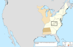 |
| 30 พฤศจิกายน พ.ศ. 2446 | " Southwick Jog " ได้รับการยกจากรัฐคอนเนตทิคัตให้กับรัฐแมสซาชูเซตส์เพื่อยุติข้อพิพาทที่มีมายาวนานเกี่ยวกับพรมแดน[ bd ] [ 156 ] | 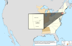 |
ค.ศ. 1803–1818 (การซื้อดินแดนลุยเซียนา)
| วันที่ | เหตุการณ์ | เปลี่ยนแผนที่ |
|---|---|---|
| 20 ธันวาคม พ.ศ. 2446 | การซื้อลุยเซียนาได้รับการยกให้จากฝรั่งเศส อย่างเป็น ทางการ[ be ] [ 160 ]การได้มาซึ่งดินแดนนี้ทำให้ประเทศขยายไปทั่วทั้งลุ่มแม่น้ำมิสซิสซิปปี[ bf ]แต่ขอบเขตของลุยเซียนาทางตอนใต้เป็นที่ถกเถียงกับสเปนสหรัฐอเมริกาอ้างว่าการซื้อนี้รวมถึงส่วนหนึ่งของเวสต์ฟลอริดาทางตะวันตกของแม่น้ำเพอร์ดิโดในขณะที่สเปนอ้างว่าสิ้นสุดที่ชายแดนตะวันตกของเวสต์ฟลอริดา[ bg ] [ 162 ]และชายแดนทางตะวันตกเฉียงใต้กับนิวสเปนก็เป็นที่ถกเถียงเช่นกันเนื่องจากสหรัฐอเมริกาอ้างว่าแม่น้ำซาบีนเป็นชายแดน แต่สเปนยืนยันว่าเป็นแม่น้ำคาลคาซิยูและแม่น้ำอื่นๆ[ 163 ] | 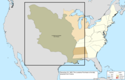 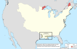 |
| 27 มีนาคม พ.ศ. 2447 | ภูมิภาคระหว่างเทนเนสซีและดินแดนมิสซิสซิปปีซึ่งก่อนหน้านี้จอร์เจีย ได้ยก ให้ ได้ถูกจัดสรรให้กับดินแดนมิสซิสซิปปี[ 135 ] [ AO ] | 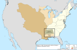 |
| วันที่ 1 ตุลาคม พ.ศ. 2447 | ดินแดนออร์ลีนส์ได้รับการจัดตั้งขึ้นจากการซื้อดินแดนลุยเซียนาทางใต้ของเส้นละติจูด33 ° เหนือโดยส่วนที่เหลือได้รับการกำหนดให้เป็นเขตลุยเซียนาและอยู่ภายใต้เขตอำนาจศาลของดินแดนอินเดียนา[ 164 ] [ AP ] | 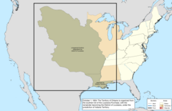 |
| 30 มิถุนายน พ.ศ. 2448 | ดินแดนมิชิแกนได้รับการจัดตั้งขึ้นจากดินแดนอินเดียนาทางเหนือของเส้นที่ลากจากปลายใต้สุดของทะเลสาบมิชิแกน ไป ทางตะวันออก และทางตะวันออกของเส้นที่ลากจากปลายเหนือสุดของทะเลสาบไปทางเหนือ[ 165 ] [ AQ ] | 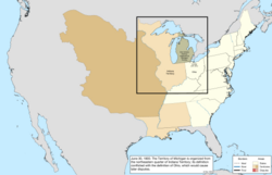 |
| 4 กรกฎาคม พ.ศ. 2448 | เขตลุยเซียนา ได้รับการจัดตั้ง ขึ้นเป็นดินแดนลุยเซียนา[ 164 ] [ AR ] | 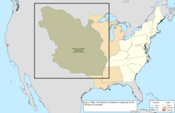 |
| วันที่ 1 มีนาคม พ.ศ. 2452 | ดินแดนอิลลินอยส์ ถูกจัดตั้ง ขึ้นจากครึ่งตะวันตกของดินแดนอินเดียนา[ bh ] [ 166 ] [ AS ] | 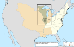 |
| 26 กันยายน พ.ศ. 2453 | สาธารณรัฐเวสต์ฟลอริดาประกาศเอกราชจากสเปนโดยอ้างสิทธิ์ในพื้นที่เวสต์ฟลอริดาทางตะวันตกของแม่น้ำเพิร์ล[ 167 ] [ 168 ] | 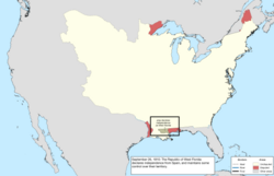 |
| วันที่ 10 ธันวาคม พ.ศ. 2453 | กองทัพสหรัฐฯ เข้าครอบครองส่วนหนึ่งของเวสต์ฟลอริดาทางตะวันตกของแม่น้ำเพิร์ลซึ่งพวกเขาถือว่ารวมอยู่ในการซื้อลุยเซียนา รวมทั้งพื้นที่ซึ่งเคยเป็นสาธารณรัฐเวสต์ฟลอริดา[ 167 ] [ 169 ] [ 170 ] | 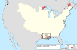 |
| 30 เมษายน พ.ศ. 2455 | ดินแดนออร์ลีนส์ส่วนใหญ่ได้รับการยอมรับให้เป็นรัฐที่สิบแปด คือรัฐลุยเซียนา[ bi ] [ 172 ] [ AT ] | 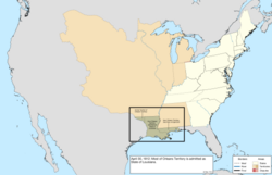 |
| วันที่ 14 พฤษภาคม พ.ศ. 2455 | ส่วนที่อ้างสิทธิ์ของเวสต์ฟลอริดาทางตะวันออกของแม่น้ำเพิร์ล ถูก จัดสรรให้กับดินแดนมิสซิสซิปปี[ 135 ] [ AU ] | 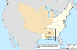 |
| 4 สิงหาคม พ.ศ. 2455 | ส่วนที่เหลือของเวสต์ฟลอริดา ที่อ้างสิทธิ์ไว้ ซึ่งอยู่ทางตะวันตกของแม่น้ำเพิร์ลได้ถูกผนวกเข้ากับหลุยเซียน่า[ bj ] [ 164 ] | 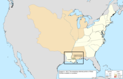 |
| 7 ธันวาคม พ.ศ. 2455 | เนื่องจากชื่อของรัฐ ลุยเซียนาถูกใช้ร่วมกับรัฐลุยเซียนาดินแดนลุยเซียนา จึงได้รับการจัดระเบียบ ใหม่เป็นดินแดนมิสซูรี[ 174 ] [ AX ] | 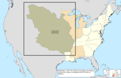 |
| 24 สิงหาคม พ.ศ. 2457 | กองกำลังอังกฤษเข้ายึดและเผากรุงวอชิงตันแต่ถูกบังคับให้ถอนกำลังในวันรุ่งขึ้น การทำงานของเมืองหลวงถูกระงับเพียงชั่วคราวเท่านั้น แม้ว่าประธานาธิบดีเจมส์ แมดิสันจะลี้ภัยไปยังบรูกวิลล์ รัฐแมริแลนด์ก็ตาม[ 175 ] | ไม่มีการเปลี่ยนแปลงแผนที่ |
| 25 ตุลาคม พ.ศ. 2457 | การสำรวจเขตแดนระหว่างนิวยอร์กและเวอร์มอนต์ได้รับการส่งแล้ว[ ag ] [ 176 ] [ 177 ] | 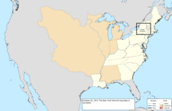 |
| 25 ตุลาคม พ.ศ. 2458 | ส่วนสุดท้ายของการสำรวจชายแดนระหว่างนอร์ทแคโรไลนาและเซาท์แคโรไลนาเสร็จสมบูรณ์แล้ว[ ag ] [ 178 ] | 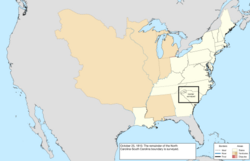 |
| วันที่ 11 ธันวาคม พ.ศ. 2459 | ส่วนทางใต้ของดินแดนอินเดียนาพร้อมด้วยส่วนเล็กๆ ของดินแดนอิลลินอยส์และดินแดนมิชิแกนได้รับการยอมรับให้เป็นรัฐที่สิบเก้าคืออินเดียนา[ bk ] [ 143 ] [ AY ] | 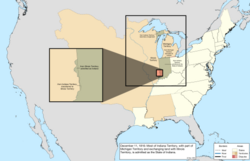 |
| 3 มีนาคม พ.ศ. 2460 | ดินแดนอะลาบามาได้รับการจัดตั้งขึ้นจากครึ่งตะวันออกของดินแดนมิสซิสซิปปี[ bl ] [ 171 ] [ AZ ] | 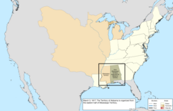 |
| วันที่ 10 ธันวาคม พ.ศ. 2460 | ดินแดนมิสซิสซิปปีได้รับการยอมรับให้เป็นรัฐที่ยี่สิบ คือรัฐมิสซิสซิปปี[ 179 ] [ BA ] | 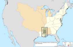 |
| 30 มิถุนายน พ.ศ. 2461 | ตามข้อตกลงในสนธิสัญญาเกนต์ที่ยุติสงครามปี 1812สหรัฐอเมริกาและสหราชอาณาจักร[ bm ]ได้แลกเปลี่ยนเกาะหลายแห่งที่ถูกยึดครองระหว่างสงคราม โดยคืนเกาะมูสให้กับแมสซาชูเซตส์และ คืนเกาะ แคมโปเบลโลเกาะเดียร์และเกาะแกรนด์มานันให้กับสหราชอาณาจักร[ 180 ] [ 181 ] | ไม่ได้แมป |
| 3 ธันวาคม พ.ศ. 2461 | ครึ่งหนึ่งของดินแดนอิลลินอยส์ทางใต้ของละติจูด 42°30′ เหนือ ได้รับการยอมรับให้เป็นรัฐที่ 21 คืออิลลินอยส์[ 182 ] ส่วนที่เหลือของดินแดน พร้อมกับดินแดนที่ยังไม่มีการจัดระเบียบซึ่งเพิ่งเป็นส่วนหนึ่งของดินแดนอินเดียนาได้ถูกจัดสรรให้กับดินแดนมิชิแกน[ BB ] | 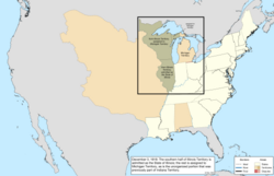 |
ค.ศ. 1819–1845 (การขยายตัวไปทางตะวันตกเฉียงเหนือ)
| วันที่ | เหตุการณ์ | เปลี่ยนแผนที่ |
|---|---|---|
| 30 มกราคม พ.ศ. 2462 | สนธิสัญญาปี 1818กำหนดให้ ละติจูด 49° เหนือเป็นพรมแดนกับสหราชอาณาจักรทางตะวันตกของทะเลสาบวูดส์และกำหนดให้ดินแดนโอเรกอนเป็นภูมิภาคที่แบ่งปันกับสหราชอาณาจักร[ bn ] [ bo ] [ 184 ] | 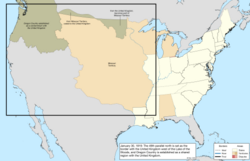 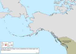 |
| 4 กรกฎาคม พ.ศ. 2462 | ดินแดนอาร์คันซอ ได้รับ การจัดตั้งขึ้นจากส่วนใต้ของดินแดนมิสซูรี[ bp ] [ 186 ] [ BD ] | 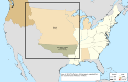 |
| 30 ตุลาคม พ.ศ. 2462 | การสำรวจเขตแดนระหว่างจอร์เจียและเทนเนสซีได้รับการอนุมัติจากเทนเนสซี[ 187 ] [ BE ]เส้นเขตแดนซึ่งสำรวจอยู่ทางใต้เล็กน้อยของเขตแดนที่ตั้งใจไว้ที่ละติจูด35° เหนือและตัดจอร์เจียออกจากแม่น้ำเทนเนสซีไม่เคยได้รับการอนุมัติจากจอร์เจีย[ 189 ] | 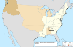 |
| วันที่ 14 ธันวาคม พ.ศ. 2462 | ดินแดนอะลาบามาได้รับการยอมรับให้เป็นรัฐที่ 22 คือรัฐอะลาบามา[ 190 ] [ BF ] | 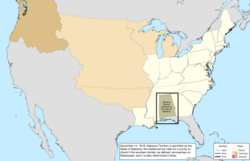 |
| วันที่ 15 มีนาคม พ.ศ. 2363 | ตามข้อตกลงมิสซูรีเขตเมนซึ่งเป็นส่วนเหนือและแยกจากรัฐแมสซาชูเซตส์ได้รับการยอมรับให้เป็นรัฐที่ 23 คือรัฐเมน[ 191 ] [ BG ] | 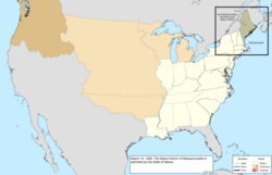 |
| 21 เมษายน พ.ศ. 2363 | นี่คือวันที่เก่าแก่ที่สุดเท่าที่ทราบของการใช้ชื่อ " Arkansas Territory " อย่างเป็นทางการแทน "Arkansaw Territory" [ BH ] | 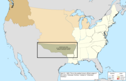 |
| วันที่ 12 พฤษภาคม พ.ศ. 2363 | การสำรวจ พรมแดน เคนตักกี้ - เทนเนสซีจากทางตะวันออกไปยังเคลียร์ฟอร์กและจากแม่น้ำคัมเบอร์แลนด์ไปยังแม่น้ำเทนเนสซีได้รับการอนุมัติ[ bq ] [ 193 ] [ 194 ] | 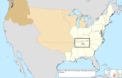 |
| 19 กรกฎาคม พ.ศ. 2363 | การสำรวจชายแดนระหว่างรัฐอะลาบามาและรัฐมิสซิสซิปปีเสร็จสมบูรณ์แล้ว[ ag ] [ br ] [ 89 ] [ 195 ] | 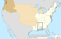 |
| 1821 | การสำรวจพรมแดนระหว่างจอร์เจียและนอร์ทแคโรไลนาเสร็จสมบูรณ์ในปี พ.ศ. 2364 [ ag ] [ 196 ] [ 197 ] | 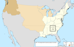 |
| 22 กุมภาพันธ์ พ.ศ. 2464 | สนธิสัญญา อดัมส์-โอนิสกับสเปนมีผลบังคับใช้[ bs ] [ 162 ]การเปลี่ยนแปลงหลายประการได้แก่:
| 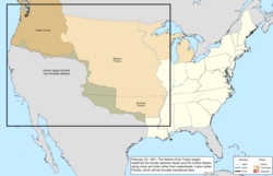 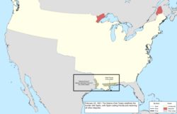 |
| 2 กรกฎาคม พ.ศ. 2464 | การสำรวจชายแดนรัฐอิลลินอยส์ - อินเดียนาเสร็จสมบูรณ์แล้ว[ ag ] [ 166 ] [ 199 ] | 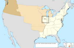 |
| วันที่ 10 กรกฎาคม พ.ศ. 2464 | ฟลอริดาตะวันออกถูกโอนอย่างเป็นทางการให้กับสหรัฐอเมริกาโดยสเปน[ 200 ] | 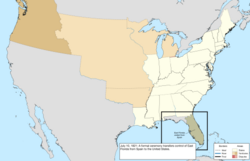 |
| วันที่ 17 กรกฎาคม พ.ศ. 2464 | เวส ต์ฟลอริดาถูกโอนอย่างเป็นทางการให้กับสหรัฐอเมริกาโดยสเปน[ 201 ] | 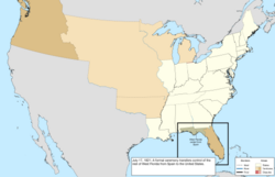 |
| 10 สิงหาคม พ.ศ. 2464 | มุมตะวันออกเฉียงใต้ของดินแดนมิสซูรีได้รับการยอมรับให้เป็นรัฐที่ 24 คือรัฐมิสซูรี[ bu ] [ 204 ] [ BL ] | 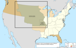 |
| 19 พฤศจิกายน พ.ศ. 2464 | การสำรวจชายแดนระหว่างนอร์ทแคโรไลนาและเทนเนสซีได้รับการอนุมัติจากนอร์ทแคโรไลนา[ bv ] [ 196 ] | 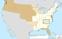 |
| 22 พฤศจิกายน พ.ศ. 2464 | การสำรวจช่องว่างในการสำรวจชายแดนเคนตักกี้ - เทนเนสซี ครั้งก่อนได้รับการอนุมัติแล้ว [ bw ] [ 193 ] | 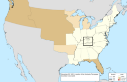 |
| 30 มีนาคม พ.ศ. 2465 | ฟลอริดาตะวันออกและฟลอริดาตะวันตกเดิม ได้รับ การจัดตั้งเป็นดินแดนฟลอริดา[ 206 ] [ BN ] | 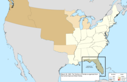 |
| 26 พฤษภาคม พ.ศ. 2467 | พรมแดนด้านตะวันตกของดินแดนอาร์คันซอถูกเลื่อนไปทางตะวันออกเป็นเส้นที่อยู่ทางใต้จากจุดที่อยู่ห่างจากพรมแดนด้านตะวันตกของรัฐมิสซูรี ไปทางตะวันตก 40 ไมล์ [ 185 ] [ BO ] | 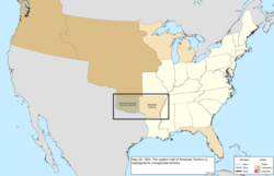 |
| วันที่ 11 มกราคม พ.ศ. 2468 | สนธิสัญญากับจักรวรรดิรัสเซียกำหนดให้ละติจูด54 °40′ เหนือเป็นพรมแดนทางเหนือของดินแดนโอเรกอน [ bx ] สนธิสัญญาอีกฉบับหนึ่งได้สร้างพรมแดนเดียวกันระหว่างรัสเซียและสหราช อาณาจักร | 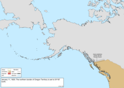 |
| 3 พฤศจิกายน พ.ศ. 2469 | มีการปรับแก้ไขเส้นเขตแดนระหว่างรัฐคอนเนตทิคัตและรัฐแมสซาชูเซตส์เพื่อแก้ไขความคลาดเคลื่อนเล็กน้อย[ 208 ] | ไม่ได้แมป |
| 28 พฤษภาคม พ.ศ. 2461 | พรมแดนด้านตะวันตกของดินแดนอาร์คันซอถูกเลื่อนไปทางตะวันออกอีกครั้ง โดยยกดินแดนให้แก่ชาวเชอโรคี[โดย] [ bz ] [ 185 ] | 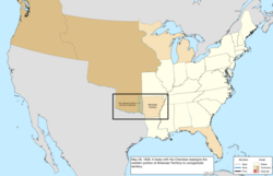 |
| วันที่ 1 กรกฎาคม พ.ศ. 2462 | การสำรวจชายแดนเมน - นิวแฮมป์เชอร์ได้รับการอนุมัติ[ ca ] [ 211 ] | 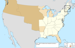 |
| วันที่ 10 มกราคม พ.ศ. 2474 | พระเจ้าวิลเลียมที่ 1 แห่งเนเธอร์แลนด์ได้รับการร้องขอตามสนธิสัญญาเกนต์ให้เป็นผู้ไกล่เกลี่ยข้อพิพาทเรื่องพรมแดนระหว่างเมนและสหราชอาณาจักรพระองค์ทรงมีพระราชดำรัสตัดสินว่า เนื่องจากเป็นการยากที่จะทำให้สนธิสัญญาสอดคล้องกับแผนที่ที่ให้มา พระองค์จึงทรงลากเส้นประประนีประนอม สหราชอาณาจักรยอมรับ แต่สหรัฐอเมริกาปฏิเสธ[ 212 ] [ BS ] | ไม่มีการเปลี่ยนแปลงแผนที่ |
| 20 ธันวาคม พ.ศ. 2474 | การสำรวจชายแดนเคนตักกี้ - เทนเนสซี ช่วงสุดท้ายทางตะวันตก ได้รับการอนุมัติแล้ว[ cb ] | 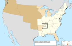 |
| 9 กรกฎาคม พ.ศ. 2475 | ภูมิภาคนิวแฮมป์เชอร์ทางเหนือของทะเลสาบคอนเนตทิคัตซึ่งเป็นพื้นที่พิพาทกับสหราชอาณาจักรได้ประกาศเอกราชเป็นสาธารณรัฐอินเดียนสตรีม[ 214 ] [ 215 ] | 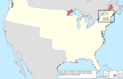 |
| 28 มิถุนายน พ.ศ. 2477 | ดินแดนมิชิแกนได้รับพื้นที่ขนาดใหญ่จากดินแดนที่ไม่มีการจัดระเบียบ โดยขยายไปทางทิศตะวันตกถึงแม่น้ำมิสซูรีและแม่น้ำไวท์เอิร์ธ[ 165 ] [ BT ] | 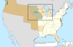 |
| 5 สิงหาคม พ.ศ. 2478 | สาธารณรัฐอินเดียนสตรีมยอมรับเขตอำนาจศาลของนิวแฮมป์เชอร์ซึ่งเป็นการยุติการอ้างเอกราช[ cc ] [ 214 ] | 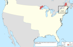 |
| 15 มิถุนายน พ.ศ. 2479 | ดินแดนอาร์คันซอได้รับการยอมรับให้เป็นรัฐที่ 25 คือรัฐอาร์คันซอ[ cd ] [ 217 ] [ BU ] | 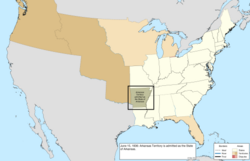 |
| 23 มิถุนายน พ.ศ. 2479 | การสำรวจชายแดนทางเหนือของรัฐอิลลินอยส์อินเดียนาและโอไฮโอได้รับการอนุมัติแล้ว[ ce ] [ 152 ] [ BV ] | 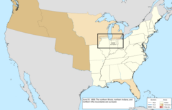 |
| 3 กรกฎาคม พ.ศ. 2479 | ดินแดนวิสคอนซิน ได้รับการจัดตั้ง ขึ้นจากดินแดนทางตะวันตกของดินแดนมิชิแกน[ cf ] [ 219 ] [ BW ]คาบสมุทรขนาดใหญ่สองแห่งระหว่างทะเลสาบใหญ่ยังคงอยู่ในดินแดนมิชิแกนคาบสมุทรตอนบนถูกรวมเข้ามาโดยแลกกับการที่ดินแดนดังกล่าวสละสิทธิ์ในการอ้างสิทธิ์ในแถบโตเลโด | 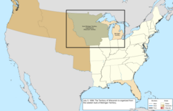 |
| วันที่ 14 ธันวาคม พ.ศ. 2479 | ดินแดนมิชิแกนตกลง ที่จะสละสิทธิ์ในการอ้าง สิทธิ์ในแถบโตเลโดซึ่งเป็นการยุติข้อพิพาทกับโอไฮโอ[ 152 ] [ 220 ] | 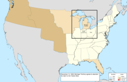 |
| 26 มกราคม พ.ศ. 2480 | ดินแดนมิชิแกนได้รับการยอมรับให้เป็นรัฐที่ 26 คือรัฐมิชิแกน[ 221 ] [ BX ] | 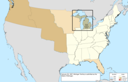 |
| 28 มีนาคม พ.ศ. 2480 | การซื้อ Platteซึ่งได้มาจากหลายชาติรวมถึงPotawatomi , Iowa , Missouria , Otoe , SaukและMeskwaki [ 222 ]ถูกยกให้แก่รัฐมิสซูรี โดย ขยายพรมแดนทางเหนือไปทางตะวันตกจนถึงแม่น้ำมิสซูรี[ cg ] [ 202 ] | 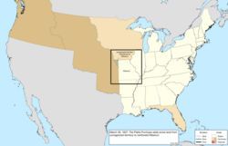 |
| 9 พฤศจิกายน พ.ศ. 2480 | การสำรวจชายแดนระหว่างมิสซิสซิปปีและเทนเนสซี ได้รับการ อนุมัติจากเทนเนสซี[ ch ] [ 223 ] [ CB ] | 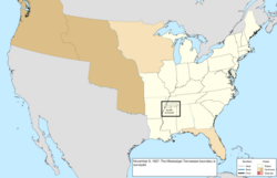 |
| 3 กรกฎาคม พ.ศ. 2481 | ดินแดนไอโอวา ได้รับการ จัดตั้งขึ้นจากดินแดนวิสคอนซินทางตะวันตกของแม่น้ำมิสซิสซิปปี[ 225 ] [ CC ] | 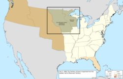 |
| 1839 | การสำรวจพรมแดนระหว่างรัฐอะลาบามาและรัฐเทนเนสซีเสร็จสมบูรณ์ในปี พ.ศ. 2482 [ ag ] [ 89 ] | 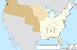 |
| วันที่ 11 กุมภาพันธ์ พ.ศ. 2482 | Missouri claimed an area north of its border with Iowa Territory, initiating the long dispute known as the Honey War.[226][CD] | 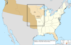 |
| January 27, 1840 | The survey of the Alabama–Georgia border was approved.[ci][229] | 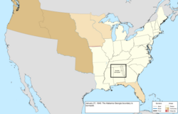 |
| June 24, 1841 | The survey of the border with Texas was completed.[210][CE] | 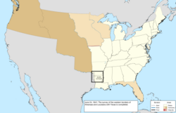 |
| October 13, 1842 | The Webster–Ashburton Treaty defined the border with the United Kingdom east of the Rocky Mountains.[cj][231] The treaty resolved the disputes over the northern borders of Maine and New Hampshire[ck] and the northeastern border of Wisconsin Territory,[cl] as well as affirming the American claim to Sugar Island.[231] | 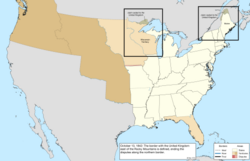 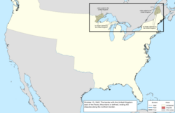 |
| March 3, 1845 | Florida Territory was admitted as the twenty-seventh state, Florida.[232][CG] | 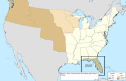 |
1845–1860 (Southwest expansion)
| Date | Event | Change map |
|---|---|---|
| December 29, 1845 | The Republic of Texas was annexed and admitted as the twenty-eighth state, Texas,[cm][234][CH] extending the United States southwest to the Rio Grande. All of Texas was claimed by Mexico.[cn] The annexation led to the beginning of the Mexican–American War a few months later.[233] | 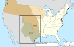 |
| July 17, 1846 | The Oregon Treaty established 49° north west of the Lake of the Woods as the continental border with the holdings of the United Kingdom, ending the sharing of Oregon Country.[co][236] The treaty was vague on which strait should be the border between Vancouver Island and the continent, causing a dispute over ownership of the San Juan Islands.[184] | 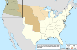 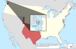 |
| December 28, 1846 | The portion of Iowa Territory south of 43°30′ north and east of the Big Sioux River was admitted as the twenty-ninth state, Iowa.[cp][226][CJ] | 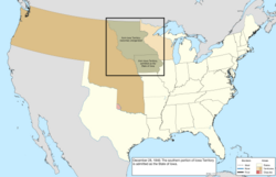 |
| March 20, 1847 | The District of ColumbiaretrocededAlexandria County to Virginia.[cq][240] | 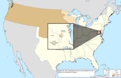 |
| June 28, 1847 | The survey of the border with the United Kingdom east of the Great Lakes was submitted.[cr][236] | 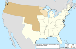 |
| November 5, 1847 | The survey of the Michigan–Wisconsin Territory border was submitted.[ag][242][CO] | 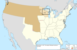 |
| February 15, 1848 | The survey of the Arkansas–Missouri border was approved.[210][CP] | 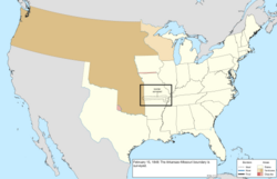 |
| May 29, 1848 | The southern bulk of Wisconsin Territory was admitted as the thirtieth state, Wisconsin.[cs][243][CQ] However, the citizens of the remainder decided to continue on with a civil government, and elected a delegate to the United States House of Representatives who would be seated on January 15, 1849, essentially making this region a de facto continuation of Wisconsin Territory.[244][245] | 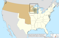 |
| May 30, 1848 | The Treaty of Guadalupe Hidalgo ended the Mexican–American War and ceded a large region from Mexico, consisting of its territories of Alta California and Santa Fe de Nuevo México, and its claim to Texas;[ct][cu] however, there was a disagreement over the specific southern border of Santa Fe de Nuevo México.[247] | 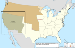 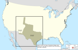 |
| August 14, 1848 | Oregon Territory was organized from the former Oregon Country.[248][CS] | 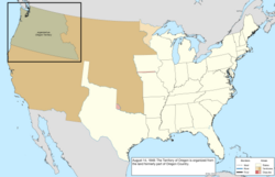 |
| February 13, 1849 | The border dispute between Iowa and Missouri known as the Honey War was resolved by the Supreme Court.[237] The resulting border was the Sullivan Line that existed before the dispute, roughly splitting the two claims.[CT] | 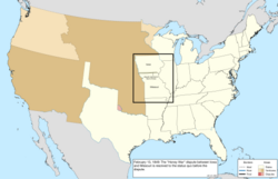 |
| March 3, 1849 | Minnesota Territory was organized from the region that had been operating as de facto Wisconsin Territory, and unorganized territory east of the Missouri and White Earth Rivers.[237][CU] | 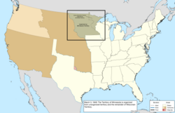 |
| March 12, 1849 | Settlers formed the State of Deseret and claimed a vast portion of the southwest. Though it petitioned to be admitted to the United States, the proposal was rejected and, in 1850, Utah Territory was formed instead.[249][250] | 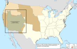 |
| November 24, 1849 | The Louisiana–Texas border was shifted from the west bank to the middle of the Sabine River.[cv][252][CW] | not mapped |
| September 9, 1850 | The western portion of the Mexican Cession was admitted as the thirty-first state, California.[cw][254][CX] The portion of the remainder north of 37° north and west of the summit of the Rocky Mountains was organized as Utah Territory.[cx][249][CY] | 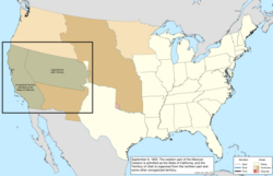 |
| December 9, 1850 | The United Kingdom ceded less than one acre of underwater rock for a lighthouse in Lake Erie near Buffalo, New York;[255] although it was on Middle Reef, it was named for the nearby Horseshoe Reef.[256] It was surrounded by British waters, creating a form of enclave.[CN] | 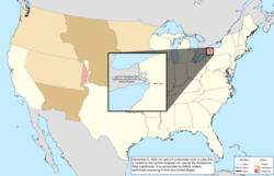 |
| December 13, 1850 | The federal government purchased the western claim of Texas.[cy][257]New Mexico Territory was organized from the part of this region east of the Rio Grande, along with the remaining unorganized territory from the Mexican Cession.[cz][259][CZ] | 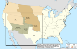 |
| January 3, 1851 | The survey of the Iowa–Missouri border was approved by the Supreme Court.[237][DA] | 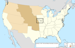 |
| April 5, 1851 | The State of Deseret dissolved itself, its functions and territory largely having been superseded by Utah Territory.[260] | 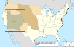 |
| December 11, 1852 | The survey of the western Wisconsin border was submitted.[ag][225][261] | 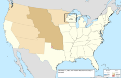 |
| March 2, 1853 | Washington Territory was organized from the half of Oregon Territory north of 46° north and the Columbia River.[262][DB] | 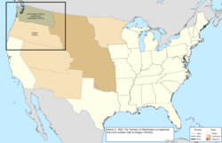 |
| May 30, 1854 | The Kansas–Nebraska Act organized Kansas Territory from unorganized territory lying between 37° north and 40° north,[263] and Nebraska Territory from unorganized territory north of 40° north.[264][DC] Much of the remaining unorganized territory, east of 100° west, became known as Indian Territory, designated as a place to resettle native nations. A small strip between the Texas Panhandle and Kansas Territory was unclaimed because it fell south of Kansas Territory's border but north of 36°30′ north, which had been established in the Missouri Compromise as the northern limit of slavery, and thus Texas could not have it. This became known as the Public Land Strip, or sometimes "No Man's Land".[265] | 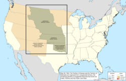 |
| June 30, 1854 | The United States purchased a large parcel from Mexico known as the Gadsden Purchase, as it offered a much better route for a southern transcontinental railroad.[da][db] This resolved the border dispute, since the disputed region was included in the purchase.[267] | 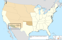 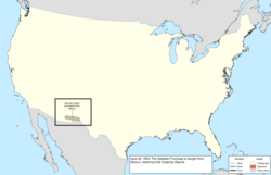 |
| August 4, 1854 | The recently obtained Gadsden Purchase was assigned to New Mexico Territory.[268][DE] | 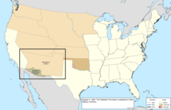 |
| January 11, 1855 | Boston Corner was ceded by Massachusetts to New York due to its inaccessibility from the rest of the Massachusetts.[dc][97] | 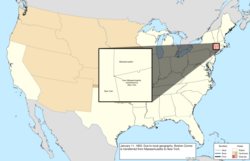 |
| March 6, 1855 | The Supreme Court ruled in favor of Florida in a border dispute with Georgia, setting the state line along McNeil's line.[DG] | no change to map |
| August 1, 1856 | The survey of the border with Mexico was submitted.[267][DH] | 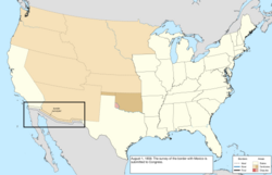 |
| October 28, 1856 | Baker Island and Jarvis Island were claimed under the Guano Islands Act.[270][271] | 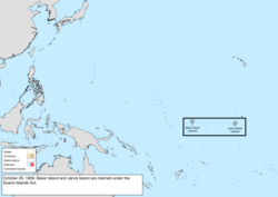 |
| May 11, 1858 | The eastern half of Minnesota Territory was admitted as the thirty-second state, Minnesota.[dd][272][DI] | 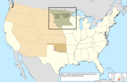 |
| August 31, 1858 | Navassa Island was claimed under the Guano Islands Act;[273][274] it was claimed by Haiti.[de] | 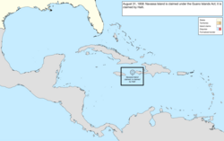 |
| December 3, 1858 | Howland Island was claimed under the Guano Islands Act.[270][271] | 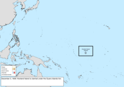 |
| February 14, 1859 | The western half of Oregon Territory was admitted as the thirty-third state, Oregon.[df][277] The remainder was assigned to Washington Territory.[DL] | 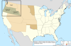 |
| July 6, 1859 | Surveyors created the "Middleton Offset", a small notch in the Kentucky–Tennessee border. It is unknown exactly why this was done, though one theory is a local landowner wanted his property in Tennessee.[278][279] | 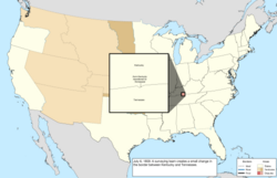 |
| September 6, 1859 | Johnston Atoll was claimed under the Guano Islands Act,[280][271] though it had been claimed by Hawaii in 1858.[281] | 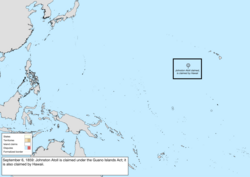 |
| November 7, 1859 | Settlers organized a provisional government for parts of the territories of Kansas, Nebraska, New Mexico, Utah, and Washington, with the name of Jefferson Territory.[dg] While never recognized by the federal government, it operated until Colorado Territory was established.[283] | 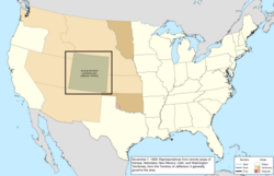 |
| December 27, 1859 | Enderbury Island, McKean Island, Phoenix Island, and Starbuck Island were claimed under the Guano Islands Act.[271] | 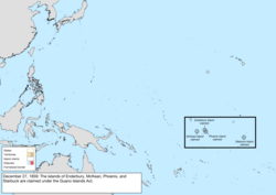 |
| December 29, 1859 | Christmas Island and Malden Island were claimed under the Guano Islands Act.[271] | 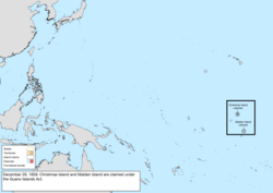 |
| February 8, 1860 | Several dozen islands in the Pacific Ocean were claimed under the Guano Islands Act,[271] including Atafu, Birnie Island, Butaritari, Canton Island, Caroline Island, Fanning Island, Flint Island, Gardner Island, Kingman Reef, Manihiki, Marakei, Nassau, Nukunonu, Palmyra Atoll, Penrhyn, Pukapuka, Rakahanga, Swains Island, Sydney Island, Vostok Island, and Washington Island.[dh] | 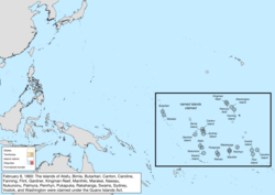 |
1860–1865 (Civil War)
| Date | Event | Change map |
|---|---|---|
| December 20, 1860 | In response to the election of Abraham Lincoln, South Carolinaproclaimed its secession from the Union, withdrawing from the United States Congress.[297] | 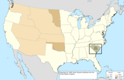 |
| January 9, 1861 | Mississippi proclaimed its secession from the Union, withdrawing from Congress.[297] | 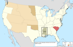 |
| January 10, 1861 | Florida proclaimed its secession from the Union, withdrawing from Congress.[297] | 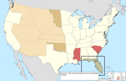 |
| January 11, 1861 | Alabama proclaimed its secession from the Union, withdrawing from Congress.[297] | 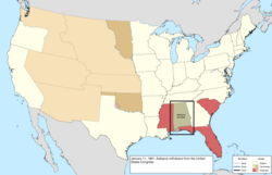 |
| January 19, 1861 | Georgia proclaimed its secession from the Union, withdrawing from Congress.[297] | 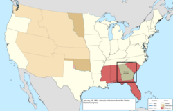 |
| January 26, 1861 | Louisiana proclaimed its secession from the Union, withdrawing from Congress.[297] However, the 1st and 2nd congressional districts, around New Orleans, continued to send representatives to Congress. | 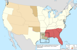 |
| January 29, 1861 | The bulk of Kansas Territory east of 25° west from Washington was admitted as the thirty-fourth state, Kansas.[di][299][DM] | 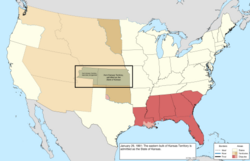 |
| February 8, 1861 | The Confederate States of America was formed by the seceded states of Alabama, Georgia, Florida, Louisiana, Mississippi, and South Carolina.[300] | 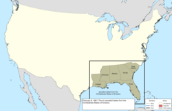 |
| February 28, 1861 | Colorado Territory was organized from portions of Nebraska Territory, New Mexico Territory, and Utah Territory, along with unorganized territory.[dj][283][DN] | 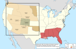 |
| March 2, 1861 | Texas proclaimed its secession from the Union, withdrawing from Congress,[297] and was admitted to the Confederate States.[DO] Dakota Territory was organized from Nebraska Territory and the unorganized territory north of it.[dk] Nebraska Territory's western border was moved to 33° west from Washington, gaining small portions of Utah Territory and Washington Territory.[303][DP]Nevada Territory was organized from Utah Territory west of 39° west from Washington.[304][DQ] | 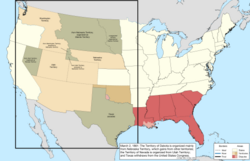 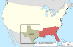 |
| March 28, 1861 | Representatives in the southern half of New Mexico Territory proclaimed an independent Arizona Territory south of 34° north.[305] | 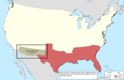 |
| April 17, 1861 | Following the Battle of Fort Sumter and President Abraham Lincoln's call for troops to respond, Virginiaproclaimed its secession from the Union, withdrawing from Congress.[297] However, the 1st (along the Eastern Shore), 7th (near Washington, D.C.), and 10th, 11th, and 12th (in the northwest of the state) congressional districts continued to send representatives to Congress. | 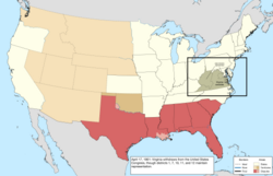 |
| May 6, 1861 | Arkansas proclaimed its secession from the Union, withdrawing from Congress.[297] | 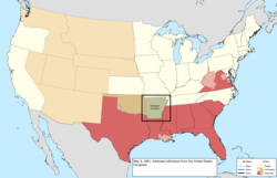 |
| May 7, 1861 | Virginia was admitted to the Confederate States.[DR] | 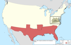 |
| May 20, 1861 | Arkansas was admitted to the Confederate States.[DS] North Carolina proclaimed its secession from the Union, withdrawing from Congress.[297] Kentuckydeclared itself neutral in the American Civil War.[308][309] | 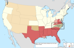 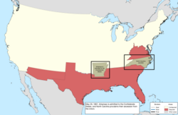 |
| May 21, 1861 | North Carolina was admitted to the Confederate States.[dl] | 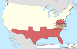 |
| June 6, 1861 | Robert Williamson Steele, governor of Jefferson Territory, declared the territory disbanded and handed over the government to the first governor of Colorado Territory.[313] | 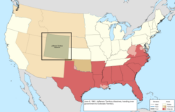 |
| June 8, 1861 | Tennessee proclaimed its secession from the Union, withdrawing from Congress.[297] However, the 1st, 2nd, 3rd, and 4th congressional districts in the eastern half of the state continued to send representatives to Congress. | 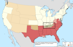 |
| June 25, 1861 | The federal government recognized the Restored Government of Virginia in Wheeling as the legitimate government of Virginia.[314] | 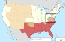 |
| July 2, 1861 | Tennessee was admitted to the Confederate States.[DU] | 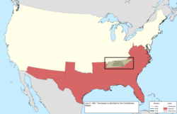 |
| August 1, 1861 | Following Confederate victory in the First Battle of Mesilla, Arizona Territory was proclaimed as part of the Confederate States.[317] | 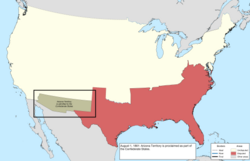 |
| September 13, 1861 | Following the Confederate occupation of Columbus, Kentucky, on September 3, 1861, the state abandoned neutrality and aligned with the Union government.[DV] | no change to map |
| October 31, 1861 | A splinter government in Neosho, Missouri, proclaimed the secession of the state from the Union.[297] | 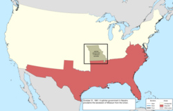 |
| November 20, 1861 | A convention in Russellville, Kentucky, proclaimed the formation of a splinter government in Bowling Green and the secession of Kentucky from the Union.[297] | 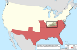 |
| November 28, 1861 | The splinter Neosho government of Missouri was admitted to the Confederate States. The Confederate States never held control over the state, but it was given full representation in the legislature.[DW] | 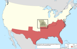 |
| December 10, 1861 | The splinter Bowling Green government of Kentucky was admitted to the Confederate States. Like Missouri, despite lack of control, it was given full representation in the legislature.[DX] | 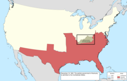 |
| December 21, 1861 | The Confederate States ratified treaties with the Great Osage Tribe,[dm] and the Seneca and Shawnee.[dn][do][326] | 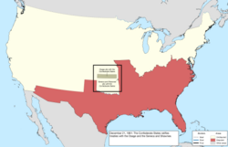 |
| December 23, 1861 | The Confederate States ratified treaties with the Cherokee Nation,[dp] granting them a delegate to the Congress of the Confederate States, and with the Seminole Nation,[dq] granting them a delegate to be shared with the Creek Nation.[326] | 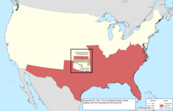 |
| December 31, 1861 | The Confederate States ratified treaties with the Choctaw Nation and Chickasaw Nation,[dr]granting them a shared delegate in the Congress of the Confederate States; with the Comanche;[du] with the Creek Nation,[dv] granting them a delegate shared with the Seminole Nation; and with the Quapaw.[dw][326] | 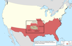 |
| March 1, 1862 | A decree by the Supreme Court modified the Massachusetts–Rhode Island border.[dx][341] | 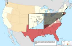 |
| April 15, 1862 | Palmyra Atoll was annexed by Hawaii, after which the American claim fell dormant.[342][343] | 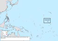 |
| July 14, 1862 | The slice of Utah Territory west of 38° west from Washington was assigned to Nevada Territory.[304][EH] | 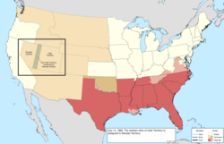 |
| December 30, 1862 | The Swan Islands were claimed under the Guano Islands Act.[270][274] | 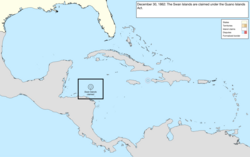 |
| February 24, 1863 | Arizona Territory was organized from the half of New Mexico Territory west of 32° west from Washington.[344][EI] | 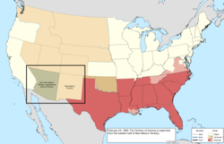 |
| March 3, 1863 | Idaho Territory was organized from the parts of Dakota Territory and Nebraska Territory west of 27° west from Washington, and the half of Washington Territory east of the Snake River and a line north from the mouth of the Clearwater River.[345][EJ] | 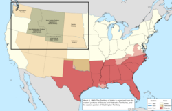 |
| March 4, 1863 | Because of disruption in voting and low turnout, no one was allowed to take the seats in the United States House of Representatives held by the Unionist areas of Louisiana, Tennessee, and Virginia, effectively expelling the states; Virginia maintained representation in the United States Senate.[346] | 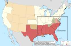 |
| June 20, 1863 | The northwestern counties of Virginia, represented by the Restored Government of Virginia in Wheeling, were admitted as the thirty-fifth state, West Virginia.[dy][dz][347] The Restored Government of Virginia was relocated to Alexandria. | 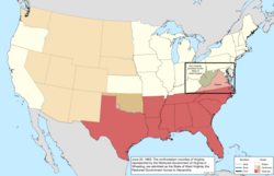 |
| August 5, 1863 | Berkeley County was ceded by Virginia to West Virginia.[ea] | 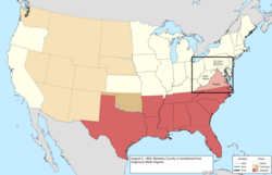 |
| November 2, 1863 | Jefferson County was ceded by Virginia to West Virginia.[eb] | 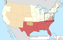 |
| May 26, 1864 | Montana Territory was organized from the northeast third of Idaho Territory,[ec][352] and the southeast third of Idaho Territory was assigned to Dakota Territory.[ed][302][ER] | 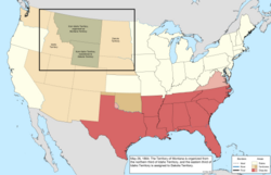 |
| October 31, 1864 | Nevada Territory was admitted as the thirty-sixth state, Nevada.[ee][353][ES] | 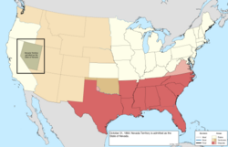 |
| May 5, 1865 | The Confederate States cabinet met in Washington, Georgia, and dissolved.[354] Military surrenders were scattered throughout 1865, but the most important is regarded as that of the Army of Northern Virginia following the Battle of Appomattox Court House on April 9. | 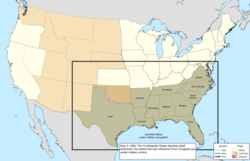 |
1866–1897 (Reconstruction and western statehood)
| Date | Event | Change map |
|---|---|---|
| May 5, 1866 | The slice of Utah Territory west of 37° west from Washington was ceded to Nevada.[ef][304] | 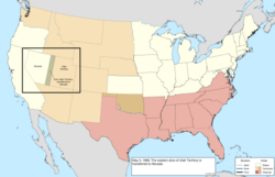 |
| July 24, 1866 | Tennessee was readmitted to Congress.[EV] | 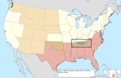 |
| December 13, 1866 | The survey of the Florida–Georgia border was approved.[eg][358][86] | 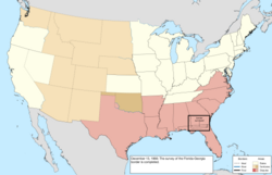 |
| December 26, 1866 | Starbuck Island was claimed by the United Kingdom.[359] | 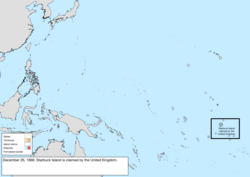 |
| January 18, 1867 | The northwestern corner of Arizona Territory, west of the Colorado River and 37° west from Washington, was ceded to Nevada.[eh][ei][304] | 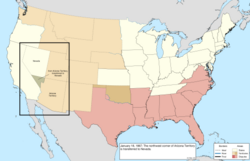 |
| March 1, 1867 | Nebraska Territory was admitted as the thirty-seventh state, Nebraska.[362][FA] | 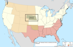 |
| July 1, 1867 | Canada was formed from several British colonies, including New Brunswick, inheriting the dispute over Machias Seal Island and North Rock. | 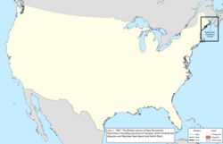 |
| August 28, 1867 | Midway Atoll was claimed.[280][FB] | 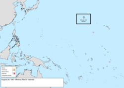 |
| October 18, 1867 | Alaska was purchased from the Russian Empire and designated the Department of Alaska.[ej][ek][267] A vague description and lack of quality surveying made the southeastern border with British holdings unclear and disputed.[365] | 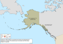 |
| June 22, 1868 | Arkansas was readmitted to Congress.[FD] | 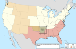 |
| June 25, 1868 | Florida was readmitted to Congress.[el] | 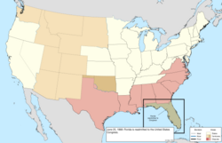 |
| July 4, 1868 | North Carolina was readmitted to Congress.[em] | 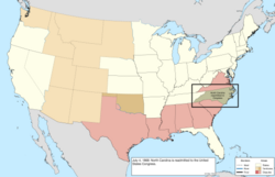 |
| July 9, 1868 | Louisiana and South Carolina were readmitted to Congress.[en] Caroline Island was claimed by the United Kingdom.[366] | 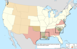 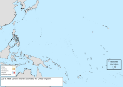 |
| July 13, 1868 | Alabama was readmitted to Congress.[eo] | 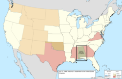 |
| July 21, 1868 | Georgia was readmitted to Congress.[ep] | 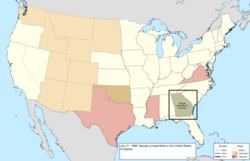 |
| July 25, 1868 | Wyoming Territory was organized from portions of Dakota, Idaho, and Utah Territories.[eq][er][368] A tiny portion of the Dakota Territory was erroneously left behind on the western side of Wyoming Territory.[369] | 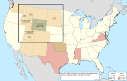 |
| August 12, 1868 | The list of bonded guano island claims mentions "Islands in Caribbean Sea not named" bonded on this date, but it is unknown to what this is referring.[370] | no change to map |
| December 11, 1868 | Serrana Bank was claimed under the Guano Islands Act.[371]Colombia has claimed it throughout its history. | 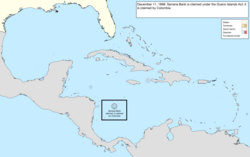 |
| March 3, 1869 | Georgia was again expelled from Congress; the representatives elected in April 1868 to serve in the last few months of the 40th United States Congress attempted to present the same credentials to the 41st United States Congress, but were denied.[372] | 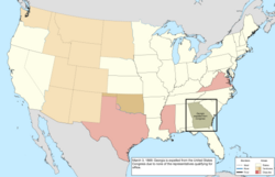 |
| November 22, 1869 | Bajo Nuevo Bank, Pedro Cays, Quita Sueño Bank, and Roncador Bank were claimed under the Guano Islands Act.[es][373]Colombia has claimed all but Pedro Cays throughout its history. | 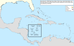 |
| January 26, 1870 | Virginia was readmitted to Congress.[FK] | 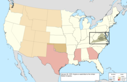 |
| February 23, 1870 | Mississippi was readmitted to Congress.[FL] | 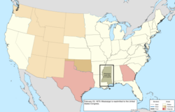 |
| March 30, 1870 | Texas was readmitted to Congress.[FM] | 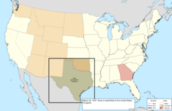 |
| July 15, 1870 | Georgia was again readmitted to Congress.[et] The North-Western Territory was ceded by the United Kingdom to Canada, including its portion of the Alaska boundary dispute.[374] | 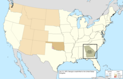 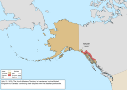 |
| February 9, 1871 | A small parcel was ceded from Dakota Territory to Nebraska following a sudden change in course of the Missouri River.[eu][376] | 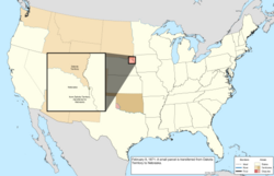 |
| February 21, 1871 | The District of Columbia was reorganized.[129][FR] | no change to map |
| July 20, 1871 | British Columbia joined Canada, including the dispute over the San Juan Islands as well as its portion of the Alaska boundary dispute.[377] | 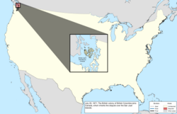 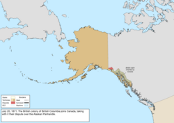 |
| 1872 | Flint Island was claimed by the United Kingdom.[378] | 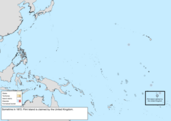 |
| October 21, 1872 | The dispute with Canada over the San Juan Islands was resolved in the favor of the United States claim.[ev] | 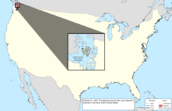 |
| October 15, 1873 | Vostok Island was claimed by the United Kingdom.[380] | 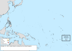 |
| February 17, 1873 | The small portion of Dakota Territory that was left behind when Wyoming Territory was created was assigned to Montana Territory.[369][FT] | 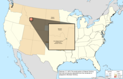 |
| May 29, 1876 | The International Boundary Commission produced its final report on the survey of the 49th parallel north.[381][382] | 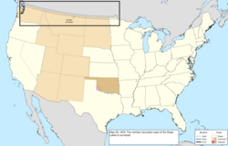 |
| August 1, 1876 | Colorado Territory was admitted as the thirty-eighth state, Colorado.[ew][383][FU] | 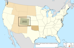 |
| August 13, 1877 | The United Kingdom created the British Western Pacific Territories, annexing the Gilbert Islands (including Butaritari and Marakei, after which the American claim fell dormant), the Phoenix Islands (including Canton Island, Enderbury Island, Birnie Island, McKean Island, Phoenix Island, Sydney Island, and Gardner Island), and the Union Islands (including Atafu and Nukunonu).[FV] | 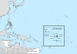 |
| March 3, 1879 | The Maryland–Virginia border across the Chesapeake Bay was adjusted, ceding the southern half of Smith Island to Virginia.[385][FW] | 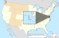 |
| September 8, 1879 | Arenas Key (claimed by Mexico), the Morant Cays, and Serranilla Bank (claimed by Colombia) were claimed by the United States under the Guano Islands Act.[373] | 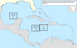 |
| April 7, 1880 | A very small area of Fair Haven, Vermont, was ceded to New York in response to a change in the course in the Poultney River.[176][FX] | not mapped |
| September 13, 1880 | Western Triangle Island, claimed by Mexico, was claimed by the United States under the Guano Islands Act.[ex][387] | 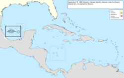 |
| May 23, 1882 | The area between 43° north and the Keya Paha and Niobrara Rivers was ceded from Dakota Territory to Nebraska.[ey][263] | 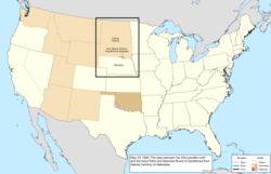 |
| June 1, 1882 | The Morant Cays and Pedro Cays were annexed by the United Kingdom to Jamaica,[GA] after which the American claim fell dormant.[390] | 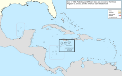 |
| May 17, 1884 | The Department of Alaska was organized as the District of Alaska.[GB] | 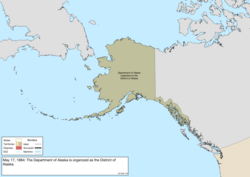 |
| June 21, 1884 | Scorpion Reef, claimed by Mexico, was claimed under the Guano Islands Act.[ez] | 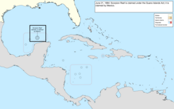 |
| March 15, 1888 | Fanning Island was claimed by the United Kingdom,[391] after which the American claim fell dormant. | 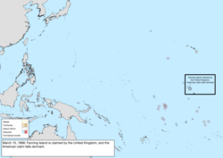 |
| March 17, 1888 | Christmas Island was claimed by the United Kingdom.[392] | 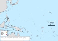 |
| September 20, 1888 | The United Kingdom proclaimed a protectorate over the Cook Islands, initiating a claim on Manihiki, Penrhyn, and Rakahanga.[fa] | 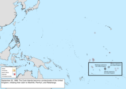 |
| May 29, 1889 | Washington Island was claimed by the United Kingdom,[395] after which the American claim fell dormant. | 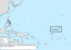 |
| June 3, 1889 | Jarvis Island was claimed by the United Kingdom.[396] | 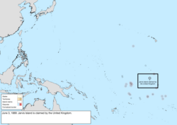 |
| November 2, 1889 | Dakota Territory was split along the "seventh standard parallel north", a few miles south of 46° north, and admitted as the thirty-ninth state, North Dakota, and the fortieth state, South Dakota.[fb][397][GC][GD] | 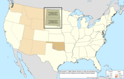 |
| November 8, 1889 | Montana Territory was admitted as the forty-first state, Montana.[fc][398][GC][GE] | 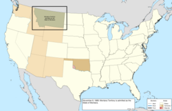 |
| November 11, 1889 | Washington Territory was admitted as the forty-second state, Washington.[fd][399][GC][GF] | 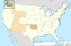 |
| May 2, 1890 | Oklahoma Territory was organized from the Public Land Strip and the western half of Indian Territory, except for the Cherokee Outlet, which would be added later upon cession from the Cherokee.[fe][298][GG] | 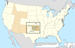 |
| July 3, 1890 | Idaho Territory was admitted as the forty-third state, Idaho.[ff][403][GH] | 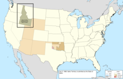 |
| July 10, 1890 | Wyoming Territory was admitted as the forty-fourth state, Wyoming.[fg][404][GI] | 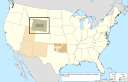 |
| March 3, 1891 | The survey of the New Mexico Territory–Texas and Public Land Strip–Texas borders was approved.[405][GJ] | 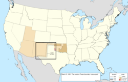 |
| 1892 | Nassau and Pukapuka were made protectorates of the United Kingdom;[fh][407] the American claim to Nassau fell dormant. | 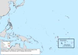 |
| September 16, 1893 | The federal government purchased the Cherokee Outlet in the Indian Territory and opened it to settlement, assigning it to Oklahoma Territory.[fi][409] | 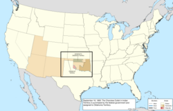 |
| November 17, 1894 | Arenas Key, Scorpion Reef, and Western Triangle Island were stricken from the list of claimed guano islands.[410] | 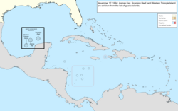 |
| January 4, 1896 | Utah Territory was admitted as the forty-fifth state, Utah.[fj][411][GM] | 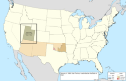 |
| March 16, 1896 | The dispute between the federal government, on behalf of Oklahoma Territory, and Texas over Greer County was resolved in favor of the federal claim.[409][GN] | 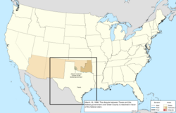 |
| July 24, 1897 | An island was ceded by Nebraska to South Dakota to account for an earlier shift in the course of the Missouri River.[GO] | 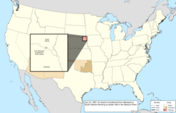 |
1898–1945 (Pacific and Caribbean expansion)
| Date | Event | Change map |
|---|---|---|
| August 12, 1898 | The Republic of Hawaii was annexed.[fk][414] | 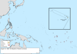 |
| January 17, 1899 | Wake Island was claimed.[280][415] | 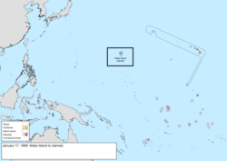 |
| April 11, 1899 | Guam, Porto Rico, and, for a payment of $20 million, the Philippines, were ceded by Spain following the Spanish–American War.[fl][417] The Insular Government of the Philippine Islands was claimed by the First Philippine Republic, and the ceded region included the island of Palmas, which was administered by the Netherlands, though the overlap would not be noticed until 1906.[418] | 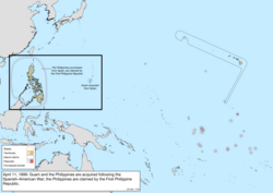 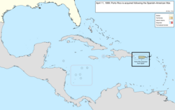 |
| February 16, 1900 | The Samoan Islands east of 171° west were acquired per the terms of the Tripartite Convention.[fm][421] | 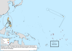 |
| February 19, 1900 | The newly acquired Samoan islands were placed under the jurisdiction of the Department of the Navy,[GV] which designated them Naval Station, Tutuila.[GW] | 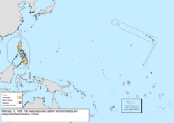 |
| May 1, 1900 | Porto Rico was organized.[GX] | 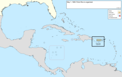 |
| June 14, 1900 | The former Republic of Hawaii was organized as Hawaii Territory.[414][GY] | 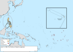 |
| March 3, 1901 | The north half of Main Street between Bristol, Tennessee, and Bristol, Virginia, was ceded by Tennessee to Virginia, setting the border to run down the center of the road.[fn][193] | not mapped |
| March 23, 1901 | Several islands, including Cagayan de Sulu and Sibutu, were purchased from Spain and assigned to the Philippines.[fo][fp] | 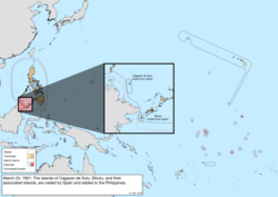 |
| April 19, 1901 | The president of the First Philippine Republic, Emilio Aguinaldo, captured on March 23, 1901, took an oath of allegiance to the United States, ending the First Philippine Republic.[425] | 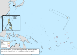 |
| July 1, 1902 | The Philippines were organized.[HD] | 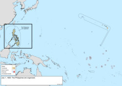 |
| February 27, 1903 | The survey of the California–Nevada border was approved.[fq][428] | 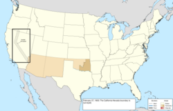 |
| October 20, 1903 | The Alaska boundary dispute with Canada was resolved, generally in favor of the United States claim.[365] | 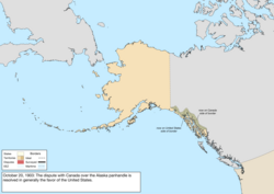 |
| December 10, 1903 | An area along southern Guantánamo Bay was leased in perpetuity from Cuba for use as a naval base.[fr][431] | 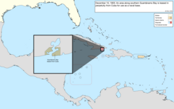 |
| May 19, 1904 | The Panama Canal Zone was granted by Panama;[fs][ft][280][434] as Panama had just seceded, it was claimed by Colombia. | 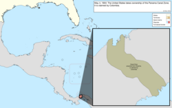 |
| December 12, 1904 | The maritime border of the harbor of Panama City was defined.[fu] | not mapped |
| February 10, 1905 | A small area on the east side of the Poteau River near Fort Smith was ceded from Indian Territory to Arkansas.[210][HI][436] | not mapped |
| September 26, 1907 | New Zealand became largely independent from the United Kingdom, inheriting the claim on the atolls of Manihiki, Penrhyn, Pukapuka, and Rakahanga. | 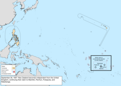 |
| November 16, 1907 | Indian Territory and Oklahoma Territory were combined and admitted as the forty-sixth state, Oklahoma.[fv][437][HJ] | 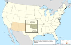 |
| April 11, 1908 | A treaty with the United Kingdom on behalf of Canada redefined their maritime borders,[438] making Horseshoe Reef Lighthouse in Lake Erie contiguous with American waters.[CN] | not mapped |
| January 1, 1909 | The new Constitution of Michigan included some area of Wisconsin within its definition of Michigan.[HK][439] | 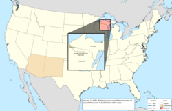 |
| February 21, 1910 | The Supreme Courtruled that the Maryland–West Virginia border followed the Deakins Line, surveyed around 1788 but disputed by Virginia and West Virginia.[440][441][HL] | 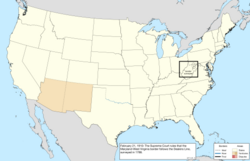 |
| August 20, 1910 | A treaty with the United Kingdom on behalf of Canada refined the maritime border in Passamaquoddy Bay;[fw][443][444] the border ran through Pope's Folly Island,[445] and was adjusted to run east of the island. | not mapped |
| July 7, 1911 | United States Naval Station, Tutuila, was renamed American Samoa;[fx] the naval station itself continued to operate under that name. | 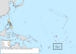 |
| January 6, 1912 | New Mexico Territory was admitted as the forty-seventh state, New Mexico.[fy][453][HN][HO] | 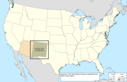 |
| February 14, 1912 | Arizona Territory was admitted as the forty-eighth state, Arizona.[fz][344][HN][HP] | 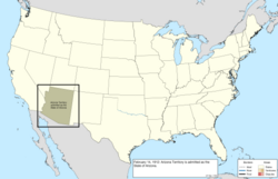 |
| August 24, 1912 | The District of Alaska was reorganized as Alaska Territory.[267][HQ] | 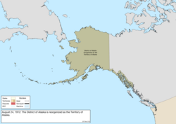 |
| February 11, 1915 | The borders of the Panama Canal Zone were explicitly defined.[ga][gb][456][457] | 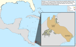 |
| May 27, 1915 | An area around the mouth of the Rio Chagres was annexed to the Panama Canal Zone.[458][459] | not mapped |
| December 8, 1915 | The region between the Rio Chagres and Caribbean Sea was annexed to the Panama Canal Zone.[460][461] | |
| June 22, 1916 | The Corn Islands were leased from Nicaragua for a period of 99 years;[gc][431] however, this was not a full transfer of sovereignty, and the islands were never administered as an insular area.[463] | 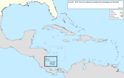 |
| August 29, 1916 | The Philippines were reorganized.[HT] | no change to map |
| March 2, 1917 | Porto Rico was reorganized.[HU] | no change to map |
| March 31, 1917 | The Danish West Indies were purchased from Denmark, becoming the United States Virgin Islands.[gd][ge][467] | 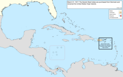 |
| July 12, 1918 | A small parcel was annexed from Punta Paitilla in Panama City to the Panama Canal Zone.[468][469][470][471] | not mapped |
| August 21, 1918 | A region between the Rio Chagres and the Quebrada Majagual was annexed to the Panama Canal Zone.[468][472] | 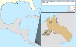 |
| September 13, 1918 | Minnesota and Wisconsin exchanged islands in the Mississippi River, ceding Island Seventytwo to Winona, Minnesota, and Barron's Island to La Crosse, Wisconsin.[225][HX] | not mapped |
| December 15, 1918 | The survey of the Alaska–Canada border along 141° west was submitted.[414] | 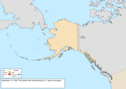 |
| September 18, 1919 | Part of the island of Largo Remo and several nearby islands were annexed to the Panama Canal Zone.[473][474] | 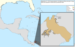 |
| June 16, 1920 | A small area on the island of Taboga Island was annexed to the Panama Canal Zone.[475][476] | not mapped |
| June 30, 1921 | The "Wedge" dispute between Delaware and Pennsylvania was resolved in Delaware's favor.[gf][75][479] The disputed area was a small region bounded on the west by Maryland, the north by the Mason-Dixon Line that defined the southern border of Pennsylvania, and the west by the Twelve-Mile Circle that defined the border of Delaware, and became an issue after a survey in 1850 provisionally assigned it to Pennsylvania.[480] | 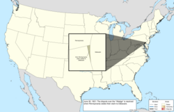 |
| March 1, 1922 | Colombiarecognized the independence of Panama.[gg] | 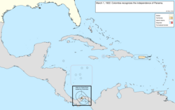 |
| October 8, 1923 | Michigan expanded its claim to Wisconsin territory.[HK] | 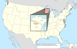 |
| November 15, 1923 | The Swan Islands were claimed by Honduras.[483] | 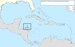 |
| February 1, 1924 | The future area for Madden Lake was annexed to the Panama Canal Zone.[456][484] | 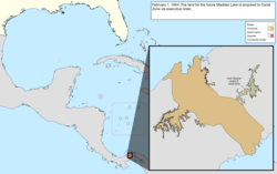 |
| March 4, 1925 | Swains Island was assigned to American Samoa.[270][IC] | 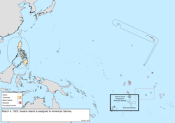 |
| July 17, 1925 | The border with Canada was slightly adjusted.[gh][gi][486] | not mapped |
| March 1, 1926 | The Supreme Court resolved the conflict between Michigan and Wisconsin in the favor of Wisconsin.[HK] | 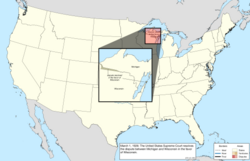 |
| November 22, 1926 | The Supreme Court defined the Michigan–Wisconsin border, transferring all islands south of the Quinnesec Falls on the Menominee River to Wisconsin, and all islands north of the falls to Michigan; however, an error in the border description introduced a small overlap between the two states over several islands in Lake Michigan north of the Door Peninsula.[IE] | 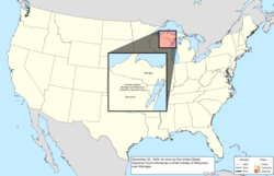 |
| July 18, 1927 | A small area of the islands of Taboga and Taboguilla were annexed to the Panama Canal Zone.[487] | not mapped |
| October 26, 1927 | Two bancos along the Colorado River were ceded from Mexico to Arizona.[488] | |
| December 5, 1927 | The "Country Club Dispute" between New Mexico and Texas, over the correct path of the Rio Grande in 1850, was resolved in Texas' favor.[489][490][IF] | 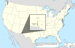 |
| April 4, 1928 | The Island of Palmas Case was decided in the favor of the Netherlands, ceding Palmas to the Dutch East Indies.[418] | 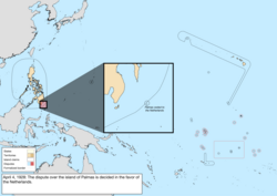 |
| September 24, 1928 | A small area near Las Minas Bay was annexed to the Panama Canal Zone.[491] | not mapped |
| March 17, 1930 | The survey of the Oklahoma–Texas border was approved by the Supreme Court.[492][IG] | 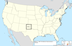 |
| July 22, 1930 | Small areas on Jicarita Island and at Punta Morro de Puercos were annexed to the Panama Canal Zone.[491] | not mapped |
| April 15, 1931 | A region around the soon-to-be-built Madden Dam was annexed to the Panama Canal Zone.[491] | 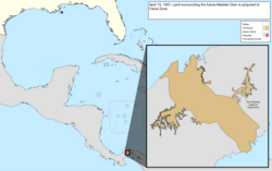 |
| May 3, 1932 | A small area in Punta Paitilla was ceded from the Panama Canal Zone to Panama.[IH] | not mapped |
| May 17, 1932 | Porto Rico was renamed Puerto Rico.[II] | 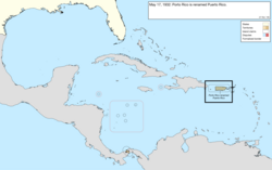 |
| December 13, 1932 | The Mangsee Islands and seven of the Turtle Islands were ceded by the United Kingdom to the Philippines.[gj] | 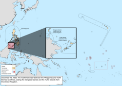 |
| November 15, 1935 | The Insular Government of the Philippine Islands was reorganized as the Commonwealth of the Philippines.[IK] | 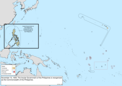 |
| March 16, 1936 | The de jure overlap between Michigan and Wisconsin was resolved by the Supreme Court.[IL] | 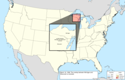 |
| May 13, 1936 | Baker Island, Howland Island, and Jarvis Island were placed under the Department of the Interior,[270][IM] after which the British claim to Jarvis Island fell dormant. | 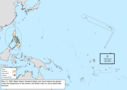 |
| June 22, 1936 | The United States Virgin Islands were organized.[IN] | 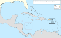 |
| August 17, 1936 | Malden Island was claimed by the United Kingdom.[gk] | 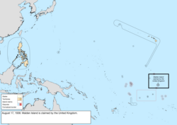 |
| April 6, 1939 | The condominium of the Canton and Enderbury Islands was established with the United Kingdom.[270][IO] | 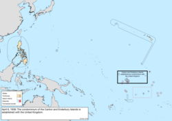 |
| July 27, 1939 | Panama gained a sovereign corridor from the Panama Canal Zone connecting Colón with the rest of Panama, along with a three-dimensional "tube" of sovereignty for a future crossing over an American highway, and a corridor around the road from the Canal Zone border to Madden Dam was annexed to the Canal Zone.[gl] | 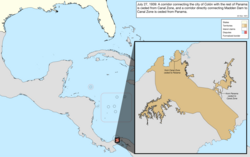 |
| August 16, 1939 | This is the earliest known date for when the United States began claiming Fakaofo, Funafuti, Hull Island, Niulakita, Nukufetau, and Nukulaelae.[499] At least Hull was claimed by the United Kingdom.[500] | 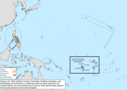 |
| December 10, 1941 | Governor George McMillin surrendered Guam to the Japanese military.[501] | not mapped |
| December 23, 1941 | The garrison on Wake Island surrendered to the Japanese military.[502] | not mapped |
| March 26, 1942 | The government of the Philippines evacuated in the face of Japanese advance; a government-in-exile would be established in Washington, D.C., on May 17, 1942.[503] | not mapped |
| October 14, 1943 | The Second Philippine Republic was established as a puppet state of Japan.[503] | not mapped |
| August 10, 1944 | Guam was captured from Japan.[501] | not mapped |
| August 17, 1945 | The Second Philippine Republic was dissolved; the process of re-establishing the Commonwealth government on Philippine soil had started on October 23, 1944.[503] | not mapped |
| September 4, 1945 | The Japanese garrison on Wake Island surrendered to the United States.[502] | not mapped |
1946–present (Decolonization)
| Date | Event | Change map |
|---|---|---|
| July 4, 1946 | The Commonwealth of the Philippinesbecame independent as the Republic of the Philippines.[gm][IS] | 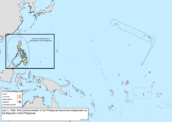 |
| July 18, 1947 | The Trust Territory of the Pacific Islands was entrusted by the United Nations.[gn][507] | 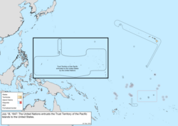 |
| January 1, 1949 | The Tokelau Islands were incorporated into New Zealand, transferring the claims to Atafu, Fakaofo, and Nukunonu.[IV] | 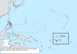 |
| August 1, 1950 | Guam was organized.[421][IW] | 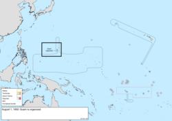 |
| August 3, 1950 | Kansas and Missouri exchanged small areas along the Missouri River due to shifts in the river following a flood in 1944.[go][202] | not mapped |
| November 26, 1951 | The survey of the Alaska–Canada border along Alaska panhandle was submitted.[509][510] | 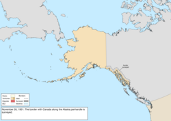 |
| July 25, 1952 | Puerto Rico adopted a constitution, becoming the Commonwealth of Puerto Rico.[417][IZ] | 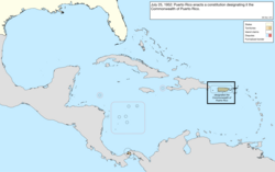 |
| May 6, 1954 | Alabama and Florida defined their border around the mouth of the Perdido River.[gp][135] | not mapped |
| July 22, 1954 | The United States Virgin Islands were reorganized.[JD] | no change to map |
| April 11, 1955 | The corridor connecting Colón with the rest of Panama was adjusted, and several three-dimensional "tubes" of sovereignty were created, allowing Panamanian bridges to pass over the Panama Canal Zone.[JE][514] | not mapped |
| August 23, 1955 | Punta Paitilla, the area held on Taboga Island, and the remaining American holdings in Colón and Panama City were ceded to Panama.[456][JF][516] | 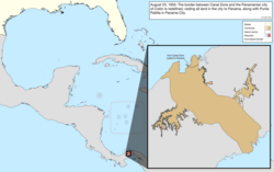 |
| January 3, 1959 | Alaska Territory was admitted as the forty-ninth state, Alaska.[517][JG] | 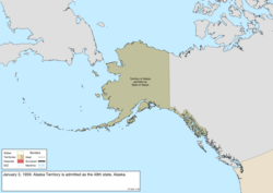 |
| August 21, 1959 | Most of Hawaii Territory was admitted as the fiftieth state, Hawaii;[518][JH]Palmyra Atoll remained a territory.[342][343] | 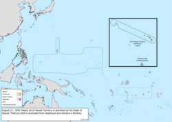 |
| August 25, 1961 | A small area cut off from Minnesota by flood control alterations to the Red River of the North was ceded to North Dakota.[gq][302] | not mapped |
| January 14, 1964 | The Chamizal, a tract between El Paso, Texas, and Ciudad Juárez, Chihuahua, was divided between the United States and Mexico.[gr][522] | not mapped |
| August 4, 1965 | The Cook Islands became self-governing from New Zealand, transferring the claims to Manihiki, Penrhyn, Pukapuka, and Rakahanga. | 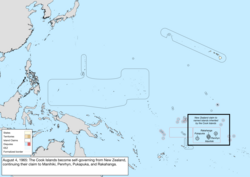 |
| December 30, 1966 | Land on Diego Garcia in the Indian Ocean was leased from the United Kingdom for use as a military base.[431][JM] | not mapped |
| April 25, 1971 | The lease of the Corn Islands from Nicaragua was terminated.[gs][431][463] | 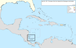 |
| September 1, 1972 | The United States recognized the sovereignty of Honduras over the Swan Islands.[gt][270][463] | 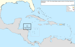 |
| May 26, 1977 | Several parcels were exchanged with Mexico along the Rio Grande under the terms of the Boundary Treaty of 1970, including the Horcón Tract, on which the town of Río Rico was located.[gu][gv][528] | not mapped |
| December 16, 1977 | The maritime border with Cuba was provisionally defined.[gw][444] | 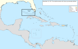 |
| October 1, 1978 | Tuvalu became independent from the United Kingdom, transferring the claims to Funafuti, Nukufetau, Nukulaelae, and Niulakita. | 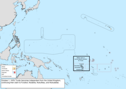 |
| July 12, 1979 | The Republic of Kiribati became independent from the United Kingdom, transferring the claims to Birnie Island, Canton Island, Caroline Island, Christmas Island, Enderbury Island, Flint Island, Gardner Island, Hull Island, Malden Island, McKean Island, Phoenix Island, Starbuck Island, Sydney Island, and Vostok Island, and dissolving the condominium of the Canton and Enderbury Islands. | 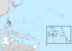 |
| October 1, 1979 | The Panama Canal Zone was ceded to Panama.[gx] The countries continued to share operational control of the canal until December 31, 1999, when it would be fully turned over to Panama. The United States retained control over several hundred small parcels that would be turned over in piecemeal fashion over time. | 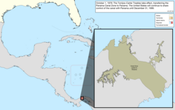 |
| November 24, 1980 | The maritime border with Venezuela was defined.[gy][444] | 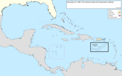 |
| September 17, 1981 | The claims to Quita Sueño Bank, Roncador Bank, and Serrana Bank were abandoned.[gz][463] | 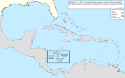 |
| March 10, 1983 | An exclusive economic zone was proclaimed, extending up to 200 nautical miles.[533][JS] | not mapped |
| September 3, 1983 | The maritime border with the New Zealand territory of Tokelauwas defined, and their sovereignty was recognized over Atafu, Fakaofo, and Nukunonu.[ha][444][463] | 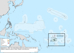 |
| September 8, 1983 | The maritime border with the Cook Islandswas defined, and their sovereignty was recognized over Manihiki, Penrhyn, Pukapuka, and Rakahanga.[hb][444][463] | 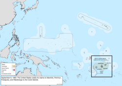 |
| September 23, 1983 | The sovereignty of Kiribatiwas recognized over Birnie Island, Canton Island, Caroline Island, Christmas Island, Enderbury Island, Flint Island, Gardner Island, Hull Island, Malden Island, McKean Island, Phoenix Island, Starbuck Island, Sydney Island, and Vostok Island.[hc][463] The sovereignty of Tuvalu was recognized over Funafuti, Nukufetau, Nukulaelae, and Niulakita.[hd][463] | 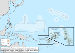 |
| October 12, 1984 | The International Court of Justice returned a judgment on the maritime border with Canada in the Gulf of Maine.[444][JX] | not mapped |
| October 21, 1986 | The Marshall Islands District of the Trust Territory of the Pacific Islands became an independent, freely associated state, as the Republic of the Marshall Islands.[he] The Marshall Islanders had claimed Wake Island since at least 1973.[539] | 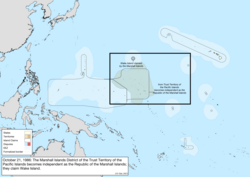 |
| November 3, 1986 | The Chuuk, Pohnpei, and Yap Districts of the Trust Territory of the Pacific Islands became an independent, freely associated state, as the Federated States of Micronesia.[hf] The Mariana Islands District, having already established a covenant with the United States,[hg] remained a territory and became the Commonwealth of the Northern Mariana Islands. | 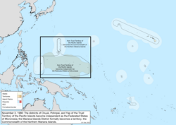 |
| June 15, 1990 | The maritime border with the Soviet Union was provisionally defined.[hh][444] | 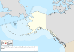 |
| December 22, 1990 | The United Nations Security Councilterminated the trusteeship over the Marshall Islands, Federated States of Micronesia, and Northern Mariana Islands.[KD] | no change to map |
| July 5, 1994 | The maritime border with Japan was defined.[hi] | 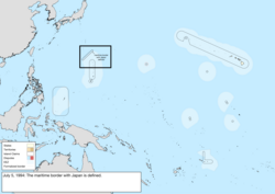 |
| October 1, 1994 | The remaining district of the Trust Territory of the Pacific Islands, the Palau District, became an independent, freely associated state, as the Republic of Palau.[hj] | 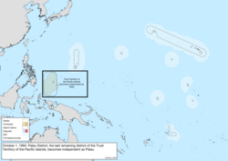 |
| November 10, 1994 | The United Nations Security Councilterminated the trusteeship over Palau, formally dissolving the Trust Territory of the Pacific Islands.[KH] | no change to map |
| June 1, 1995 | The maritime borders with territories of the United Kingdom in the Caribbean Seawere defined.[hk][444] | 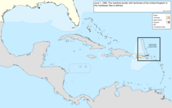 |
| November 13, 1997 | The maritime border with Mexico was defined.[hl][444] | 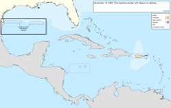 |
| May 26, 1998 | The Supreme Courtruled that reclaimed land added to Ellis Island since 1834 belonged to New Jersey; the 1834 boundary remained part of New York.[KL] | not mapped |
| December 31, 1999 | All remaining parcels of the Panama Canal Zone were ceded to Panama.[546] | not mapped |
| January 17, 2001 | The maritime border with Mexico on the continental shelf in the western Gulf of Mexico beyond 200 nautical miles was defined.[hm][444] | 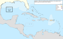 |
| November 24, 2009 | Texas and Mexico exchanged small parcels along the Rio Grande, with six islands being ceded to Mexico, and three islands and two bancos being ceded to Texas.[hn] | not mapped |
| October 7, 2014 | The maritime border with Niue was defined.[ho][444] | 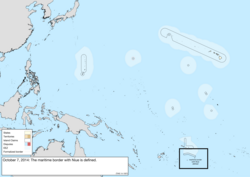 |
| January 1, 2017 | The North Carolina–South Carolina border was resurveyed.[552][553] | not mapped |
| July 18, 2019 | The maritime border with the Federated States of Micronesia was defined.[hp] | 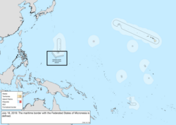 |
| July 19, 2019 | The maritime border with Kiribati was defined.[hq] | 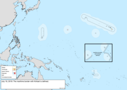 |
| November 30, 2020 | The State of Rhode Island and Providence Plantations adopted a constitutional amendment renaming itself the State of Rhode Island.[556][557] | 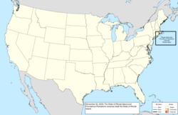 |
Bancos along the Rio Grande
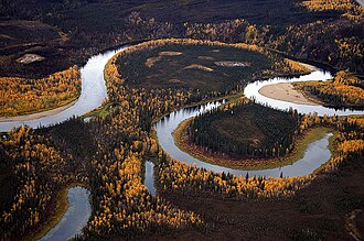
The Banco Convention of 1905 between the United States and Mexico allowed, in the event of sudden changes in the course of the Rio Grande (as by flooding), for the border to be altered to follow the new course.[558] The sudden changes often created bancos (land surrounded by bends in the river that became segregated from either country by a cutoff, often due to rapid accretion or avulsion of the alluvial channel), especially in the Lower Rio Grande Valley. When these bancos are created, the International Boundary and Water Commission investigates if land previously belonging to the United States or Mexico is to be considered on the other side of the border.[559] In all cases of these adjustments along the Rio Grande under the 1905 convention, which occurred on 37 different dates from 1910 to 1976, the transferred land was minuscule (ranging from 1-acre (4,000 m2) to 646 acres (261 ha)) and uninhabited.[560][561][562]
See also

- List of territorial disputes
- Geography of the United States
- Territories of the United States
- Historic regions of the United States
- American frontier
- List of U.S. state partition proposals
- List of U.S. states by date of admission to the Union
- Movements for the annexation of Canada to the United States
- Manifest destiny
- National Atlas of the United States
- Ostend Manifesto (annexation of Cuba)
- List of territorial claims and designations in Colorado
- Territorial evolution of Arizona
- Territorial evolution of California
- Territorial evolution of Idaho
- Territorial evolution of Montana
- Territorial evolution of Nevada
- Territorial evolution of New Mexico
- Territorial evolution of North Dakota
- Territorial evolution of Oregon
- Territorial evolution of South Dakota
- Territorial evolution of Utah
- Territorial evolution of Washington
- Territorial evolution of Wyoming
- Territories of the United States on stamps
- List of United States treaties § U.S.–Native American treaties
Notes
- ^Even though there were borders drawn as far as the Mississippi River, the early United States was only settled along the east coast. As the states were surveyed, these lines were solidified, though often missing their intended mark. By the time the country was surveying its western acquisitions in the mid-19th century, the process had improved and was being conducted through the United States General Land Office; the western borders were rarely controversial. Border surveys are given their own entry in this list if they were performed east of the Mississippi River, involved legislation, or were otherwise notable; the rest are detailed in footnotes in the relevant statehood or cession entries.
- ^The boundaries of the country would be defined in the Treaty of Paris of 1783, with the general claim being everything north of the Floridas, south of Quebec, and east of the Mississippi River.[1]
- ^The Connecticut General Assembly adopted the name "State of Connecticut" during their session beginning October 10, 1776.[2][3]
- ^Georgia formally became the "State of Georgia" with the adoption of their constitution on February 5, 1777.[8][9]
- ^Maryland formally became the "State of Maryland" with the adoption of their constitution around November 11, 1776.[11][12]
- ^The Massachusetts Bay House of Representatives adopted the name "State of Massachusetts Bay" on December 7, 1776.[14][15]
- ^New Hampshire formally adopted the name "State of New Hampshire" on September 11, 1776.[17][B]
- ^New Jersey formally adopted the name "State of New Jersey" on September 20, 1777.[21][C]
- ^New York formally became the "State of New York" with the adoption of their constitution on April 20, 1777;[24] the New York Provincial Congress adopted the name "Convention of the Representatives of the State of New-York" on July 10, 1776.[25][26]
- ^North Carolina formally became the "State of North Carolina" with the adoption of their constitution on December 18, 1776.[28][29]
- ^Pennsylvania was first formally referred to as the "State of Pennsylvania" on July 25, 1776.[31][32]
- ^Rhode Island formally adopted the name "State of Rhode Island and Providence Plantations" on July 20, 1776.[34][35]
- ^South Carolina formally became the "State of South Carolina" with the adoption of their constitution on March 19, 1778.[39][40]
- ^Virginia formally became the "Commonwealth of Virginia" with the adoption of their constitution on June 29, 1776.[42][43]
- ^Sources disagree on whether the constitution took effect on September 20[50] or September 21.[51]
- ^Sources disagree on whether this formally occurred on January 15[54] or January 17.[55]
- ^The New Hampshire towns petitioning to join Vermont were: Apthorp (now Littleton), Bath, Canaan, Cardigan (now Orange), Cornish, Dresden (now part of Hanover), Enfield, Franconia, Gunthwaite (now Lisbon), Haverhill, Landaff, Lebanon, Lyman, Lyme, Orford, and Piermont.[58]
- ^The New Hampshire towns petitioning to join Vermont were: Acworth, Alstead, Bath, Cardigan (now Orange), Charlestown, Chesterfield, Claremont, Cornish, Croydon, Dorchester, Dresden, Franconia, "Gilsom" (likely Gilsum), Grafton, Grantham, Gunthwaite (now Lisbon), Hanover, Haverhill, Hinsdale, Landaff, Lancaster, Lebanon, "Leinster" (possibly Lempster), Lincoln, Lyman, Lyme, Marlow, Newport, Piermont, Plainfield, Richmond, Saville (now Sunapee), Surry, Walpole, and Westmoreland.[65]
- ^The New York towns petitioning to join Vermont were: "Black-Creek" (unknown; possibly is or is near Hebron), Cambridge, Fort Edward, Granville, "Greenfield" (unknown; there is a town named Greenfield but it is west of the Hudson River, which was explicitly the western extent of the West Union), Hoosick, Kingsbury, "Little Hoosack" (unknown; presumably near Hoosick), Saratoga, "Scorticook" (possibly Schaghticoke), Skeensborough (now Whitehall), and "Upper-White-Creek" (probably White Creek).[66]
- ^The Supreme Court noted in 1933 that this occurred on February 22,[E] but a 1823 printing of the Vermont State Papers indicates it was February 23.[69]
- ^New York made the cession on March 1, 1781, and Congress accepted it on October 29, 1782.[F]
- ^It is unclear from where this claim came; many sources state that New York had surrendered it, but few elaborate on how it was obtained, beyond some saying it was a cession from the Six Nations.[73][74]
- ^Virginia made the cession during the session beginning October 20, 1783, and Congress accepted it on March 1, 1784.[G]
- ^The agreement was made provisionally on August 31, 1779;[80] approved by Virginia on June 23, 1783; and approved by Pennsylvania on April 1, 1784.[81]
- ^The treaty was signed September 3, 1783, ratified January 14, 1784, and entered into force May 12, 1784.[H]
- ^The treaty established the boundaries of the new country, from the Bay of Fundy: up the "St. Croix River" (which river this referred to was disputed) to its source; north to the height of the land (the "Northwest Angle of Nova Scotia"); along the height of the land to the "northwesternmost Head" of the Connecticut River (which source this referred to was disputed); down that to 45° north; west to the St. Lawrence River; up that to the Great Lakes, through Lake Ontario, the Niagara River, Lake Erie, the Detroit River, Lake St. Clair, the St. Clair River, Lake Huron, and Lake Superior; to "Long Lake" (which lake this referred to was disputed) towards the Lake of the Woods; to the northwest angle of the Lake of the Woods; then west to the Mississippi River. However, the Lake of the Woods was north of the source of the Mississippi River; maps universally show this undefined boundary as a straight line, nearly straight south, between the two points. From there, it followed the Mississippi River down to 31° north; east to the Chattahoochee River; down that to the confluence of the Chattahoochee and Flint rivers; a line from there to the source of the St. Mary's River; then down that to the Atlantic Ocean.[H]
- ^All sources show Georgia enlarging to fill the new borders,[86] but an act in 1798 referred to the federal and Georgia governments having "interfering claims" over the region.[I]
- ^There is some confusion over if the state was named Franklin or Frankland, complicated by another attempt at a state in the region using the name Frankland.[88]
- ^Massachusetts made the cession on November 13, 1784, and Congress accepted it on April 19, 1785.[K]
- ^Massachusetts' ceded claim was a strip west of New York and Pennsylvania stretching to the Mississippi River, bounded by the latitudes of Massachusetts Bay Colony's original charter: on the north by a line west from one league north of Lake Winnipesaukee, and on the south by a line west from Massachusetts' southwest corner.[74]
- ^Connecticut made the cession on May 11, 1786, and Congress accepted it on September 14, 1786.[L]
- ^Connecticut's ceded claim was a strip west of 120 miles west of Pennsylvania (the western border of its Western Reserve) stretching to the Mississippi River, bounded by 41° north and the southern edge of Massachusetts' western claim, roughly 42°2′ north.[74]
- ^ abcdefghijThis is the date used to consider the border as formally surveyed, as no dates of government approval are known.
- ^Massachusetts noted in a resolve passed on November 21, 1787, that the surveyors agreed on their report on July 21, 1787.[O]
- ^South Carolina made the cession on March 8, 1787,[P] and Congress accepted it on August 9, 1787.[Q]
- ^No date of approval by New York is known.
- ^North Carolina made the cession on December 22, 1789,[74] and the federal government accepted it on April 2, 1790.[T]
- ^Surveyor Andrew Ellicott wrote several letters on October 11, 1790, referring to his work having been completed the previous day,[113][114] but no dates of government approval are known.
- ^Vermont ratified the United States Constitution on January 10, 1791.[115]
- ^The New York–Vermont border was Lake Champlain, the Poultney River, then south following borders of townships.[116]
- ^The district did not have a formal name; in September 1791, the commissioners in charge of planning the city would term it the "Territory of Columbia".[117]
- ^Maryland made the cession on December 23, 1788,[X] and, after the district's borders were set, formally ceded the specific parcel on December 19, 1791.[Y] Virginia made the cession on December 3, 1789.[120]
- ^The act approving the sale was approved on January 3, 1792.[Z] President George Washington presented the deed to Pennsylvania on March 3, 1792,[122] and most sources use this date for the formal transfer;[52][123] however, some use April 23.[124][125]
- ^Virginia agreed to cede the territory to the federal government on December 18, 1789.[AA]
- ^The new Kentucky–Virginia border was, from the south: north along the Cumberland Mountains and Pine Mountain to the Russell Fork; northeast to the Tug Fork; then down that to the Big Sandy River and to the Ohio River.[126]
- ^The treaty was signed October 27, 1795, ratified March 7, 1796, and entered into force April 25, 1796.[AC]
- ^No date of approval by Kentucky is known.
- ^Surveyor Andrew Ellicott wrote, "The reports with the maps... being completed on the 10th of April;"[140] no dates of government approval are known.
- ^The act accepting the cession was approved on April 28, 1800,[AF] and Connecticut approved on May 30, 1800.[142]
- ^The new Indiana Territory–Northwest Territory border was a line from the mouth of the Kentucky River to Fort Recovery, then north.[143]
- ^Georgia's commissioners agreed to cede the region on April 24, 1802, and the legislature approved on June 16, 1802.[AI]
- ^The new Georgia–federal border was: up the Chattahoochee River to its great bend (near West Point), then a line from there towards and past Nickajack until it reached the Tennessee River, and up that to Tennessee.[146]
- ^On February 19, 1803, the president signed an act approving Ohio's boundaries and constitution;[AJ] however, Congress never passed a formal resolution admitting it as a state. When this was noticed in 1953, Congress retroactively set the date of statehood to March 1, 1803,[AK] the date the state legislature first met.[147]
- ^The western border of Ohio had been surveyed in 1799 as far north as Fort Recovery.[148]
- ^The survey was approved by Virginia on January 22, 1803, and by Tennessee on November 3, 1803.[AM]
- ^The final report of the commissioners was delivered on November 30, 1803;[155] no dates of government approval are known.
- ^The treaty was signed April 30, and ratified and entered into force October 21, 1803.[AN] The formal turnover occurred in New Orleans on December 20, 1803,[158] and would be recognized in St. Louis in Upper Louisiana on March 10, 1804, which would be known as known as Three Flags Day.[159]
- ^There was some question as to whether the purchase also included the basins of the Missouri River and the Red River of the North,[161] but the question was not relevant before the Treaty of 1818 definitively settled the border.
- ^The western border of West Florida was a series of waterways, mainly the Mississippi, Iberville, and Amite Rivers, and Lakes Pontchartrain and Maurepas.[162]
- ^The new Illinois Territory–Indiana Territory border was, up the Wabash River to Post Vincennes, then north.[166]
- ^The northern border of Louisiana had been surveyed in 1806.[171]
- ^The cession was approved by the federal government on April 14, 1812,[AV] and accepted by Louisiana on August 4, 1812.[AW]
- ^Indiana was defined as the territory north of the Ohio River and east of the Wabash River, but while the territory's line turned north at Post Vincennes, the state's border continued up the Wabash until it reached the point where a line drawn north from Post Vincennes would last intersect the river as it weaved back and forth. The northern border of the state was a line east from 10 miles north of the southern tip of Lake Michigan, until it reached the meridian that formed Ohio's western border, which was a line drawn north from the mouth of the Great Miami River.[150]
- ^The new Alabama Territory–Mississippi Territory border was, from the north: up the Tennessee River to Bear Creek (around today's Pickwick Lake); a line to the northwestern corner of Washington County, Mississippi Territory; then south.[171]
- ^The Kingdom of Great Britainunited with the Kingdom of Ireland on January 1, 1801, becoming the United Kingdom.
- ^The treaty was signed October 20, 1818, ratified January 28, 1819, and entered into force January 30, 1819.[BC]
- ^Oregon Country had no defined northern limit; it can be assumed that it did not encroach upon Russian-held lands, and 54°40′ north would be established as the border in 1825.
- ^The new Arkansaw Territory–Missouri Territory border was, from where the Mississippi River meets 36° north: west to the St. Francis River, up that to 36°30′ north, then west.[185]
- ^The compact between the states was signed on February 2, 1820; approved by Kentucky on February 11, 1820;[BI] and approved by the federal government on May 12, 1821.[BJ]
- ^Alabama's southwestern border was defined as a north-south line, but the statehood act called for a survey to confirm if this encroached on counties established by Mississippi; it was found to do so, and the southern terminus of the border was moved about 3.8 miles to the east.[89]
- ^The treaty was signed February 22, 1819, and ratified and entered into force February 22, 1821.[BK]
- ^The new border was, from the Gulf of Mexico: up the Sabine River to 32° north; north to the Red River; up that to 100° west; north to the Arkansas River; up that to its source; north to 42° north; then west to the Pacific Ocean.[162]
- ^The new Missouri–federal border was, from the mouth of the Des Moines River: up the river to a point west of the Des Moines Rapids on the Mississippi River, west to a point north of the mouth of the Kansas River, then south.[174] The northern border had been surveyed in 1816,[202] and the survey of the western border south of the Kansas River would be completed on October 16, 1823.[202][203]
- ^The survey was approved by North Carolina during the session beginning November 19, 1821;[BM] no date of approval by Tennessee is known.
- ^The survey was approved by Kentucky on November 13, 1821, and by Tennessee on November 22, 1821.[194]
- ^The treaty was signed April 17, 1824, ratified January 7, 1825, and entered into force January 11, 1825.[BP]
- ^The treaty was signed May 6, and ratified May 28, 1828.[BQ]
- ^The new Arkansas Territory–federal border was, from the north: a line from the southwestern corner of Missouri to a point on the Arkansas River "100 paces east" of Fort Smith, as the border of the lands of the Eastern Choctaw, then south.[185] However, the Arkansas Supreme Court determined in 1909 that the "100 paces east" was a clerical error, and that logically it should have said "100 paces west".[BR] The western border of Arkansas Territory south of Fort Smith had been surveyed in 1825.[210]
- ^The survey was approved by Maine on February 28, 1829, and by New Hampshire on July 1, 1829.[211]
- ^The survey was approved by Kentucky on February 9, 1828, and by Tennessee on December 20, 1831.[213]
- ^Authorities with Indian Stream communicated to the British government on August 5, 1835, that they had accepted New Hampshire jurisdiction;[216] a resolution to this effect was approved by the citizens of Indian Stream on April 2, 1836.[215]
- ^The western border north of Fort Smith had been surveyed in 1831.[210]
- ^The northern half of the Indiana–Ohio border was surveyed in 1817 along with the northern border.[152]
- ^The new Michigan Territory–Wisconsin Territory border was, from Lake Superior: up the Montreal River to Lac Vieux Desert; a line to the source of the Menominee River; then down that to Green Bay. However, this definition was impossible, as the Montreal River ended long before it reached Lac Vieux Desert.[218]
- ^The cession was approved by the federal government on June 7, 1836,[BY] accepted by Missouri on December 16, 1836,[BZ] and proclaimed by the president on March 28, 1837.[CA]
- ^No date of approval by Mississippi is known.
- ^The survey was approved by Georgia on December 8, 1826,[227] and by Alabama on January 27, 1840.[228]
- ^The treaty was signed August 9, ratified August 22, and entered into force October 13, 1842.[CF]
- ^The new northeastern border was, from Passamaquoddy Bay: up the St. Croix River to its source; north to the St. John River; up that to the St. Francis River; up that to its source outlet at Lake Pohenegamook; southwest to the northwest branch of the St. John River; a line from there to where the St. John River crosses 46°25′ north; up the river to its source; along the highlands to the source of Halls Stream, then down that to 45° north.[231]
- ^The new northern border was, from Lake Superior: up the Pigeon River to the many lakes and rivers of the Boundary Waters, eventually reaching the Rainy River; then down that to the Lake of the Woods.[231]
- ^Texas formally handed over sovereignty to the United States in a ceremony on February 19, 1846.[233]
- ^While many sources state that Mexico recognized the independence of the eastern portion of Texas, the treaties were rejected by the Mexican government.
- ^The treaty was signed June 15, ratified June 19, and entered into force July 17, 1846.[CI]
- ^The survey of the northern border would be completed on August 9, 1852.[237][238]
- ^The retrocession act was approved on July 9, 1846,[CK] residents of Alexandria County were proclaimed by the president on September 7, 1846, to have agreed to it,[CL] and Virginia took possession on March 20, 1847.[CM]
- ^Article III of the Treaty of 1908 noted that the survey was completed on June 28, 1847.[CN]
- ^The new Wisconsin–Wisconsin Territory border was, from Lake Superior: up the St. Louis River to its first rapids; south to the St. Croix River; then down that to the Mississippi River.[242]
- ^The treaty was signed February 2, ratified March 16, and entered into force May 30, 1848.[CR]
- ^The new international border was, from the Rio Grande: along the southern and western border of New Mexico until it met the Gila River; down that to the Colorado River; then a line to a point one league south of the port of San Diego. However, the southern border of New Mexico was in question, with the American claim being 31°52′ north, and the Mexican claim being 32°22′ north.[247]
- ^The federal government consented on July 5, 1848,[CV] and Texas approved on November 24, 1849.[251]
- ^The new California–federal border was, from the north: south along 120° west to 39° north; a line to where the Colorado River intersects 35° north; then down the Colorado River.[253]
- ^Part of Utah Territory overlapped with the portion of Texas that would be purchased on December 13, 1850.
- ^The new Texas–federal border was, from the south: up the Rio Grande to 32° north; east to 103° west; north to 36°30′ north; then east.[257]
- ^The new New Mexico Territory–federal border was, from 36°30′ north and 103° west: north to 38° north; then west to the summit of the San Juan Mountains (called then the Sierra Madre).[258]
- ^The treaty was signed December 30, 1853, ratified June 29, 1854, and entered into force June 30, 1854.[DD]
- ^The new international border was, starting from where the Rio Grande crosses 31°47′ north: west 100 miles; south to 31°20′ north; west to 111° west; a line to a point on the Colorado River 20 miles below the mouth of the Gila River; then up the Colorado River.[267]
- ^Massachusetts made the cession on May 14, 1853, New York accepted it on July 21, 1853, the federal government consented on January 8, 1855,[DF] and the cession was proclaimed on January 11, 1855.[269]
- ^The new Minnesota–federal border was, from the north: up the Red River to the Bois de Sioux River; up that to Lake Traverse and its southern tip; a line to Big Stone Lake and through that to its southern tip; then south.[237]
- ^Haiti claimed the island by name in its 1874 constitution,[DJ] and had considered it included in the "adjacent islands" claimed since the 1801 constitution.[DK]
- ^The new Oregon–Washington Territory border was, from the north, up the Snake River to the mouth of the Owyhee River, then south.[262] The border with California would be surveyed in 1870.[253]
- ^The claimed borders of Jefferson Territory were between 37° north, 43° north, 102° west, and 110° west.[282]
- ^Forty-six islands were claimed on February 8, 1860, with varying degrees of accuracy and provenance:[271]
- The islands that were accurately described and named: Birnie Island, Caroline Island, Flint Island, Gardner Island, Nassau, Palmyra Atoll, Penrhyn, Sydney Island, and Washington Island.
- The islands that were accurately described, with less common names: Atafu (recorded as "Duke of York Island"[284]); Butaritari (recorded as "Mackin or Makin"); Canton Island (recorded as "Mary's Island"[285]); Fanning Island (recorded as "America Islands"[286]); Kingman Reef (recorded as "Danger Rock"[287]); Manihiki (recorded as "Ganges Island" and "Humphrey's Island"[288]); Marakei (recorded as "Mathews Island"[289]); Nukunonu (recorded as "Clarence Island"[290]); Pukapuka (recorded as "Dangerous Islands"[291]); Rakahanga (recorded as "Rierson's Island"[292]); Swains Island (recorded as "Quiros Island"[293]); and Vostok Island (recorded as "Staver's Island"[294]).
- The rest appear to be phantom islands; Sarah Ann Island was sighted in 1917, but has since disappeared.[295]
- Enderbury Island, Phoenix Island, and Starbuck Island were re-bonded to the United States Guano Company, having been bonded to the Phoenix Guano Company on December 27, 1859.[296]
- ^The northern Kansas border had been surveyed by 1859.[298]
- ^The borders of Colorado Territory were parallels 37° north and 41° north, and Washington meridians25° west and 32° west.[283]
- ^The new Nebraska Territory–Dakota Territory border was, from the east: up the Missouri River to the Niobrara River; up that to the Keya Paha River; up that to 43° north; then west.[302]
- ^The law admitting the state required a presidential proclamation before it was to take effect,[DT] which sources say took place on May 21, 1861;[311] the closest known primary document is a statement from Jefferson Davis on July 20 stating that the proclamation had been made.[312]
- ^The treaty was signed October 2,[DY] and ratified December 21, 1861.[322]
- ^The treaty was signed October 4,[DZ] and ratified December 21, 1861.[324]
- ^The full description of the native party to the treaty was, "the Seneca tribe of Indians, formerly known as the Senecas of Sandusky, and the Shawnees of the tribe or confederacy of Senecas and Shawnees, formerly known as the Senecas and Shawnees of Lewistown, or the mixed bands of Senecas and Shawnees."[325]
- ^The treaty was signed October 7,[EA] and ratified December 23, 1861.[328]
- ^The treaty was signed August 1,[EB] and ratified December 23, 1861.[330]
- ^The treaty was signed July 12,[EC] and ratified December 31, 1861.[332]
- ^The full description of the native party to the treaty was, "The Pen-e-tegh-ca Band of the Ne-um or Comanches, and the tribes and bands of the Wich-i-tas, Cado-Ha-da-chos, Hue-cos, Ta-hua-ca-ros, A-na-dagh-cos, Ton-ca-wes, Ai-o-nais, Ki-chais, Shawnees and Delawares, residing in the said leased country."[334]
- ^The full description of the native party to the treaty was, "The No-co-ni, Ta-ne-i-weh, Ya-pa-rih-ca and Co-cho-tih-ca bands of the Ne-um, called by the white men the Comanches of the Prairies and the Staked Plain."[336]
- ^There were two treaties with the Comanche, one with the "Comanches and other Tribes and Bands"[ED][ds] and one with the "Comanches of the Prairies and Staked Plain."[EE][dt] Both were signed on August 12, 1861, and ratified on December 31, 1861.[337]
- ^The treaty was signed July 10,[EF], and ratified December 31, 1861.[332]
- ^The treaty was signed October 4,[EG] and ratified December 31, 1861.[340]
- ^The decree transferred land from the left bank of the Blackstone River to Rhode Island, including what is now East Providence, in exchange for land around Fall River being transferred to Massachusetts.[341]
- ^The Restored Government of Virginia gave its consent on May 13, 1862, the act admitting West Virginia was approved on December 31, 1862,[EK] and the president proclaimed on April 20, 1863, that it would become a state in sixty days.[EL]
- ^The Virginia counties that became West Virginia were: Barbour, Boone, Braxton, Brooke, Cabell, Calhoun, Clay, Doddridge, Fayette, Gilmer, Greenbrier, Hampshire, Hancock, Hardy, Harrison, Jackson, Kanawha, Lewis, Logan, McDowell, Marion, Marshall, Mason, Mercer, Monongalia, Monroe, Morgan, Nicholas, Ohio, Pendleton, Pleasants, Pocahontas, Preston, Putnam, Raleigh, Randolph, Ritchie, Roane, Taylor, Tucker, Tyler, Upshur, Wayne, Webster, Wetzel, Wirt, Wood, and Wyoming.[153]
- ^The Restored Government of Virginia gave its consent on January 31, 1863,[EM] West Virginia accepted on August 5, 1863,[EN], and the federal government consented after-the-fact on March 10, 1866.[EO]
- ^The Restored Government of Virginia gave its consent on February 4, 1863,[EP] West Virginia accepted on November 2, 1863,[EQ] and the federal government consented after-the-fact on March 10, 1866.[EO]
- ^The new Idaho Territory–Montana Territory border was, from the north: south along 39° west from Washington to the crest of the Bitterroot Range and the Rocky Mountains; then along that to the new tripoint with Dakota Territory.[352]
- ^The new Dakota Territory–Idaho Territory border was, from the south: north along 33° west from Washington to the crest of the Rocky Mountains, then northwest along that to the new tripoint with Montana Territory.[302]
- ^The northern border with Oregon would be surveyed in 1873 by the General Land Office.[304]
- ^The cession was approved by the federal government on May 5, 1866;[ET] the receipt of this specific grant was pre-approved in the Nevada constitution.[EU]
- ^The survey was approved by Florida on February 8, 1861,[EW] and by Georgia on December 13, 1866.[EX] The federal government would acknowledge the surveyed border on April 9, 1872.[EY]
- ^The cession was approved by the federal government on May 5, 1866,[ET] and accepted by Nevada on January 18, 1867.[EZ]
- ^The survey of the full eastern border would be completed on December 26, 1870.[249][361]
- ^The treaty was signed March 30, ratified May 28, and entered into force June 20, 1867.[FC] The cession was formally handed over on October 18, 1867.[364]
- ^The borders of the Department of Alaska were, from the Dixon Entrance: Up the Portland Channel to 56° north; then along the "summit of the mountains situated parallel to the coast" (the definition of which was disputed) to 141° west; then north.[267]
- ^The readmission was contingent on Florida ratifying the Fourteenth Amendment to the United States Constitution;[FE] they were proclaimed on July 11, 1868, to have done so before the readmission act's passage.[FF]
- ^The readmission was contingent on North Carolina ratifying the Fourteenth Amendment to the United States Constitution;[FE] they were proclaimed on July 11, 1868, to have done so on July 4, 1868.[FF]
- ^The readmissions were contingent on the states ratifying the Fourteenth Amendment to the United States Constitution;[FE] they were proclaimed on July 18, 1868, to have done so on July 9, 1868.[FG]
- ^The readmission was contingent on Alabama ratifying the Fourteenth Amendment to the United States Constitution;[FE] they were proclaimed on July 20, 1868, to have done so on July 13, 1868.[FH]
- ^The readmission was contingent on Georgia ratifying the Fourteenth Amendment to the United States Constitution;[FE] they were proclaimed on July 27, 1868, to have done so on July 21, 1868.[FI]
- ^The organic act specified it would take effect after the territorial government was organized;[FJ] while this would not occur until May 19, 1869,[367] all sources use July 25, 1868, as the creation date.
- ^The borders of Wyoming Territory were parallels 41° north and 45° north, and Washington meridians27° west and 34° west.[368]
- ^Pedro Cays was bonded under the name "Petrel Island."[373]
- ^Additional requirements had been made of Georgia to complete Reconstruction, including ratifying the Fifteenth Amendment to the United States Constitution;[FN] having done so, they were readmitted.[FO]
- ^The cession was approved by the federal government on April 28, 1870,[FP] and accepted by Nebraska on February 9, 1871.[FQ]
- ^Articles 34 and 35 of the Treaty of Washington[FS] provided for the dispute to be arbitrated by Wilhelm I, who delivered his decision on October 21, 1872.[236]
- ^The General Land Office surveyed the border with Nebraska in 1869,[263] and with Kansas in 1872.[298]
- ^Two other islands were bonded on September 13, 1880: "De Anes", with the coordinates of Isla de Aves, but which was acknowledged by the United States in 1859 to belong to Venezuela, so it is assumed nothing ever came of this bond, and no further claim was ever made by the United States;[386] and Serranilla Bank, being bonded a second time.[371]
- ^The cession was approved by the federal government on March 18, 1882,[FY] and accepted by Nebraska on May 23, 1882.[FZ]
- ^Scorpion Reef was bonded under the name "Alacrans Islands, viz, Perez Island, Chica Island, and Pajoras Island."[370]
- ^This is the date the protectorate was proclaimed on Rakahanga;[393] Bryan says the islands were annexed on August 9, 1889.[394]
- ^The General Land Office had surveyed the eastern border with Minnesota in 1860,[237] and the southern border with Nebraska west of the Keya Paha River in 1874;[263] and would survey east of the river in 1893,[263] and the border between the new states in 1892.[302]
- ^The General Land Office had surveyed the eastern border in 1885.[369]
- ^The General Land Office had surveyed the southern border in 1864.[262]
- ^The new Oklahoma Territory–federal border was, from where the Red River meets 98° west: north to the Canadian River; down that to Seminole land; north along that border to the North Canadian River; down that to Creek land; north and east along that border to 96° west; then north. This omits the Cherokee Outlet, whose complex borders separated the main portion of Oklahoma Territory from the former Public Land Strip.[400]
- ^The General Land Office had surveyed the border with Oregon in 1868;[262] the border with Nevada in 1873;[304] the border with Washington in 1873, though it stopped short by one mile and would be completed in 1908;[401] the eastern border with Wyoming in 1874;[352] and would survey the linear border with Montana in 1899,[402] and the montane border in 1906.[402]
- ^The General Land Office had surveyed the border with Nebraska in 1869;[263] the southern border in 1873;[352] the western border in 1874;[352] the eastern border in 1877;[264] and the northern border in 1880.[352]
- ^The ship that proclaimed the protectorates voyaged from May to July 25, 1892;[406] it is unknown what specific date the proclamations occurred on.
- ^The Oklahoma Organic Act provided that when the "interest of the Cherokee" in the land was extinguished, and proclaimed by the president, then the land would automatically become part of Oklahoma Territory.[GG] This was done via treaty, signed on December 19, 1891,[408] and ratified on March 3, 1893.[GK] It was proclaimed by the president on August 19, 1893, to take effect on September 16, 1893.[GL]
- ^The General Land Office had surveyed the border with Idaho in 1871;[411] the east-west border with Wyoming in 1873 and the north-south border in 1874;[352] and the eastern border in 1879.[412]
- ^The Newlands Resolution to annex Hawaii was approved on July 7, 1898,[GP] and the formal turnover occurred on August 12, 1898.[413]
- ^The treaty was signed December 10, 1898, ratified February 6, 1899, and entered into force April 11, 1899.[GQ]
- ^The treaty was signed December 2, 1899, ratified February 13, 1900, and entered into force February 16, 1900.[GR] The chiefs of the two island groups signed their own treaties with the United States, formally ceding themselves: Tutuila on April 17, 1900,[GS] and Manuʻa on July 16, 1904.[GT] The treaties would not be ratified until February 20, 1929.[GU]
- ^The cession was made by Tennessee on January 28, 1901,[GZ] accepted by Virginia on February 9, 1901,[HA] and approved by the federal government on March 3, 1901.[HB]
- ^The treaty was signed November 7, 1900, ratified January 30, 1901, and entered into force March 23, 1901.[HC]
- ^The borders specified in 1898 had excluded these islands; the new treaty simply ceded "any and all islands belonging to the Philippine Archipelago" which Spain controlled at the time.
- ^The survey was approved by California on March 1, 1901,[HE] and by Nevada on February 27, 1903.[HF]
- ^The treaty was signed May 22, 1903, ratified June 25, 1904, and entered into force July 1, 1904.[HG] The formal handover occurred on December 10, 1903.[430]
- ^The treaty was signed November 18, 1903, ratified February 25, 1904, and entered into force February 26, 1904.[HH] The agreement on the boundaries of the zone, signed June 15, 1904, stated that Panama had delivered the zone on May 19, 1904.[433]
- ^Only the basic borders were defined: a zone extending five miles from the middle of the canal on each side, excluding the cities of Colón and Panama City.[433]
- ^Notes were exchanged on December 3, 1904, and the agreement became effective on December 12, 1904.[435]
- ^The General Land Office had surveyed the border with Kansas in 1857,[298] and with Colorado in 1859.[283]
- ^The treaty was signed May 21, ratified July 13, and entered into force August 20, 1910.[HM]
- ^No primary documentation has been found; secondary sources indicate this happened on July 7[446][447][448][449] or July 17, 1911.[450][451]
- ^The General Land Office had surveyed the northern border in 1868,[452] and the border with Oklahoma in 1874.[283]
- ^The General Land Office had surveyed the eastern border in 1875,[268] and the northern border in 1901.[259]
- ^The treaty was signed September 2, 1914, ratified January 4, 1915, and entered into force February 11, 1915;[HR] one contemporary news source says that ownership was formally transferred on May 1, 1915.[455]
- ^The treaty concretely defined the previous simple borders, with the main changes being: a slice of Canal Zone was ceded to Panama so Panama City would be connected with the rest of the country; the middle island of the Las Tres Hermanas Islands, which marked the edge of Panama City's harbor, was made wholly part of Canal Zone; and Gatun Lake and other surrounding waters were annexed, as well as an area of northwest Colón.[HR][455]
- ^The treaty was signed August 5, 1914, ratified June 19, 1916, and entered into force June 22, 1916.[HS]
- ^The treaty was signed August 4, 1916, ratified January 16, 1917, and entered into force January 17, 1917;[HV] the payment was proclaimed to have been made on March 31, 1917.[HW]
- ^Water Island was privately owned at the time, and was purchased by the federal government in 1944 for defensive use.[465] It was transferred to the Department of the Interior in 1952, and to local territorial jurisdiction in phases beginning December 12, 1996.[466]
- ^The cession was approved by Pennsylvania on June 22, 1897;[HY] accepted by Delaware on March 28, 1921;[HZ] and approved by the federal government on June 30, 1921.[IA]
- ^The treaty was signed April 6, 1914, ratified January 11, 1922, and entered into force March 1, 1922.[IB]
- ^The treaty was signed February 24, ratified April 9, and entered into force July 17, 1925.[ID]
- ^The only change to a land border redefined how the border between the Lake of the Woods and the Rocky Mountains should be considered; previously, the border followed the curve of the parallel between each border monument, while the treaty changed this to straight lines between each monument. There was also a change to the border in the Lake of the Woods; a surveying anomaly caused the previous border to intersect itself several times in the lake, creating enclaves of United States water surrounded by Canadian water. The treaty changed the border to use the southernmost intersection as the northwestern point of the Lake of the Woods. Finally, the maritime border in the Bay of Fundy was adjusted.[486]
- ^The treaty was signed January 2, 1930, ratified February 21, 1930, and entered into force December 13, 1932.[IJ]
- ^Malden Island had been mined by the British since the early 1860s,[495] but was apparently never formally annexed; a British ship left a message on the island on August 17, 1936, proclaiming that it "belong[ed] to His Britannic Majesty."[496]
- ^The treaty was signed March 2, 1936, ratified July 26, 1939, and entered into force July 27, 1939.[IP]
- ^The provisional agreement was signed on July 4, 1946,[IQ] and the final treaty was signed on July 4, 1946, ratified on August 16, 1946, and entered into force on October 22, 1946.[IR]
- ^The territory was entrusted by the United Nations on April 2, 1947,[IT] and accepted by the United States on July 18, 1947.[IU]
- ^The exchange was approved by Kansas on February 22, 1949, by Missouri on December 19, 1949,[IX] and by the federal government on August 3, 1950.[IY]
- ^The border was approved by Alabama on August 28, 1953,[JA] by Florida on June 12, 1953,[JB] and by the federal government on May 6, 1954.[JC]
- ^The cession was accepted by North Dakota on February 4, 1961,[JI] approved by Minnesota on April 10, 1961,[JJ] and approved by the federal government on August 25, 1961.[JK]
- ^The convention was signed on August 29, 1963, ratified on December 20, 1963, and entered into force on January 14, 1964.[JL]
- ^The convention was signed on July 14, 1970, ratified on February 26, 1971, and entered into force on April 25, 1971.[JN]
- ^The treaty was signed November 22, 1971, ratified July 1, 1972, and entered into force September 1, 1972.[JO]
- ^The minute was signed on May 18, 1977, and approved by the parties on May 26, 1977.[526]
- ^Other changes included settling the border around the towns of Presidio, Texas, and Hidalgo, Texas, as well as Beaver Island near Roma, Texas.[527]
- ^The treaty was signed December 16, 1977, and provisionally entered into force January 1, 1978,[529] but has not been ratified.
- ^The treaty was signed September 7, 1977, ratified June 15, 1978, and entered into force October 1, 1979.[JP]
- ^The treaty was signed March 28, 1978, ratified October 10, 1980, and entered into force November 24, 1980.[JQ]
- ^The treaty was signed September 8, 1972, ratified August 24, 1981, and entered into force September 17, 1981.[JR]
- ^The treaty was signed December 2, 1980, ratified August 16, 1983, and entered into force September 3, 1983.[JT]
- ^The treaty was signed June 11, 1980, ratified August 16, 1983, and entered into force September 8, 1983.[JU]
- ^The treaty was signed September 20, 1979, ratified August 16, 1983, and entered into force September 23, 1983.[JV]
- ^The treaty was signed February 7, 1979, ratified August 16, 1983, and entered into force September 23, 1983.[JW]
- ^The compact of free association was signed on June 25, 1983, approved on January 14, 1986,[JY] and entered into force on October 21, 1986.[JZ]
- ^The compact of free association was signed on October 1, 1982, approved on January 14, 1986,[JY] and entered into force on November 3, 1986.[JZ]
- ^The covenant was signed on February 15, 1975, approved on March 24, 1976,[KA] and entered into force on November 3, 1986.[JZ]
- ^The treaty was signed June 1, 1990, and ratified September 16, 1991.[KB] While never ratified by the Soviet Union or its successor state, Russia, the parties agreed to abide by the terms pending entry into force, effective June 15, 1990.[KC]
- ^The Federal Register mentions an exchange of notes with Japan on July 5, 1994,[KE] but no primary sourcing has been found.
- ^The compact of free association was signed on January 10, 1986, approved on November 14, 1986,[KF] and entered into force on October 1, 1994.[KG]
- ^The treaties were signed on November 5, 1993, ratified by the Senate on October 7, 1994,[KI] and entered into force on June 1, 1995.[KJ]
- ^The treaty was signed May 4, 1978, ratified October 23, 1997, and entered into force November 13, 1997.[KK]
- ^The treaty was signed June 9, 2000, ratified January 12, 2001, and entered into force January 17, 2001.[KM]
- ^The minute was signed on November 5, 2009,[549] and approved by the parties on November 24, 2009.[526]
- ^The treaty was signed May 13, 1997, ratified November 26, 2003, and entered into force October 7, 2014.[KN]
- ^The treaty was signed August 1, 2014, ratified March 27, 2019, and entered into force July 18, 2019.[KO]
- ^The treaty was signed September 6, 2013, ratified March 27, 2019, and entered into force July 19, 2019.[KP]
Bibliography
- Bevans, Charles I., ed. (1968). Treaties and other International Agreements of the United States of America 1776–1949. Vol. 1. Washington, D.C.: Government Printing Office.
- Bevans, Charles I., ed. (1971a). Treaties and other International Agreements of the United States of America 1776–1949. Vol. 6. Washington, D.C.: Government Printing Office.
- Bevans, Charles I., ed. (1971b). Treaties and other International Agreements of the United States of America 1776–1949. Vol. 7. Washington, D.C.: Government Printing Office.
- Bevans, Charles I., ed. (1972a). Treaties and other International Agreements of the United States of America 1776–1949. Vol. 9. Washington, D.C.: Government Printing Office.
- Bevans, Charles I., ed. (1972b). Treaties and other International Agreements of the United States of America 1776–1949. Vol. 10. Washington, D.C.: Government Printing Office.
- Bevans, Charles I., ed. (1974a). Treaties and other International Agreements of the United States of America 1776–1949. Vol. 11. Washington, D.C.: Government Printing Office.
- Bevans, Charles I., ed. (1974b). Treaties and other International Agreements of the United States of America 1776–1949. Vol. 12. Washington, D.C.: Government Printing Office.
- Bowen, Clarence Winthrop (1882). The Boundary Disputes of Connecticut. Boston: James R. Osgood and Company.
- Bryan, Edwin H. (1942). American Polynesia and the Hawaiian Chain. Honolulu: Tongg Publishing Company.
- Carter, Clarence, ed. (1956). The Territorial Papers of the United States: The Territory of Florida. Vol. 22. Washington, D.C.: Government Printing Office.
- Clarke, H.W. (1886). Report of the Regents Boundary Commission upon the New York and Pennsylvania Boundary. Weed, Parsons and Company.
- Journal of the Confederate States of America, 1861–1865. Vol. 1. Washington, D.C.: Government Printing Office. 1904.
- Duffy, John J.; Hand, Samuel B.; Orth, Ralph H., eds. (2003). The Vermont Encyclopedia. University Press of New England. ISBN 978-1-58465-086-7.
- Fitzpatrick, John C., ed. (1933). Journals of the Continental Congress 1774-1789. Vol. 28. Washington, D.C.: Government Printing Office.
- Fitzpatrick, John C., ed. (1934). Journals of the Continental Congress 1774-1789. Vol. 31. Washington, D.C.: Government Printing Office.
- Hague, James D. (1862). "On the Phosphatic Guano Islands of the Pacific Ocean". American Journal of Science and Arts. Second. XXXIV (101). doi:10.5962/bhl.title.35160. LCCN 12013005. OCLC 17619374.
- Hill, Roscoe R., ed. (1936a). Journals of the Continental Congress 1774-1789. Vol. 32. Washington, D.C.: Government Printing Office.
- Hill, Roscoe R., ed. (1936b). Journals of the Continental Congress 1774-1789. Vol. 33. Washington, D.C.: Government Printing Office.
- Hunt, Gaillard, ed. (1914). Journals of the Continental Congress 1774-1789. Vol. 23. Washington, D.C.: Government Printing Office.
- Hunt, Gaillard, ed. (1928). Journals of the Continental Congress 1774-1789. Vol. 26. Washington, D.C.: Government Printing Office.
- Marsh, C.C., ed. (1922). Official Records of the Union and Confederate Navies in the War of the Rebellion. 2. Vol. 3. Washington, D.C.: Government Printing Office.
- Janvier, Louis Joseph (1886). Les Constitutions d'Haïti (1801-1885) (in French).
- Mathews, Catharine Van Cortlandt (1908). Andrew Ellicott, His Life and Letters. The Grafton Press.
- Matthews, James M. (1864). The Statutes at Large of the Provisional Government of the Confederate States of America. Richmond, Virginia: R.M. Smith.
- Maude, H.E. (1940). Western Pacific High Commission Report on the Phoenix and Line Islands with Special Reference to the Question of British Sovereignty (Report). Suva: F.W. Smith. hdl:2440/88870.
- McCain, William D. (1937). "Territorial Expropriation". The United States and the Republic of Panama. Durham, North Carolina: Duke University Press. pp. 144–159.
- Miller, Hunter, ed. (1931). Treaties and other International Acts of the United States of America. Vol. 2. Washington, D.C.: Government Printing Office.
- Miller, Hunter, ed. (1933). Treaties and other International Acts of the United States of America. Vol. 3. Washington, D.C.: Government Printing Office.
- Miller, Hunter, ed. (1934). Treaties and other International Acts of the United States of America. Vol. 4. Washington, D.C.: Government Printing Office.
- Miller, Hunter, ed. (1937). Treaties and other International Acts of the United States of America. Vol. 5. Washington, D.C.: Government Printing Office.
- Miller, Hunter, ed. (1942). Treaties and other International Acts of the United States of America. Vol. 6. Washington, D.C.: Government Printing Office.
- Moore, John Bassett, ed. (1906). A Digest of International Law. Vol. 1. Washington, D.C.: Government Printing Office. pp. 566–580.
- Memoria del Secretario de Relaciones Exteriores a la Asamblea Nacional en Sus Sesiones Ordinaries de 1916 (in Spanish). Panama City.
- Memoria que presenta el Secretario de Relaciones Exteriores a la Honorable Asamblea Nacional en Sus Sesiones Ordinaries de 1918 (in Spanish). Panama City.
- Paullin, Charles O. (1932). John K. Wright (ed.). Atlas of the Historical Geography of the United States. Washington, D.C.: Carnegie Institution., digital edition edited by Robert K. Nelson et al., 2013, accessed December 21, 2025.
- Paxson, Frederic L. (1906). "The Territory of Colorado". The American Historical Review. 12 (1): 53–65. doi:10.2307/1832884. JSTOR 1832884.
- Ordinances and Acts of the Restored Government of Virginia, with the Constitution and Laws of the State of West Virginia. Wheeling, West Virginia: John Frew. 1866.
- Thorpe, Francis Newton, ed. (1909a). The Federal and State Constitutions, Colonial Charters, and Other Organic Laws of the States, Territories, and Colonies Now or Heretofore Forming the United States of America. Vol. 1. Government Printing Office.
- Thorpe, Francis Newton, ed. (1909b). The Federal and State Constitutions, Colonial Charters, and Other Organic Laws of the States, Territories, and Colonies Now or Heretofore Forming the United States of America. Vol. 2. Government Printing Office.
- Thorpe, Francis Newton, ed. (1909c). The Federal and State Constitutions, Colonial Charters, and Other Organic Laws of the States, Territories, and Colonies Now or Heretofore Forming the United States of America. Vol. 3. Government Printing Office.
- Thorpe, Francis Newton, ed. (1909d). The Federal and State Constitutions, Colonial Charters, and Other Organic Laws of the States, Territories, and Colonies Now or Heretofore Forming the United States of America. Vol. 4. Government Printing Office.
- Thorpe, Francis Newton, ed. (1909e). The Federal and State Constitutions, Colonial Charters, and Other Organic Laws of the States, Territories, and Colonies Now or Heretofore Forming the United States of America. Vol. 5. Government Printing Office.
- Thorpe, Francis Newton, ed. (1909f). The Federal and State Constitutions, Colonial Charters, and Other Organic Laws of the States, Territories, and Colonies Now or Heretofore Forming the United States of America. Vol. 6. Government Printing Office.
- Thorpe, Francis Newton, ed. (1909g). The Federal and State Constitutions, Colonial Charters, and Other Organic Laws of the States, Territories, and Colonies Now or Heretofore Forming the United States of America. Vol. 7. Government Printing Office.
- Van Zandt, Franklin K. (1976). Boundaries of the United States and the Several States. Washington, D.C.: U.S. Government Printing Office. OCLC 69426475.
- Vermont (1823). Vermont State Papers.
- Walker, Francis A. (1874). Statistical Atlas of the United States. New York: J. Bien, lith. plate XV, Areas and Political Divisions of the United States 1776–1874.
- Williams, Samuel Cole (1924). History of the Lost State of Franklin.
- Wrighton, Scot W. (1983). "Appendix 4". The Pacific Guano Rush (MA thesis). University of Hawaii. pp. 241–243. hdl:10125/76145.
Further reading
- Atlas of Historical County Boundaries
- Stein, Mark (2008). How the States Got Their Shapes. New York: Smithsonian Books/Collins. ISBN 978-0-06-143138-8. OCLC 137324984.