
รายชื่อเกาะต่างๆ ของสกอตแลนด์


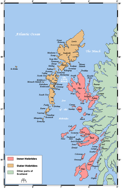
นี่คือรายชื่อเกาะต่างๆ ของสกอตแลนด์ซึ่งแผ่นดินใหญ่เป็นส่วนหนึ่งของเกาะบริเตนใหญ่นอกจากนี้ยังรวมถึงตารางและรายการอื่นๆ ที่เกี่ยวข้องอีกด้วย คำจำกัดความของเกาะ นอกชายฝั่ง ที่ใช้ในรายการนี้คือ "แผ่นดินที่ล้อมรอบด้วยน้ำทะเลทุกวัน แต่ไม่จำเป็นต้องเป็นทุกช่วงเวลาของน้ำขึ้นน้ำลง โดยไม่รวมถึงสิ่งก่อสร้างของมนุษย์ เช่น สะพานและทางเชื่อม" [หมายเหตุ 1 ]
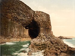
สกอตแลนด์ มี เกาะนอกชายฝั่งประมาณ 900 เกาะ [ 1 ]ซึ่งส่วนใหญ่อยู่ในกลุ่มหลัก 4 กลุ่ม ได้แก่เชตแลนด์ออร์กนีย์และเฮบริดีสซึ่งแบ่งย่อยเป็นเฮบริดีสชั้นในและเฮบริดีสชั้นนอก[ 2 ]นอกจากนี้ยังมีกลุ่มเกาะอยู่ใน อ่าวเฟิร์ธ ออฟไคลด์อ่าวเฟิร์ธออฟฟอร์ธและ อ่าว โซลเวย์เฟิร์ธ และเกาะเล็กๆ จำนวนมากในแหล่งน้ำจืดหลายแห่งในสกอตแลนด์ รวมถึงทะเลสาบลอคโลมอนด์และทะเลสาบลอคมารีเกาะที่ใหญ่ที่สุดคือเกาะลูอิสและแฮร์ริสซึ่งมีพื้นที่ 2,179 ตารางกิโลเมตร( 841 ตารางไมล์) และยังมีเกาะอีก 200 เกาะที่มีพื้นที่มากกว่า 40 เฮกตาร์ (100 เอเคอร์) ส่วนที่เหลืออีกหลายเกาะ เช่นสตาฟฟาและหมู่เกาะแฟลนแนนเป็นที่รู้จักกันดี แม้จะมีขนาดเล็กก็ตาม[ 2 ]ปัจจุบันมีเกาะของสกอตแลนด์ประมาณ 101 เกาะที่มีผู้คนอาศัยอยู่ถาวร โดย 89 เกาะอยู่นอกชายฝั่ง ตามข้อมูลสำมะโนประชากรปี 2011 [ 3 ]ระหว่างปี 2001 ถึง 2011 ประชากรบนเกาะของสกอตแลนด์โดยรวมเพิ่มขึ้น 4% เป็น 103,702 คน[ 4 ]แม้ว่าในปี 2022 จำนวนประชากรทั้งหมดจะลดลงเหลือต่ำกว่า 103,000 คนเล็กน้อย[ 5 ] [หมายเหตุ 2 ]
ธรณีวิทยาและธรณีสัณฐานวิทยาของเกาะต่างๆ มีความหลากหลาย บางเกาะ เช่นสกายและมัลล์เป็นภูเขา ในขณะที่เกาะอื่นๆ เช่นไทรีและแซนเดย์เป็นที่ราบต่ำ เกาะหลายแห่งมีหินฐานที่ประกอบด้วยหินไนส์ลูอิเซียนยุคอาร์เคียน โบราณ ซึ่งก่อตัวขึ้นเมื่อ 3 พันล้านปีก่อน เกาะ ชาปินเซย์และเกาะอื่นๆ ในหมู่เกาะออร์กนีย์ก่อตัวขึ้นจากหินทรายแดงโบราณซึ่งมีอายุ 400 ล้านปี และเกาะอื่นๆ เช่นรูม เกิด จาก ภูเขาไฟยุคเทอร์เชียรีที่เกิดขึ้นใหม่กว่า[ 7 ]เกาะหลายแห่งถูกกระแสน้ำขึ้นลงที่รุนแรงพัดผ่าน และกระแสน้ำวนคอร์รีฟเรคกันระหว่างสการ์บาและจูราเป็นหนึ่งในกระแสน้ำวนที่ใหญ่ที่สุดในโลก[ 8 ]กระแสน้ำขึ้นลงที่รุนแรงอื่นๆ พบได้ในช่องแคบเพนต์แลนด์ระหว่างแผ่นดินใหญ่ของสกอตแลนด์และออร์กนีย์และอีกตัวอย่างหนึ่งคือ "เกรย์ด็อก" ระหว่างสการ์บาและลุงกา[ 2 ]
วัฒนธรรมของหมู่เกาะได้รับผลกระทบจากอิทธิพลที่สืบทอดกันมาของชนชาติที่พูดภาษาเซลติกนอร์สและอังกฤษ และสิ่งนี้สะท้อนให้เห็นในชื่อที่ตั้งให้กับหมู่เกาะ ตั้งแต่ศตวรรษที่ 9 ถึงศตวรรษที่ 13 หมู่เกาะสก็อตส่วนใหญ่รวมกันอยู่ภายใต้การปกครอง ของชาวนอร์ส-เก ลิก แห่งหมู่เกาะ หมู่ เกาะเฮบริ ดีสหลายแห่งมีชื่อที่มาจาก ภาษา เกลิกของสก็อตในขณะที่หมู่เกาะทางเหนือมักมีชื่อที่มาจาก ชื่อของ ชาวไวกิงบางเกาะมี รากศัพท์มาจากภาษา บริทอนิก ภาษาสก็อตและอาจมีรากศัพท์มาจากยุคก่อนเซลติกด้วย[ 2 ]
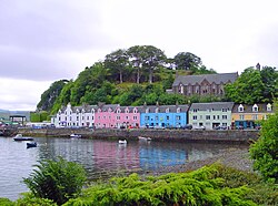
ลักษณะเด่นอย่างหนึ่งของชีวิตสมัยใหม่บนเกาะเหล่านี้คืออัตราการเกิดอาชญากรรมต่ำ และถือว่าเป็นหนึ่งในสถานที่ที่ปลอดภัยที่สุดในการอยู่อาศัยใน สห ราชอาณาจักร[ 9 ]ออร์กนีย์ได้รับการจัดอันดับให้เป็นสถานที่ที่ดีที่สุดในการอยู่อาศัยในสกอตแลนด์ทั้งในปี 2013 และ 2014 ตามการสำรวจคุณภาพชีวิตของHalifax [ 10 ]
เกาะร็อคคอลเป็นเกาะหินเล็กๆ ในมหาสมุทรแอตแลนติกเหนือ ซึ่งได้รับการประกาศให้เป็นส่วนหนึ่งของสกอตแลนด์โดย พระราชบัญญัติ เกาะร็อคคอล พ.ศ. 2515 [ 11 ] [ 12 ] อย่างไรก็ตามแม้จะไม่มีรัฐอื่นใดครอบครอง และมีแบบอย่างอื่นๆ มาก่อน ความถูกต้องตามกฎหมายของการอ้างสิทธิ์นี้ก็ยังเป็นที่ถกเถียงกันโดยสาธารณรัฐไอร์แลนด์เดนมาร์กและไอซ์แลนด์ และบางคนกล่าว ว่าอาจไม่สามารถบังคับใช้ได้ตามกฎหมายระหว่างประเทศ[ 13 ] [ 14 ]

ข้อมูลประชากร
การสำรวจสำมะโนประชากรปี 2022บันทึกว่ามีเกาะในสกอตแลนด์ 101 เกาะที่มีประชากรอาศัยอยู่เป็นประจำ โดย 96 เกาะเป็นเกาะนอกชายฝั่ง อย่างไรก็ตาม มีความซับซ้อนหลายประการเกี่ยวกับทั้งคำจำกัดความของ "เกาะ" และการอยู่อาศัยเป็นครั้งคราว และสำนักงานบันทึกแห่งชาติของสกอตแลนด์ยังได้ระบุเกาะเพิ่มเติมอีก 17 เกาะที่มีคนอาศัยอยู่ในปี 2001 แต่ไม่มีในปี 2011 หรือ "รวมอยู่ในภูมิศาสตร์สถิติของ NRS สำหรับเกาะที่มีคนอาศัยอยู่ แต่ไม่มีผู้อยู่อาศัยเป็นประจำในขณะที่มีการสำรวจสำมะโนประชากรปี 2001 หรือ 2011" [ 16 ]มีเกาะอื่นๆ อีกจำนวนเล็กน้อยที่มีคนอาศัยอยู่จริง แต่ไม่ได้บันทึกไว้ในรายการนี้[หมายเหตุ 3 ]
ในปี 2554 เขตการปกครองท้องถิ่น ที่มีเกาะที่มีประชากรอาศัยอยู่มากที่สุด ได้แก่อาร์กิลล์และบิวต์มี 23 เกาะ ออร์กนีย์ 20 เกาะ เชตแลนด์ 16 เกาะ และไฮแลนด์และคอมแฮร์ล นาน อีเลียน เซียร์มี 14 เกาะเท่ากัน นอกจากนี้ยังมี 3 เกาะใน นอ ร์ทแอร์เชอร์และเกาะละ 1 เกาะในไฟฟ์เพิร์ธและคินรอสส์ สเตอร์ลิงและเวสต์ดันบาร์ตันเชอร์เกาะ 3 เกาะสุดท้ายที่กล่าวถึงบวกกับเกาะอีก 2 เกาะในอาร์กิลล์และบิวต์เป็นเกาะน้ำจืด ไม่ใช่เกาะนอกชายฝั่ง[ 16 ]
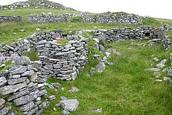
ในอดีต เกาะเล็กๆ หลายแห่งที่ปัจจุบันไม่มีผู้คนอาศัยอยู่ เคยมีประชากรอาศัยอยู่ถาวร การสูญเสียประชากรรุนแรงมากในหลายพื้นที่ในช่วงศตวรรษที่ 19 เมื่อเกาะต่างๆ เช่นPabbayและFuaigh Mòrถูกขับไล่ออกไปอย่างรุนแรงในช่วงHighland Clearances [ 18 ]การอพยพครั้งใหญ่จากหมู่เกาะเฮบริดีสถึงจุดสูงสุดในช่วงกลางศตวรรษที่ 19 แต่เริ่มขึ้นตั้งแต่ช่วงปี 1770 ในบางพื้นที่[ 19 ]เขตเกษตรกรรมมีประชากร 20% ของสกอตแลนด์ในปี 1755 แต่ในปี 1961 ตัวเลขนี้ลดลงเหลือ 5% [ 20 ]ตัวอย่างอื่นๆ ได้แก่Mingulay , Nossและ หมู่เกาะ St Kildaซึ่งถูกทิ้งร้างในช่วงศตวรรษที่ 20 การลดลงของประชากรมีความสำคัญอย่างยิ่งในเกาะที่ห่างไกลออกไป ซึ่งบางแห่งยังคงมีความเสี่ยงต่อการสูญเสียอย่างต่อเนื่อง[ 21 ]
ตารางต่อไปนี้แสดงแนวโน้มประชากรของเกาะที่มีประชากรมากที่สุด 10 เกาะตามสำมะโนประชากรปี 2011 แนวโน้มโดยรวมโดยทั่วไปคือประชากรเพิ่มขึ้นในช่วงต้นของยุคสมัยใหม่ ตามด้วยการลดลงตั้งแต่กลางศตวรรษที่ 19 เป็นต้นไป ในทุกกรณี ยกเว้นออร์กนีย์ ประชากรสูงสุดถูกบันทึกไว้ก่อนปี 1932 และตัวเลขต่ำสุดหลังการปฏิวัติอุตสาหกรรมหลังจากปี 1960 ต่อมามีการเติบโตอย่างพอประมาณโดยรวม แม้ว่าบางเกาะจะยังคงแสดงให้เห็นถึงการลดลง ระหว่างปี 1991 ถึง 2001 ประชากรของเกาะโดยรวมลดลง 3% เหลือ 99,739 คน แม้ว่าจะมี 35 เกาะที่มีประชากรเพิ่มขึ้นก็ตาม[ 22 ]ในทางตรงกันข้าม ระหว่างปี 2001 ถึง 2011 ประชากรของเกาะในสกอตแลนด์โดยรวมเพิ่มขึ้น 4% เป็น 103,702 คน[ 4 ]พันธมิตรชุมชนสก็อตแลนด์ตั้งข้อสังเกตว่า "อัตราการเพิ่มขึ้นสูงสุดอยู่ที่หมู่เกาะเวสเทิร์น (6%) ซึ่งปัจจุบันคนท้องถิ่นเป็นเจ้าของพื้นที่ประมาณ 60% ของพื้นที่ทั้งหมด ในพื้นที่ที่ประชากรลดลง (บิวต์ อาร์รัน และไอส์เลย์) การเป็นเจ้าของโดยชุมชนแทบจะไม่มีอยู่เลย" [ 23 ]
เกาะที่ใหญ่ที่สุดของสกอตแลนด์ตามจำนวนประชากร
| อันดับ | เกาะ | หน่วยงานท้องถิ่น | ประชากร | ||||||||
|---|---|---|---|---|---|---|---|---|---|---|---|
| ประมาณ ค.ศ. 1801 | 1841 | 1891 | 1931 | 1961 | 1981 | 2001 [ 22 ] | 2011 [ 16 ] | 2021 [ 5 ] | |||
| 1 | ลูอิสและแฮร์ริส[ 24 ] | Na h-Eileanan Siar | 12,164 | 20,046 | 30,726 | 28,042 | 24,107 | 22,476 | 19,918 | 21,031 | 19,680 |
| 2 | แผ่นดินใหญ่ เชตแลนด์[ 25 ] | เชตแลนด์ | 20,572 | 19,741 | 15,172 | 13,282 | 17,722 | 17,550 | 18,765 | 18,763 | |
| 3 | แผ่นดินใหญ่ ออร์กนีย์[ 26 ] | ออร์คนีย์ | 16,022 | 16,498 | 13,352 | 13,495 | 14,000 | 15,315 | 17,162 | 17,779 | |
| 4 | สกาย[ 27 ] | ไฮแลนด์ | 14,470 (ในปี ค.ศ. 1794) | 23,082 | 15,705 | 9,908 | 7,479 | 7,276 | 9,232 | 10,008 | 10,496 |
| 5 | บิวต์[ 28 ] | อาร์กิลล์และบิวต์ | 4,759 (ในปี ค.ศ. 1792) | 7,147 | 11,735 | 12,112 | 9,793 | 7,306 | 7,228 | 6,498 | 6,047 |
| 6 | อาร์รัน[ 29 ] | นอร์ธแอร์เชอร์ | 5,804 (ในปี ค.ศ. 1792) | 6,241 | 4,730 | 4,506 | 3,700 | 3,845 | 5,045 | 4,629 | 4,618 |
| 7 | ไอส์เลย์[ 30 ] | อาร์กิลล์และบิวต์ | 9,500 (ในปี ค.ศ. 1792) | 15,772 | 7,375 | 4,970 | 3,860 | 3,792 | 3,457 | 3,228 | 3,180 |
| 8 | มัลล์[ 31 ] | 8,016 (ในปี ค.ศ. 1794) | 8,316 | 4,691 | 2,903 | 2,154 | 2,197 | 2,667 | 2,800 | 3,063 | |
| 9 | เซาท์ ยูอิสต์[ 32 ] | Na h-Eileanan Siar | 5,093 | 3,708 | 2,810 | 2,376 | 2,231 | 1,818 | 1,754 | 1,650 | |
| 10 | เกรทคัมเบร[ 33 ] | นอร์ธแอร์เชอร์ | 509 (ในปี ค.ศ. 1793) | 1,413 | 1,784 | 2,144 | 1,638 | 1,300 | 1,434 | 1,376 | 1,293 |
| ทั้งหมด | 123,704 | 116,693 | 95,919 | 81,884 | 82,145 | 83,664 | 87,251 | 86,569 | |||
| เปลี่ยน | −5.7% | -7.8% | −14.6% | +0.3% | +1.8% | +4.3% | -0.8% | ||||
ตารางต่อไปนี้เปรียบเทียบจำนวนประชากรของหมู่เกาะหลักของสกอตแลนด์กับหมู่เกาะแฟโรในช่วงเวลาใกล้เคียงกับข้างต้น[หมายเหตุ 4 ]
| หมู่เกาะ | 1801 | 1851 | 1901 | 1931 | 1971 | 2011 [ 16 ] |
|---|---|---|---|---|---|---|
| หมู่เกาะเฮบริดีส[ 34 ] | 64,690 | 88,615 | 76,780 | 60,390 | 45,480 | 46,632 |
| เปลี่ยน |  37% 37% |  13% 13% | 21% | 25% | 3% | |
| ออร์คนีย์[ 35 ] | 24,445 | 31,318 | 27,763 | 21,933 | 17,007 | 21,349 |
| เปลี่ยน | 28% | 11% | 21% | 22% | 26% | |
| เชตแลนด์[ 36 ] | 22,000 | 31,000 | 28,000 | 21,000 | 17,500 | 23,167 |
| เปลี่ยน | 41% | 10% | 25% | 17% | 32% | |
| หมู่เกาะแฟโร | 5,265 [ 37 ] | 8,000 [ 38 ] | 15,230 [ 37 ] | 24,500 | 38,612 [ 37 ] | 48,515 [ 39 ] |
| เปลี่ยน | 52% | 90% | 61% | 58% | 26% |
กฎหมาย
ในเดือนกรกฎาคม พ.ศ. 2556 รัฐบาลสกอตแลนด์ได้ออกแถลงการณ์เลอร์วิกซึ่งแสดงให้เห็นถึงความตั้งใจที่จะกระจายอำนาจไปยังพื้นที่สภาเกาะทั้งสามแห่ง ได้แก่ ออร์กนีย์ เชตแลนด์ และหมู่เกาะเวสเทิร์น และต่อมาในปีเดียวกันนั้นก็ได้ให้คำมั่นที่จะดำเนินการดังกล่าว[ 40 ]ในปี พ.ศ. 2560 ได้มีการเสนอ ร่าง กฎหมายเกี่ยวกับเกาะต่างๆ เพื่อให้ "การป้องกันเกาะ" (รวมถึงเกาะที่ไม่มีผู้คนอาศัยอยู่) เป็นข้อกำหนดตามกฎหมายสำหรับหน่วยงานของรัฐ ร่างกฎหมายดังกล่าวผ่านขั้นตอนที่ 1 เมื่อวันที่ 8 กุมภาพันธ์ พ.ศ. 2561 [ 41 ] จากนั้นพระราชบัญญัติ เกาะ(สกอตแลนด์) พ.ศ. 2561ก็ได้รับการอนุมัติอย่างเป็นทางการ
เกาะขนาดใหญ่
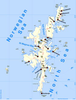
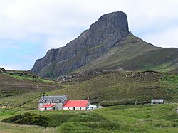
นี่คือรายชื่อเกาะในสกอตแลนด์ที่มีพื้นที่มากกว่า 40 เฮกตาร์ (ประมาณ 100 เอเคอร์) และ/หรือมีผู้คนอาศัยอยู่ กลุ่มหลักจาก Haswell-Smith (2004) ในหลายกรณีให้ข้อมูลที่เป็นประโยชน์มากกว่าพื้นที่ของหน่วยงานท้องถิ่นในการระบุตำแหน่ง กลุ่มเหล่านี้ได้แก่: Firth of Clyde , Islay , Firth of Lorn , Mull , Small Isles , Skye , Lewis and Harris , Uists and Barra , St Kilda , Orkney , ShetlandและFirth of Forthในบางกรณีที่เกาะเป็นส่วนหนึ่งของกลุ่มเกาะขนาดเล็กที่สามารถระบุได้ หรือเป็นหมู่เกาะ หรือตั้งอยู่ห่างจากกลุ่มหลัก จะใช้ชื่อหมู่เกาะ ชื่อหน่วยงานท้องถิ่น หรือชื่ออื่น ๆ ที่อธิบายลักษณะแทน "F" หมายถึงเกาะน้ำจืด
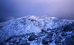
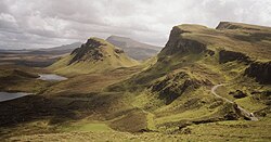
เกาะต่างๆ ของสกอตแลนด์ประกอบด้วยภูเขามุนโร 13 ลูก (ภูเขาที่มีความสูงมากกว่า 3,000 ฟุต หรือ 914.4 เมตร) โดย 12 ลูกอยู่ในเกาะสกาย และมี ภูเขามาริลินทั้งหมด 227 ลูก (เนินเขาที่มีความสูงสัมพัทธ์อย่างน้อย 150 เมตร โดยไม่คำนึงถึงความสูงที่แท้จริง ) [ 42 ]
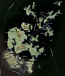




เกาะสี่แห่งถูกบันทึกว่ามีผู้คนอาศัยอยู่ในปี พ.ศ. 2554 ซึ่งไม่ได้กล่าวถึงในการสำรวจสำมะโนประชากร พ.ศ. 2544 ได้แก่Eilean dà Mhèinn , Eilean Tioram , Holm of Grimbister และ Inner Holm [ 16 ]
รายชื่อต่อไปนี้จัดทำโดยสำนักงานบันทึกแห่งชาติของสกอตแลนด์ โดยระบุว่า "รวมอยู่ในภูมิศาสตร์สถิติของ NRS สำหรับเกาะที่มีผู้คนอาศัยอยู่ แต่ไม่มีผู้อยู่อาศัยประจำในช่วงเวลาของการสำรวจสำมะโนประชากรปี 2001 หรือ 2011" [ 16 ]ไม่มีเกาะใดนอกจาก Lamb Holm ที่มีพื้นที่มากกว่า 40 เฮกตาร์
| เกาะ | ที่ตั้ง |
|---|---|
| Castle Stalker ( เอลีน อัน สตาลแคร์ ) | เฟิร์ธแห่งลอร์น |
| เอลีน ฮอร์ริสเดล ( เอลีน โธราธาสเดล ) | แกร์ ล็อค |
| อีเลียน โลน | ล็อค สวีน |
| อีเลียน นา ซิลเล | ยูอิสต์และบาร์รา |
| เอนเซย์ | ลูอิสและแฮร์ริส |
| อินช์ เคนเนธ ( อินนิส ชอยนิช ) | มัลล์ |
| อินช์โลเนก ( อินนิส ลอนแนก ) [F] | ล็อคโลมอนด์ |
| อินนิส ครูอิน ( อินนิส ครูอิน ) [F] [ Note 7 ] | |
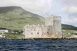
| ปราสาทคิซิมุล ( Caisteal Chiosmuil ) | ยูอิสต์และบาร์รา |
| แลมบ์โฮล์ม | ออร์คนีย์ |
เกาะน้ำจืด
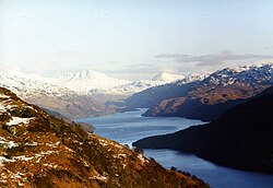
นอกจากนี้ยังมีเกาะน้ำจืดอีกมากมาย ซึ่งเกาะที่มีชื่อเสียงได้แก่เกาะปราสาทล็อคอินดอร์บเกาะปราสาทล็อคเลเวน เกาะเซนต์เซอร์ฟส์อินช์และเกาะอินช์มาโฮมซึ่งแต่ละเกาะล้วนมีบทบาทสำคัญในประวัติศาสตร์ของสกอตแลนด์
Inchmurrinเป็นเกาะน้ำจืดที่ใหญ่ที่สุดในเกาะอังกฤษ[ 50 ] [ 51 ]อยู่ในทะเลสาบโลมอนด์ซึ่งมีเกาะอื่นๆ มากกว่าหกสิบเกาะนอกจากนี้ทะเลสาบมารียังมีเกาะหลายแห่ง โดยเกาะที่ใหญ่ที่สุด ได้แก่Eilean Sùbhainn , Garbh EileanและEilean Ruairidh Mòrแต่ไม่ใหญ่เท่ากับเกาะอื่นๆ
เกาะนอกชายฝั่งขนาดเล็ก


นี่คือรายชื่อเกาะร้างในสกอตแลนด์ที่มีขนาดเล็กกว่า 40 เฮกตาร์ (รายชื่อต่อเนื่อง)
| ชื่อ | กลุ่มเกาะ / สถานที่ตั้ง |
|---|---|
| บัค มอร์ | หมู่เกาะอินเนอร์เฮบริดีส: หมู่เกาะเทรชนิช |
| เบสร็อค | เฟิร์ธแห่งฟอร์ธ |
| เกาะเบย์เบิล | หมู่เกาะเอาเตอร์เฮบริดีส: ลูอิสและแฮร์ริส |
| เบียราไซห์ | วานูอาตูด้านนอก: ลูอิส: Loch Ròg |
| เบลนาฮัว | หมู่เกาะอินเนอร์เฮบริดีส: หมู่เกาะสเลท |
| เกาะขวด | ซัมเมอร์ไอล์ส |
| บรูกแห่งเบอร์เซย์ | ออร์คนีย์ |
| สเกอร์รี่ที่ถูกผูกไว้ | เชตแลนด์ |
| Cairn na Burgh Beag | หมู่เกาะอินเนอร์เฮบริดีส: หมู่เกาะเทรชนิช |
| Cairn na Burgh Mòr | |
| กัลบฮา บีเอจ | ซัทเธอร์แลนด์: อ่าวเอ็ดราชิลลิส |
| ลูกวัวของฟลอตตา | ออร์คนีย์ |
| คาลเวย์ | หมู่เกาะเอาเตอร์เฮบริดีส : เซาท์ยูอิสต์ |
| แคมเปญ | วานูอาตูด้านนอก: ลูอิส: Loch Ròg |
| เกาะปราสาท | เฟิร์ธออฟไคลด์ |
| เคล็ตต์ | ไฮแลนด์ |
| คอร์นโฮล์ม | ออร์คนีย์ |
| เครกลีธ | เฟิร์ธแห่งฟอร์ธ |
| เครกเลธี | คินคาร์ดีนเชียร์: ฟาวล์เชิฟ |
| เกาะแครมอนด์ | เฟิร์ธแห่งฟอร์ธ |
| ดัมเซย์ | ออร์คนีย์ |
| ดอร์ โฮล์ม | เชตแลนด์ |
| ดูบห์ อาร์ทัค | หมู่เกาะอินเนอร์เฮบริดีส |
| ดุน | เซนต์คิลดา |
| ดัน ชอนนูอิลล์ | หมู่เกาะอินเนอร์เฮบริดีส: การ์เวลลัคส์ |
| อีสต์ลิงก้า | เชตแลนด์ |
| อีเลียน ชาธาสเทล | หมู่เกาะอินเนอร์เฮบริดีส: หมู่เกาะเล็ก ๆ |
| อีเลียน ดูบห์ | เฟิร์ธออฟไคลด์ |
| อีเลียน อิเก | หมู่เกาะเฮบริดีสชั้นใน: อาริเซก |
| อีเลียน มูร์ | วานูอาตูชั้นนอก: หมู่เกาะ Shiant |
| อีเลียน มอร์, ล็อค ดันเวแกน | สกาย |
| อายบรูกกี | เฟิร์ธแห่งฟอร์ธ |
| ฟิดรา | |
| ฟิชโฮล์ม | เชตแลนด์ |
| ฟลัดดา | หมู่เกาะอินเนอร์เฮบริดีส: หมู่เกาะสเลท |
| ฟลัดดา | หมู่เกาะเทรชนิช |
| Flodday ใกล้ Vatersay | หมู่เกาะเอาเตอร์เฮบริดีส: หมู่เกาะบาร์รา |
| Fuaigh Beag (Vuia Beg) | วานูอาตูด้านนอก: ลูอิส: Loch Ròg |
| แกสเกอร์ | หมู่เกาะเอาเตอร์เฮบริดีส: แฮร์ริส |
| การ์บ สเกียร์ | หมู่เกาะอินเนอร์เฮบริดีส: หมู่เกาะเล็ก ๆ |
| เกาะกิกาลุม | หมู่เกาะอินเนอร์เฮบริดีส: กิฮา |
| กลูป โฮล์ม | เชตแลนด์ |
| เกาะกลูนิมอร์ | เฟิร์ธออฟไคลด์ |
| กรุนเนย์ | เชตแลนด์: หมู่เกาะนอกชายฝั่ง |
| กรูนีย์ | เชตแลนด์ |
| กัวลัน | หมู่เกาะเอาเตอร์เฮบริดีส: เบนเบคูลา |
| ฮาฟ กรูนีย์ | เชตแลนด์ |
| เกาะฮาร์ลอช | หมู่เกาะอินเนอร์เฮบริดีส: เกาะสกาย |
| ฮัสเคียร์ | หมู่เกาะเอาเตอร์เฮบริดีส |
| ฮาสเคียร์ อีแกช | |
| เฮิร์นิช | หมู่เกาะเอาเตอร์เฮบริดีส: หมู่เกาะโมนาค |
| เฮลเลียร์ โฮล์ม | ออร์คนีย์ |
| เกาะเฮสตัน | ซอลเวย์เฟิร์ธ |
| เกาะแห่งฟาเรย์ | ออร์คนีย์ |
| โฮล์มแห่งฮุยป์ | |
| โฮล์มแห่งปาปา | |
| โฮล์มแห่งสค็อกเนส | |
| เกาะม้า | เฟิร์ธออฟไคลด์ |
| ฮันนี่ | เชตแลนด์ |
| อินช์การ์วี | เฟิร์ธแห่งฟอร์ธ |
| อินช์คีธ | |
| อินช์มิคเกอรี่ | |
| อินนิส มอร์ | อีสเตอร์ รอสส์ |
| คิลิ โฮล์ม | ออร์คนีย์ |
| เลดี้ส์ โฮล์ม | เชตแลนด์ |
| เลดี้ไอล์ | เฟิร์ธออฟไคลด์ |
| เนื้อแกะ | เฟิร์ธแห่งฟอร์ธ |
| ลิงก้าน้อย | เชตแลนด์ |
| ลิตเติลโร | |
| ลิงก้า, แซมฟรีย์ | |
| ลิงเกห์ | หมู่เกาะเอาเตอร์เฮบริดีส: หมู่เกาะบาร์รา |
| ลุนนา โฮล์ม | เชตแลนด์ |
| เกาะเมเดน | หมู่เกาะอินเนอร์เฮบริดส์: อ่าวโอบัน |
| มิงเกย์ | หมู่เกาะอินเนอร์เฮบริดีส: เกาะสกาย |
| มักเคิล ฟลักก้า | เชตแลนด์ |
| มักเคิล กรีน โฮล์ม | ออร์คนีย์ |
| มักเคิล สเกอร์รี | เพนท์แลนด์ สเกอร์รีส์ |
| เกาะมักดรัม | อ่าวเทย์ |
| เกาะเนฟ | หมู่เกาะอินเนอร์เฮบริดีส: เกาะอิสเลย์ |
| นอร์ธฮาวรา | เชตแลนด์ |
| โออิก-สเกียร์ | หมู่เกาะอินเนอร์เฮบริดีส |
| ออร์ฟาเซย์ | เชตแลนด์ |
| ออร์นเซย์ | หมู่เกาะอินเนอร์เฮบริดีส: เกาะสกาย |
| ออร์เซย์ | หมู่เกาะอินเนอร์เฮบริดีส: เกาะอิสเลย์ |
| กองออก | เชตแลนด์ |
| แพลดดา | เฟิร์ธออฟไคลด์ |
| ร็อคคอลล์ | มหาสมุทรแอตแลนติกเหนือ |
| เกาะหยาบ | ซอลเวย์เฟิร์ธ |
| รัสค์ โฮล์ม | ออร์คนีย์ |
| ไรซ่า ลิตเติ้ล | |
| สการาเวย์ | หมู่เกาะเอาเตอร์เฮบริดีส: เสียงแห่งแฮร์ริส |
| สกาต มอร์ และ สกาต บีก | เฟิร์ธออฟไคลด์ |
| เกาะแกะ | |
| สิภินี | หมู่เกาะเอาเตอร์เฮบริดีส: หมู่เกาะโมนาค |
| ชิลเลย์ | |
| โซเอ บีแอก | หมู่เกาะเอาเตอร์เฮบริดีส: แฮร์ริส |
| เกาะกลีทเนสทางใต้ | เชตแลนด์ |
| เกาะเซนต์นิเนียน | |
| สแต็คกับอาร์มิน | เซนต์คิลดา |
| สแต็ก ไบโอราค | |
| สแต็ก ลี | |
| สแต็ก เลเวนิช | |
| สตาฟฟา | หมู่เกาะอินเนอร์เฮบริดีส |
| สต็อกเคย์ | หมู่เกาะเอาเตอร์เฮบริดีส: หมู่เกาะโมนาค |
| สตูเลย์ | หมู่เกาะเอาเตอร์เฮบริดีส: เซาท์ยูอิสต์ |
| ซูลา สเกียร์ | มหาสมุทรแอตแลนติกเหนือ |
| ซูเล สเกอร์รี | |
| ซูเล่ สแต็ค | |
| สเวน โฮล์ม | ออร์คนีย์ |
| เกาะทาร์เนอร์ | หมู่เกาะอินเนอร์เฮบริดีส: เกาะสกาย |
| เท็กซัส | หมู่เกาะอินเนอร์เฮบริดีส: เกาะอิสเลย์ |
| ไตรอะลาเบรก | หมู่เกาะเอาเตอร์เฮบริดีส |
| ยูรี ลิงเกย์ | เชตแลนด์ |
| อูเยอา, นอร์ธมาวีน | |
| อุยนาเรย์ | |
| วันหยุดพักผ่อน | วานูอาตูด้านนอก: ลูอิส: Loch Ròg |
หมู่เกาะเล็กๆ

มีหมู่เกาะเล็กๆ หลายแห่งที่อาจเป็นที่รู้จักมากกว่าเกาะใหญ่ๆ ที่อยู่ภายในหมู่เกาะเหล่านั้น ซึ่งได้แก่:
เกาะเดิม

ต่อไปนี้เป็นรายชื่อสถานที่ที่เคยเป็นเกาะ แต่ปัจจุบันไม่ได้เป็นเกาะอีกต่อไปแล้วเนื่องจากการทับถมของตะกอน การสร้างท่าเรือ ฯลฯ
- คาบสมุทรอาร์เดียร์นอร์ทแอร์เชอร์
- เกาะโบดินโบใกล้กับเมืองเออร์สกิน บนแม่น้ำไคลด์ ปัจจุบันเชื่อมต่อกับฝั่งแม่น้ำบางส่วนแล้ว
- Broch of Clickiminเป็นเกาะเดิมใน Loch of Clickimin, Lerwickใน Shetland เดิมทีเป็นเกาะนอกชายฝั่ง แต่ทะเลสาบถูกตัดขาดจากทะเลเมื่อราว 200 ปีก่อนคริสตกาล และปัจจุบันเกาะนี้เชื่อมต่อกับแผ่นดินใหญ่ด้วยทางเชื่อมถาวร[ 52 ]
- บังกลันเคยเป็นเกาะแยกต่างหาก แต่ปัจจุบันเชื่อมต่อกับเกาะแซมฟรีย์ด้วยสันดอนทราย สองแห่ง
- Eilean-a-beithichเคยเป็นหนึ่งในเกาะ Slate Islandsและตั้งอยู่ใน Easdale Sound อย่างไรก็ตาม เกาะนี้ถูกขุดลงไปลึกถึง 76 เมตร (249 ฟุต) ใต้ระดับน้ำทะเล ทำให้เหลือเพียงขอบด้านนอกของเกาะเท่านั้น ซึ่งในที่สุดก็ถูกทะเลกัดเซาะจนทะลุ และปัจจุบันแทบไม่มีร่องรอยของเกาะให้เห็นอีกแล้ว[ 53 ]
- Eilean Chaluim Chille เป็นเกาะในอดีตใกล้กับKilmuirบน Skye ในทะเลสาบที่ปัจจุบันมีน้ำไหลออกมาแล้ว ซึ่งมีความเกี่ยวข้องกับPáll ลอร์ดชาว Hebridean ในศตวรรษที่ 13 บุตรชายของ Bálki
- อินช์บรอช หรือที่รู้จักกันในชื่อเกาะรอสซี ปัจจุบันเป็นส่วนหนึ่งของท่าเรือมอนโทรส แล้ว
- Inch of Culter เป็นเกาะเดิมในแม่น้ำ Deeใกล้กับMaryculter [ 54 ]
- เกาะอินนิสเบียกหรือ เกาะแพเทอร์สัน ใกล้พอร์ตมาโฮแมคในอีสเตอร์รอสส์ได้เชื่อมต่อกับมอร์ริชมอร์ อย่างถาวรแล้ว เนื่องจากทรายเคลื่อนตัว[ 55 ]
- Keith Inch (อย่าสับสนกับInchkeith ) ปัจจุบันเป็นส่วนหนึ่งของท่าเรือ Peterheadและเป็นจุดที่อยู่ทางตะวันออกสุดของแผ่นดินใหญ่สกอตแลนด์
- คิงส์อินช์ซึ่งเป็นที่ตั้งของปราสาทอินช์
- เกาะมิลตันหรือ กรีนอินช์ เป็นเกาะในบริเวณปากแม่น้ำไคลด์ ใกล้กับจุดข้ามแม่น้ำเก่าที่ดัมบัก ใกล้กับดัมบาร์ตัน
- เกาะนิวช็อตหรือ นิวช็อต ไอล์ เป็นเกาะขนาดประมาณ 50 เอเคอร์ หรือ 20 เฮกตาร์ ตั้งอยู่ในแม่น้ำไคลด์ ใกล้กับพาร์ค คีย์ ในเขตเรนฟรูว์เชียร์ ประเทศสกอตแลนด์ ปัจจุบันบางส่วนของเกาะเชื่อมต่อกับฝั่งแม่น้ำแล้ว
- นอร์ธ อินช์ (North Inch)หนึ่งใน "อินช์" (Inches) ในเมืองเพิร์ธเดิมทีเป็นเกาะในแม่น้ำเทย์ (Tay )
- เกาะเพรสตันซึ่งเป็นสิ่งก่อสร้างเทียมทางใต้ของโลว์แวลลีย์ฟิลด์ ได้รับการถมกลับอย่างสมบูรณ์แล้ว โดยใช้เถ้าเหลวจากโรงไฟฟ้าลองแกนเน็ต[ 56 ]
- ปราสาทโรซิธตั้งอยู่บนพื้นที่ซึ่งเคยเป็นเกาะน้ำขึ้นน้ำลงในอ่าวเฟิร์ธออฟฟอร์ธปัจจุบันล้อมรอบด้วยพื้นที่ถมทะเล
- แซนด์ อินช์เป็นเกาะเล็กๆ ในแม่น้ำไคลด์ ตั้งอยู่ติดกับคิงส์ อินช์
- Scalp na Caoraich , Cridhe An Uisge , RònachและScalp Phàdraig Mhòir - เกาะเล็กๆ สี่เกาะบริเวณสามเหลี่ยมปากแม่น้ำ Nessในเมือง Invernessซึ่งถูกถอดออกในศตวรรษที่ 19
- เกาะ Scottle Holm เคยเป็นเกาะเล็กๆ ทางเหนือของเมือง Lerwick ในหมู่เกาะ Shetland ปัจจุบันได้กลายเป็นส่วนหนึ่งของนิคมอุตสาหกรรม[ 57 ] [ 58 ] [ 59 ]
- ไวท์ อินช์ซึ่งปัจจุบันเป็นย่านหนึ่งของเมืองกลาสโกว์
เกาะที่มีสะพานเชื่อม
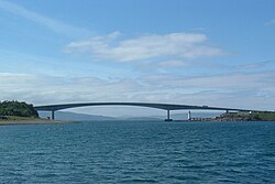
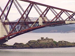

เกาะหลายแห่งของสกอตแลนด์เชื่อมต่อกับแผ่นดินใหญ่และ/หรือเกาะอื่นๆ ด้วยสะพานหรือทางเชื่อม แม้ว่าบางคนจะถือว่าพวกมันไม่ใช่เกาะอีกต่อไปแล้ว แต่โดยทั่วไปแล้วพวกมันก็ยังได้รับการปฏิบัติเหมือนเป็นเกาะอยู่
หมู่เกาะเอาเตอร์เฮบริดีส
เกาะหลายแห่งในหมู่เกาะเอาเตอร์เฮบริดีสตอนใต้เชื่อมต่อกับเกาะอื่นๆ ด้วยทางเชื่อมและสะพาน ซึ่งได้แก่:
- บาเลแชร์
- เบนเบคูล่า
- เบอร์เนอเรย์
- เอริสเคย์
- กริมเซย์
- นอร์ธ ยูอิสต์
- เซาท์ ยูอิสต์
- เกาะวาเทอร์เซย์เชื่อมต่อกับเกาะบาร์รา (แต่ไม่เชื่อมต่อกับเกาะอื่นๆ ที่กล่าวมาข้างต้น) โดยสะพานวาเทอร์เซย์คอสเวย์
ทางทิศเหนือ เกาะScalpayและGreat Berneraเชื่อมต่อกับเกาะ Lewis และ Harris
หมู่เกาะอินเนอร์เฮบริดีส
- เกาะสกายเชื่อมต่อกับแผ่นดินใหญ่ด้วยสะพานสกายซึ่งปัจจุบันได้รวมเอา เกาะ อีเลียนบัน (Eilean Bàn ) เข้าไปด้วยแล้ว
- Eilean Donanริมทางหลวงสู่แผ่นดินใหญ่
- เอริสกาโดยทางเชื่อมไปยังแผ่นดินใหญ่
- Seil (ไปยังแผ่นดินใหญ่) ผ่าน " สะพานข้ามมหาสมุทรแอตแลนติก " ของ John Stevenson [ 60 ] ปี 1792
- ดานนาผ่านทางเชื่อมไปยังแผ่นดินใหญ่
หมู่เกาะออร์คนีย์
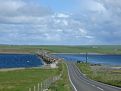
ในทำนองเดียวกัน เกาะออร์คนีย์สี่เกาะเชื่อมต่อกับแผ่นดินใหญ่ของออร์คนีย์ด้วยทางเชื่อมที่เรียกว่าแนวกั้นเชอร์ชิลล์ได้แก่:
ในทางกลับกัน Hundaเชื่อมต่อกับ Burray ผ่านทางทางหลวง
เกาะ เซาท์วอลล์และเกาะฮอยเชื่อมต่อกันด้วยทางเชื่อมที่เรียกว่าแอร์ ในสำมะโนประชากรของสหราชอาณาจักร เกาะทั้งสองถูกนับรวมเป็นหน่วยเดียว (เกาะฮอย)
มีการหารือเกี่ยวกับอุโมงค์ใต้น้ำระหว่างหมู่เกาะและเคธเนส ซึ่งมีความยาวประมาณ 9–10 ไมล์ (14–16 กม.) และอุโมงค์ที่เชื่อมแผ่นดินใหญ่ออร์กนีย์กับชาปินเซย์ [ 61 ] [ 62 ]แม้ว่าจะยังไม่มีความคืบหน้ามากนัก
หมู่เกาะเชตแลนด์
เกาะหลายแห่งในหมู่เกาะเช็ตแลนด์เชื่อมต่อกับแผ่นดินใหญ่ของหมู่เกาะเช็ตแลนด์ :
- West BurraและEast Burra (ผ่าน Trondra)
- มักเคิล โร
- ทรอนดรา
- เกาะบร็อคแห่งคลิกิมินเป็นเกาะน้ำจืดที่เชื่อมต่อกับแผ่นดินใหญ่ด้วยทางเดินหิน[ 63 ]
- เกาะ Holm of Mel เคยเป็นเกาะน้ำขึ้นน้ำลงที่เชื่อมต่อกับชายฝั่งตะวันตกของเกาะ Bressay ในช่วงน้ำลง แต่ปัจจุบันเกาะนี้เชื่อมต่อกับเกาะข้างเคียงที่ใหญ่กว่าอย่างถาวรด้วยทางเดินหินยาว 75 เมตร[ 59 ] [ 64 ]
นอกจากนี้ยังมีสะพานที่เชื่อมระหว่างหมู่บ้าน HousayและBrurayในบริเวณOut Skerriesอีก ด้วย
คนอื่น
นอกจากนี้ ยังมีเกาะอื่นๆ อีกหลายแห่งที่เชื่อมต่อกับแผ่นดินใหญ่หรือเกาะอื่นๆ ด้วยสะพานหรือทางเชื่อม ได้แก่:
- Inchgarvie (part of Forth Bridge), thus joined to both Fife and Lothian on the Mainland.
- Garbh Eilean at the entrance to Loch Glencoul is now joined to the mainland by both the Kylesku Bridge to the south and its associated roadworks to the north.
- Innis Chonan, an inhabited island in Loch Awe is connected to the mainland by a small road bridge.
- Moncreiffe Island connected to the mainland by the Tay Viaduct
- Buchan Ness is a tidal island joined to mainland Buchan by road.
Tidal islands and tombolos
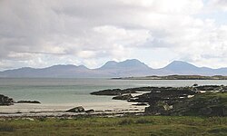

There are a large number of small tidal islands in Scotland. The more notable ones include:
- Baleshare
- Bernera
- Calve Island
- Castle Island
- Corn Holm
- Cramond Island
- Island Davaar
- Dunnicaer
- Eilean Mhic Chrion
- Eilean Shona
- Eriska
- Erraid
- Helliar Holm
- Kili Holm
- Isle Ristol
- Sanday
- Torsa
Oronsay means "ebb island" and there are several tidal islands of this name.[65]
The three main islands of the Monach Islands (Heisgeir), Ceann Iar, Ceann Ear and Shivinish are connected at low tides. It is said that at one time it was also possible to walk all the way to Baleshare, and on to North Uist, five miles (eight kilometres) away at low tide. In the 16th century, a large tidal wave was said to have washed the route away.[2]
St Ninian's Isle is connected to Mainland Shetland by a tombolo. Although greater than 40 hectares in size it fails to meet the definition of an island used in this list as it is only surrounded by water during occasional spring tides and storms.[66]
Dùn in St Kilda is separated from Hirta by a shallow strait about 50 metres (160 feet) wide. This is normally impassable but is reputed to dry out on rare occasions.[2]
Complex islands
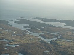
There are a number of offshore islands that defy easy classification.
- Ceallasaigh Mòr and Ceallasaigh Beag are islands in Loch Maddy, North Uist which are both c. 50 hectares (120 acres) in extent at high tide. At low tide they are connected to one another and several other small tidal islets in the shallow lagoon that surrounds them.
- Eileanan Iasgaich in Loch Boisdale, South Uist comprises five small islands and several other islets at high tide but forms a single large one of 50 hectares (120 acres) at low tide.
- Eileanan Chearabhaigh. At low tide these islands form a peninsula with a total area of 49 hectares (120 acres), which is connected to Benbecula by drying sands.[46] At high tide the connection to Benbecula is lost and a number of small islets stretching for over 2 kilometres (1.2 mi) from east to west appear, the largest of which is about 30 hectares (74 acres) in extent.
- The Crowlin Islands, located in the Inner Sound off Raasay are three separate islands at high tide and a single one of 270 hectares (670 acres) at low tide.
- Similarly, Lunga in the Firth of Lorn is six or more separate islets at high tide but a single one of 254 hectares (630 acres) at low tide.
Castle islands
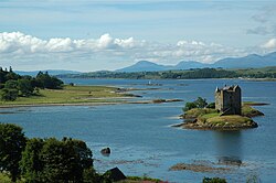
There are several small Scottish islands that are dominated by a castle or other fortification. The castle is often better known than the island, and the islands are often tidal or bridged. Due to their picturesque nature some of them are well known from postcards and films. Examples are:
- Bass Rock
- Broch of West Burrafirth
- Castle Island
- Calvay
- Castle Stalker
- Castle Tioram
- Eilean Aigas (F)
- Eilean Dearg, Loch Riddon
- Eilean Donan
- Inchtalla (F)
- Inveruglas Isle (F)
- Kilchurn Castle (F)
- Kisimul Castle
- Lochindorb Castle (F)
- Loch Leven Castle (F)
- Mousa
- Threave Castle (F)
- Wyre
Many of the Islands of the Forth and southern Orkney Islands have fortifications from the two world wars. Rosyth Castle stands on a former island.
Holy islands

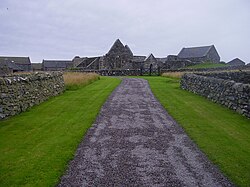
A large number of the islands of Scotland have some kind of culdee/church connection, and/or are dominated by a church. The more notable include:
- Island Davaar
- Egilsay
- Eynhallow
- Holy Island
- Inchcolm
- Inch Kenneth
- Inchmahome (F)
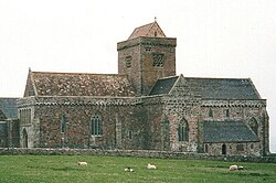
- Iona
- Isle Maree
- North Rona
- Oronsay
- Papa Stronsay (current Transalpine Redemptorist monastery. Islands called "Papa" or "Pabbay" tend to be former saints' islands)
- St Ninian's Isle
- St Serf's Inch (F)
- Tiree ("land of Iona")
Brother Isle's name is not ecclesiastical in origin as is sometimes stated.
Islands named after people
This is a list of islands, which are known to be named after someone. In some cases such as North Ronaldsay this status may not be obvious (it isn't named after a "Ronald", unlike South Ronaldsay). This list omits names such as Hildasay, where the person in question is mythological, or Ailsa Craig, where the individual in question is not known, and also Colonsay & Egilsay where the derivation is disputed.
- Eilean Chaluim Chille - Saint Columba
- Island Davaar - Saint Barr
- Eilean Donan - Saint Donan
- Flannan Isles - Saint Flannan
- Frank Lockwood's Island (south of Lochbuie, Mull)
- Inchcolm - Saint Columba
- Inch Kenneth - Saint Kenneth
- Inchmarnock - Saint Mearnag
- Inchmahome (F) - Saint Colmag
- Inchmurrin (F) - Saint Meadhran/Mirin
- Innis Chonan (F) - Saint Conan
- Isle Maree (F) - Maelrubha
- Isle Martin - Saint Martin
- North Rona - Saint Ronan
- St Serf's Inch (F) - Saint Serf
- Sweyn Holm – Sweyn Asleifsson
- Taransay - Saint Taran
Iqbal Singh, the owner of Vacsay, has also expressed wishes to rename it after Robert Burns.
Places called "island" etc. that are not islands
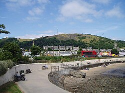
Some places in Scotland with names including "isle" or "island" are not islands. They include:
| Name | Island group / location | It actually is |
|---|---|---|
| Barmore Island | Knapdale | part of mainland |
| Black Isle (An t-Eilean Dubh) | Ross and Cromarty | peninsula |
| Burntisland | Fife | part of mainland |
| Eilean na h-Eaglaise | Torsa | peninsula |
| Eilean Garbh | Gigha | a peninsula of Gigha |
| Isle of Fethaland | Shetland | place on mainland of Shetland |
| Gluss Isle | joined to mainland of Shetland | |
| Isle of Harris (Na Hearadh) | Outer Hebrides | part of an island |
| Isle of Lewis (Eilean Leòdhais) | ||
| Isleornsay (Eilean Iarmain) | Skye | place on Skye |
| Islesteps (south of Dumfries) | Dumfries and Galloway | inland place in Scotland |
| Isle of Whithorn | place on coast of Scotland |
Lewis and Harris are separated by a range of hills but form one island, and are sometimes referred to as "Lewis and Harris". Isle of Whithorn and the Black Isle are peninsulas, and Isleornsay is a village which looks out onto the island of Ornsay. There is no commonly accepted derivation for "Burntisland" which had numerous other forms in the past, such as "Brintilun" and "Ye Brint Eland".[67]
Gluss Isle at the western entrance to Sullom Voe is one of the many promontories in Orkney and Shetland connected to a larger body of land by an ayre.
Other elements
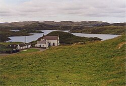
The name "Inch" (Innis) can mean island (e.g. Inchkenneth, Inchcolm), but is also used for terra firma surrounded by marsh e.g. Markinch, Insch.
Eilean is Gaelic for "island". However, Inistrynich, Eilean na Maodail, Eilean Dubh and Liever Island are all promontories on Loch Awe as opposed to islands, despite their names. Likewise Eilean Aoidhe on Loch Fyne. The Black Isle is also An t-Eilean Dubh in Gaelic, while Eilean Glas is part of Scalpay.
"-holm" is also common as a suffix in various landlocked placenames, especially in the far south of mainland Scotland e.g. Langholm, Kirk Yetholm, Holmhead (by Cumnock), Holmhill (next to Thornhill, Nithsdale). Some of these were river islands in their time, or dry land surrounded by marsh. "Holm" can be found in an element in Holmsgarth, now a suburb of Lerwick and the Parish of Holm on Mainland Shetland and Mainland Orkney respectively. Neither of these is an island in its own right.
Islands named after mainland areas
Likewise, occasionally an island may be named after a location on the nearby mainland, or a major neighbouring island – or vice versa. Examples of this include: Vementry, which was originally the name of an island, but whose name has been transferred to a nearby farm on Mainland Shetland; Oldany Island, whose name has been transferred to Oldany; Cramond Island which is named after neighbouring Cramond (a district of Edinburgh); and Eilean Mhealasta in the Outer Hebrides, which is named after Mealista on Lewis.
The name Easdale appears to be the combination of eas, which is Gaelic for "waterfall" and dal, the Norse for "valley".[68] However, it is not clear why either description should apply to this tiny island which is low-lying and has no waterfalls and the name may have come from the nearby village of the same name on Seil.[69]

Stacks
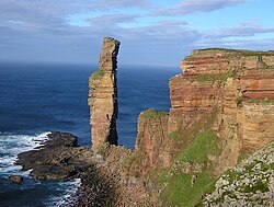
It has been estimated that there are about 275 sea stacks in Scotland, of which around 110 are located around the coasts of Shetland.[70] The highest are Stac an Armin and Stac Lee,[71] St Kilda. In July 1967, 15 million people watched the climbing of the Old Man of Hoy live on BBC television.[72] However, for many of the remoter stacks, especially in Shetland, there is no record of there having been any attempt by rock climbers to ascend them.[73]
Crannogs
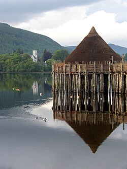
Crannogs are prehistoric artificial islands created in lochs. There are several hundred sites in Scotland. Today, crannogs typically appear as small, circular islands, between 10 and 30 metres (30–100 feet) in diameter.[74] Scottish crannogs include:
- Breachacha on Coll
- Cherry Island in Loch Ness
- Dùn Anlaimh on Coll
- Eilean Dòmhnuill on North Uist
- Keppinch (or The Kitchen) in Loch Lomond
See also
- British Isles
- Geography of Scotland
- List of the British Isles by area
- List of lochs on Scottish islands
- List of Marilyns on Scottish islands
- List of Munros on Skye and Mull
- List of Orkney islands
- List of Outer Hebrides
- List of Shetland islands
- Scottish island names
References and footnotes
Notes
- ^Various other definitions are used. For example the General Register Office for Scotland define an island as "a mass of land surrounded by water, separate from the Scottish mainland" but although they include islands linked by bridges etc. this is not clear from this definition. Haswell-Smith (2004) uses "an Island is a piece of land or group of pieces of land which is entirely surrounded by water at Lowest Astronomical Tide and to which there is no permanent means of dry access". This is widely agreed to be unhelpful as it excludes bridged islands. However, the large numbers of small tidal islets essentially defy categorisation.
- ^The RESAS data is not totalled but a figure of 102,900 can be derived from adding the individual figures on the list. This total excludes an entry for a population of 46 on 'Mainland', which does not appear to refer to any island and the 'island' of Rubha nan Gall, which is listed with a population of 6. As the name implies, and as both OS maps and the locations holiday cottage website make clear, this is a headland, not an island.[6] There are other complications. The total of all the islands in the island local authority areas do not appear to add up to the total provided by the 2022 census for those authorities. The raw data held by the National Records of Scotland is here but not in an accessible format.
- ^ For example, South Walls is included in Hoy by the census. The evidence of maps, sources and photographs makes it clear that Eriska and Seana Bhaile have been permanently inhabited for some time. They were included in 2022 but not the censuses of 2001 or 2011. The freshwater islands of Eilean Aigas and Contin Island have been omitted from all three 21st century censuses.
- ^For a discussion of some of the factors involved see Coull (1967).
- ^Island areas indicated with an asterisk are estimates based on Ordnance Survey maps and General Register Office for Scotland statistics.
- ^Islands classified as inhabited in the 2001 or 2011 census but not in 2022, and by implication classified as occasionally inhabited, are indicated with a degree symbol °.
- ^Referred to by the National Records of Scotland (2013) as "Inchruin", which is presumably a typographical error.
Specific references
- ^"Facts and figures about Scotland's sea area". Marine Scotland Information. Marine Scotland. Retrieved 27 January 2020.
- ^ abcdefHaswell-Smith (2004)
- ^"3 Methodology". www.gov.scot. Retrieved 17 March 2026.
- ^ ab"Scotland's 2011 census: Island living on the rise". BBC News. Retrieved 18 August 2013.
- ^ abc"Scottish Islands Data Dashboard". RESAS/Scottish Government. 2025. p. 6. Retrieved 1 June 2025.
- ^"Welcome to Rubha nan Gall". Rubhanangall.com. Retrieved 29 June 2025.
- ^McKirdy, Alan Gordon, John & Crofts, Roger (2007) Land of Mountain and Flood: The Geology and Landforms of Scotland. Edinburgh. Birlinn.
- ^The Corryvreckan is regularly cited as the third largest whirlpool of the world - see for example "Corryvreckan Whirlpool " Gazetteer for Scotland. Retrieved 19 September 2009. Some sources suggest it is the second largest after the Moskstraumen.
- ^Ross, John (5 October 2007). "Isolated Communities Where Violent Crime Comes as a Shock". The Scotsman. Edinburgh.
- ^Harrison, Jody (20 December 2014) "Orkney best for quality of life". Glasgow. The Herald. Retrieved 20 December 2014.
- ^"On This Day: 21 September". BBC News. 21 September 1955. Retrieved 1 August 2007.
- ^"House of Lords Hansard". 24 June 1997. Retrieved 1 August 2007.
- ^"Oral Questions to the Minister of Foreign Affairs". Official Report of the Parliamentary Debates of the Houses of the Oireachtas. Dáil Éireann. 1 November 1973. Archived from the original on 22 August 2006. Retrieved 17 January 2007.
- ^MacDonald (2006) pp. 627–647.
- ^Haswell-Smith (2007) p. 306
- ^ abcdefNational Records of Scotland (2013) pp. 11-13
- ^Haswell-Smith (2007) p. 173
- ^Haswell-Smith (2007) pp. 269, 306-07
- ^Symonds (1999) p. 101
- ^Turnock (1969) p. 190
- ^Wenham, Sheena "Modern Times" in Omand (2003) p. 110.
- ^ abGeneral Register Office for Scotland (2003)
- ^"Increase in islands’ population". Scottish Community Alliance. Retrieved 7 September 2013.
- ^Haswell-Smith (2004) p. 288
- ^Haswell-Smith (2004) p. 434
- ^Haswell-Smith (2004) p. 354
- ^Haswell-Smith (2004) p. 173
- ^Haswell-Smith (2004) p. 23
- ^Haswell-Smith (2004) p. 11
- ^Haswell-Smith (2004) p. 41
- ^Haswell-Smith (2004) p. 87
- ^Haswell-Smith (2004) p. 236
- ^Haswell-Smith (2004) p. 18
- ^Murray (1973) p. 216
- ^"Orkney" GENUKI quoting census data. Retrieved 8 September 2013.
- ^Nicolson (1972) p. 92
- ^ abcBailey (1998) p. 314
- ^"POPU08: Historical population, 1000s, by reporting country and time". Nordon. Archived from the original on 13 November 2016. Retrieved 13 November 2016.
- ^"Population and elections". Hagstova Føroya. Retrieved 8 September 2013.
- ^Ross, David (23 November 2013). "Islands set to win key decision-making powers with unprecedented legislation". The Herald (Glasgow). Retrieved 27 November 2013.
- ^"Islands (Scotland) Bill" Scottish Government. Retrieved 24 February 2018.
- ^D.A. Bearhop (1997). Munro's Tables. Scottish Mountaineering Club & Trust. ISBN 978-0-907521-53-2.
- ^Haswell-Smith (2004), save as otherwise stated.
- ^Ordnance Survey. OS Maps Online (Map). 1:25,000. Leisure. Retrieved 21 August 2013. The maps mark the height above sea level of a high point on most islands, but in a few cases this is not the highest peak.
- ^United Nations Environment Programme World Conservation Monitoring CentreDeprecated link archived 2007-07-05 at archive.today
- ^ abcdefghijklmRick Livingstone’s Tables of the Islands of Scotland (pdf) Argyll Yacht Charters. Retrieved 12 Dec 2011.
- ^"Eilean a' Ghiorr". Gazetteer for Scotland. Retrieved 1 July 2025.
- ^"Eilean Leathann". Gazetteer for Scotland. Retrieved 2 July 2025.
- ^ abThe census does not list South Walls as an island, but includes the total in Hoy.
- ^"Loch Lomond Islands - Inchmurrin". Loch Lomond.net. Retrieved 20 April 2012.
- ^ abDow, Jim (2005) Islands Galore. A Scottish Islands Handbook. Edinburgh. Black & White Publishing.
- ^"Broch of Clickimin" Undiscovered Scotland. Retrieved 20 December 2009.
- ^"Slate Islands - The Islands that Roofed the World" southernhebrides.com. Retrieved 14 November 2009.
- ^"Local Names"Archived 2011-07-19 at the Wayback Machine Culter.net. Retrieved 3 January 2009.
- ^Hansom, JD and Black, SDL (1996) "The Geomorphology of Morrich More: Management Prescription Review"Archived 2016-03-03 at the Wayback Machine (pdf) SNH. Retrieved 29 November 2009.
- ^"Preston Island". Gazetteer for Scotland. Retrieved 26 December 2009.
- ^“Map of Shetland Sheet 053”. British History Online. Retrieved 12 September 2021.
- ^“Scottle Holm, Shetland Islands”. Ordnance Survey. Retrieved 12 September 2021.
- ^ abOrdnance Survey. OS Maps Online (Map). 1:25,000. Leisure.
- ^Paxton, R.; Shipway, J. (2007). Scotland - Highlands and Islands. Civil Engineering Heritage. London: Thomas Telford Publishing. ISBN 9780727734884.
- ^David Lister (5 September 2005). "Islanders see a brighter future with tunnel vision". The Times. London. Retrieved 28 April 2007.
{{cite news}}: CS1 maint: deprecated archival service (link) - ^John Ross (10 March 2005). "£100m tunnel to Orkney 'feasible'". The Scotsman. Retrieved 7 April 2017.
- ^Clickimin Broch Gazetteer for Scotland. Retrieved 25 April 2010.
- ^For images see "Island 478 - Holm of Mel, Bressay, Shetland". alifetimeofislands.com. Retrieved 9 September 2021.
- ^Pàrlamaid na h-Alba placenames Retrieved 16 July 2007.
- ^Fettes College Shetland Landscapes Retrieved 3 August 2007.
- ^Burntisland Online Retrieved 22 June 2007.
- ^Haswell-Smith (2004), p. 78.
- ^Murton (2017), p. 29.
- ^Mellor 2020, pp. 5–6.
- ^Mellor 2020, p. 138.
- ^"The Great Climb". BBC Scotland. Retrieved 10 December 2011.
- ^Mellor 2020, p. 184.
- ^"What is a crannog?". Scottish Crannog Centre. Retrieved 12 November 2016.
General references
- Bailey, Patrick (1998). "Faroe, Orkney, Gran Canaria: Case Studies in the Geography of Marginal Europe". Geography. 83 (4): 309–21. doi:10.1080/20436564.1998.12452666. JSTOR 40573105.
- Coull, J. R. (1967). "A Comparison of Demographic Trends in the Faroe and Shetland Islands". Transactions of the Institute of British Geographers. 41 (41): 159–66. doi:10.2307/621333. JSTOR 621333.
- General Register Office for Scotland (28 November 2003) Scotland's Census 2001 – Occasional Paper No 10: Statistics for Inhabited Islands. Retrieved 26 February 2012.
- Haswell-Smith, Hamish (2004). The Scottish Islands. Edinburgh: Canongate. ISBN 978-1-84195-454-7.
- MacDonald, Fraser (2006). "The last outpost of Empire: Rockall and the Cold War". Journal of Historical Geography. 32 (3): 627–647. doi:10.1016/j.jhg.2005.10.009.
- Mellor, Chris (January 2020). "An illustrated guide to sea stack climbing in the UK & Ireland"(PDF). needlesports. Retrieved 23 January 2021.
- Murray, W.H. (1973) The Islands of Western Scotland: the Inner and Outer Hebrides. London. Eyre Methuen. ISBN 0413303802
- Murton, Paul (2017), The Hebrides, Edinburgh: Birlinn, ISBN 978-1-78027-467-6
- National Records of Scotland (15 August 2013). "Appendix 2: Population and households on Scotland's Inhabited Islands"(PDF). Statistical Bulletin: 2011 Census: First Results on Population and Household Estimates for Scotland Release 1C (Part Two)(PDF) (Report). SG/2013/126. Retrieved 15 July 2025.
- Nicolson, James R. (1972) Shetland. Newton Abbot. David & Charles.
- Omand, Donald (ed.) (2003) The Orkney Book. Edinburgh. Birlinn. ISBN 1-84158-254-9
- Symonds, James (June 1999) "Toiling in the Vale of Tears: Everyday Life and Resistance in South Uist, Outer Hebrides, 1760—1860". International Journal of Historical Archaeology/JSTOR. 3 No. 2, Archaeologies of Resistance in Britain and Ireland, Part II, pp. 101–122. Retrieved 8 September 2013.
- Turnock, David (1969). "Regional Development in the Crofting Counties". Transactions of the Institute of British Geographers. 48 (48): 189–204. doi:10.2307/621498. JSTOR 621498.
External links
 Media related to Islands of Scotland at Wikimedia Commons
- Scottish Island Network - Population Statistics
- Scottish Islands Access Rights